
June 30th 2015
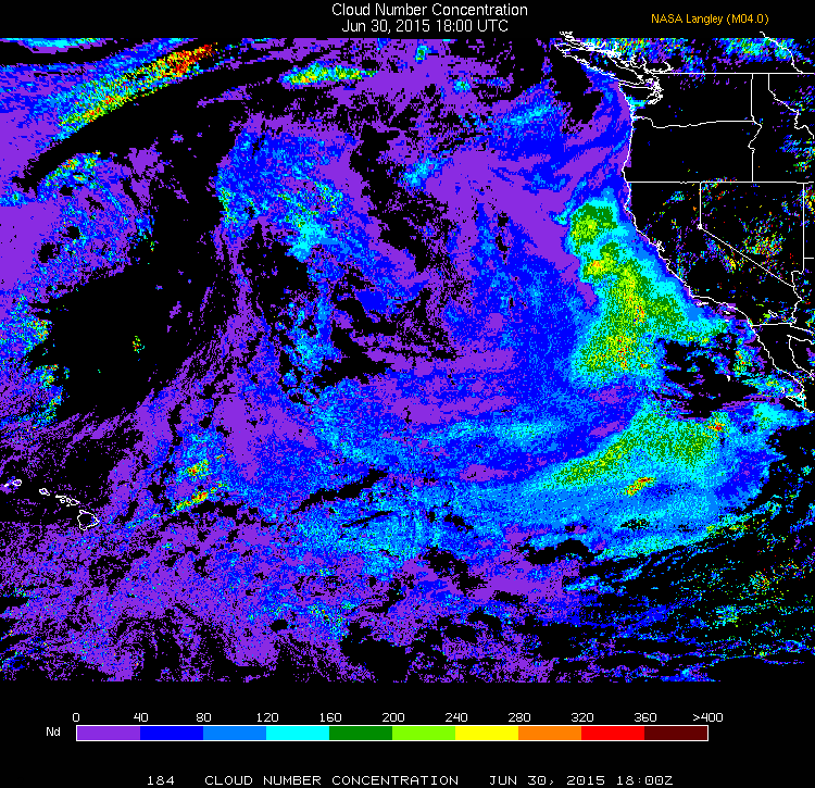
Expected first research flight (RF01) from Sacramento to Hilo expected tomorrow. Droplet concentrations from the Langley GOES products from the day before (June 30th) show strong gradients offshore, which will be interesting to sample.
Take a look at Worldview to see MODIS data from today (below) in a VIS/NIR channel blend that emphasizes cloud particle size (for liquid drops). Blue colors are large drops (>15-20 micron), white smaller. The near-coastal cloud has smaller drops but even within that there is variability. Further west is the wild west in terms of NE Pacific sampling, and it is hard to predict what will be seen, other than heterogeneity and some pretty vigorous drizzling clouds and some “drizzle without cloud” perhaps.

July 1st 2015
GOES Channel 2 NIR imagery (12:30 UTC, 06/01/15) shows extensive clearing immediately to the west of Sacramento. The first point to be sampled (35.25°N, 134.375°W) is right of where the clean region above has moved to, with evidence of shiptracks (perhaps some of Type 1 in very shallow/low aerosol boundary layer). The decision to drop points A and B to the east of the first point probably turns out to have been a (serendipitously) good one.
