Argo work in the Coral Sea
Early work: Argo trajectories in the SW Pacific:
(The Argo archive at http://www.usgodae.org shows 9 float trajectories in the region around NC. These give a crude representation of the flow at 1000m)
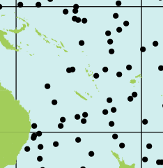
Positions of all Argo floats as of 31 Jan 2005
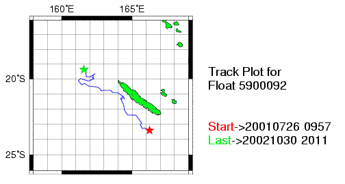
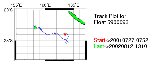
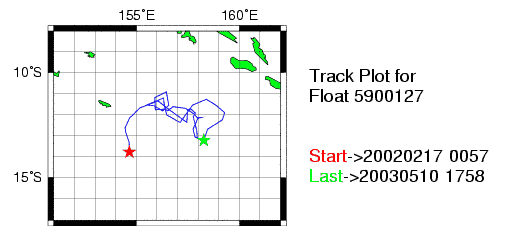
Individual trajectories from the usgodae website:
5900092
093
127
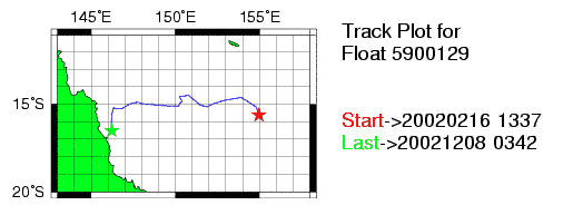
129
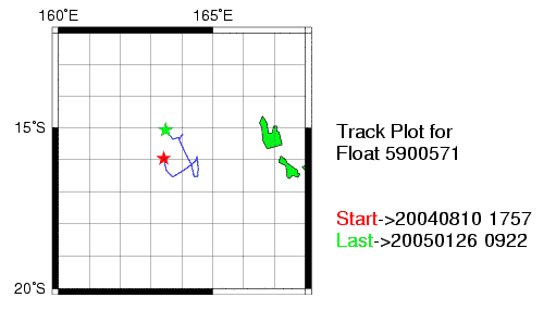
571
575
576
607
608
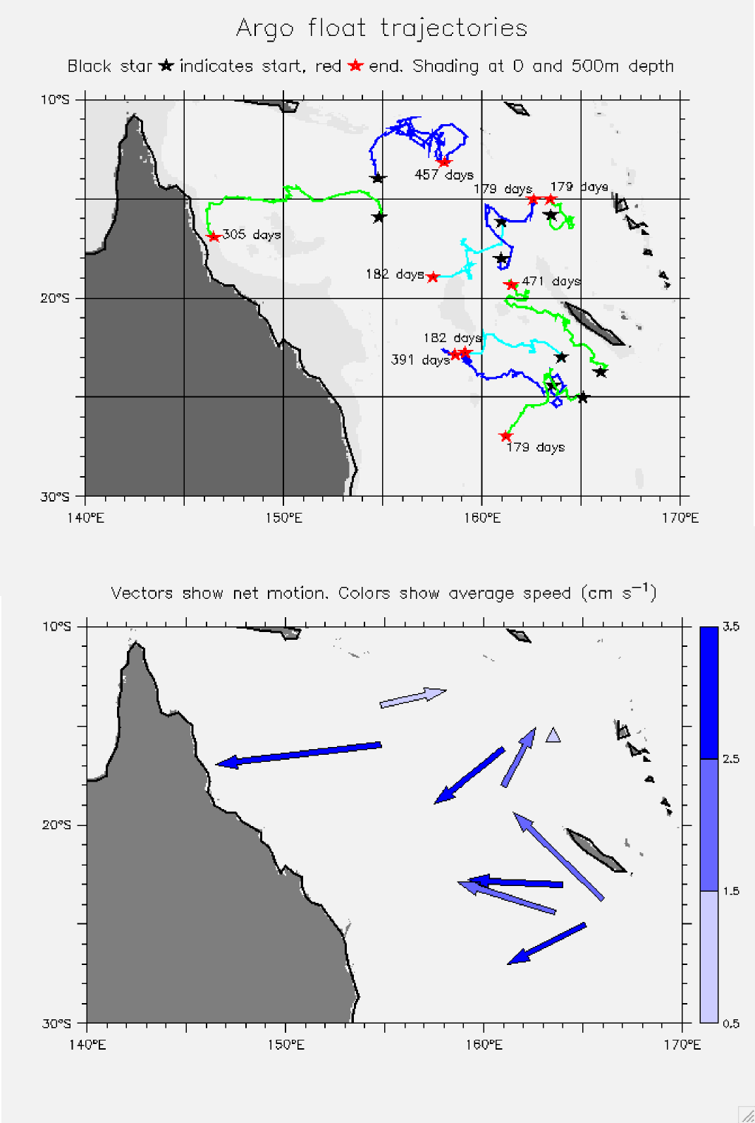
Trajectories combined
Net motion and speed
Above plots combined
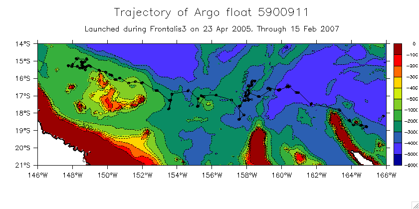
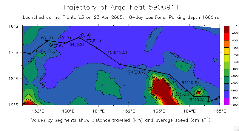
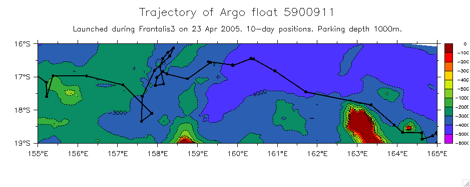
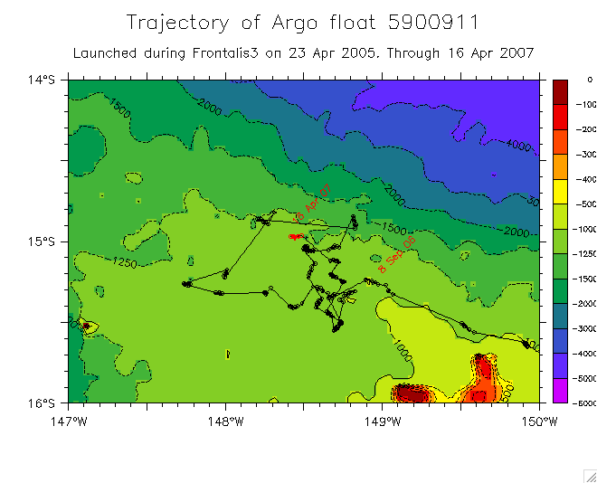
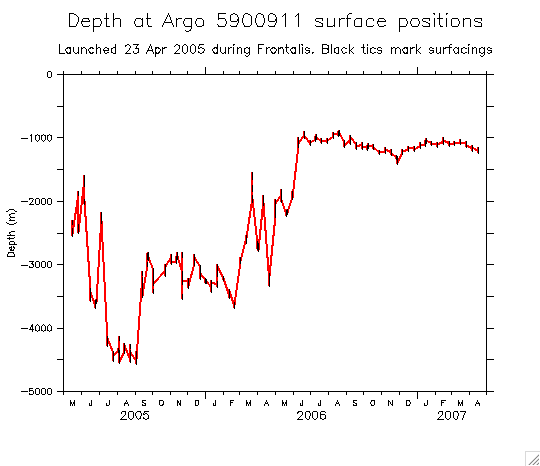
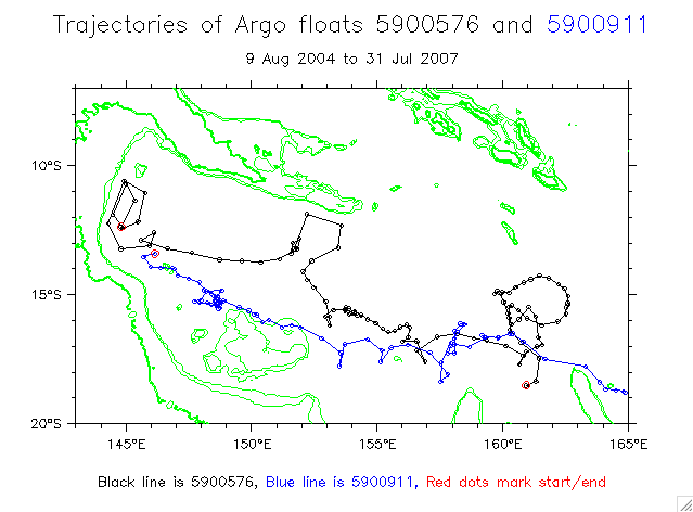
Argo 5900911:
Complete trajectory through 15 Feb 07
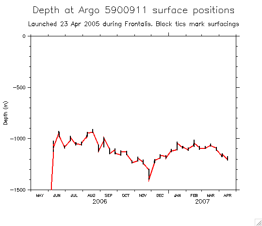
Through 16 Apr 07
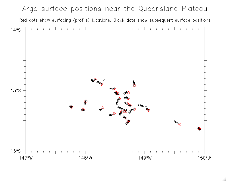
Position dots (details, over bathymetry):
Near NC; mark speeds
Into Coral Sea
Passing Queensland Plateau
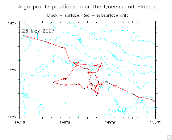
Virtual mooring west of the Queensland Plateau (to 16 Apr 07)
5900911 spent 7 months just behind the Queensland Plateau (about 1250m depth):
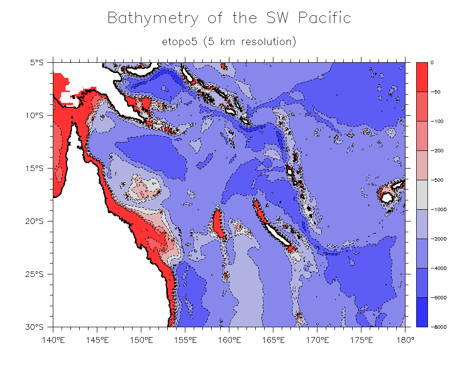
Overview: bathymetry of the SW Pacific
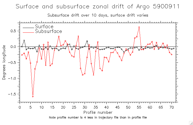
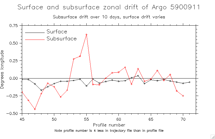
Surface and subsurface drift:
All reported positions
Displacement vectors by time intervals
Surface and subsurface vectors
(See below for updates)
Zonal component (surface and subsurface):
Whole trajectory
Detail near Queensland Plateau
Speeds
Depths (etopo02) at reported positions:
Whole track
Detail since June 06
Depth as a function of longitude
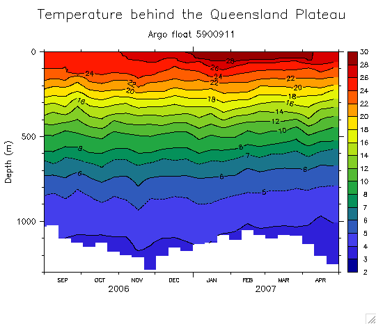
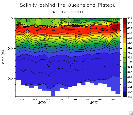
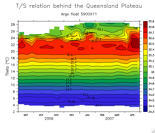
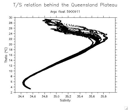
T and S west of the Queensland Plateau:
Temperature
(add 6 May 07 dive)
Salinity
Salinity(T,t)
T/S
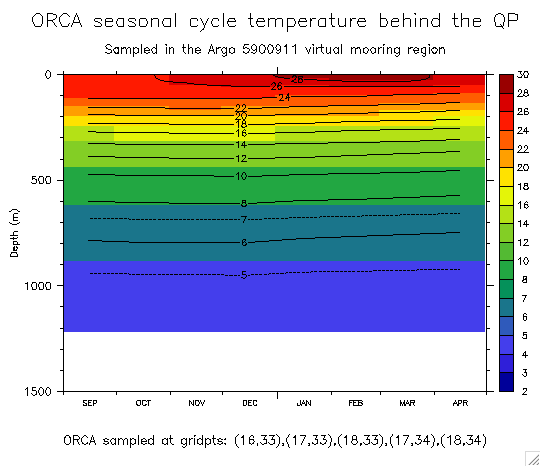
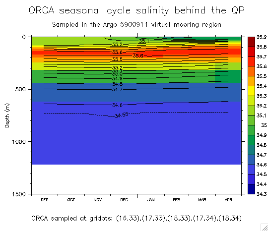
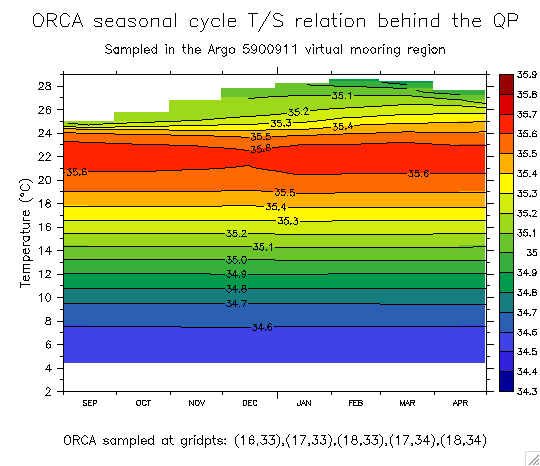
Corresponding plots from ORCA:
Map showing Argo track and ORCA gridpoints
Temperature
Salinity
Salinity(T,t)
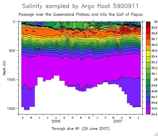
Updates on 2 July 2007 (into the Gulf of Papua):
Surface and subsurface vectors
Trajectories with 5900576
Salinity
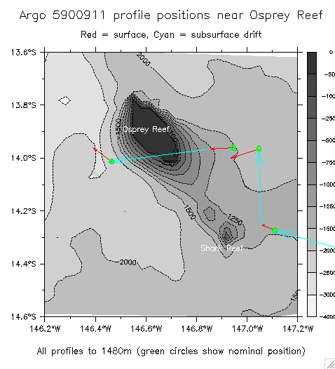
Detail of 5900911 passing Osprey Reef
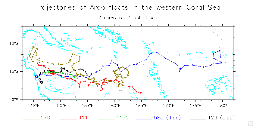
Other floats in the western Coral Sea
5900911 and 5900576 trajectories
5 floats have gone west of 150°E
Detail (Gulf of Papua)
5900911 and 5901192 surface and subsurface vectors
(Very different paths behind the Queensland Plateau)
Float tracks relevant to the SW Pacific:
Some other floats relevant to Solwara
(a partial collection)
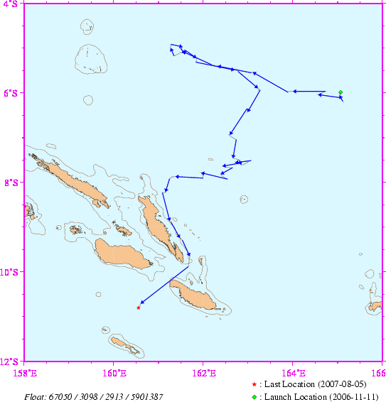
Argo 5901387 through Indispensable Strait
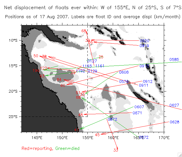
All floats that ever entered the region west of 155°E, north of 20°S in the western Coral Sea
(Collection of usgodae webpage trajectories)
Check all floats that have ever entered the region: W of 155°E, N of 25°S, S of 7°S
Net displacements and "speeds"
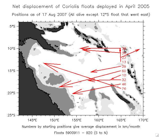
Net displacements of the 10 floats deployed during Frontalis3
Glider main page
Return to main page
Other pages:
XBT main page
XBT track data page
BMRC gridded XBT data page
XBT HiRes data page
New IFREMER page
ORCA page
2nd ORCA page (annual cycle)
3rd ORCA page (interannual)
EAC/Rossby model page
Composite El Nino
ADCP page
TOPEX page
Winds page
CARS page
CARS/Secalis comparison page
Drifter/Shipdrift page
McCreary model page
Island Rule page
Dr. William S. Kessler
NOAA / PMEL / OCRD
7600 Sand Point Way NE
Seattle WA 98115 USA
Tel: 206-526-6221
Fax: 206-526-6744
E-mail:
william.s.kessler@noaa.gov
See also:
Kessler home page
Kessler publications
PMEL home page
