Drifter and Shipdrift estimates of surface currents around NC
This work attempts to confirm the southeastward geostrophic surface currents found along the W coast of NC (see figures on the CARS page, for example Fig 2.2.h).
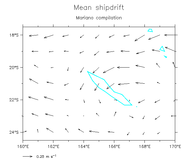
The shipdrifts show little sign of a surface eastward current in the region near NC.
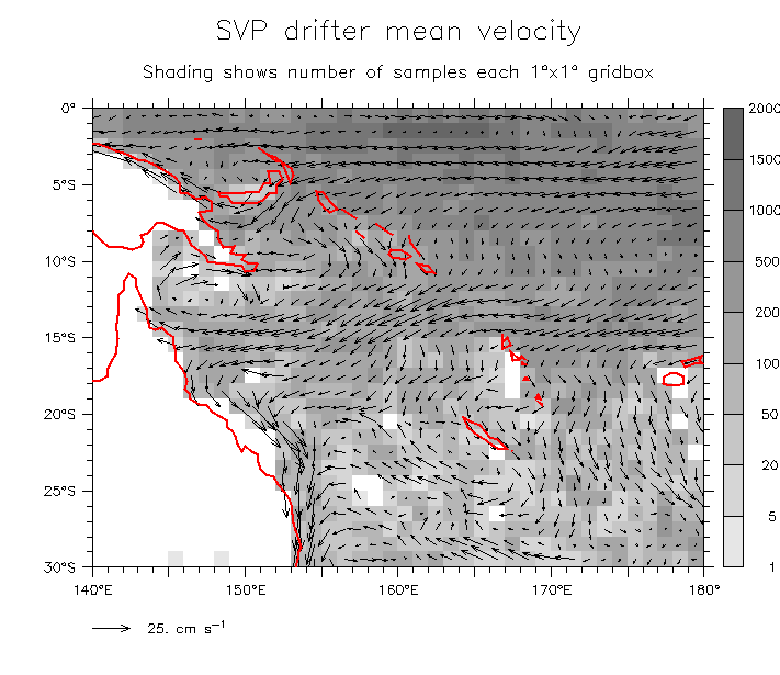
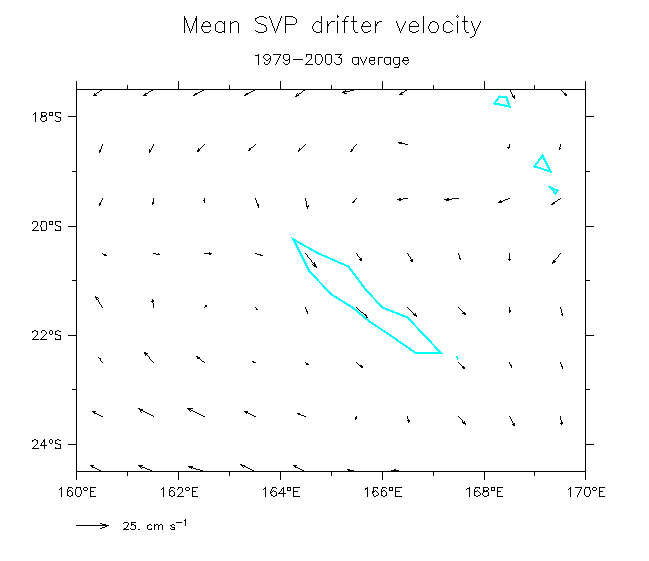
The drifters are fairly consistent with the geostrophic currents, and show the cyclonic eddy just west of NC.
Notes on gridding and filling and their consequences:
- SHIPDRIFT data
- are gridded fields provided by Mariano (Mariano and Brown, 1982, Deep-Sea Res, 39, 1255-1271). They used an OA routine that results in completely filled annual cycles, with no information about the number of obs in each box.
- Shipdrifts are known to be strongly biased by windage on the ships (Reverdin et al, 1994, JGR, 99,20323-20344). For the NC region, windage results in a NW-ward bias, which will tend to oppose the SE-ward current seen in geostrophy.
- DRIFTER data
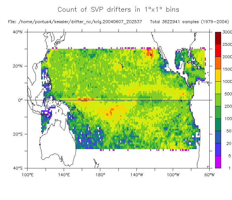
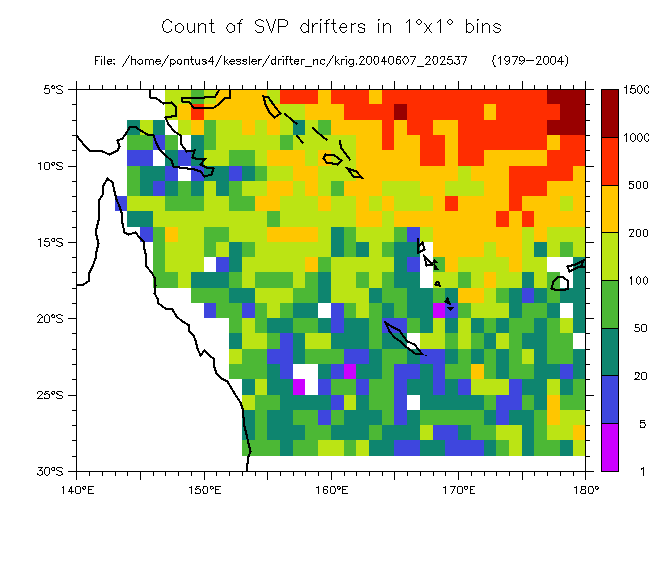
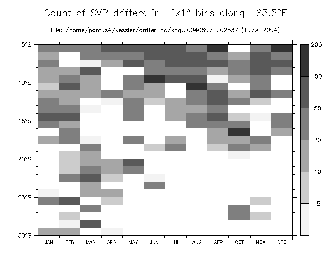
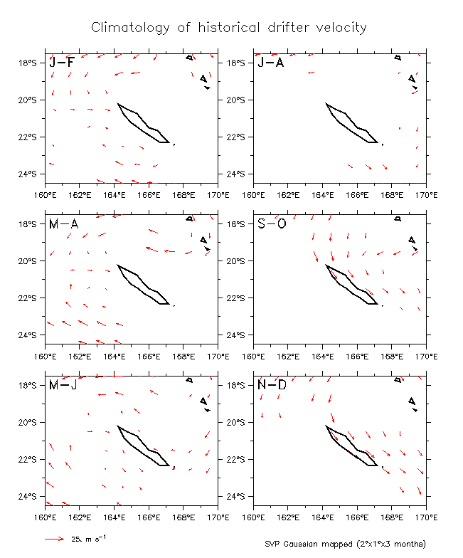
are provided as kriged positions/velocities every 6 hours (Niiler et al, 1995, Deep-Sea Res, 42, 1951-1964). I gridded them myself (using only drogue-on drifters), using a Gaussian-weighted gridding routine (Kessler and McCreary, 1993, JPO, 23, 1192-1207), with scales 2° longitude, 1° latitude, and 3 months. This procedure allows nearby points to fill some missing gridboxes, however, many are still left empty. The drifters are poorly sampled in the SW Pacific (see Figs 2.1). Especially, the sampling is biased towards the first half of the year near NC (see 3rd figure of 2.1).
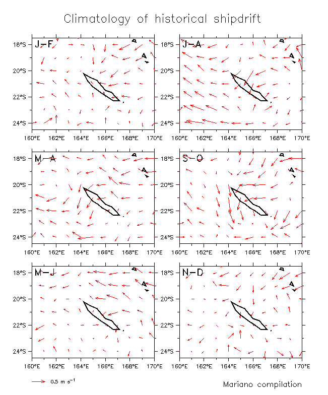
- CONSEQUENCES AND INTERPRETATION (OPINION!): It might appear that the drifter sampling is a poor choice for looking at the circulation near NC (e.g. the seasonal cycle in Figs. 2.4 (blanked)), since there are so many missing points. Certainly these data must be used with caution. However, note that the missing months are just those which include the strongest SE-ward surface current along the W side of NC, like the geostrophic currents. Even the shipdrifts show this current during Sep-Dec (Fig. 1.2), when the drifter sampling is largely missing (Fig. 2.1 and 2nd Fig. of 2.4, which excludes any box without an observation during that month, avoiding all filling). Thus, I think that the Gaussian-filled drifter fields are a better representation of reality (1st of Figs. 2.4). My tentative conclusion is that these surface data sets are consistent with the existence of a SE-ward current along the W side of NC.
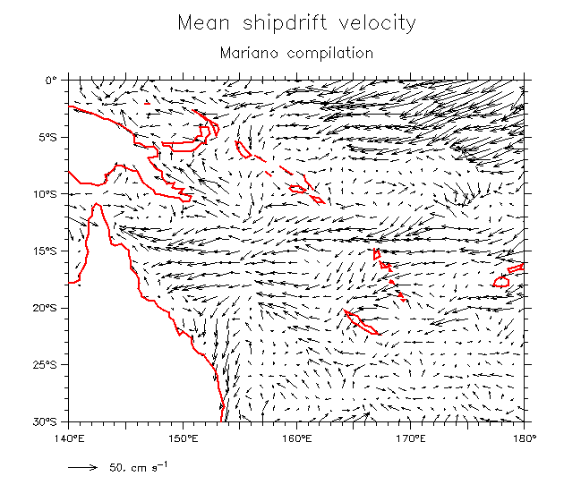
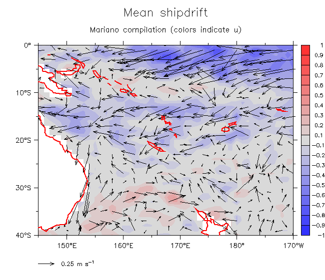
- Shipdrift estimates:
- Mean:
- SW Pacific (Compare 2.2 below, note different vector scale)
- Color zonal component
- NC region (Compare 2.3 below)
- Annual cycle: 6 bimonths All overlaid
- Drifter estimates:
- Distribution of samples: Basin-wide SW Pacific Along 163.5°E
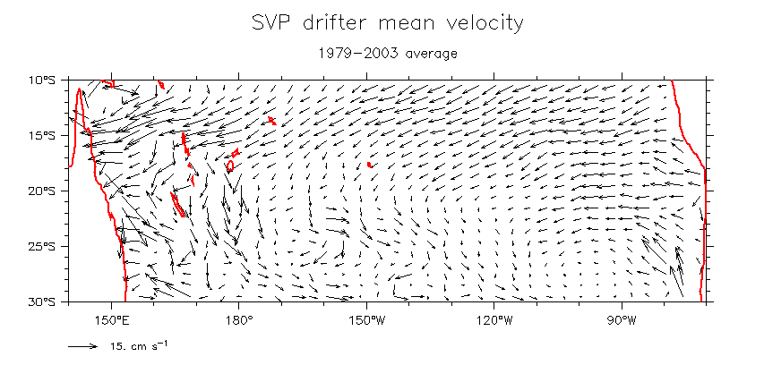
- SW Pacific Mean: SW Pacific (Compare 1.1.a above, note different scale)
Overlay sample count Blank if fewer than 25 samples/gridbox
- NC region mean (Compare 1.1.c above)
- Annual cycle: Gaussian gridded and filled Blanked for no obs each month
- Mean across S Pacific (STCC??)
Return to main page
Other pages: