Figures showing gridded BMRC XBT data
- Initial explorations: BMRC gridded product
(unless otherwise noted, DH and u_g are relative to 500m)
- Mean meridional sections
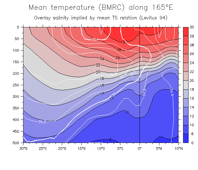
- Mean T along 165°E, and S implied by a mean T-S relation
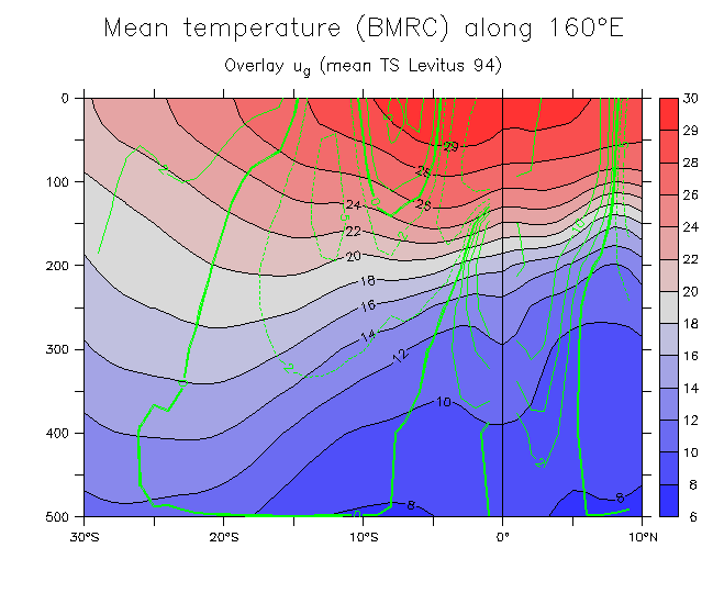
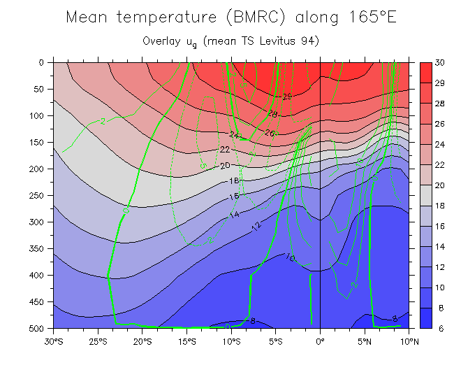
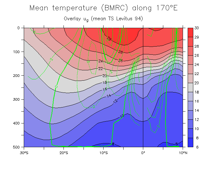
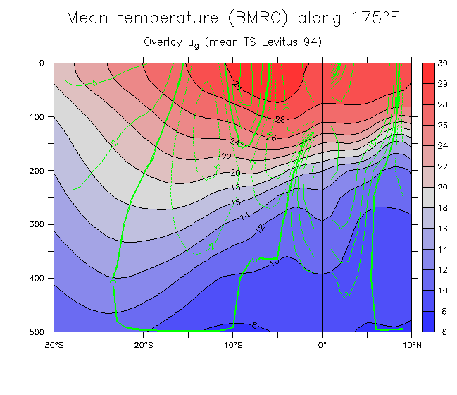
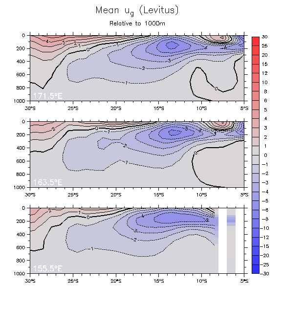
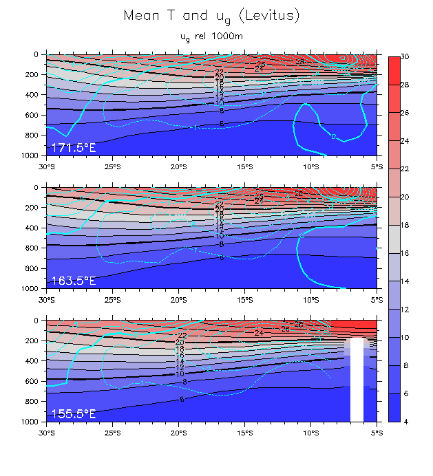
- Mean T, overlay u_g:
160°E
165°E
170°E
175°E
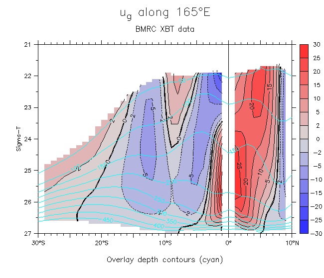
- Mean u_g along 165°E on density levels
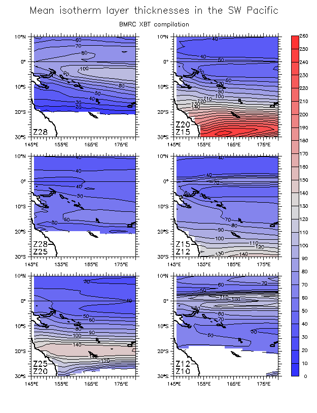
- Maps of isotherm depths: Mean isotherm depths Thicknesses
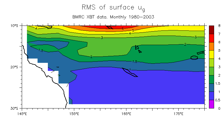
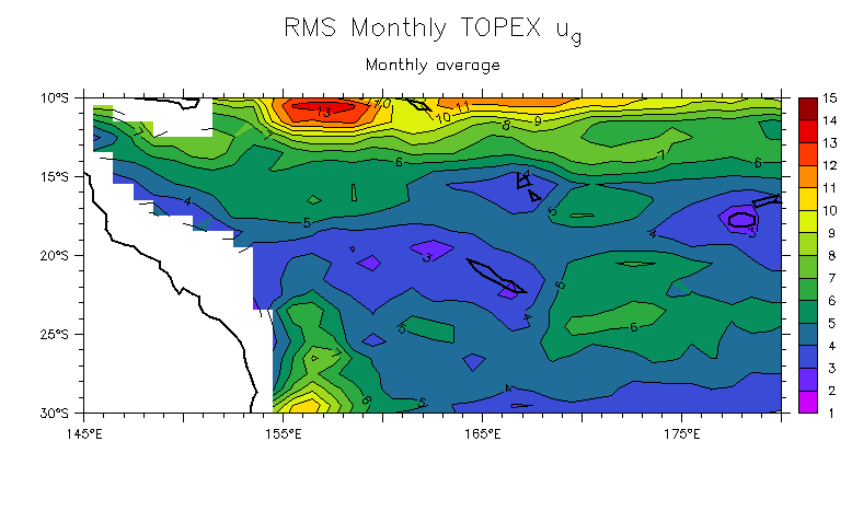
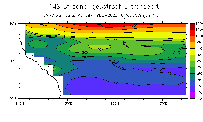
- Maps of RMS ug: ug (Compare TOPEX) Zonal transport
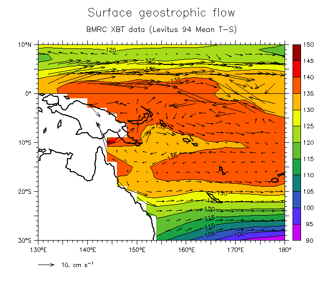
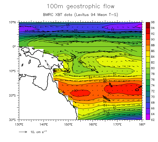
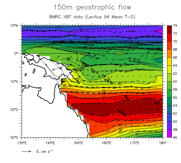
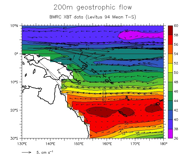
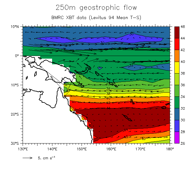
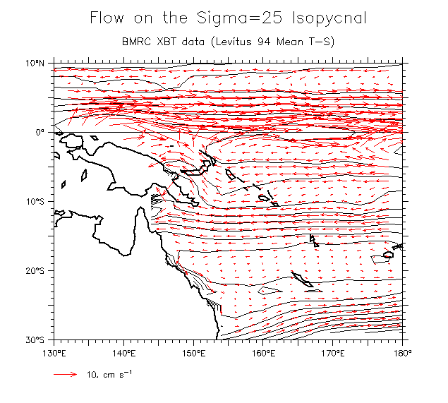
- Maps of DH and geostrophic currents at various depths:
- Surface
- 100m
- 150m
- 200m
- 250m
- On Sigma-t=25 (MSF)
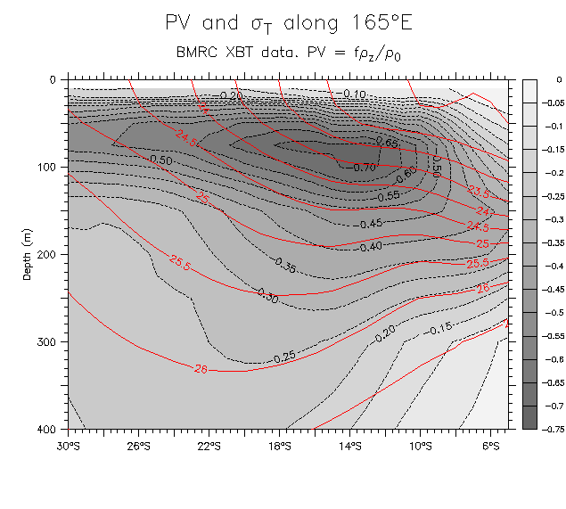
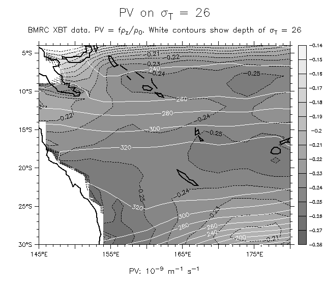
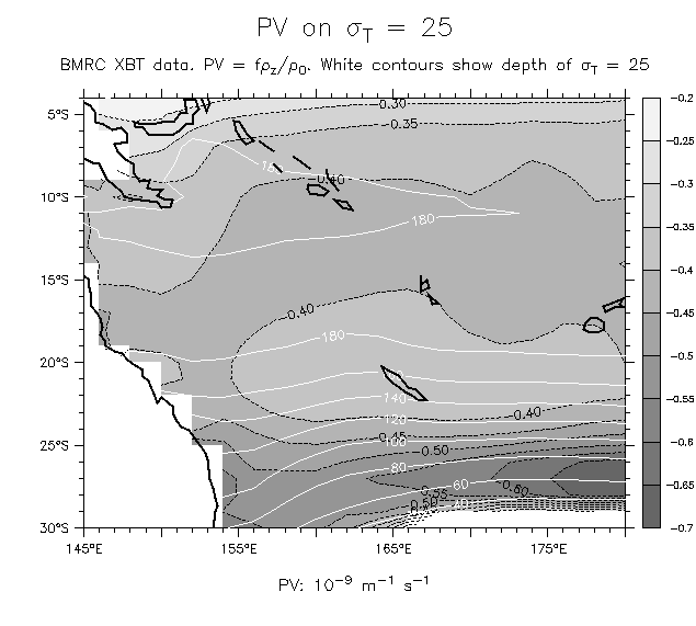
- PV [f*d(rho)/dz]/rho0:
- Along 165°E On density coordinates
- On Sigma-t=26 On Sigma-t=25
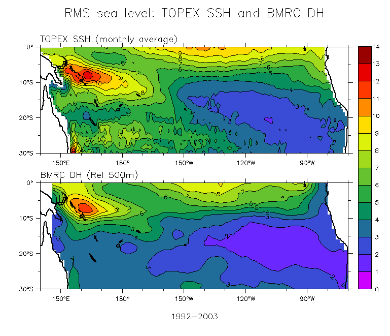
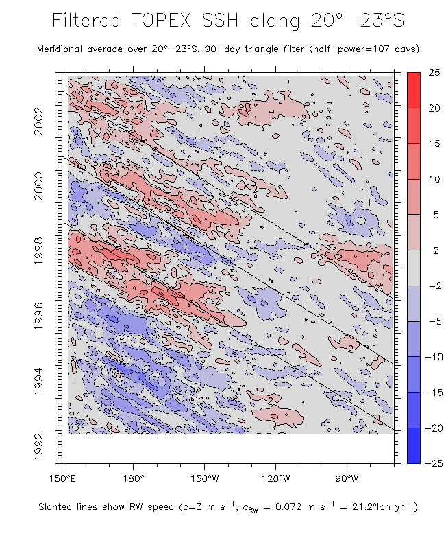
- Comparisons with TOPEX:
- TOPEX and DH RMS in the S Pacific
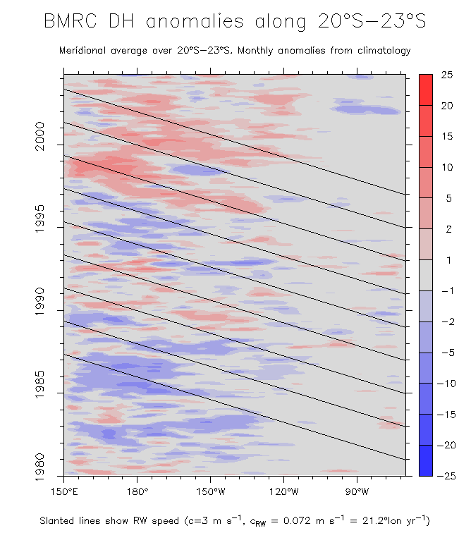
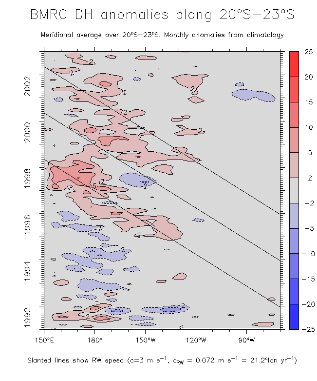
- Time series of interannual DH along 20°-23°S (1980-2003)
Time series 1992-2003 Compare TOPEX
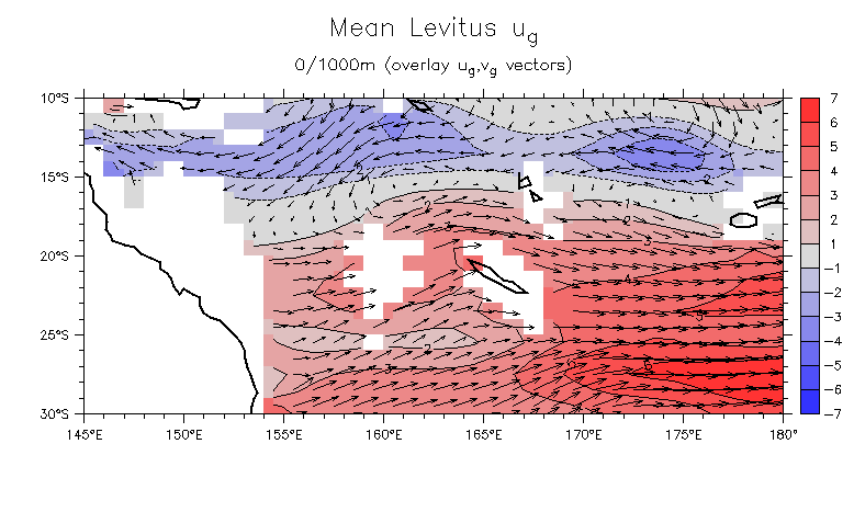
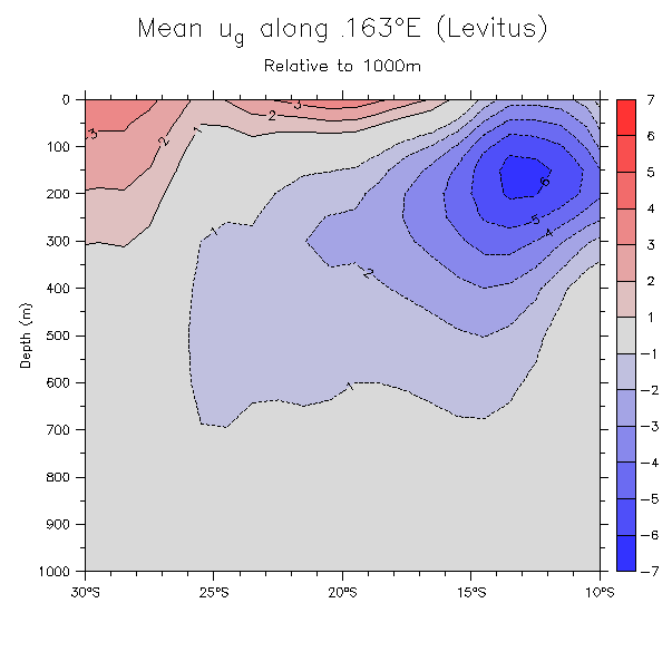
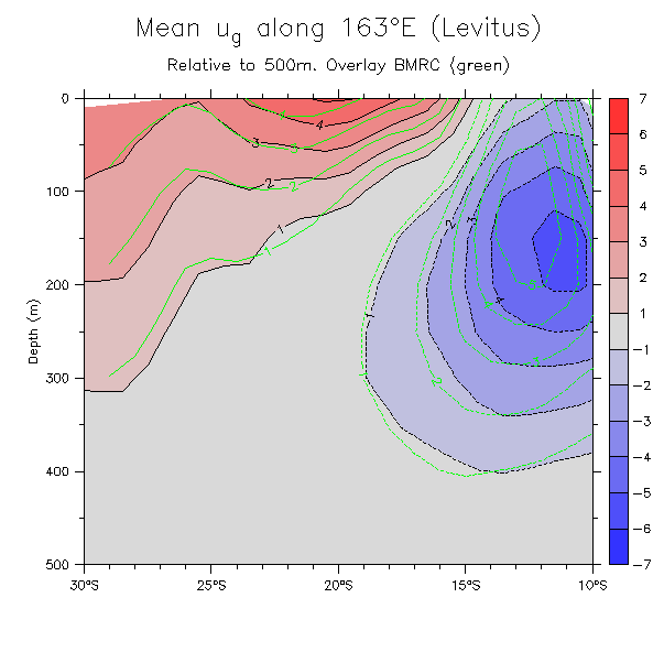
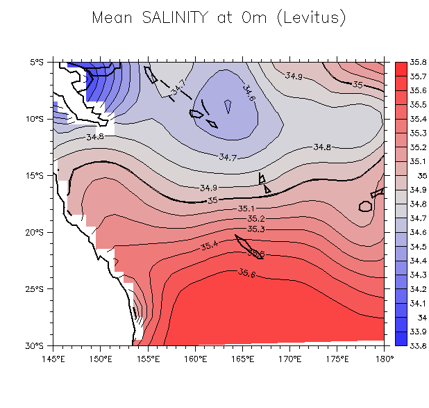
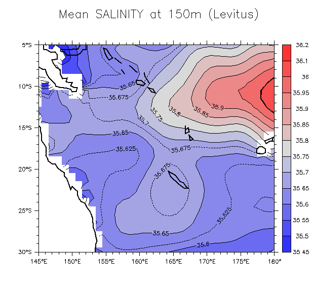
- Comparisons with Levitus:
- Levitus surface u_g
- Levitus u_g along 163°E Overlay BMRC u_g
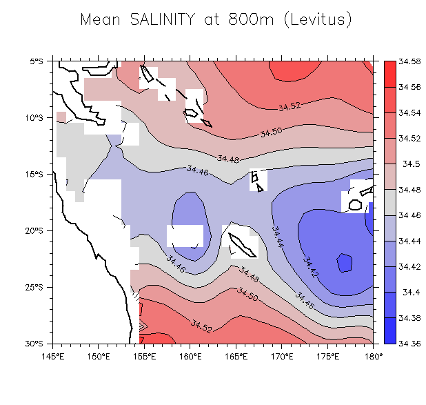
- Salinity on depth surfaces: 0m 150m 800m
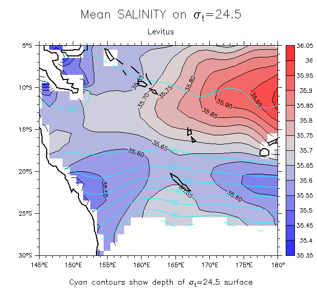
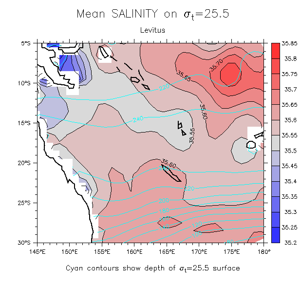
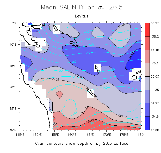
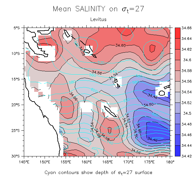
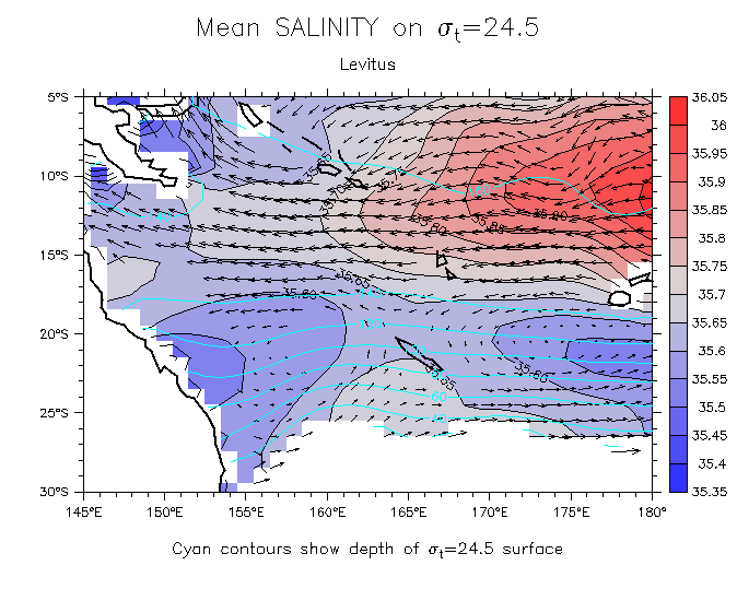
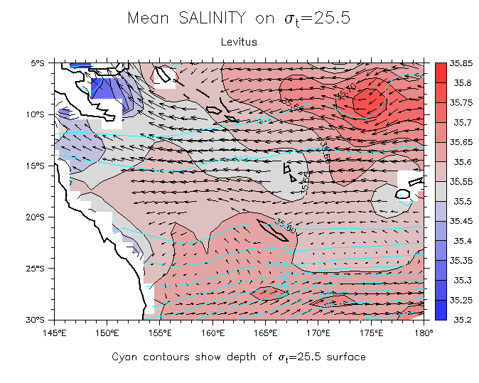
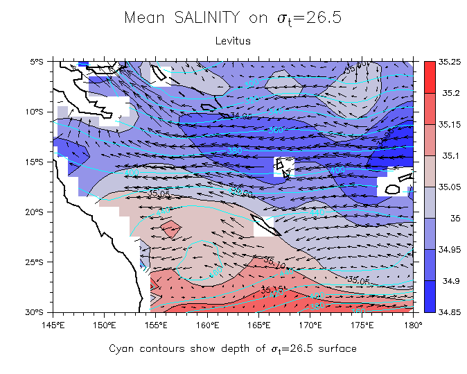
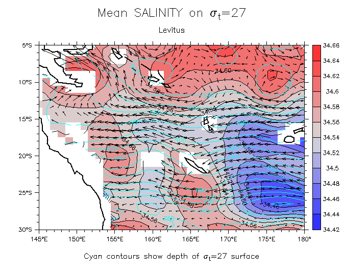
- Salinity on isopycnals: 24.5 25.5 26.5 27
Overlay velocity: 24.5 25.5 26.5 27
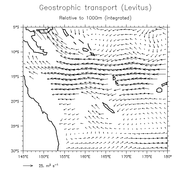
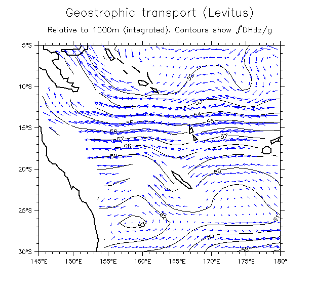
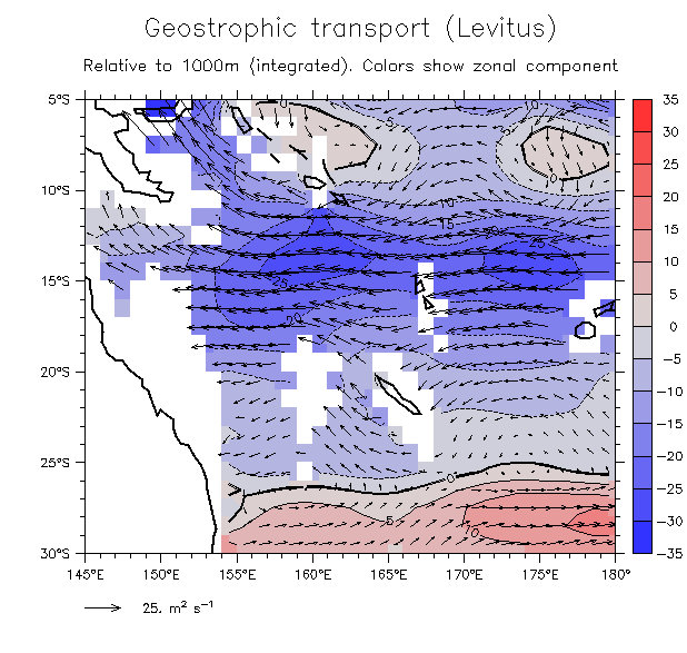
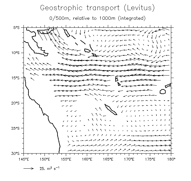
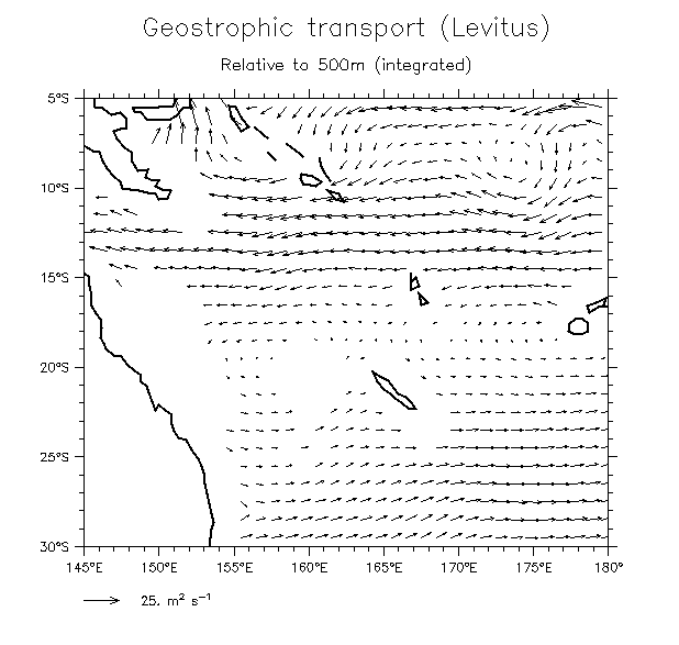
- Integrated transports: 0/1000m Vectors With transport streamlines Overlay shaded u 0/500m (rel 1000) 0/500m (rel 500)
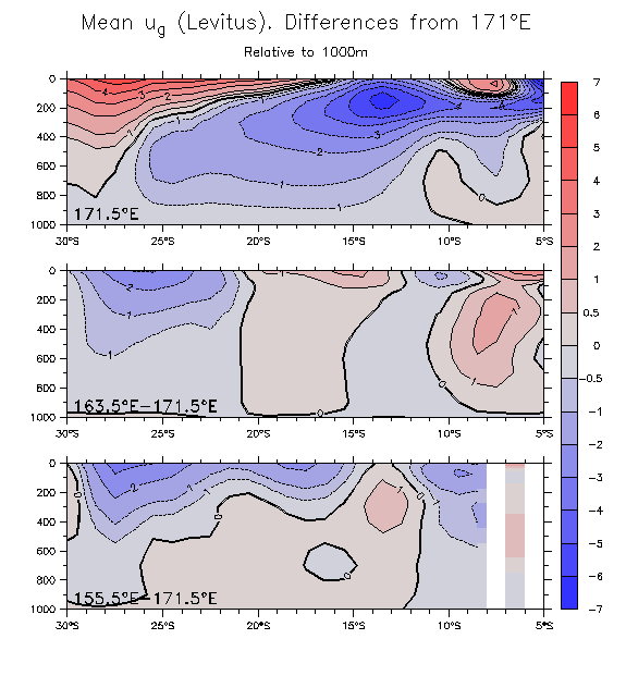
- Meridional sections of u: u u over T Differences from 171°E
Return to main page
Other pages: