Figures showing ADCP data
(Note: there was an incorrect year in two data files that were used to make some of the first plots here.
The cruise coare3 took place in 1992, not 1991. The cruise ebene75 took place in 1996, not 1991.
In some of these plots they are labeled incorrectly.)
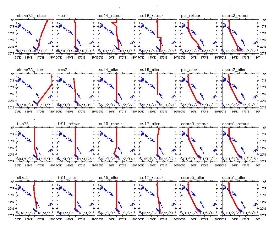
- Maps of all cruises tracks N from NC
- Track lines and first look at the u-fields
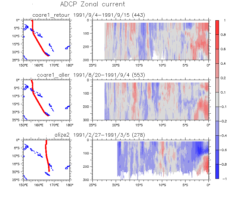
- alize2 / coare1_aller / coare1_retour
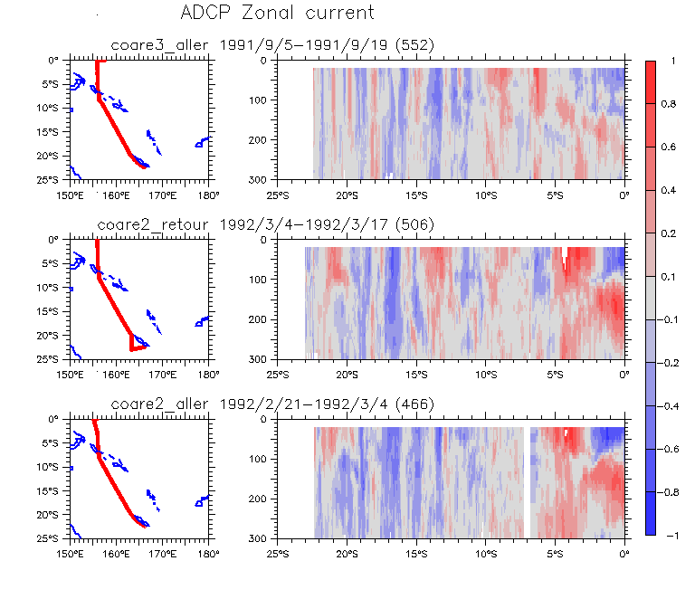
- coare2_aller / coare2_retour / coare3_aller
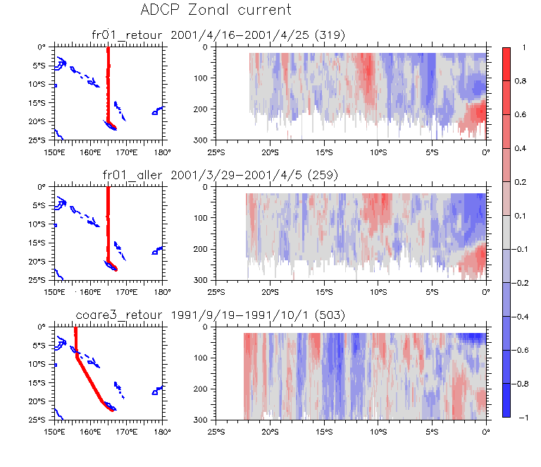
- coare3_retour / fr01_aller / fr01_retour
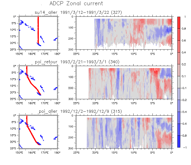
- poi_aller / poi_retour / su14_aller
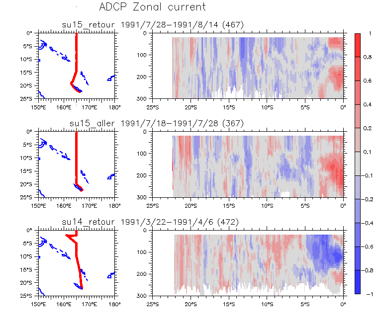
- su14_retour / su15_aller / su15_retour
- su16_aller / su16_retour / su17_aller
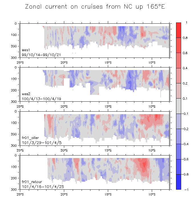
- su17_retour / wes1 / wes2
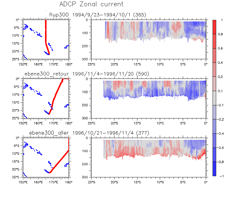
- 600m: ebene75_aller / ebene75_retour / flup75
- 150m: ebene300_aller / ebene300_retour / flup300
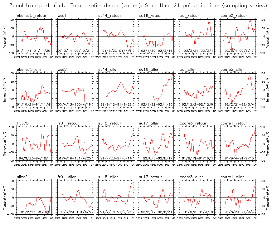
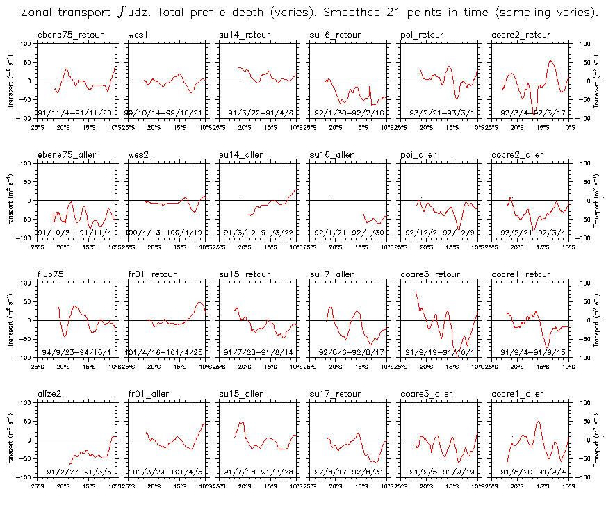
- Summary of zonal transport all cruises Detail 25°S-10°S
- Sections across the SEC
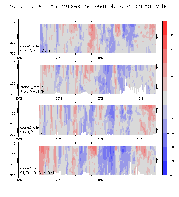
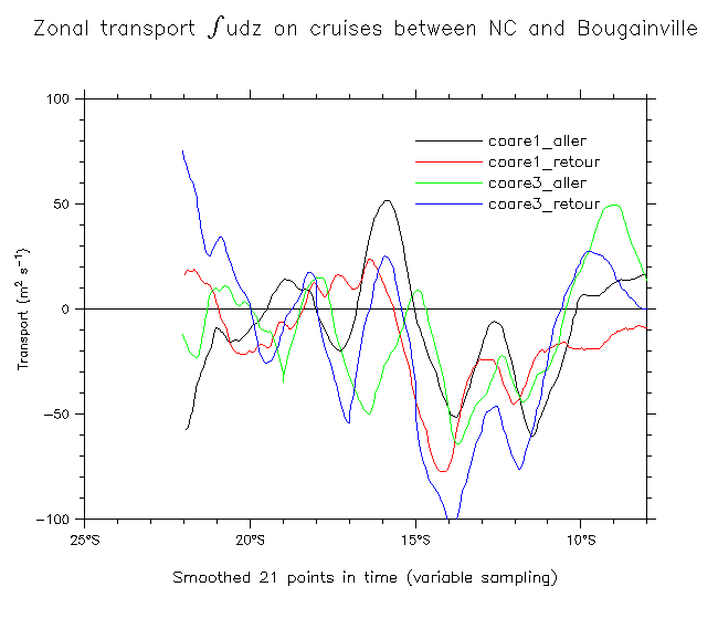
- NC-Bougainville in Aug-Sep 1991 and 1992
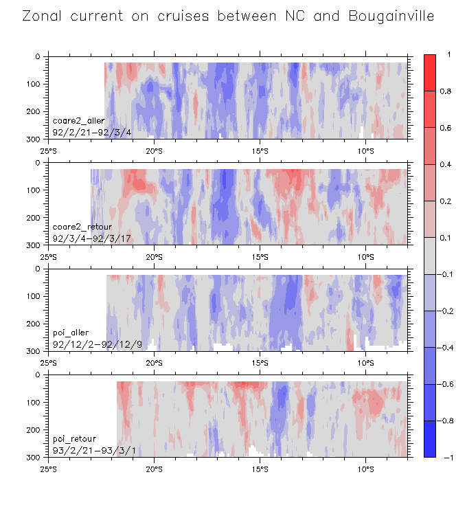
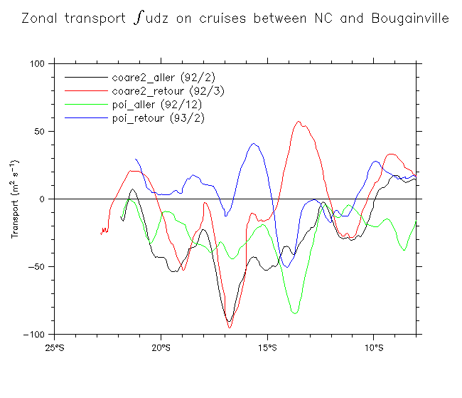
- NC-Bougainville in 1992 and 1993
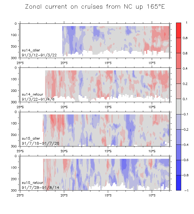
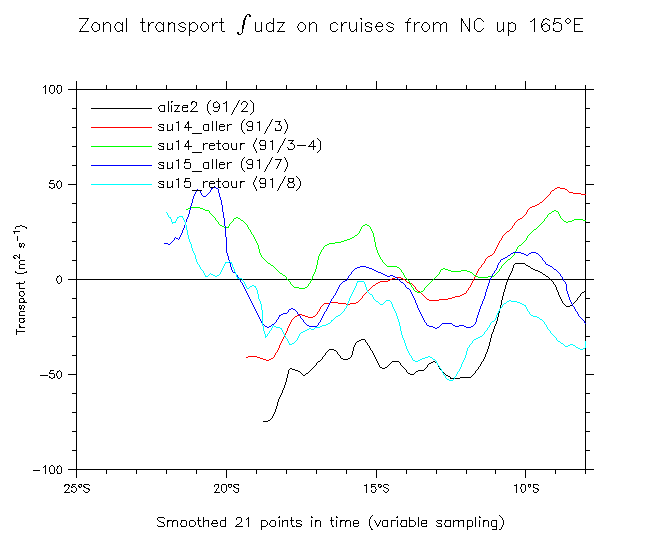
- NC-165°E in 1991
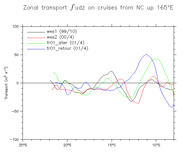
- NC-165°E in 1999-2001
- Integrated transports of sections across the SEC
- NC-Bougainville in Aug-Sep 1991 and 1992
- NC-Bougainville in 1992 and 1993
- NC-165°E in 1991
- NC-165°E in 1999-2001
Return to main page
Other pages: