TAO temperature profiles
TAO temperature profiles
Links to other pages:
1a. TAO/model comparisons (This page)
1b. Model exploration 1 (E Pacific mixing)
2. Model Exploration 2 (Other things)
3. Model Exploration 3 (circ E of Australia)
4. Two-delta-x wave?
5. Throughflow XBT lines
6. Writeup
- 95°W
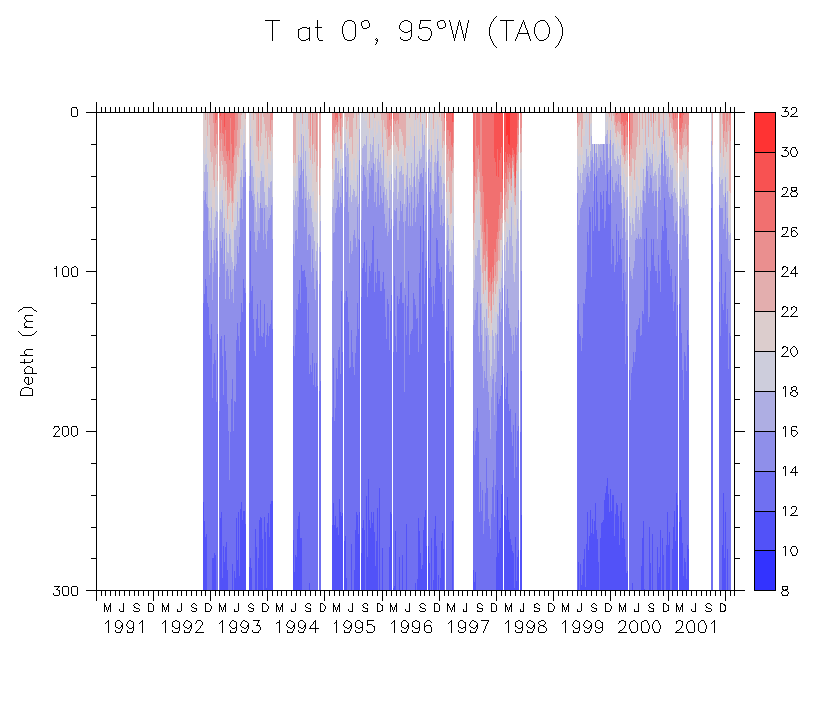
- T(z,t)
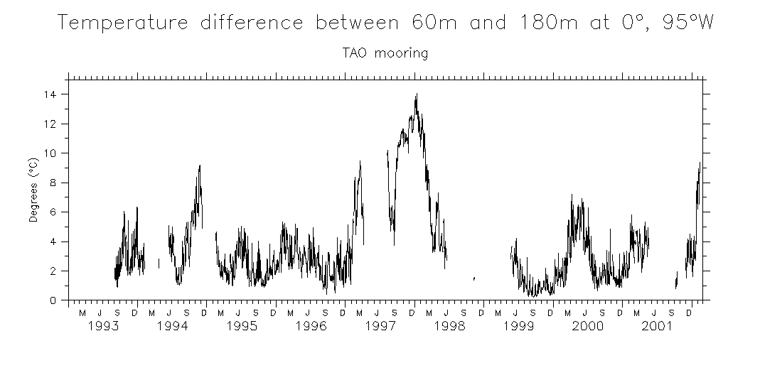
- dT/dz(z,t) T(60m)-T(180m)
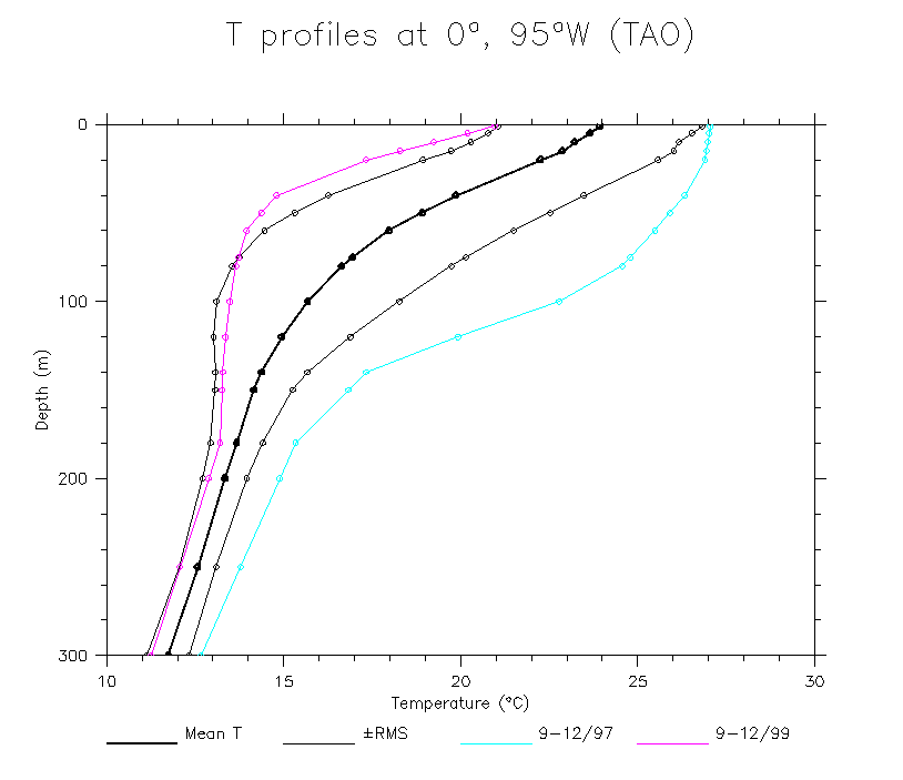
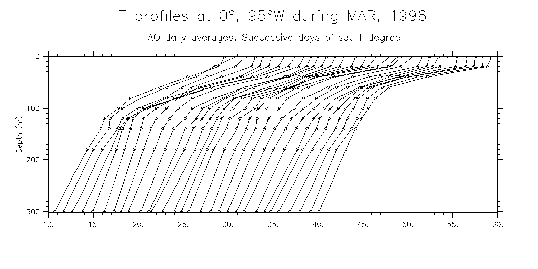
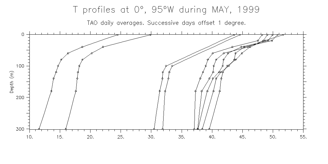
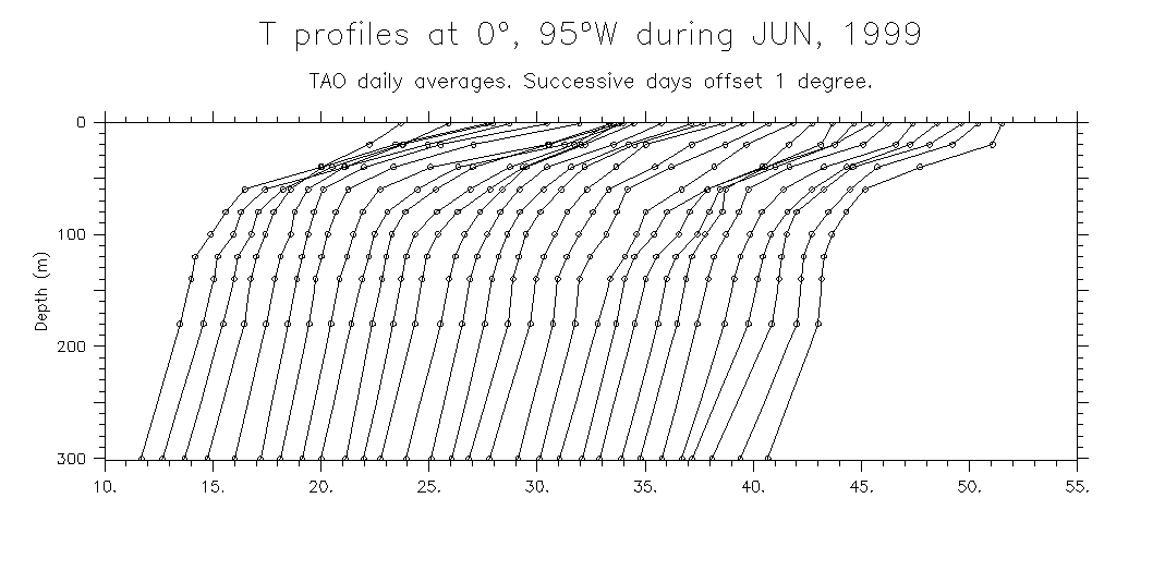
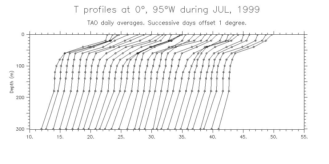
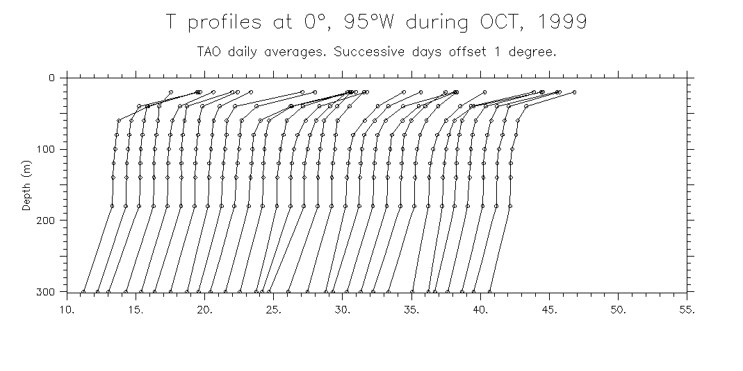
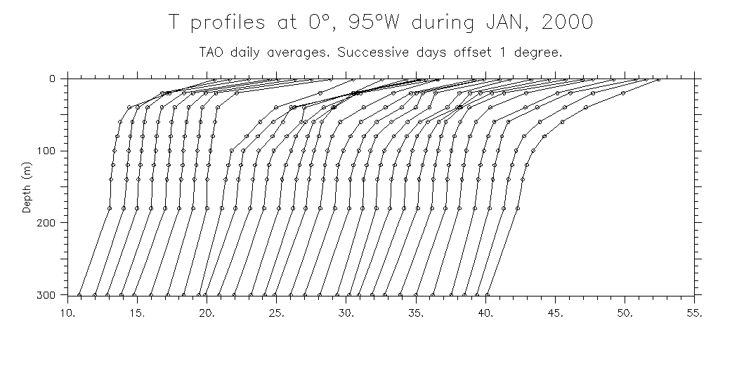
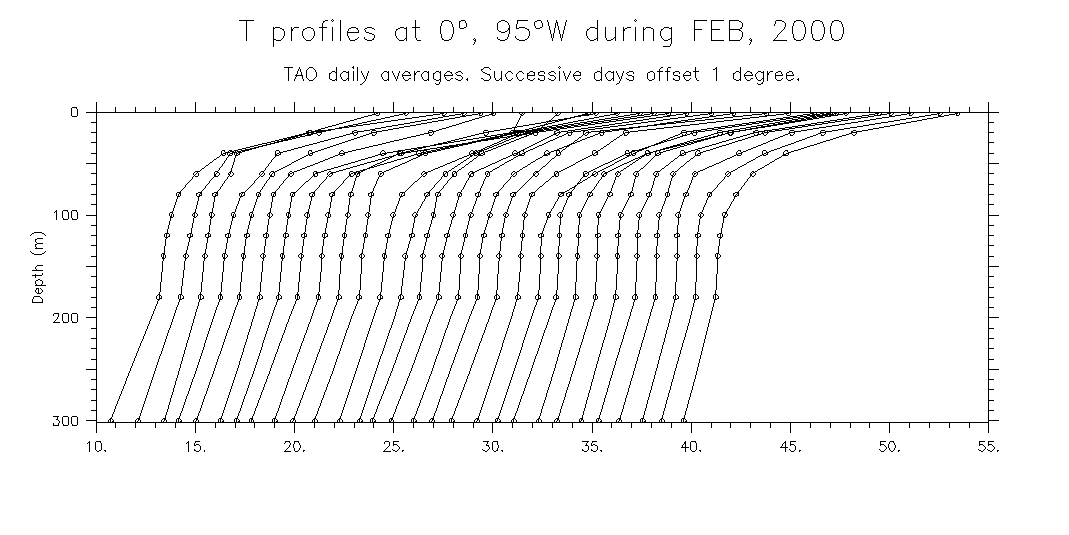
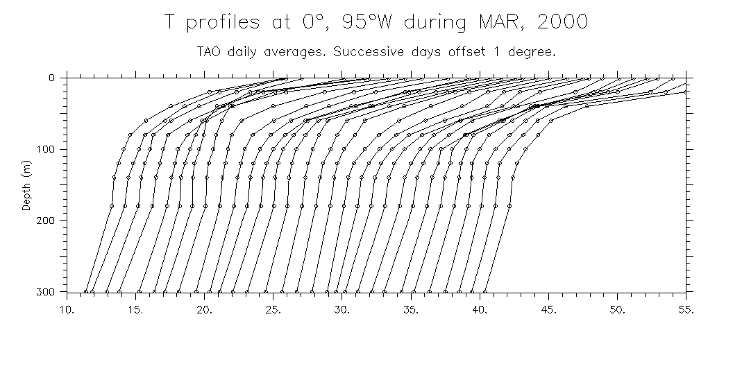
- Examples of profiles
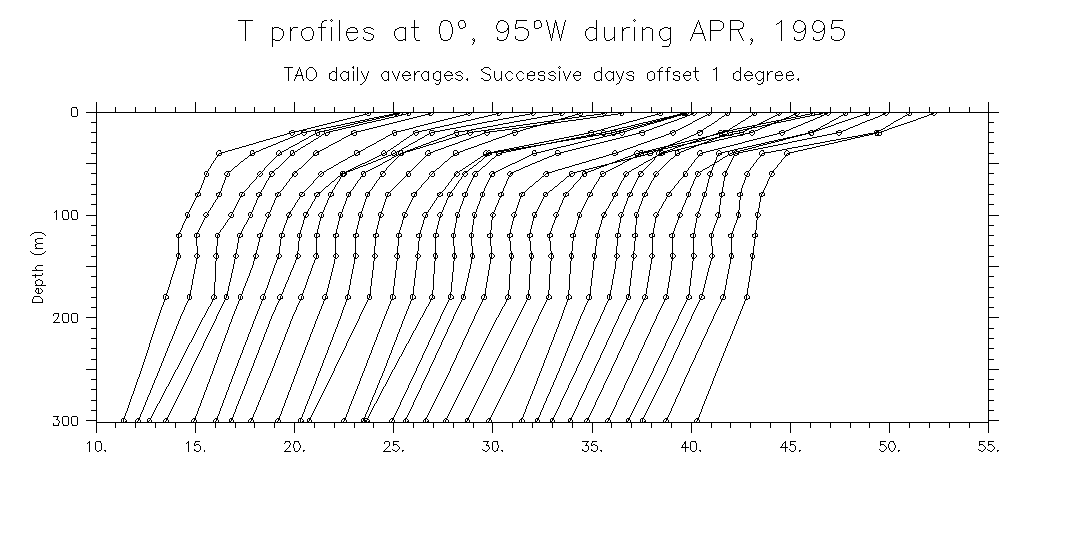
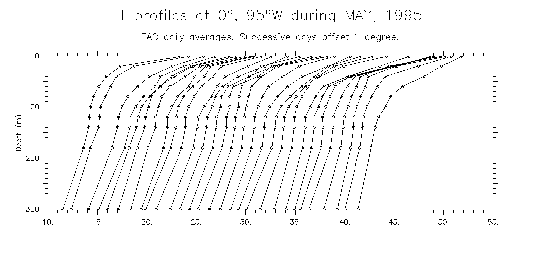
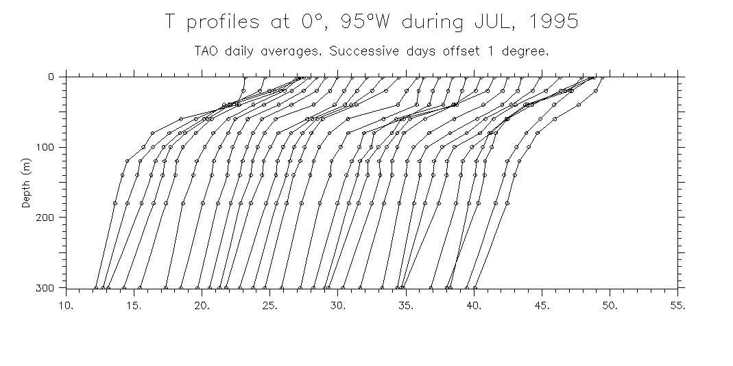
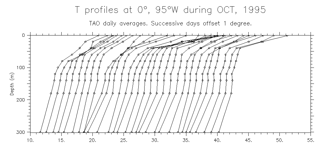
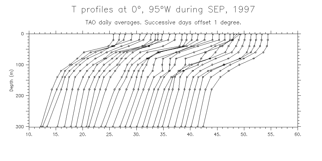
Waterfall plots during episodes of deep mixed layers:
- Mid-1995: Apr May Jun Jul Aug Sep Oct
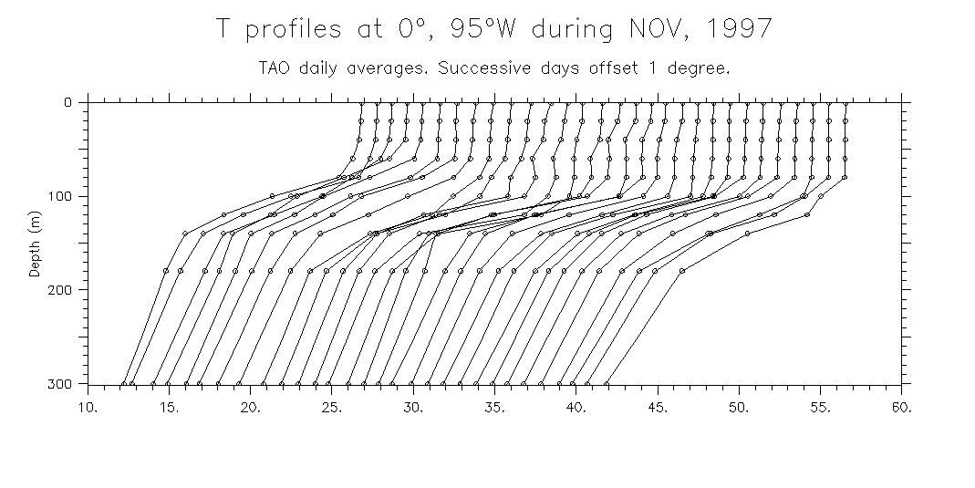
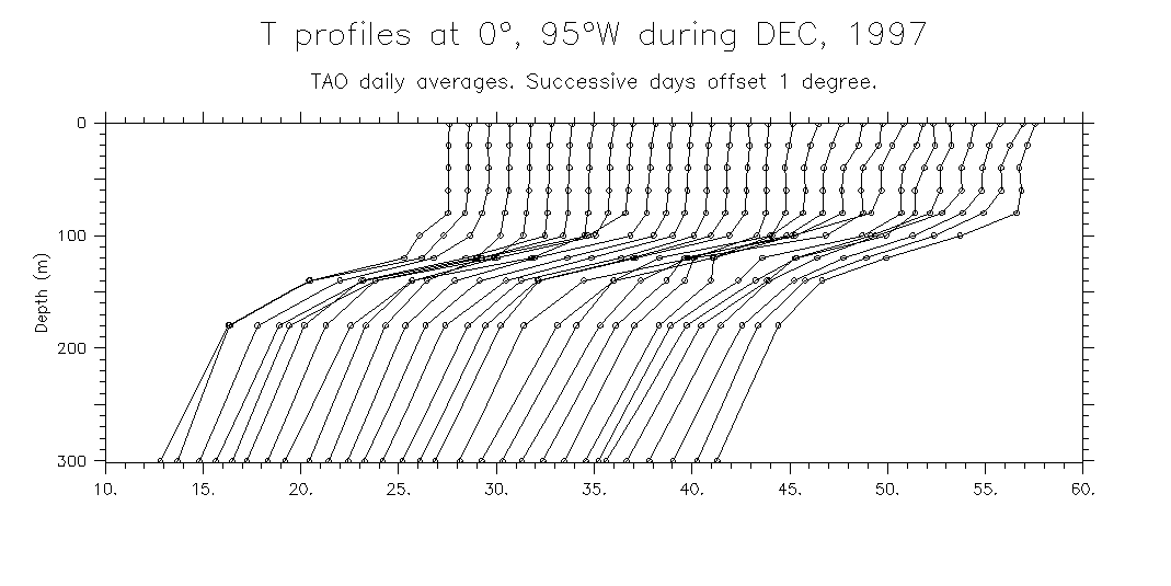
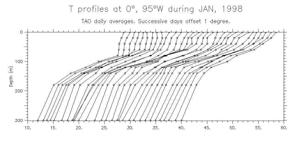
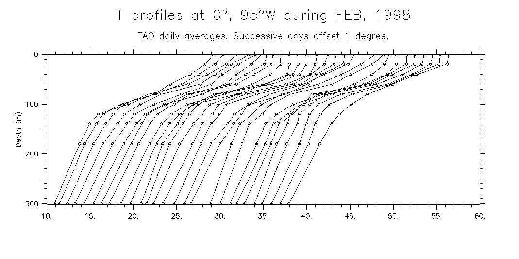
- 1997-87 El Niño: Aug Sep Oct Nov Dec Jan Feb Mar
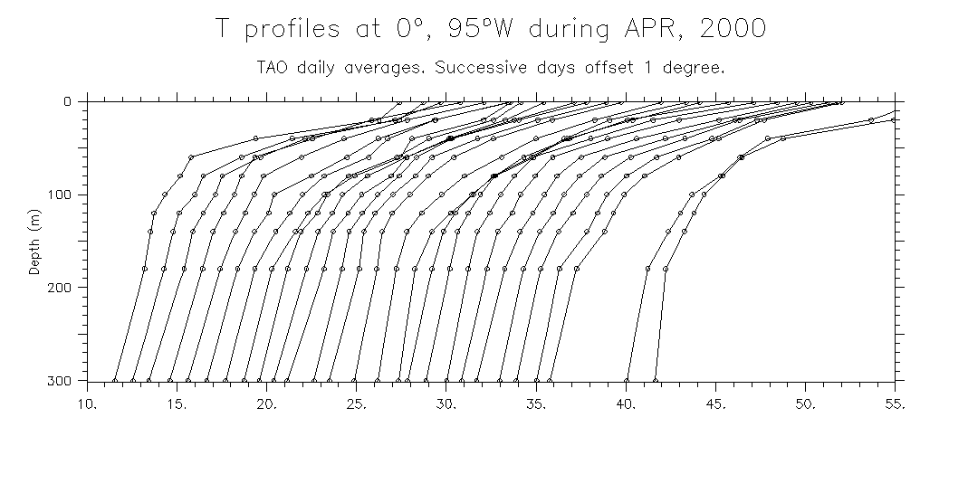
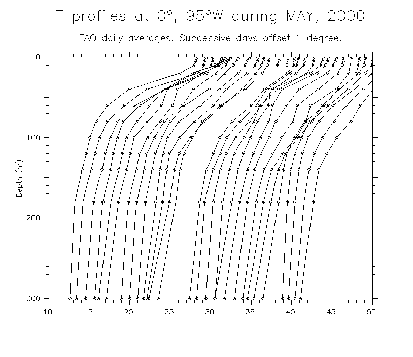
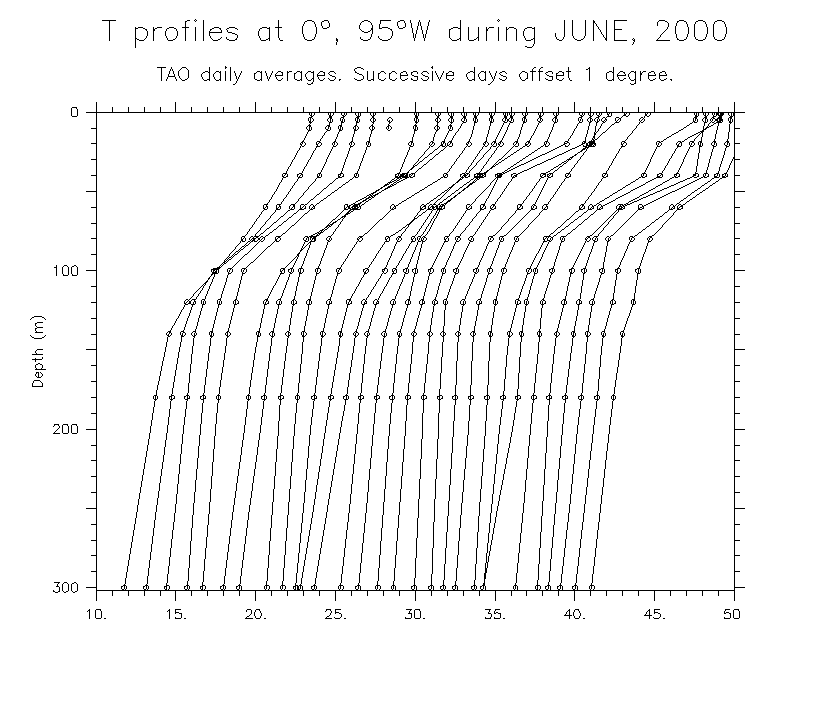
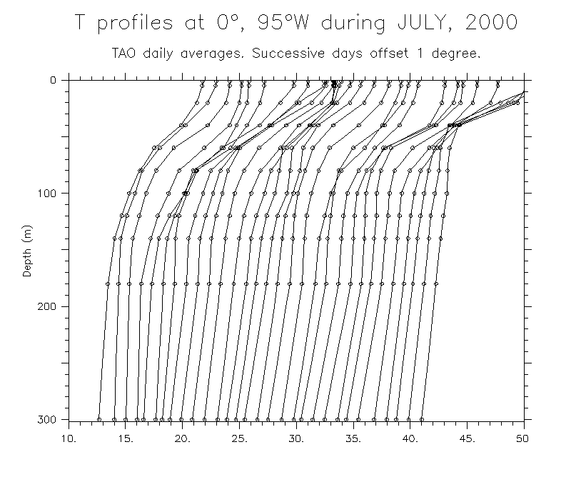
- Largest event (1999-2000): May Jun Jul Aug Sep Oct Nov Dec Jan Feb Mar Apr May Jun Jul
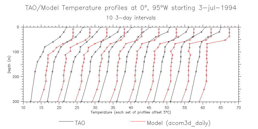
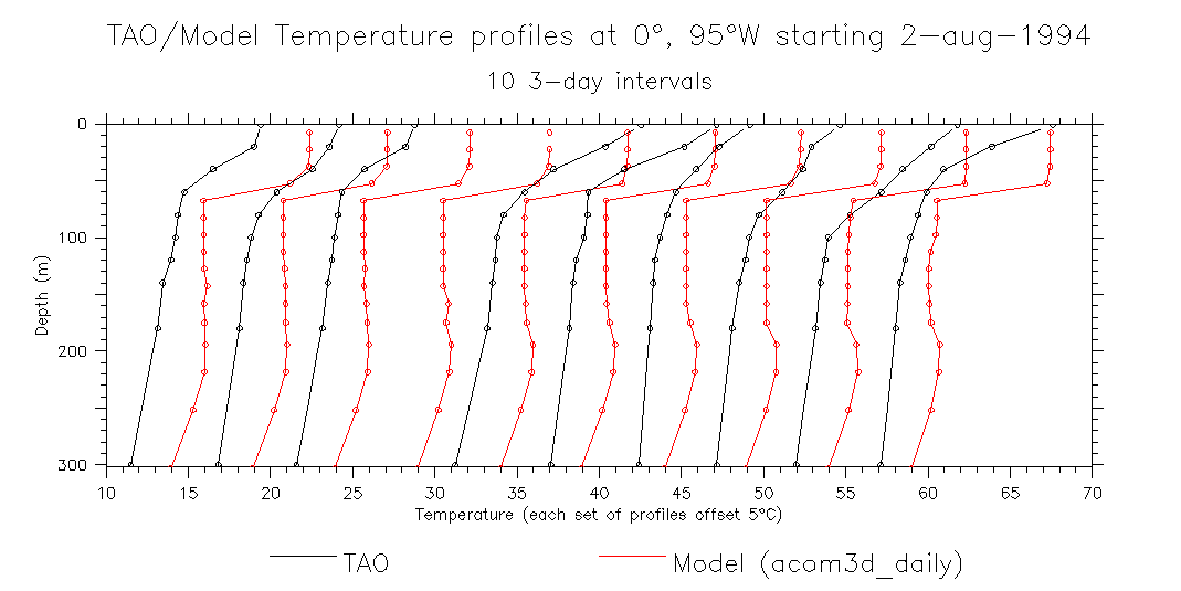
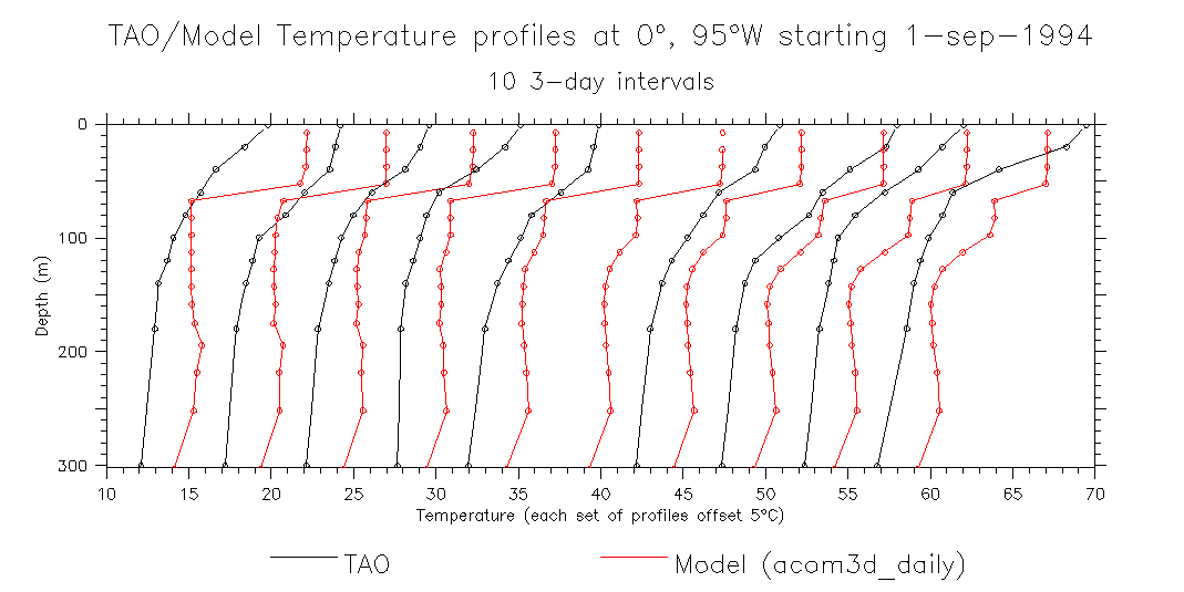
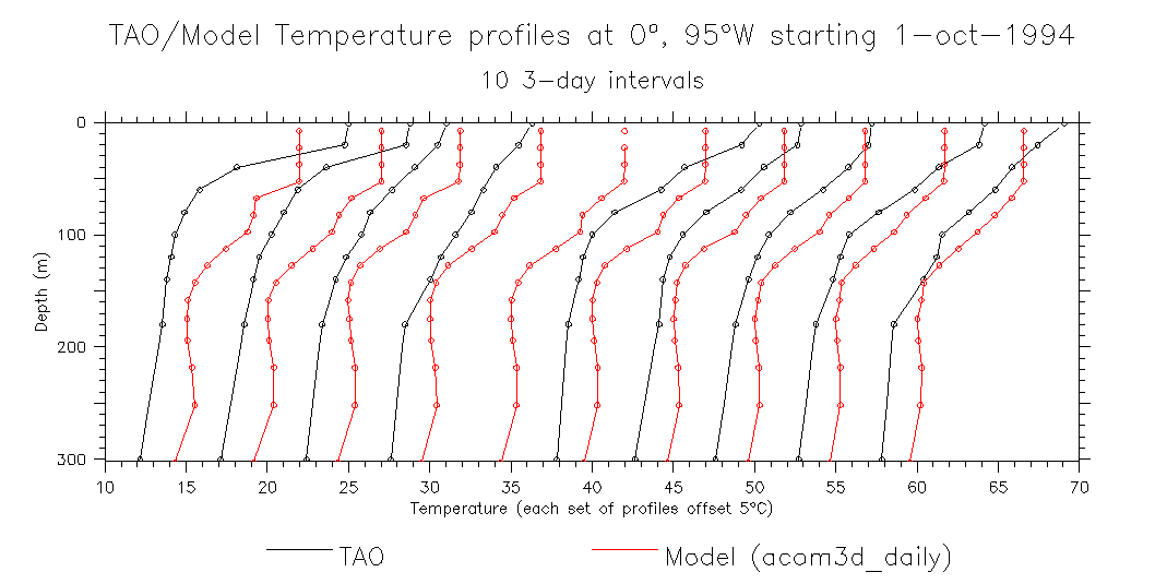
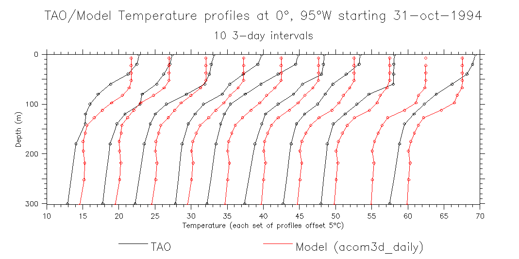
- Sequences of overlaid model and TAO profiles (Jul-Nov 1994): Jul Aug Sep Oct Nov
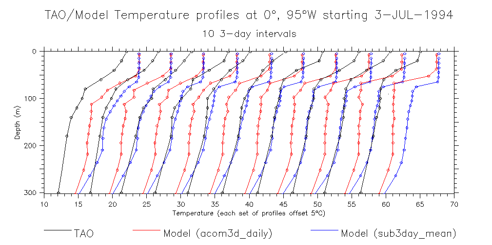
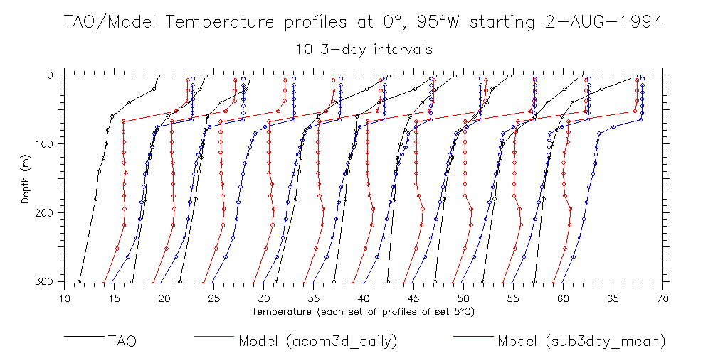
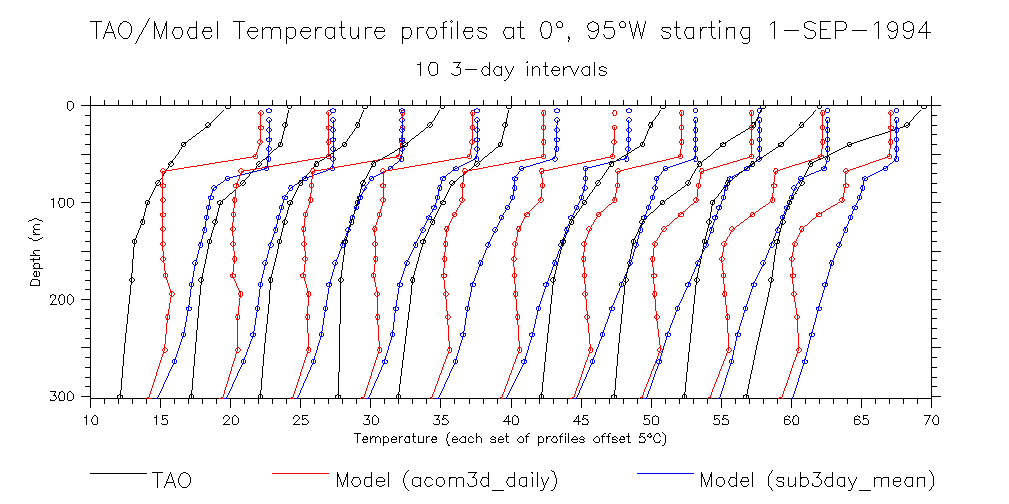
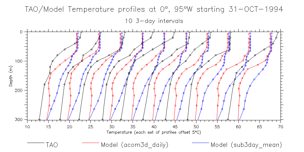
- Overlay both ACOM2 (acom3d_daily) and ACOM3 (sub3day_mean): Jul Aug Sep Oct Nov
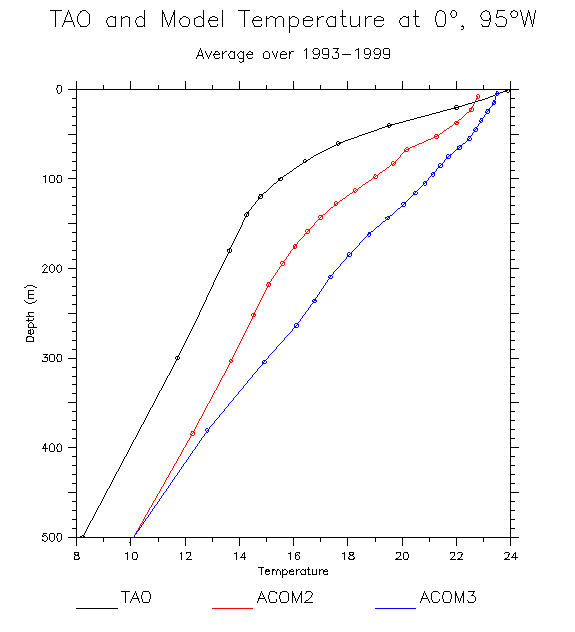
- Mean TAO and model T profiles at 0°, 95°W
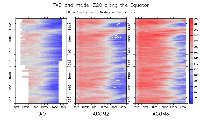
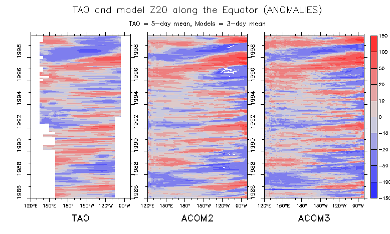
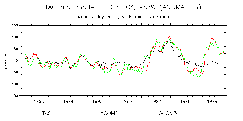
- Z20 along Eq: Data Anomalies Anomalies (monthly means) Time series at 95°W
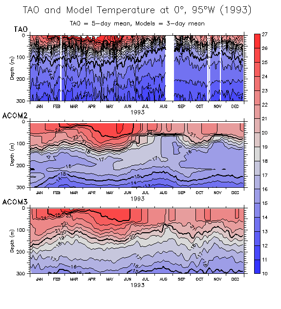
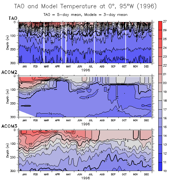
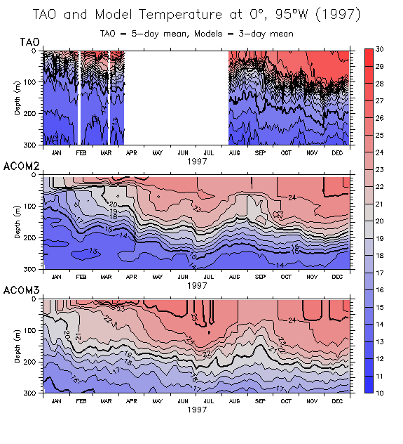
- T(z,t) time series at 0°, 95°W: 1993 1994 1995 1996 1997 1998
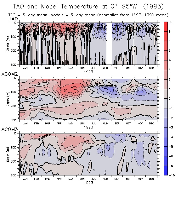
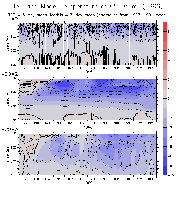
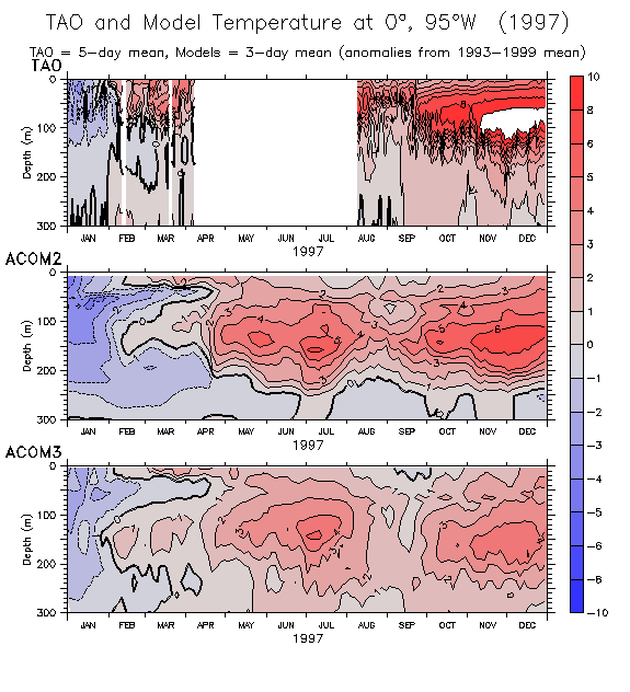
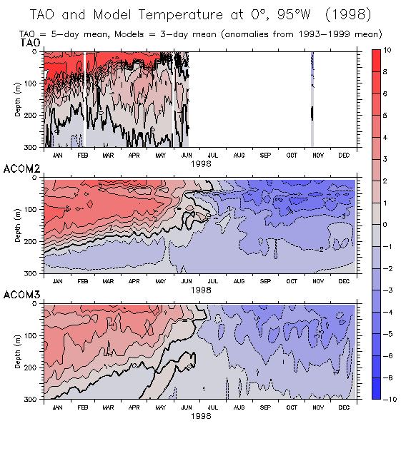
- Anomalies at 0°, 95°W: 1993 1994 1995 1996 1997 1998
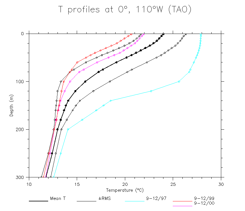
- 110°W
- T(z,t)
- dT/dz(z,t)
- Examples of profiles
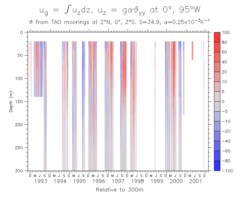
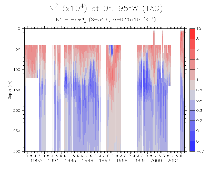
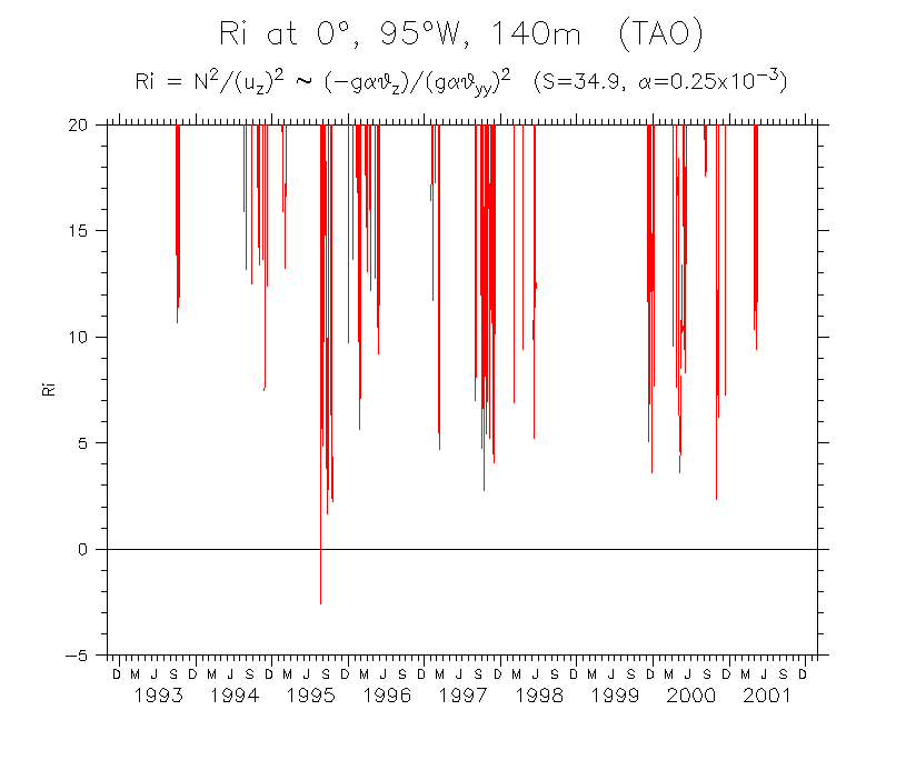
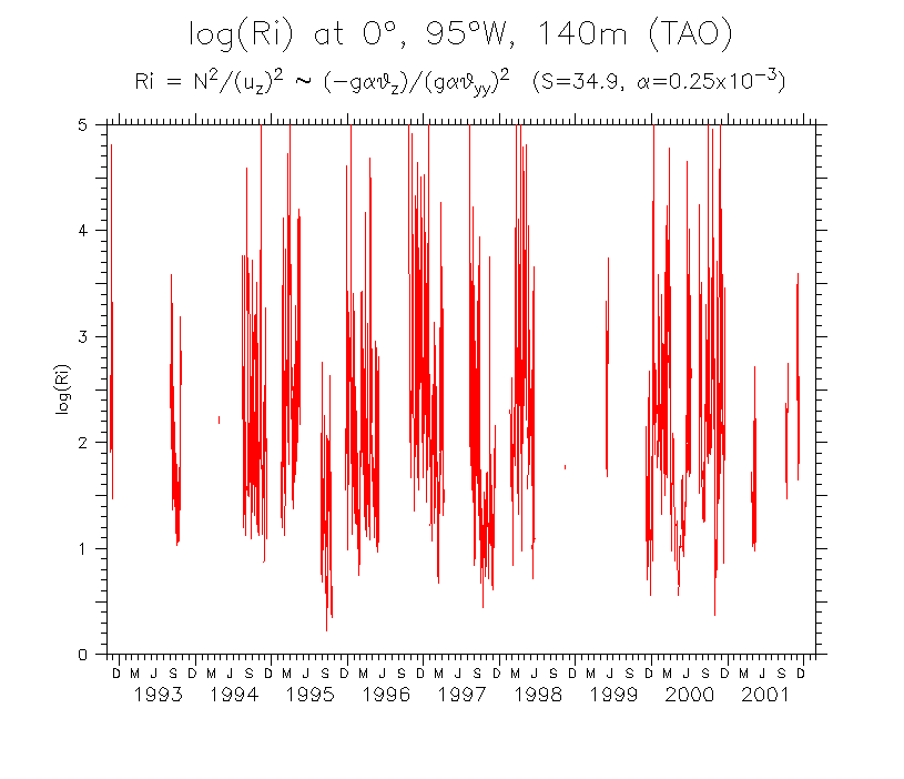
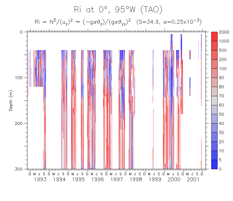
- An attempt to estimate Ri at 0°, 95°W
Use T data only and equatorial geostrophy (2°S-2°N) to estimate N2/(uz)2
- T at 2°N, 0° and 2°S (find common dates)
- Ug estimated from equatorial geostrophy
- N-squared at 0°, 95°W
- Ri at 140m (min?) log(Ri)
- Ri result???
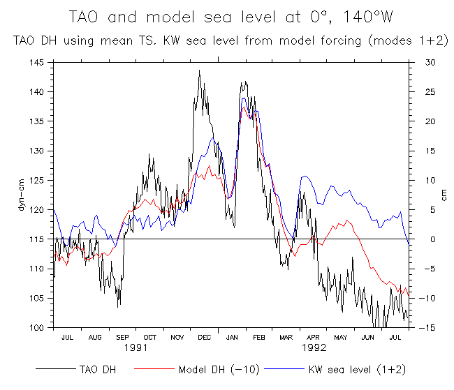
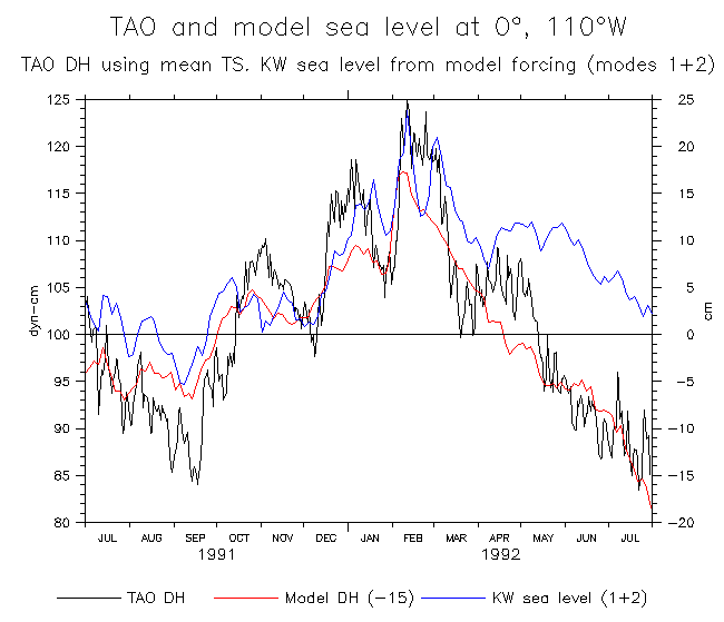
- A linear baroclinic mode Kelvin wave solution compared to TAO and model DH
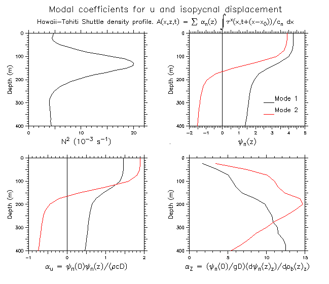
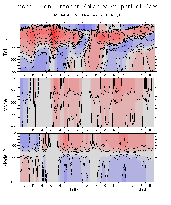
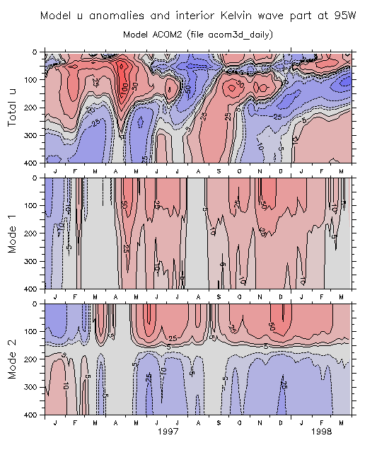
Force a linear Kelvin wave model to describe the linear, interior wind-driven, Kelvin part of the OGCM solution. The KW model consists simply of integrating the equatorial wind along Kelvin characteristics for the first 4 vertical modes. For simplicity, the wave speeds c_n are taken from the Hawaii-Tahiti Shuttle profiles (c_1=2.73m/s, c_2=1.74, c_3=1.06, c_4=0.76). Rather than project the winds onto the Kelvin meridional profiles, the winds averaged over 1.5°S-1.5°N are taken to be the Kelvin forcing for each mode (this should be pretty good for the first 2 modes at least). To estimate sea level, the characteristic integral of Tau/c_n is scaled by Psi_n^2/(gD), where the Psi are again taken from the Shuttle profiles. So this is quick and dirty .....
The aim of this exercise is to see if the vertical shears seen preceding east Pacific mixing events in the model can be related to the passage of 2nd mode KW, which would amplify the shear and thereby reduce the Richardson Number.
These first comparisons are mostly for checking, and show DH from TAO and from the model, versus the linear wind-driven Kelvin part of the sea level.
- 95°W during 1994
- 140°W during 1991-92
- 110°W during 1991-92
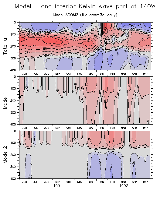
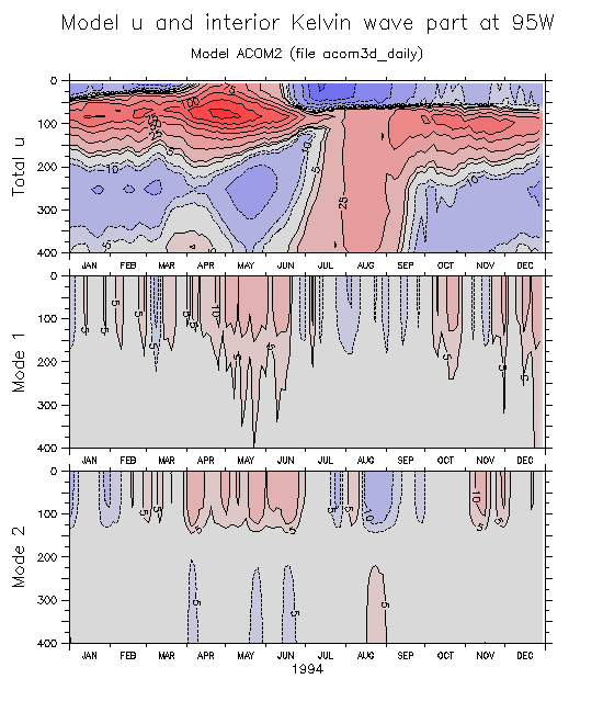
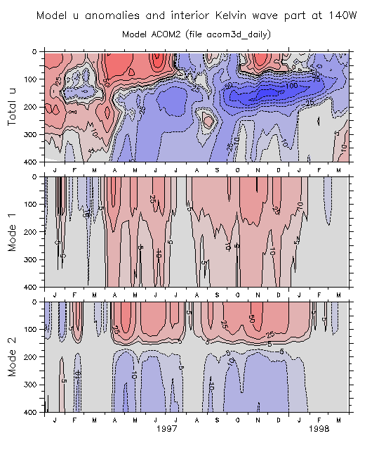
Next comparisons show model u and interior KW part.
- Coefficients to go from mode structure Psi_n(z) to u and displacment
- 140°W during 1991-92: Model total u Model anomalies
- 95°W during 1994: Model total u Model anomalies
- 140°W during 1997-98: Model total u Model anomalies
- 95°W during 1997-98: Model total u Model anomalies