Spatial Metadata
Digital Objects holding Spatial Information
Data Assets
Most analysis we want to do involves analysis of the spatial distribution of malaria. Ideally, we would like to be able to work across spatial scales, from gridded data (eg 1 km \(\times\) 1 km grids) or aggregated by sub-country, district, or region. The results of most analysis will be visualized, which requires a well-defined raster linked to GIS shape files.
The spatial heirarchies data assets are a collection of linked digital objects:
The master facility list, and for each facility, the sub-country and district it belongs to, and (ideally) its geographical location (longitude and latitude)
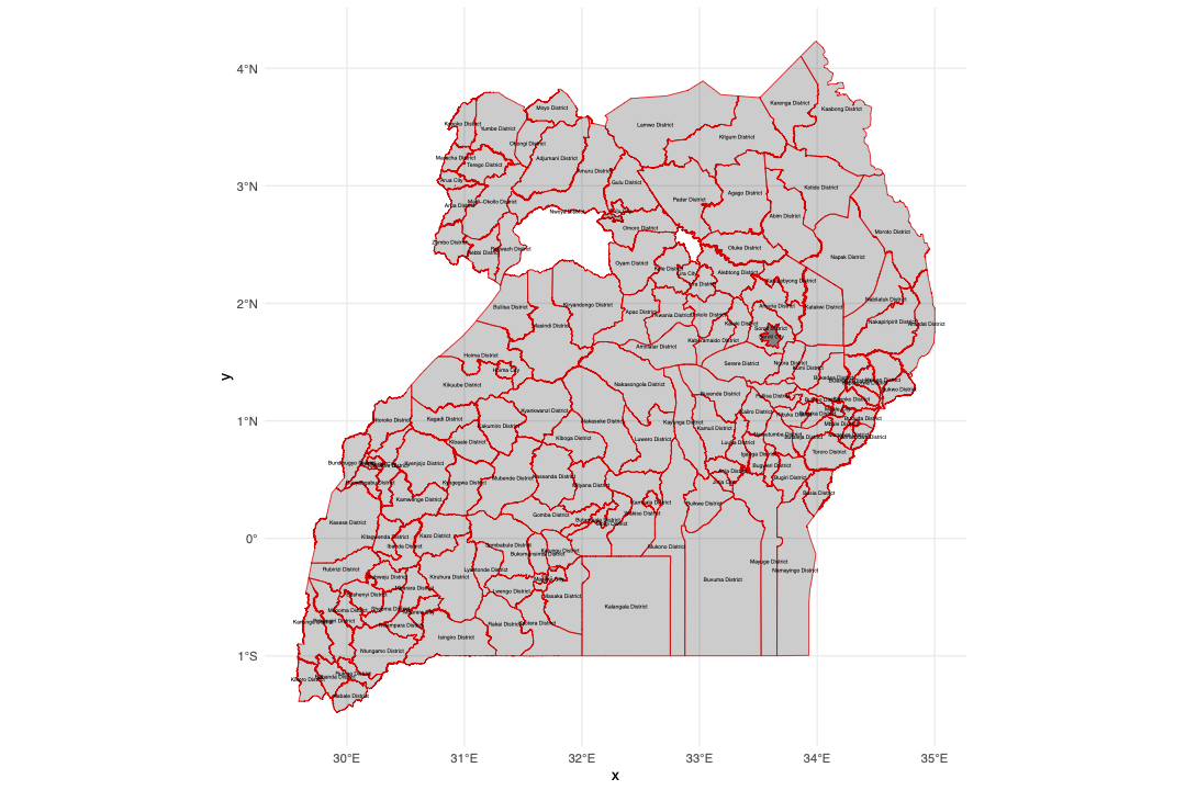
GIS shape files with the administrative boundaries of each sub-county, district, and region
A defined 1 km \(\times\) 1 km raster (we use the MAP raster)
Master Spatial File
a single file that holds information to enable a user to extract or assign data at a “pixel” level, and aggregate up to any higher administrative level.
Our “pixel” size is dictated by MAP rasters, which had data down to a 925mx925m resolution
We can create a series of data assets, which are not spatial files, but can be linked to the files through a pixel_id identifier
Commentary
In developing the spatial hierarchies, we did substantial work to generate a set of shape files, with various consistency checks:
All administrative region geometries are valid
Every level below national level (trunks) have a parent id
The geometry of a non-bottom-child (leaf) region is the union of the geometries of all regions whose parent is that region. i.e. Drawing a line around the subcounties assigned to a given district should provide the same shapefile boundary as pulling the shape for that district.
The union of geometries at a given depth (level) is always the same as the top-parent (national) geometry (collectively exhaustive)
There is no geometry overlap (beyond borders) for regions at the same depth (mutually exclusive)
All health facilities have a bottom-child (subcounties) region as a parent- and that subcounty is present in the shapefile
Health facility geolocations (lat-long) fall inside the geometry of their parent regions (subcounties)
Code
Version Control
Visualization
District Shape Files