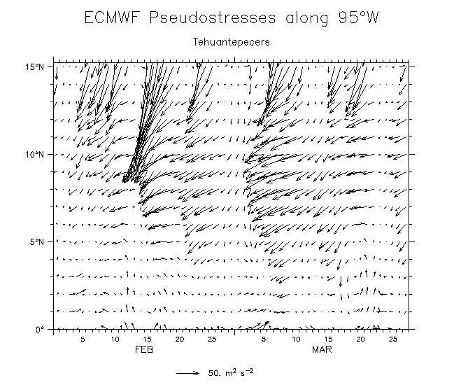
Tehuantepeckers, Papagayos, etc
The Central American mountain-gap winds and their effects on the ocean
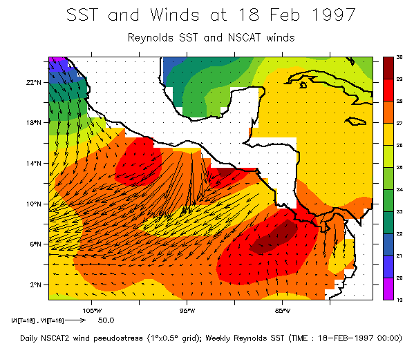
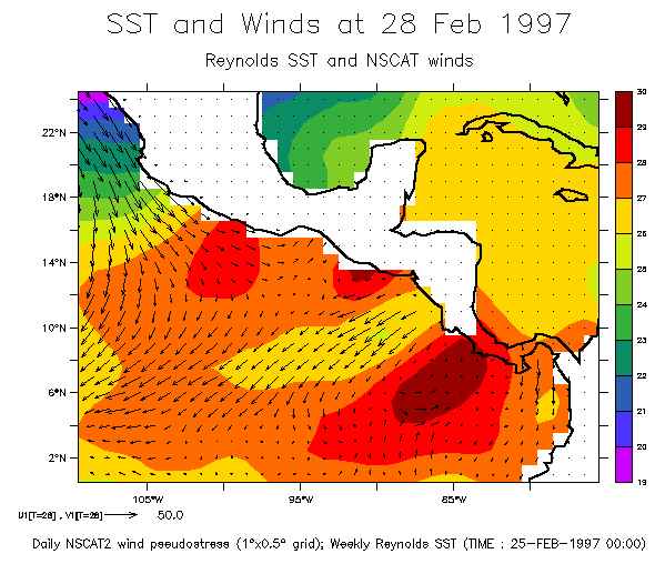
Several times each winter, high pressure over North America extends southward
over the Gulf of Mexico and Caribbean Sea. This produces winds at synoptic
timescales (5-7 days duration) through three gaps in the Central American
cordillera: at the Isthmus of Tehuantepec, the Nicaraguan lowlands (Papagayo) and Panama. The winds generate anti-cyclonic eddies (McCreary et al, 1989,
J.Mar.Res) and cool the Pacific offshore of the gaps. This cooling stretches
well offshore and is apparently a major feature of the annual cycle of
eastern Pacific SST, despite being due to episodic short-term events.
Also, SEE A VARIETY OF FIGURES FROM THE AOML DATA SET
Also, FIGURES FROM A TALK I GAVE AT THE AMS MEETING IN PHOENIX
Also, RESULTS FROM THE G/C MODEL USING IDEALIZED TEHUANTEPECKER WINDS.
Mean February winds and SST shows the situation. Even in this highly-averaged
portrayal the cooling downwind of the mountain gaps is quite evident.
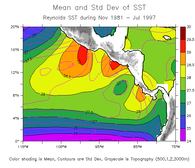
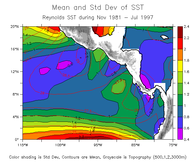
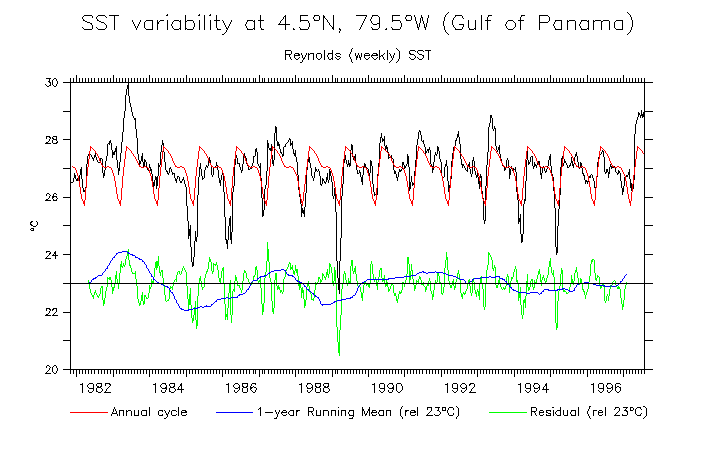
Statistics of the SST (based on Reynolds weekly SST 1981-1970).
Note:
- Low mean SST occurs just west of the three mountain gaps;
- The regions of low SST are also the regions of high variance;
- The effect of the mountain gaps extends at least 500km offshore.
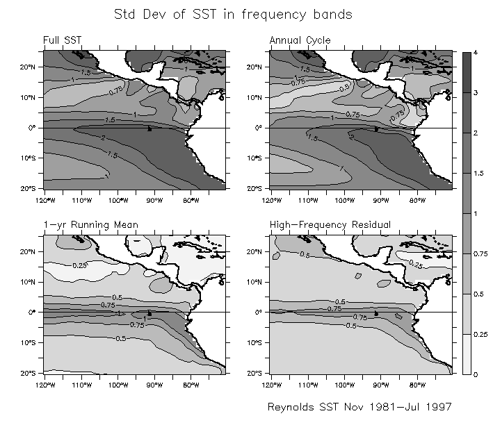
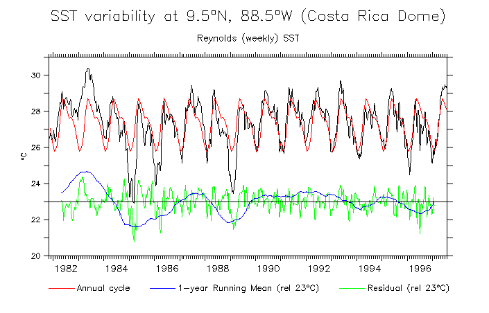
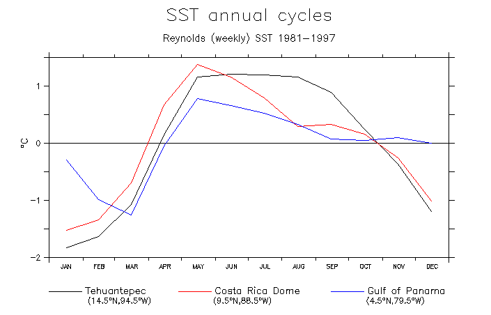
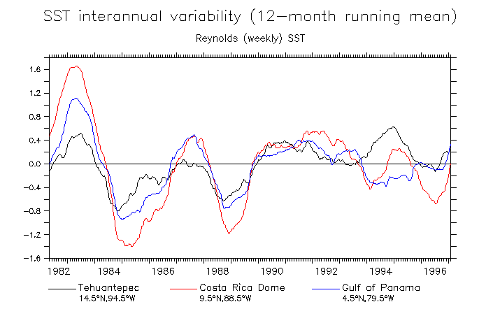
Time series of SST in frequency bands.
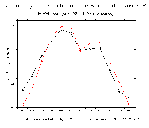
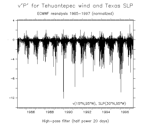
Covariance of Tehuantepec winds and Texas SLP (ECMWF).
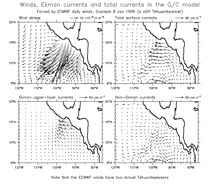
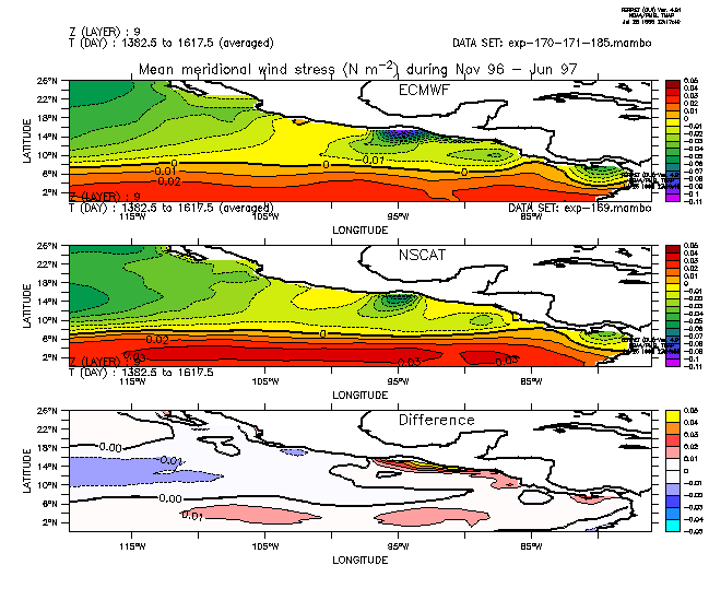
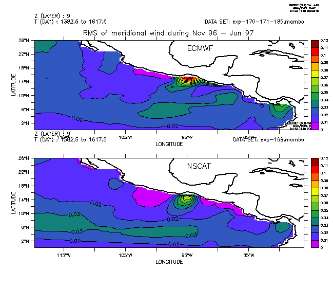
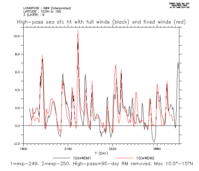
Below here are various comparisons of scatterometer and ECMWF winds, and results from forcing the G/C model with versions of these ....
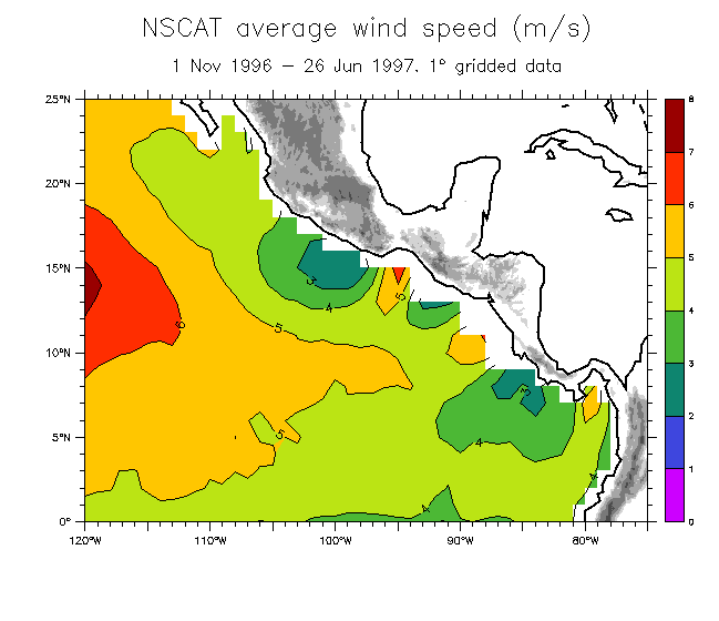
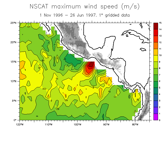
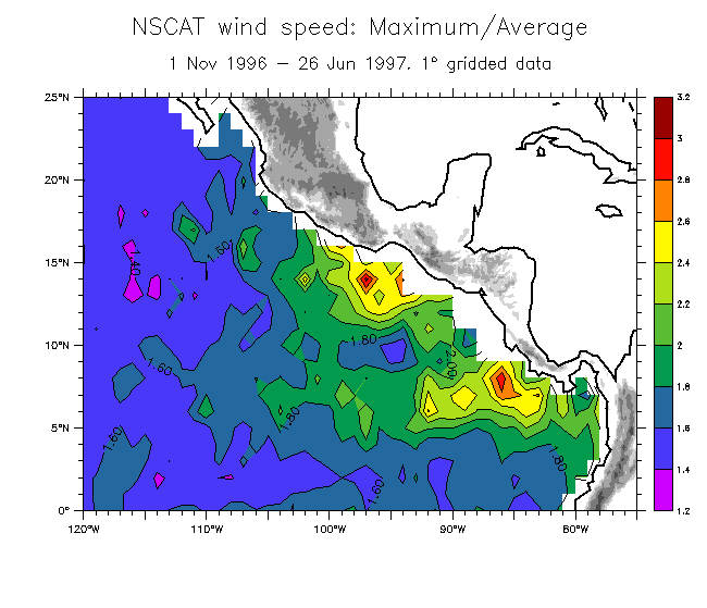
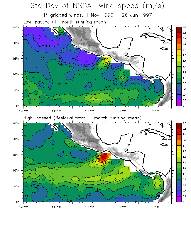
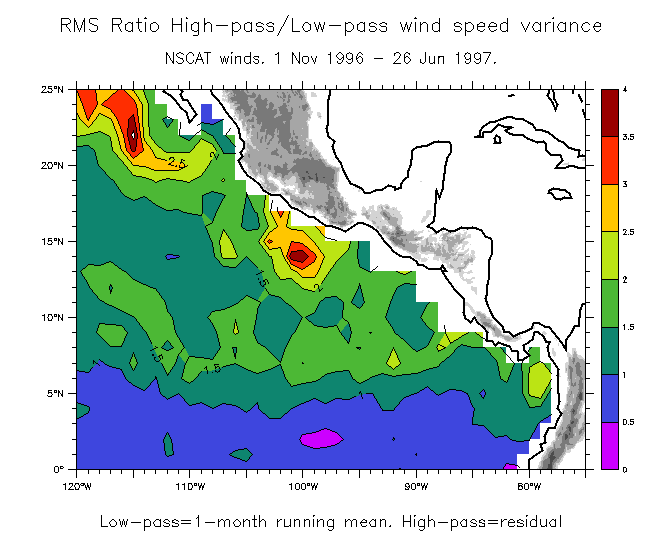
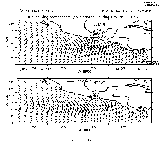
Some statistics of NSCAT winds near Central America
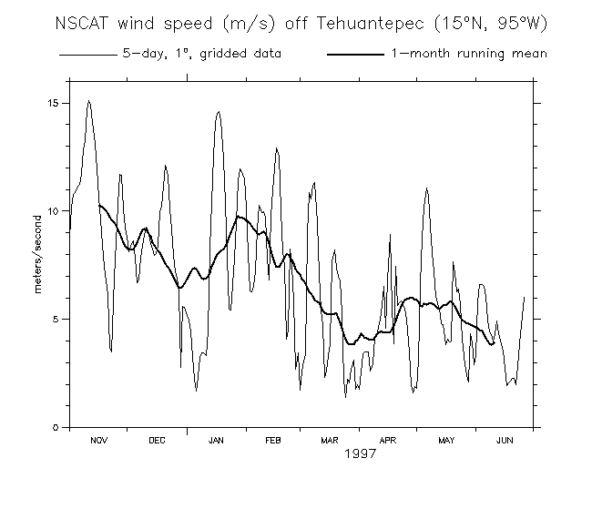
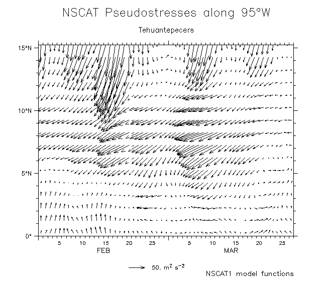
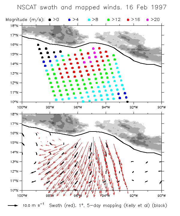
A stiff Tehuantepecker seen by NSCAT:
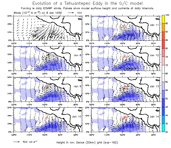
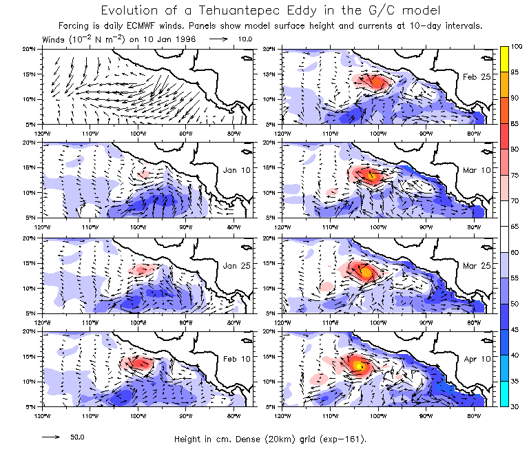
Tehuantepeckers generated in the G/C model.
These plots can be misleading! What appear to be Tehuantepecker eddies are actually
reflected from the boundary!
Check the NSCAT G/C model page, showing comparisons among model runs.
More G/C model results
More NSCAT winds comparisons
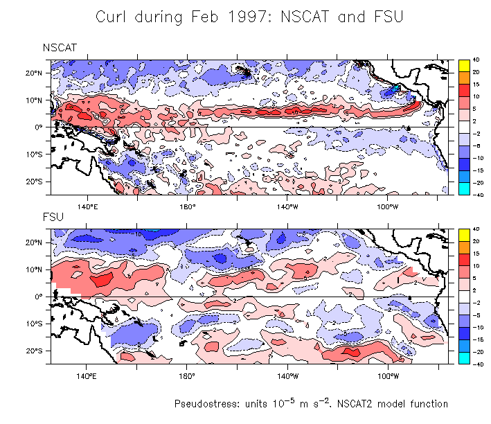
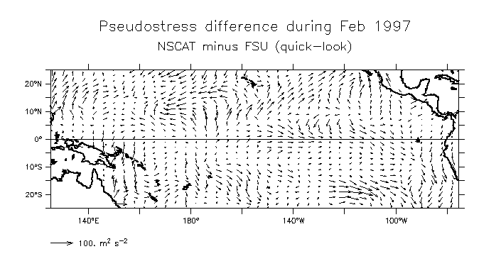
An unfair comparison? Curl from NSCAT and FSU during Feb 97.
NSCAT curl found from 2° latitude daily winds averaged over 1-28 Feb (NSCAT2 model functions).
FSU curl found from 2° latitude monthly winds (quick-look product).
Note the sharpness of the ITCZ, also the curl-y Tehuantepecer signal:
Comparing the wind speed from raw (25km) swath data and gridded fields
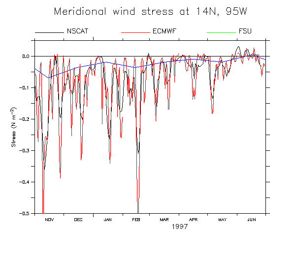
Comparing NSCAT, ECMWF and FSU (monthly average) Tau-y at 14°N, 95°W
EXPERIMENTS COMPARING MODEL RESULTS FORCED WITH DAILY AND MONTHLY-AVERAGE WINDS
EXPERIMENTS IN PUMPING THE WINDS
This is from 1997, and I can't remember what "pumping" refers to here ....
QUIKSCAT PAGE
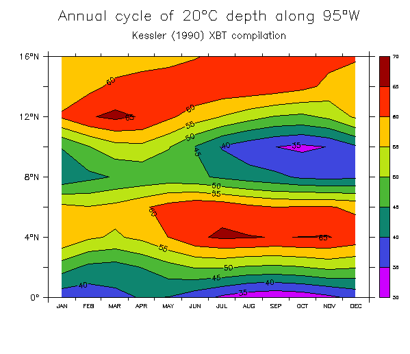
20°C depth in the eastern tropical Pacific (Kessler 1990 XBT compilation).
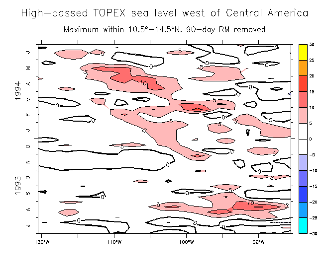
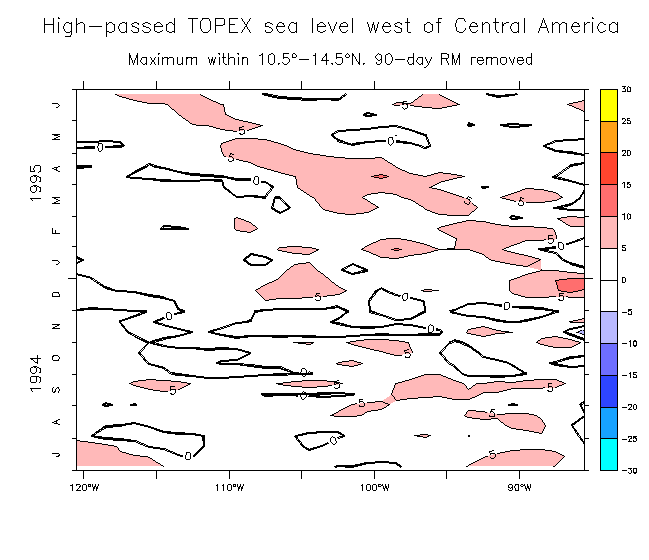
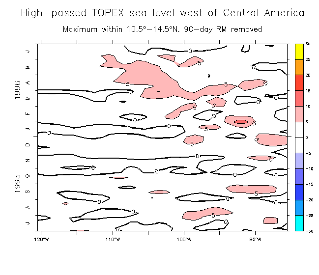
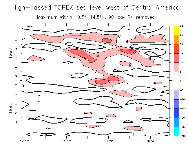
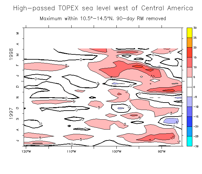
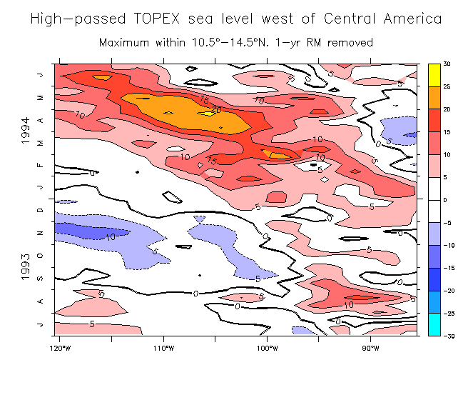
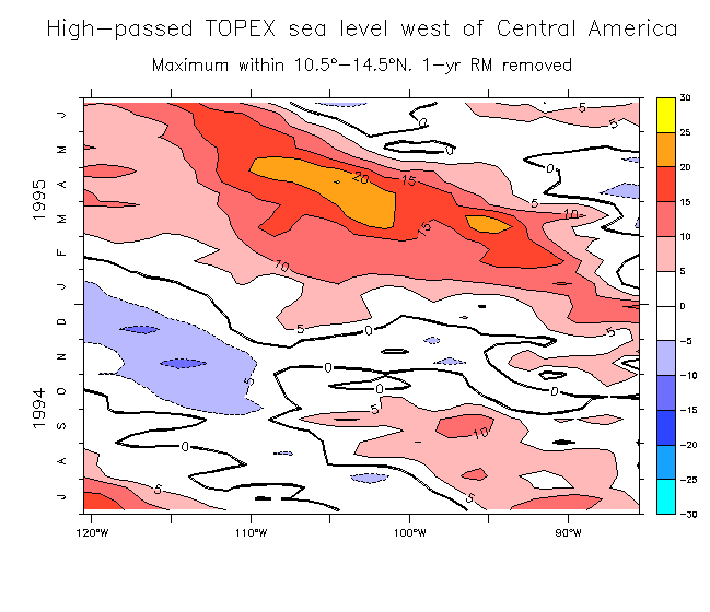
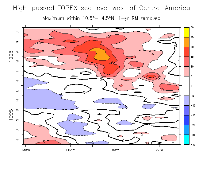
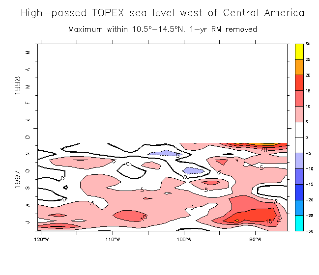
TOPEX sea level west of Central America
Back to main figure list