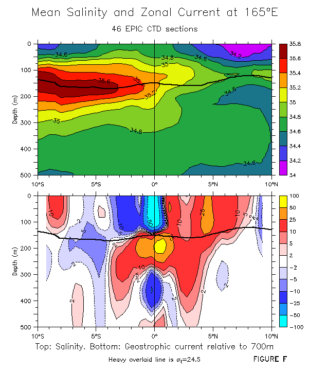
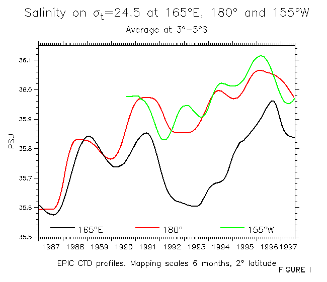
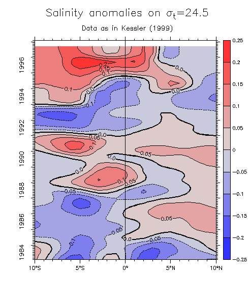
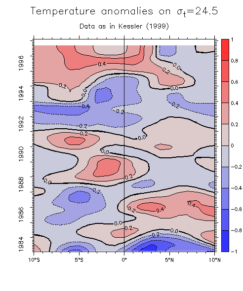
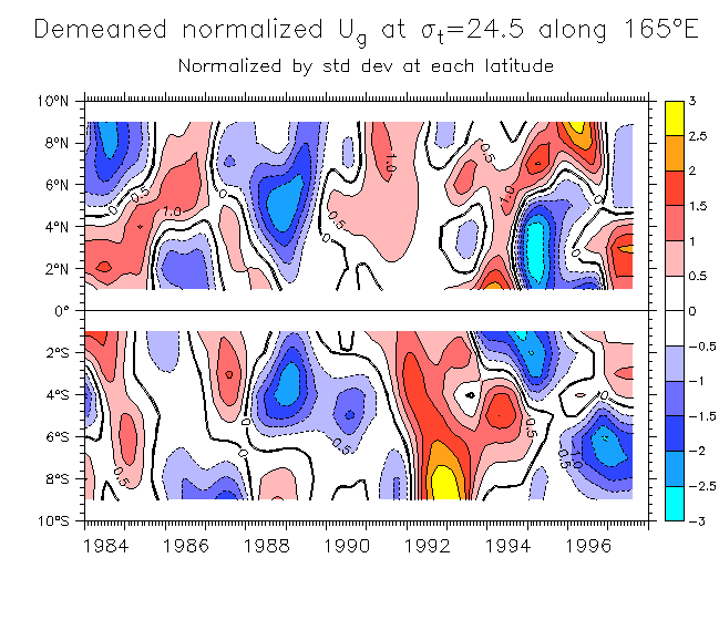
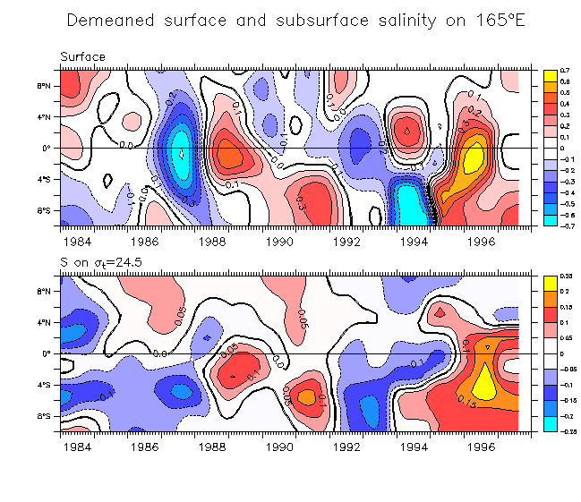
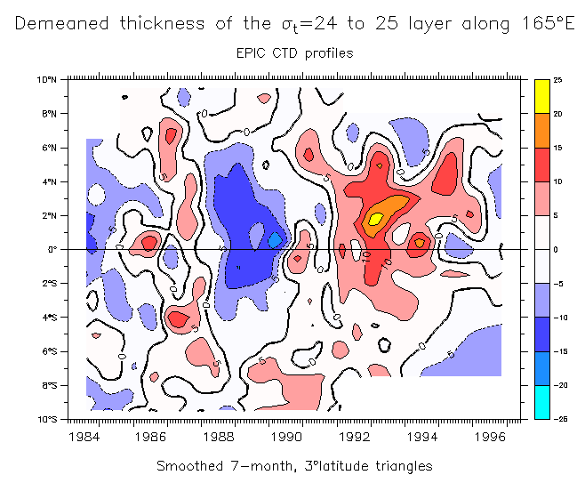
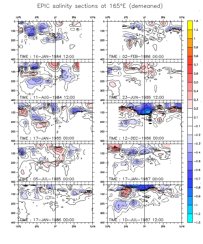
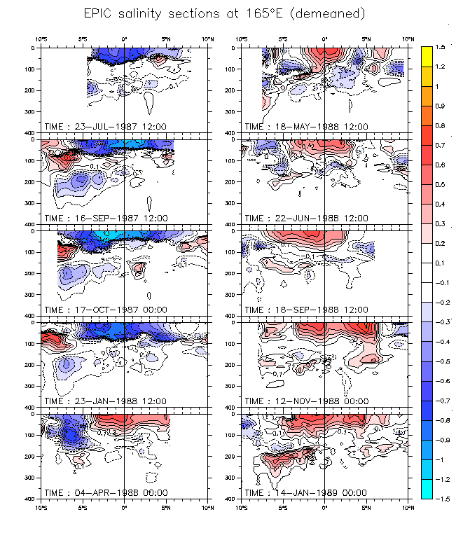
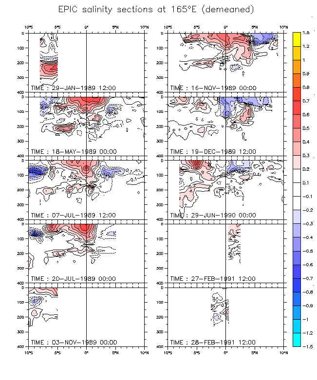
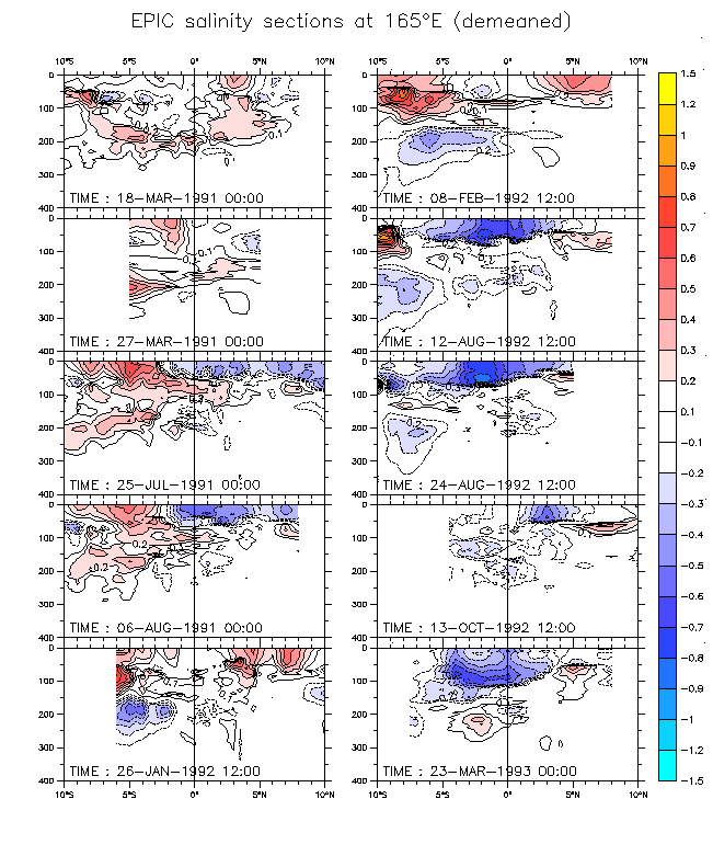
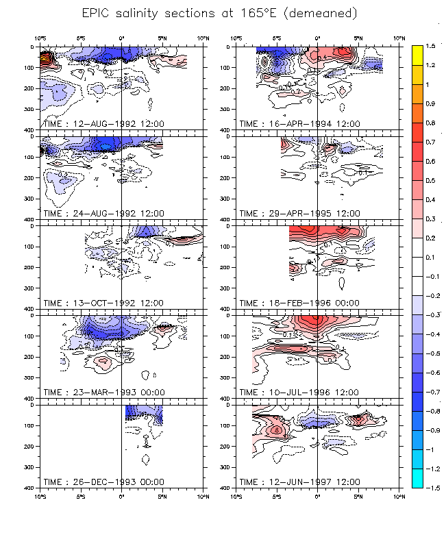
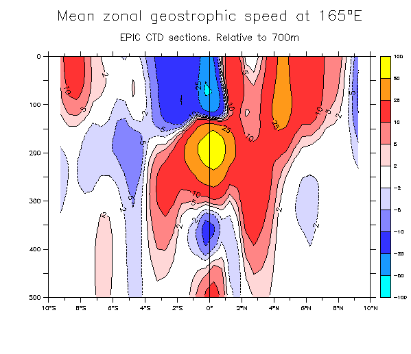
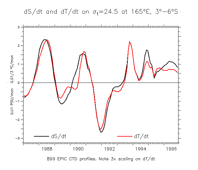
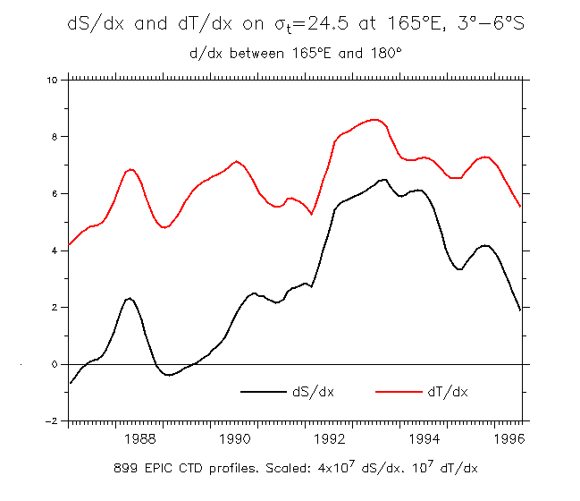
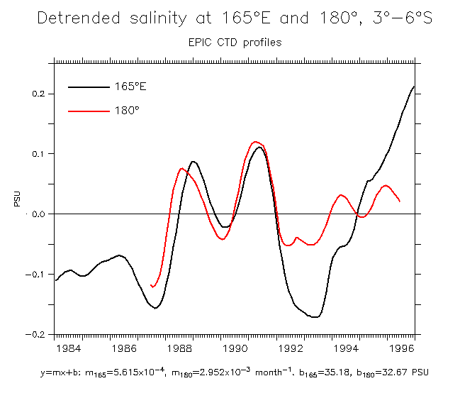
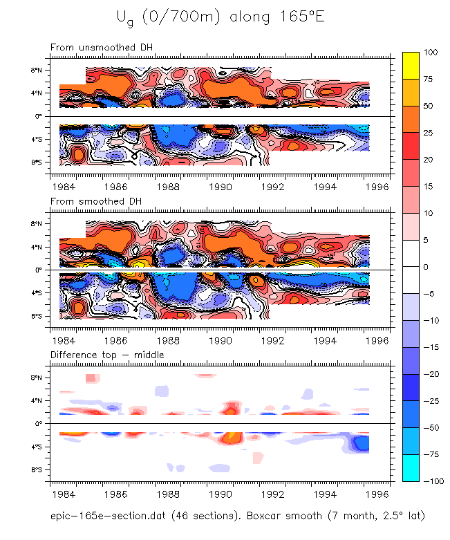
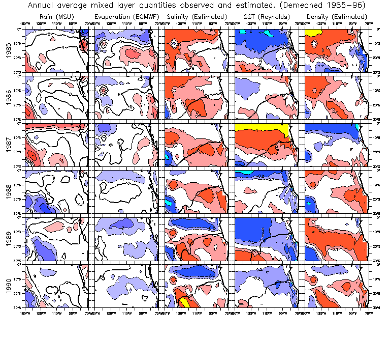
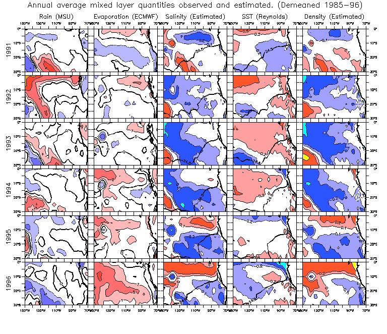
Same sections demeaned by the 1984-97 mean:
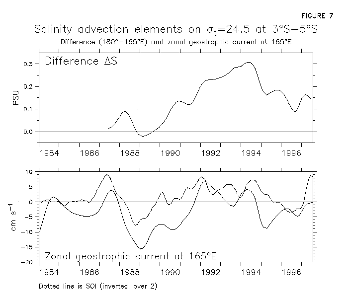
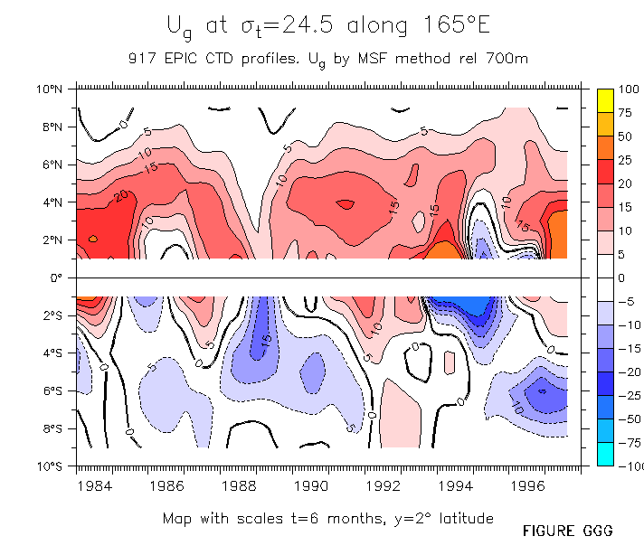
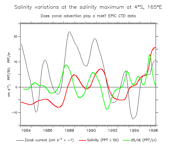
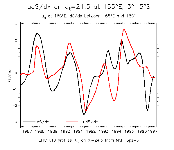
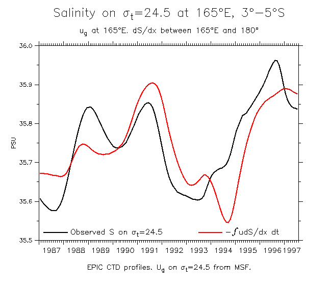
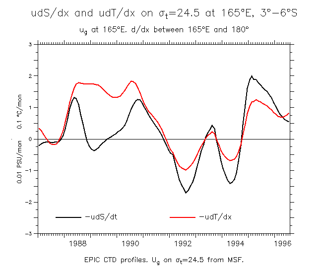
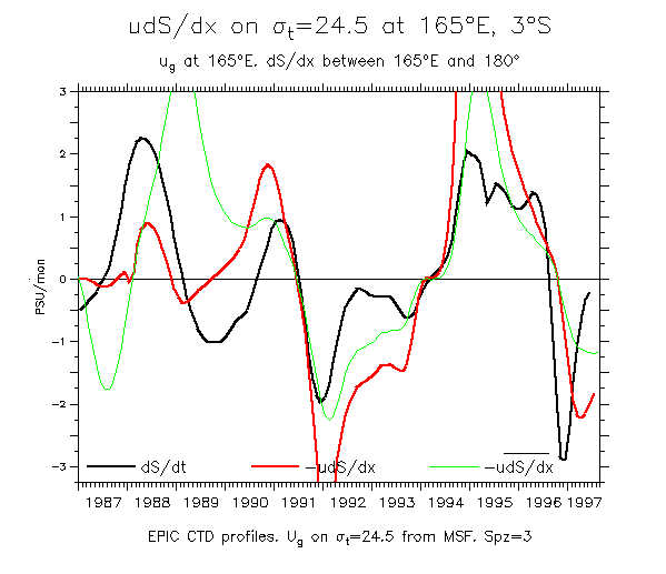
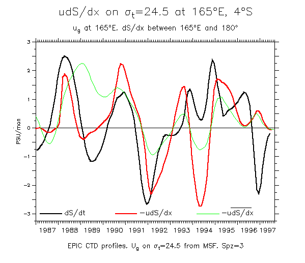
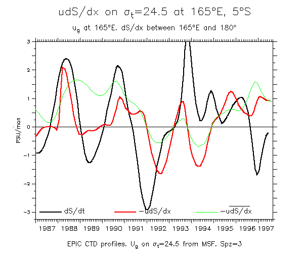
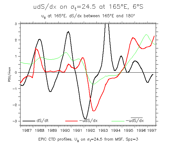
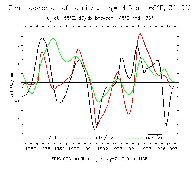
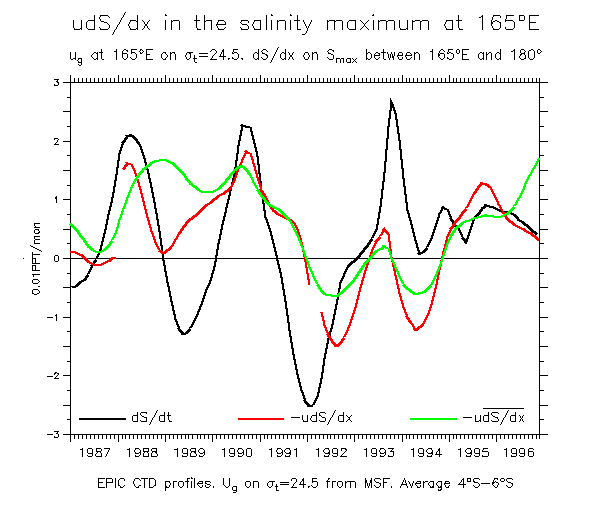
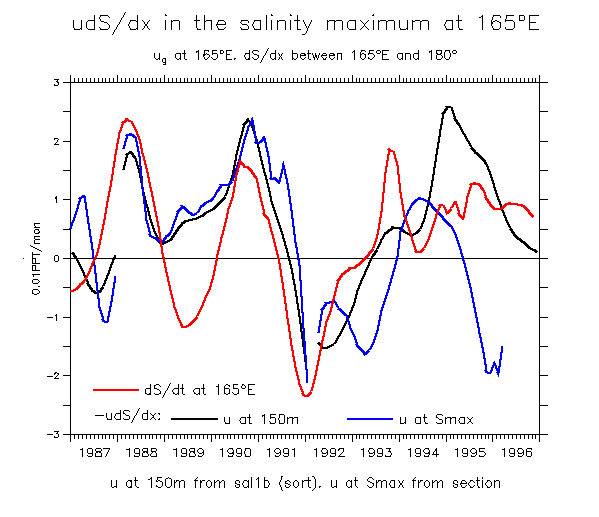
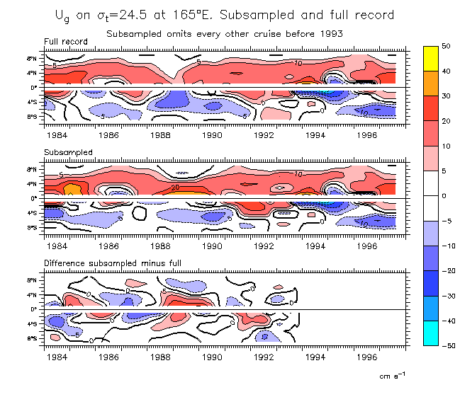
Time series comparing Ug along sigma-t=24.5 at 165°E and dS/dx in the salinity maximum between 165°E and 180°.
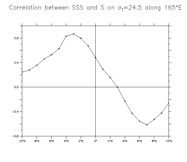
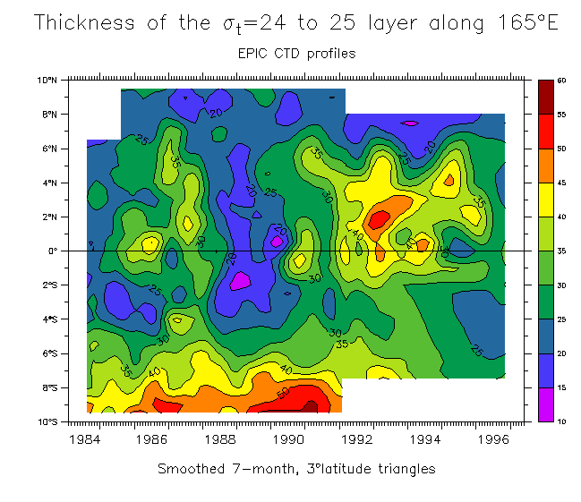
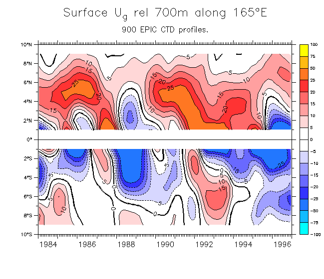
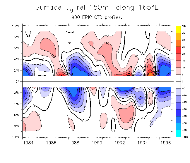
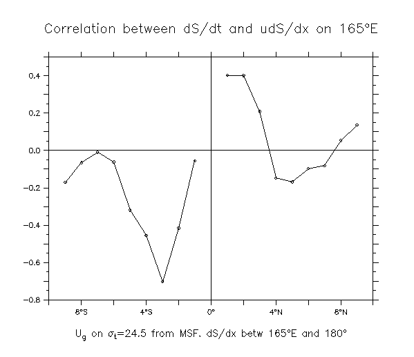
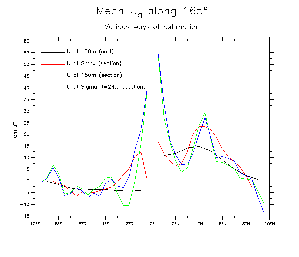
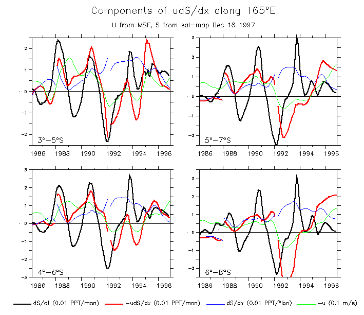
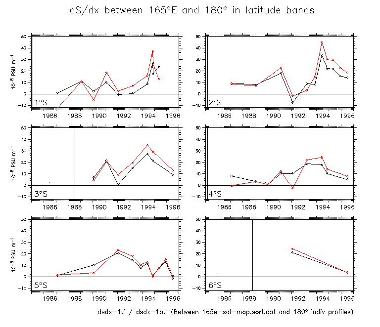
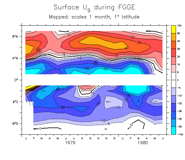
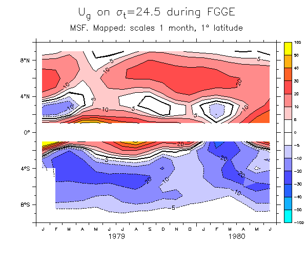
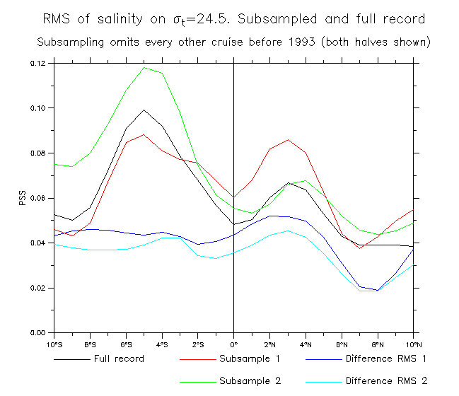
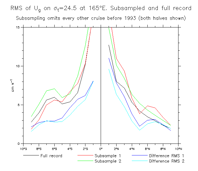
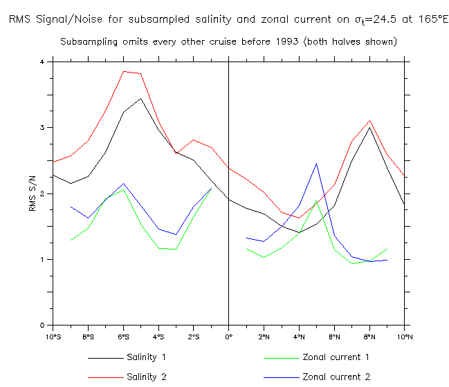
Averaged in various latitude bands as indicated.
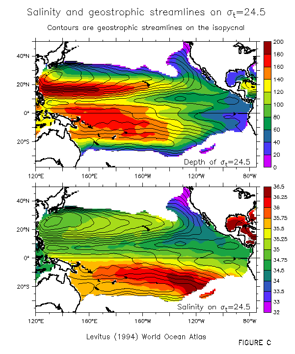
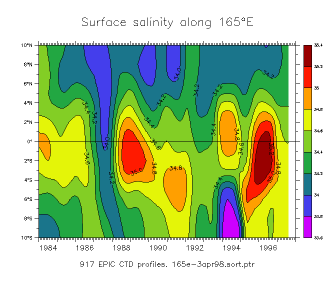
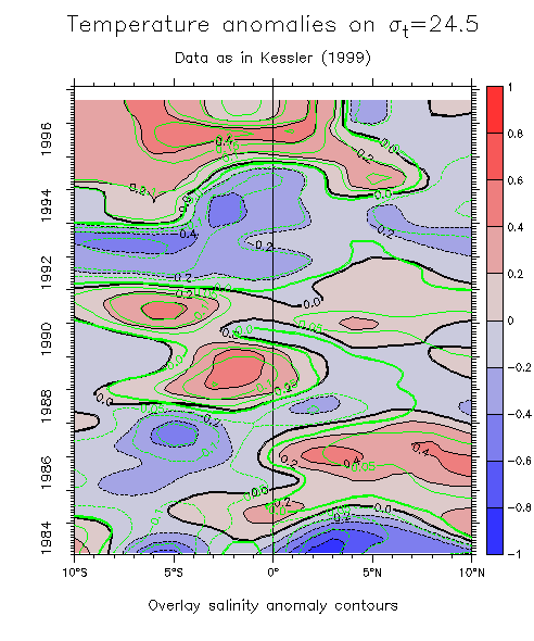
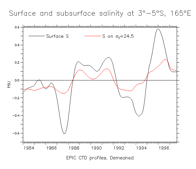
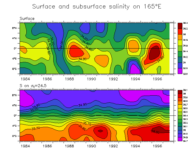
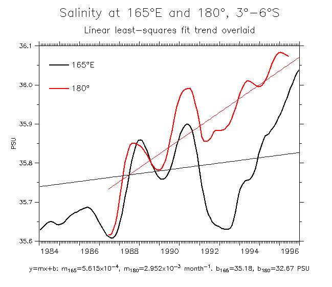
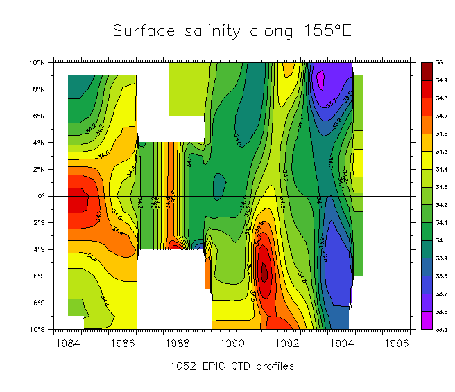
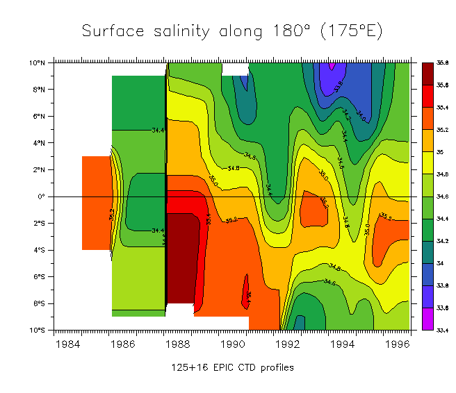
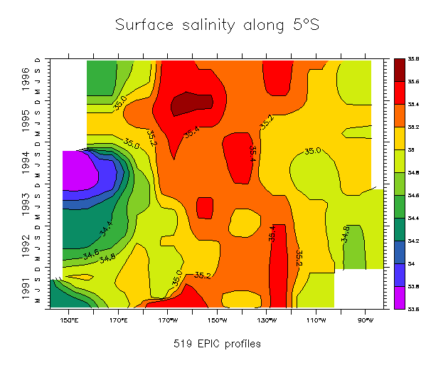
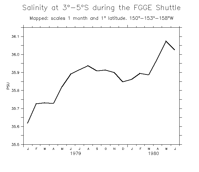
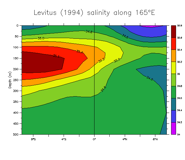
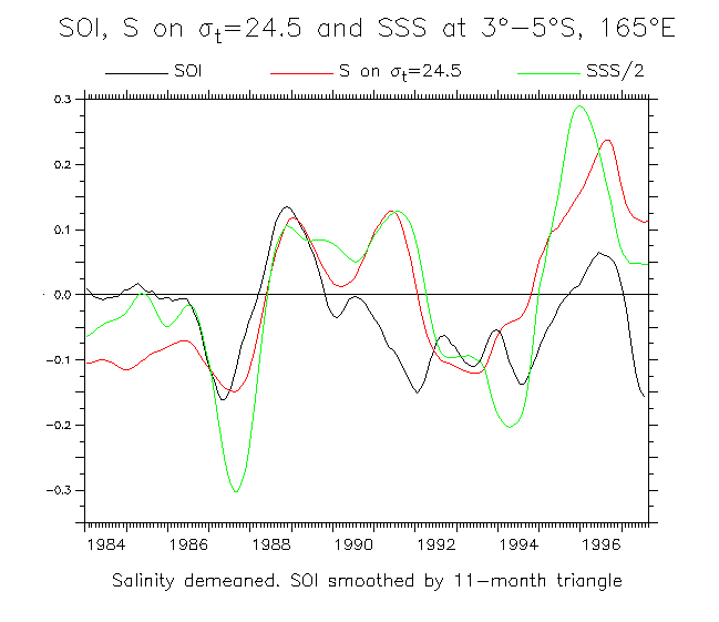
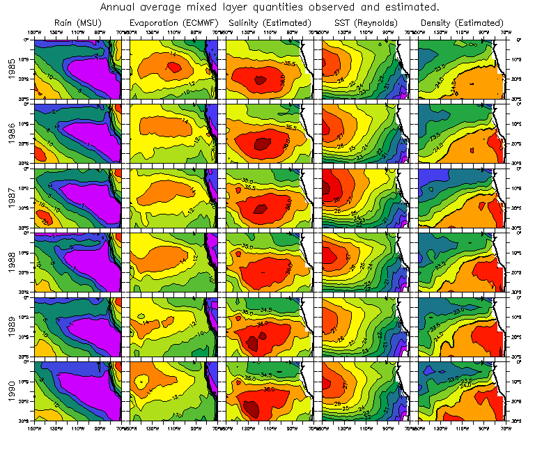
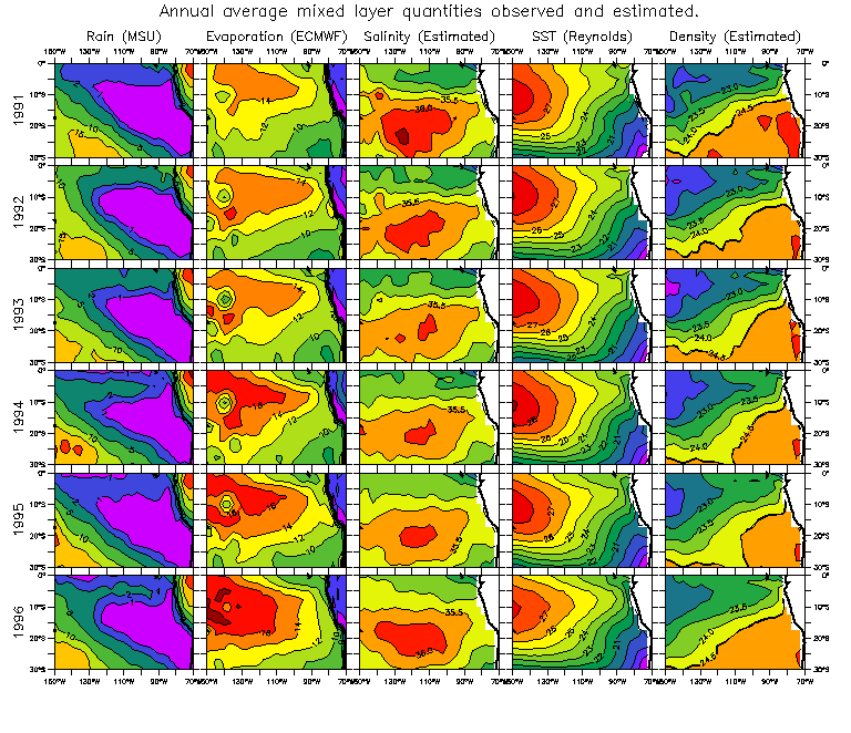
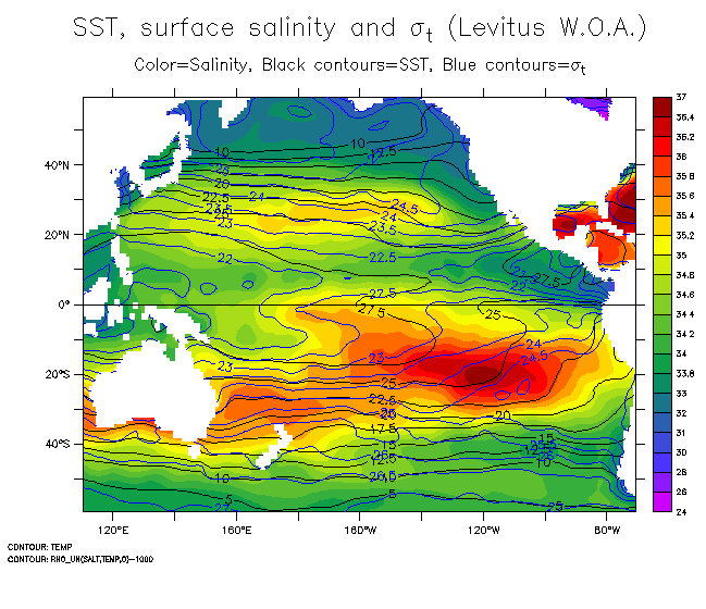
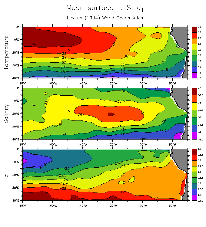
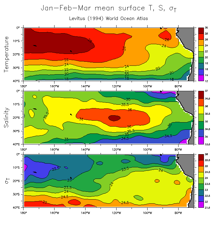
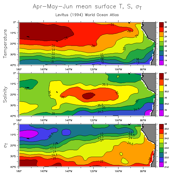
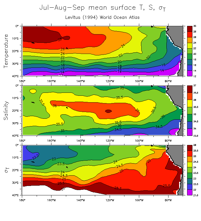
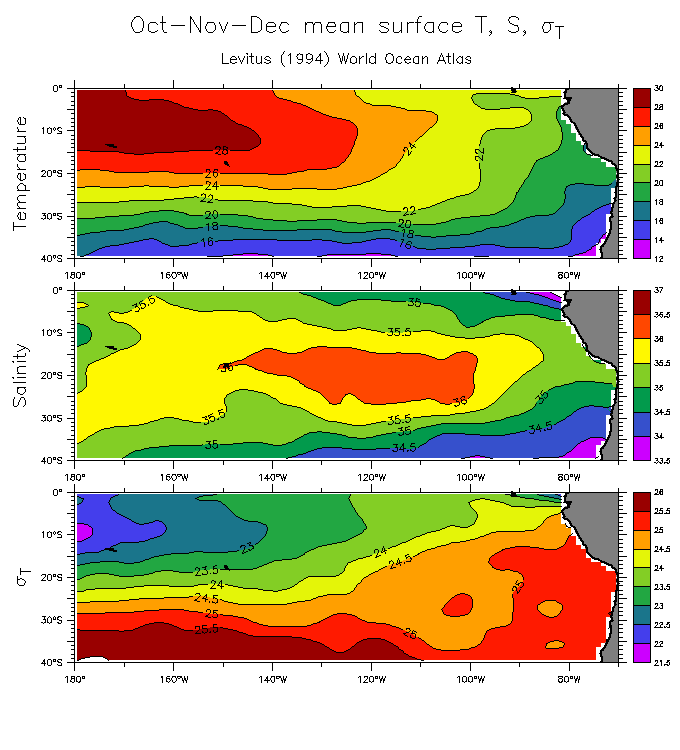
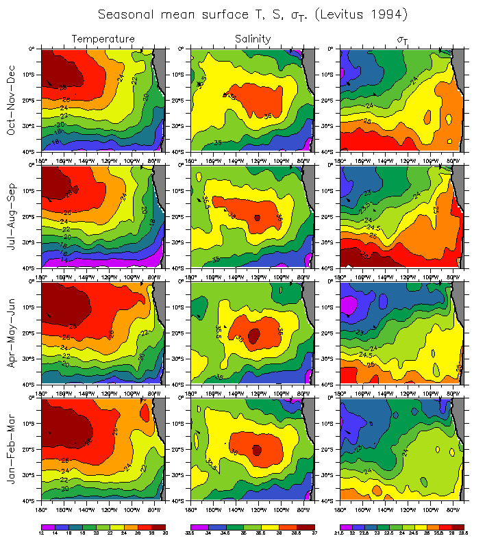
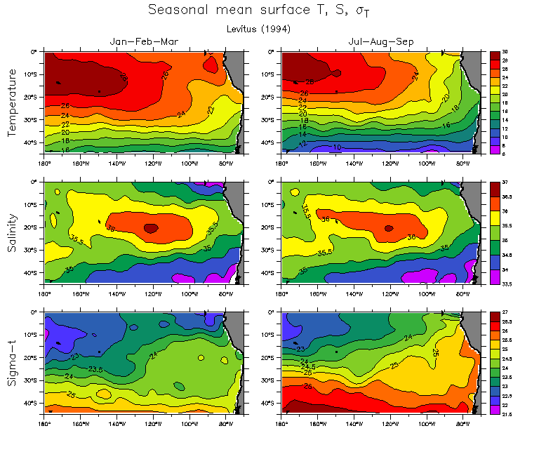
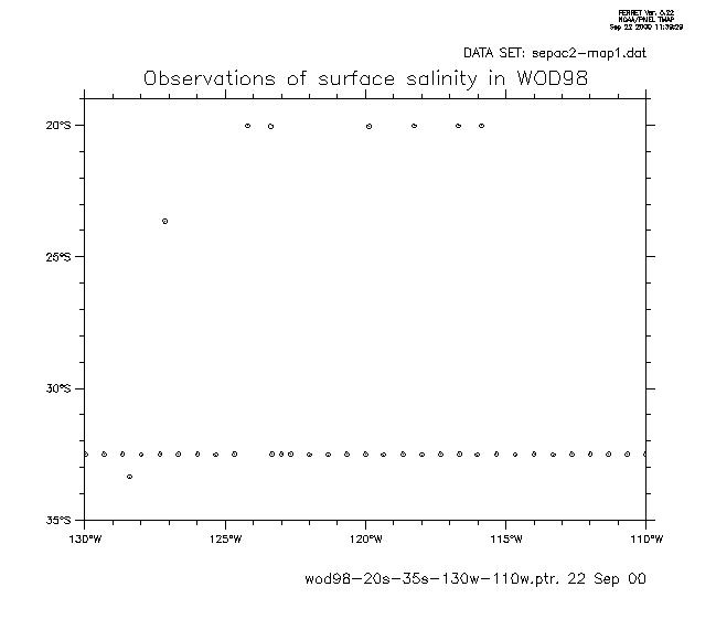
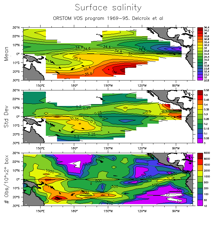
Surface salinity:
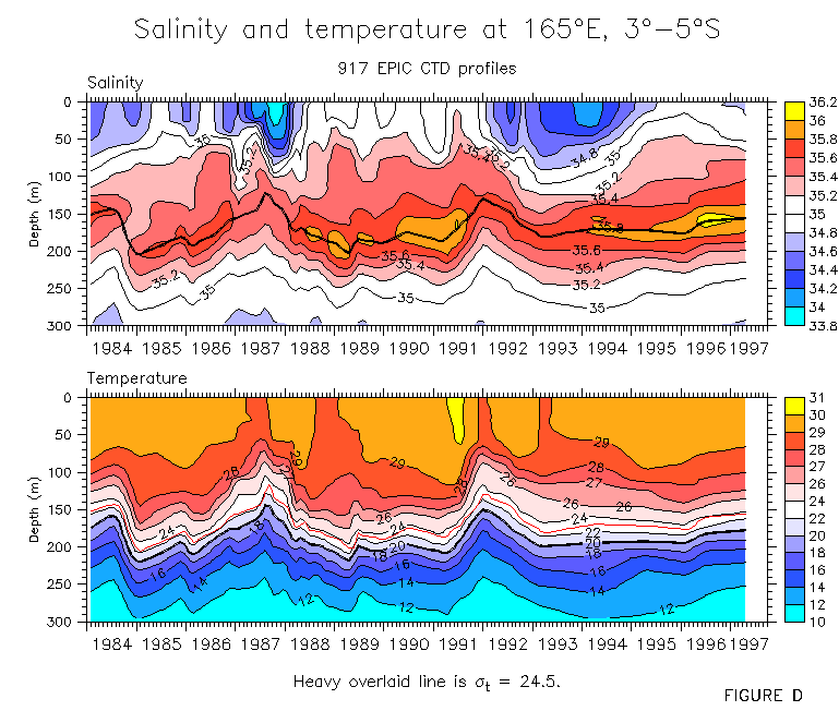
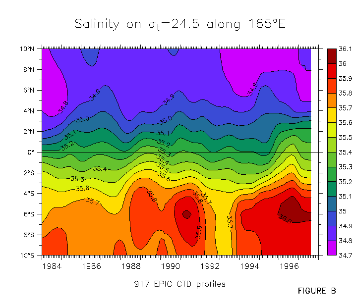
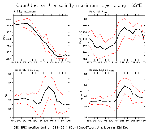
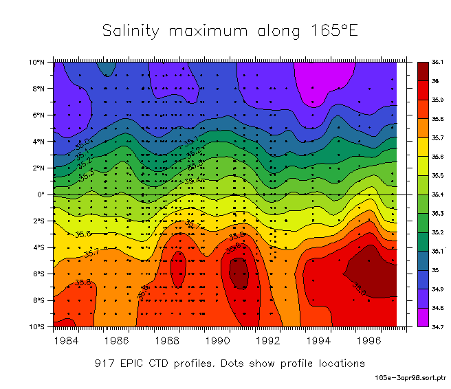
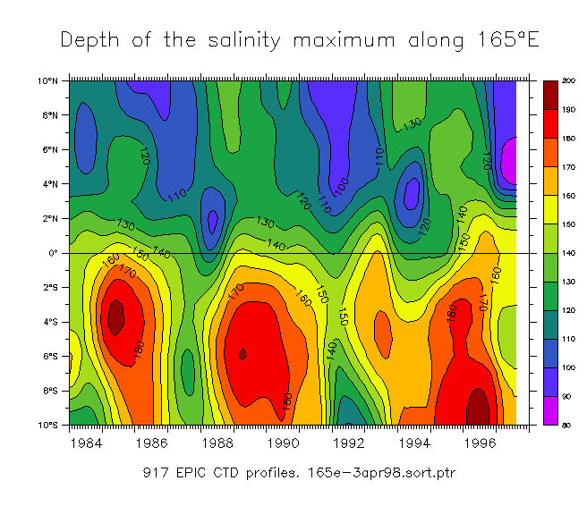
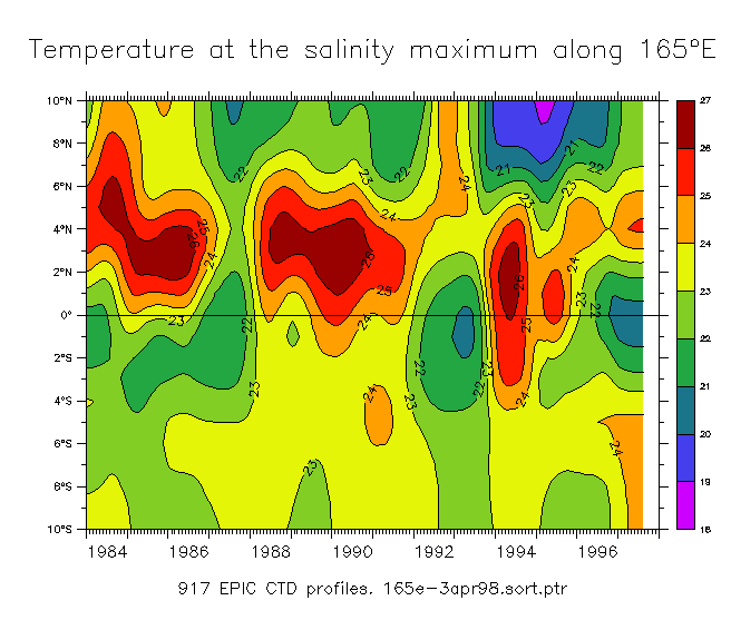
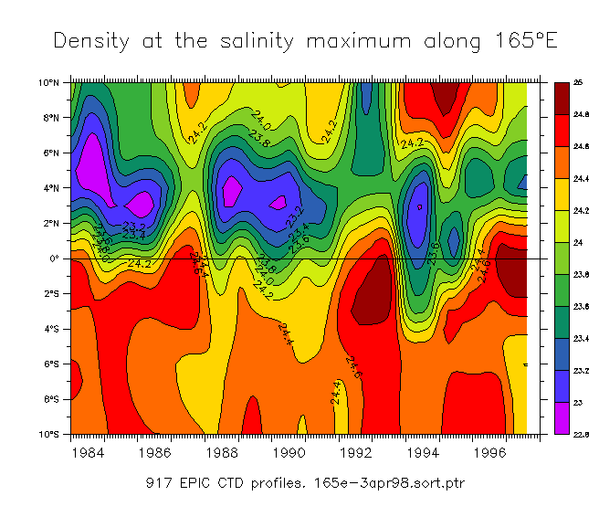
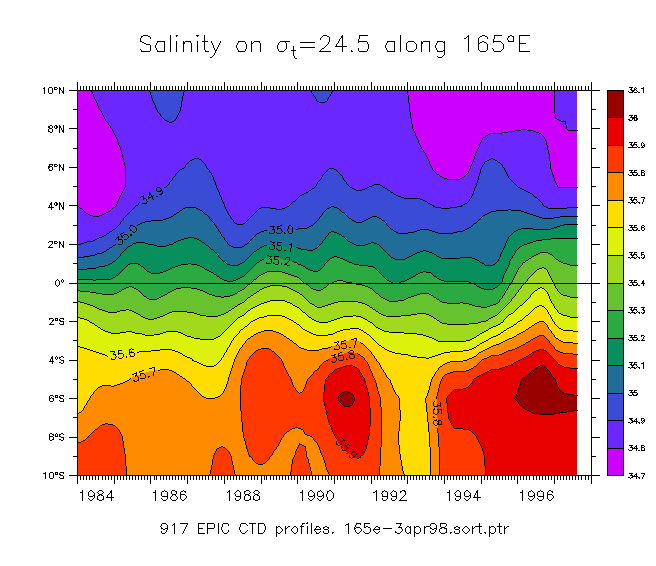
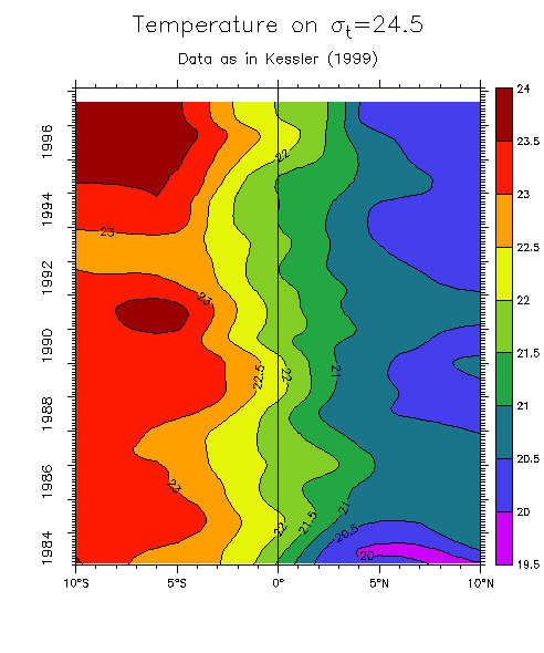
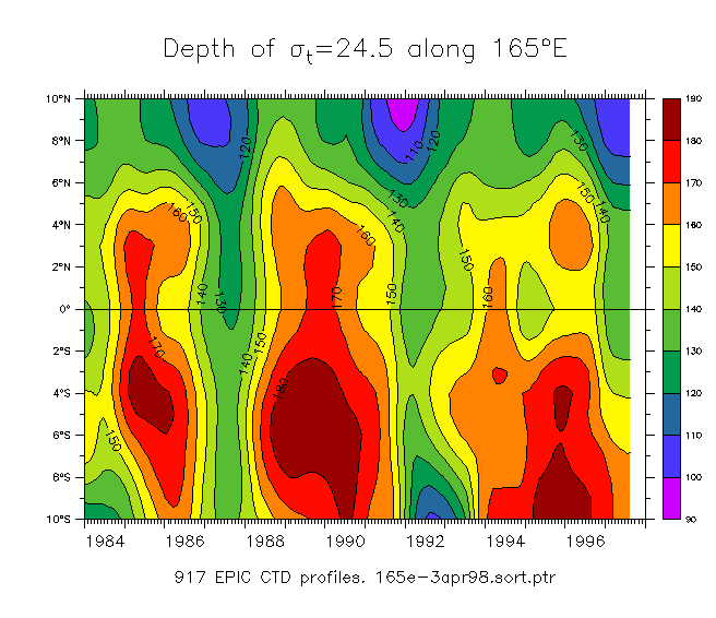
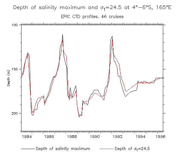
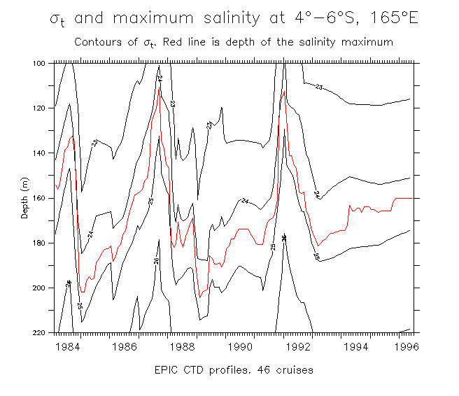
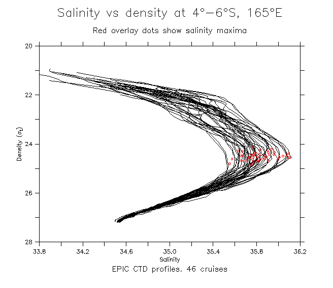
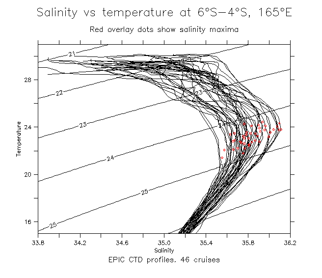
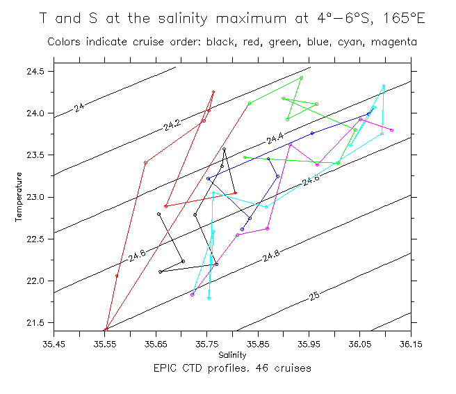
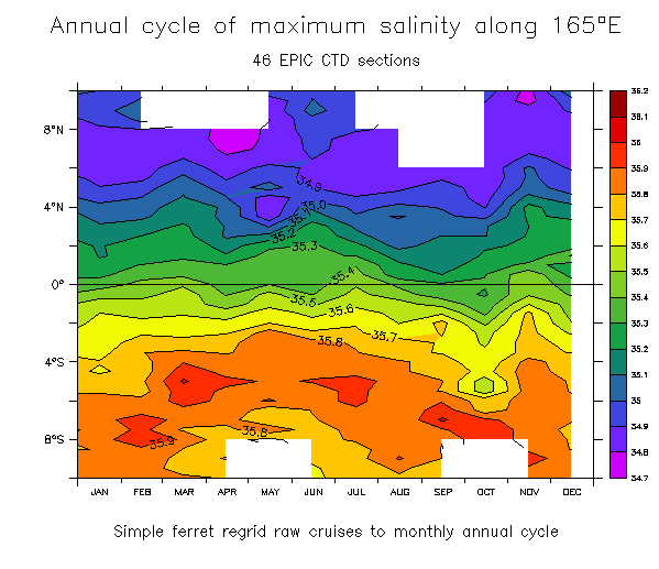
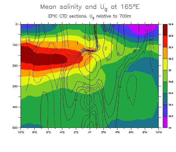
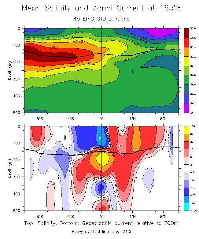
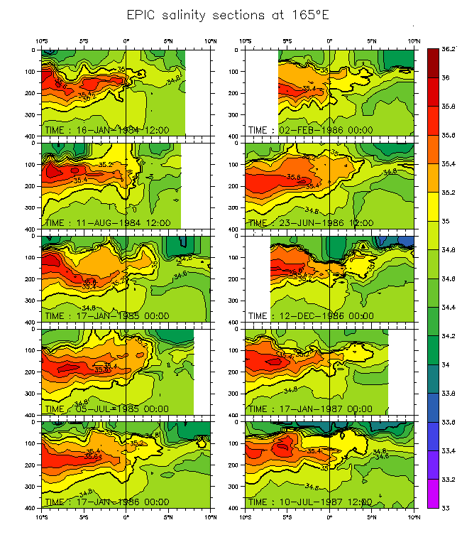
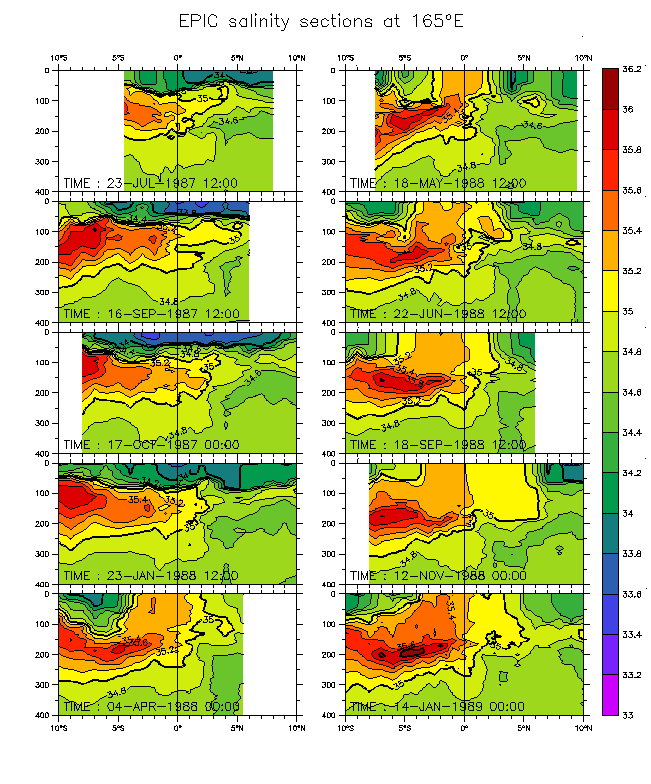
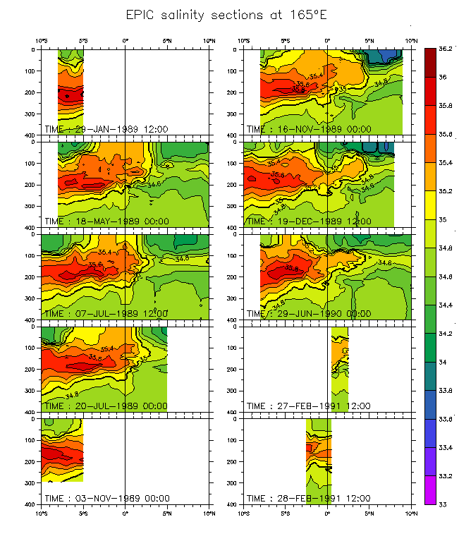
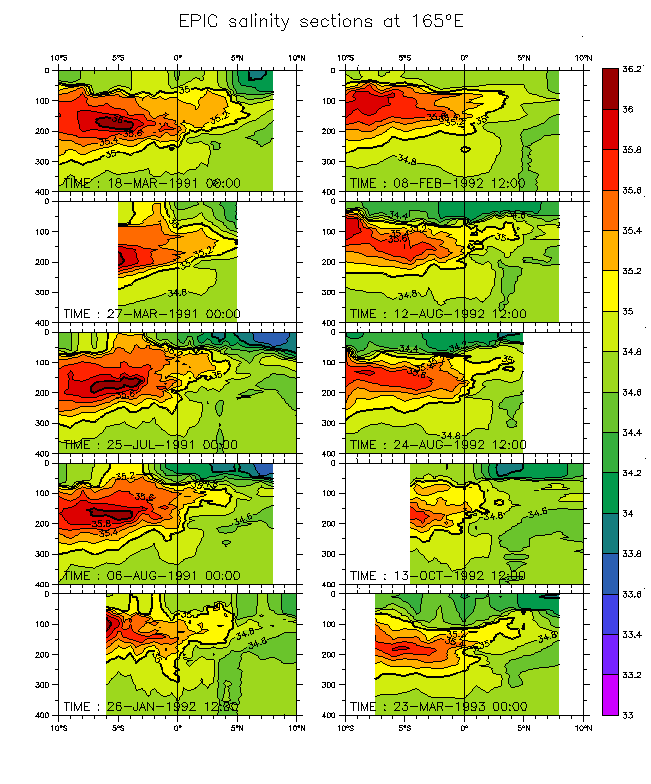
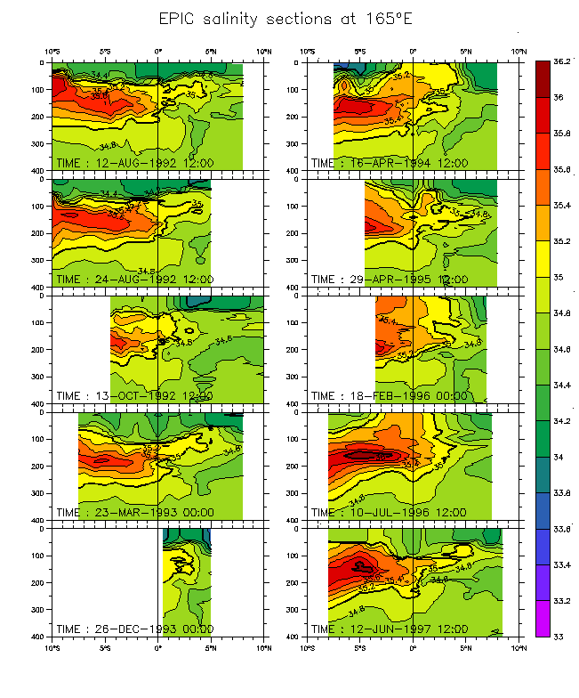
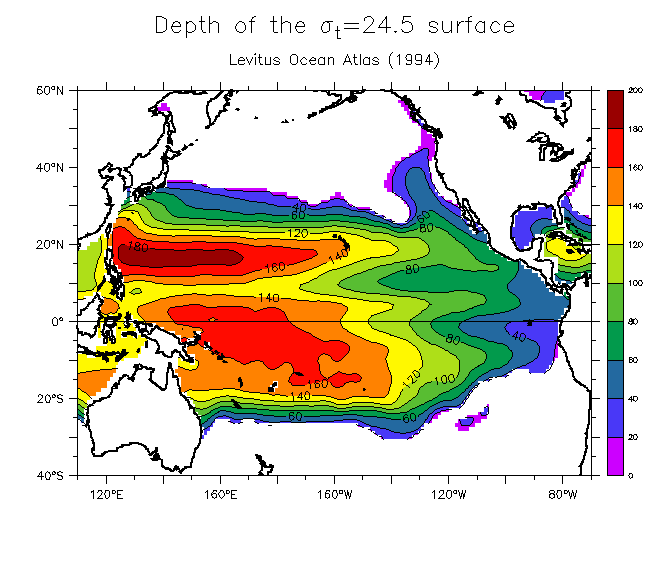
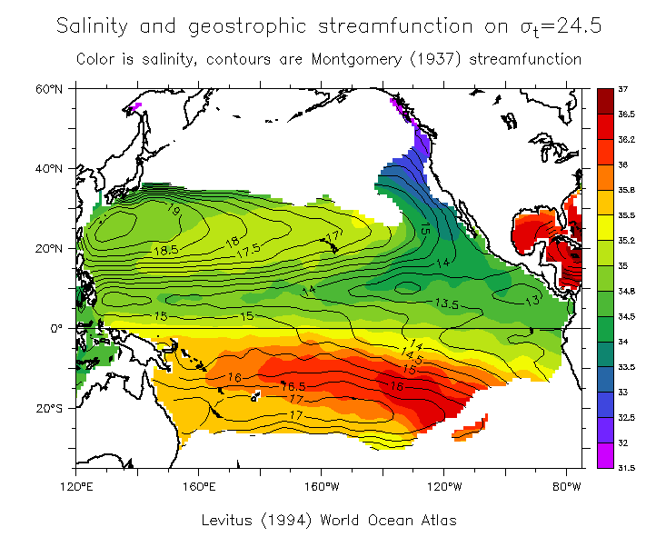
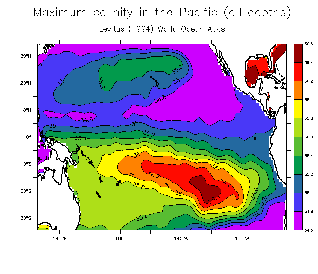
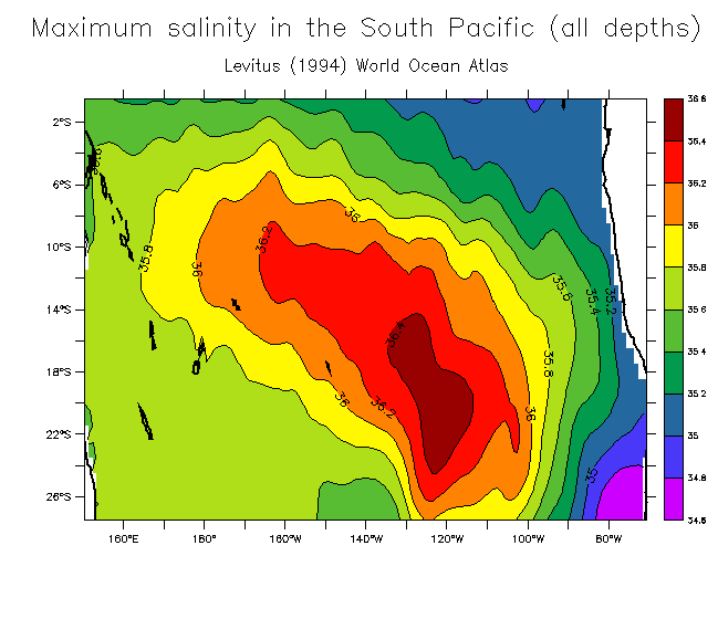
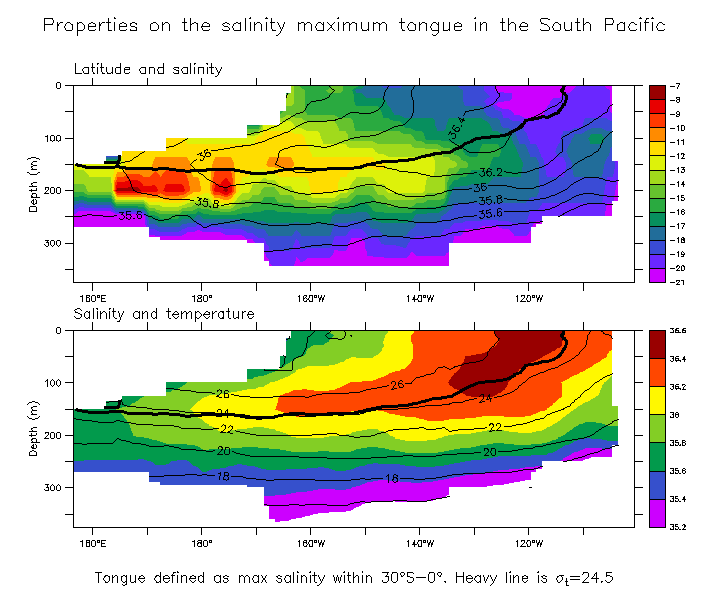
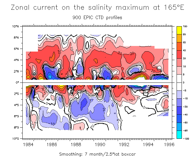
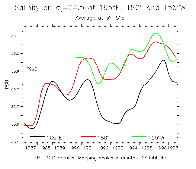
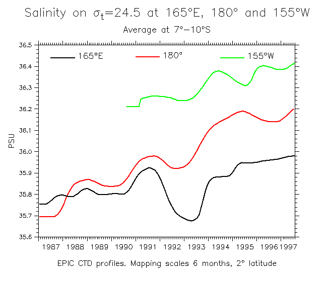
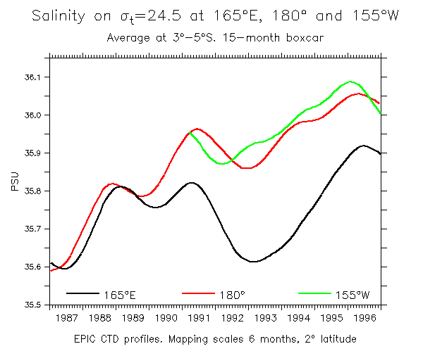
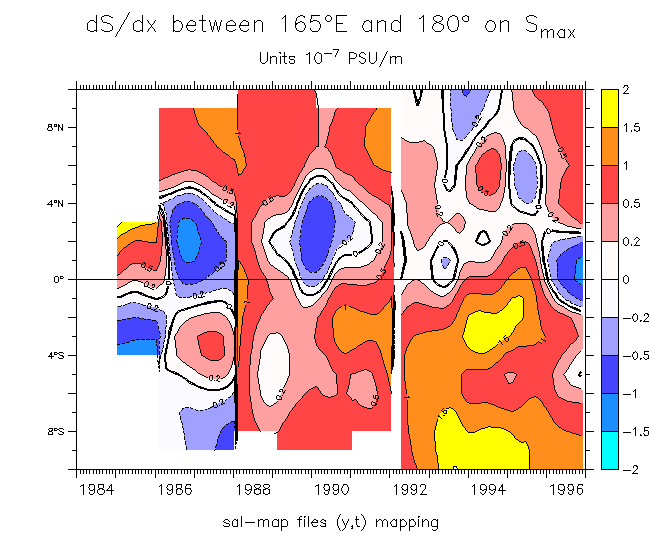
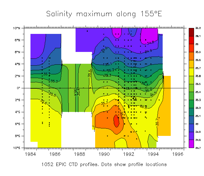
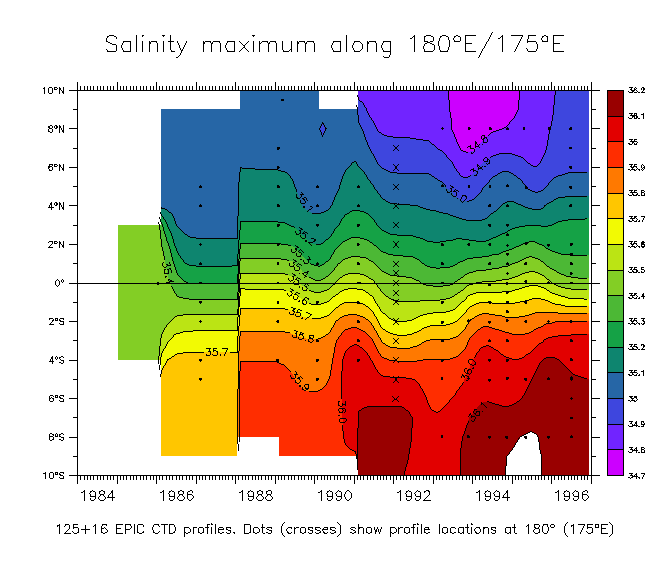
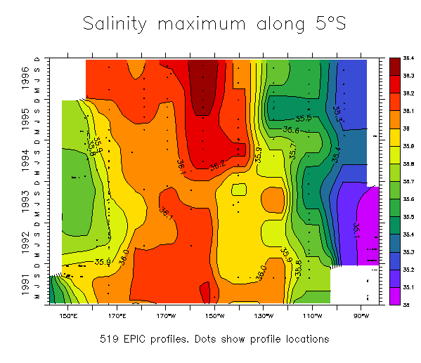
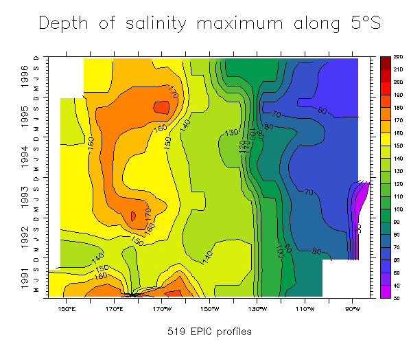
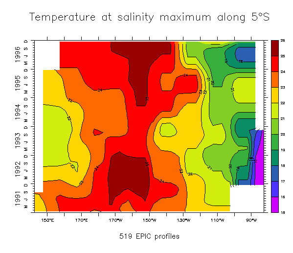
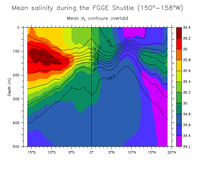
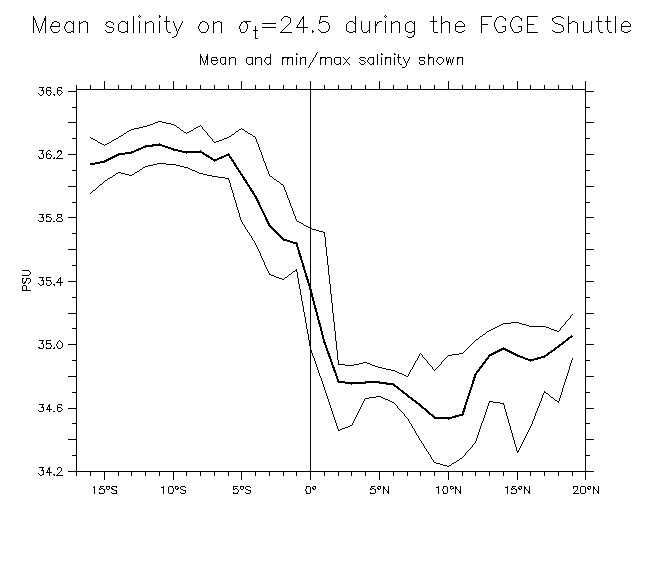
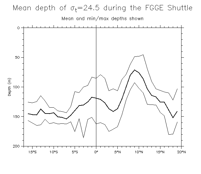
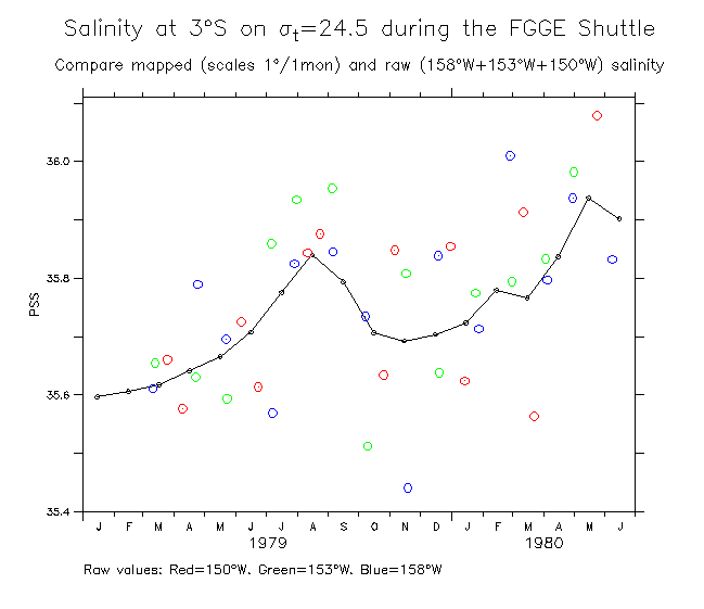
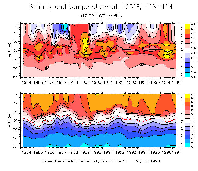
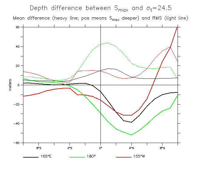
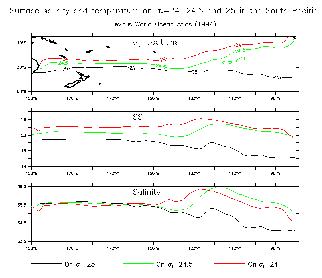
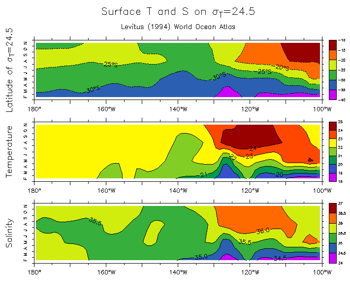
Salinity maximum:
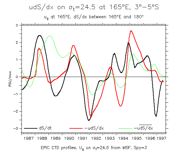
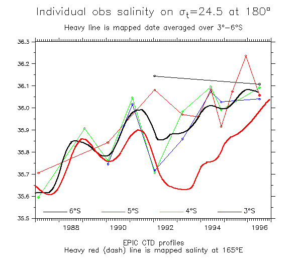
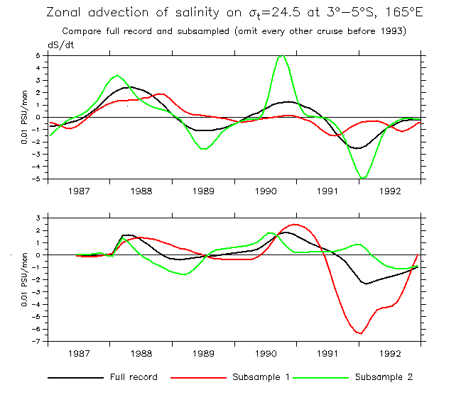
Another similar calculation along 5°S.
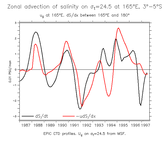
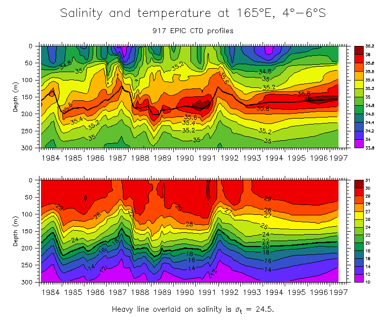
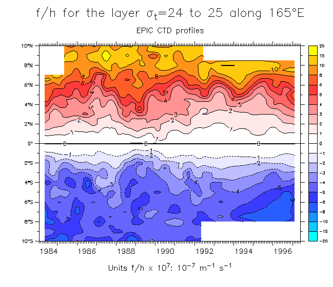
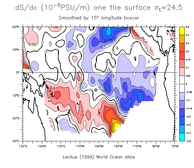
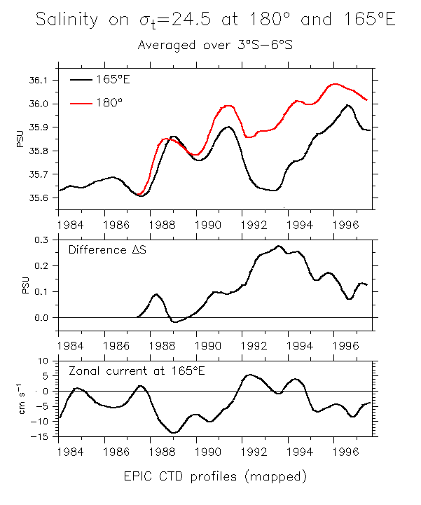
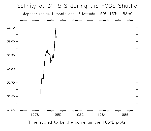
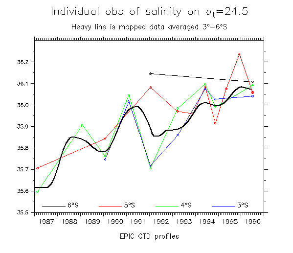
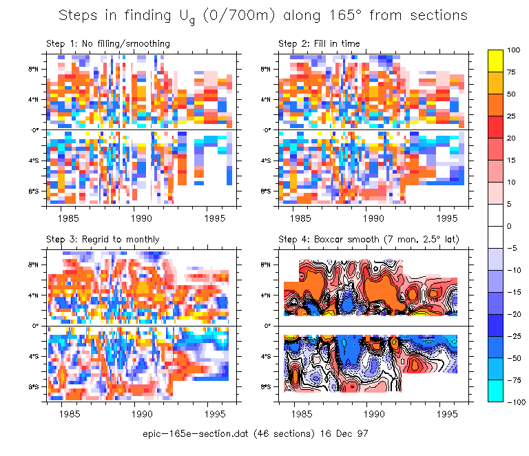
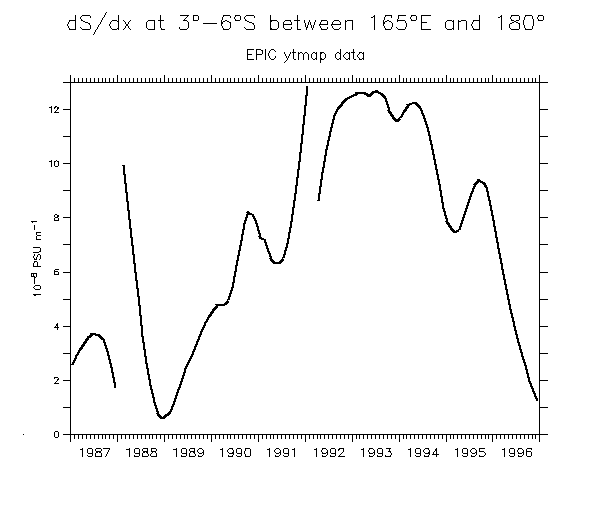
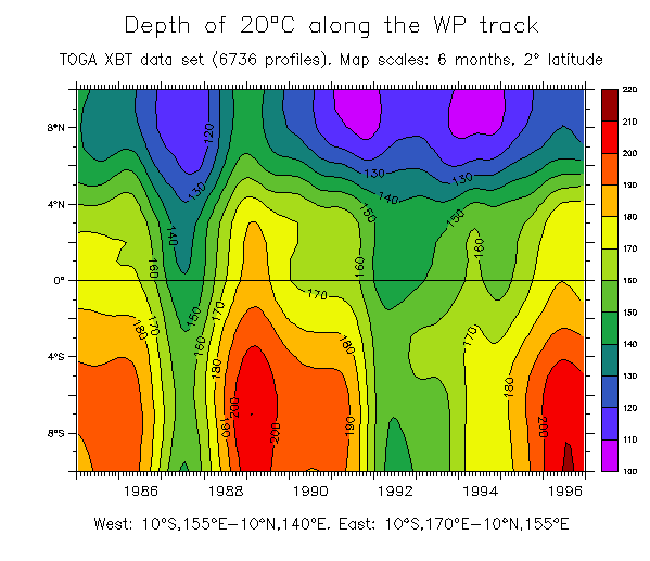
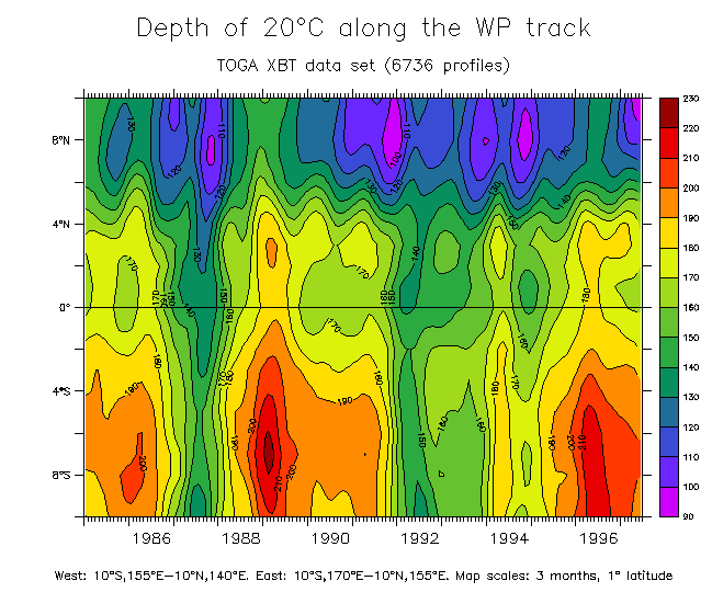
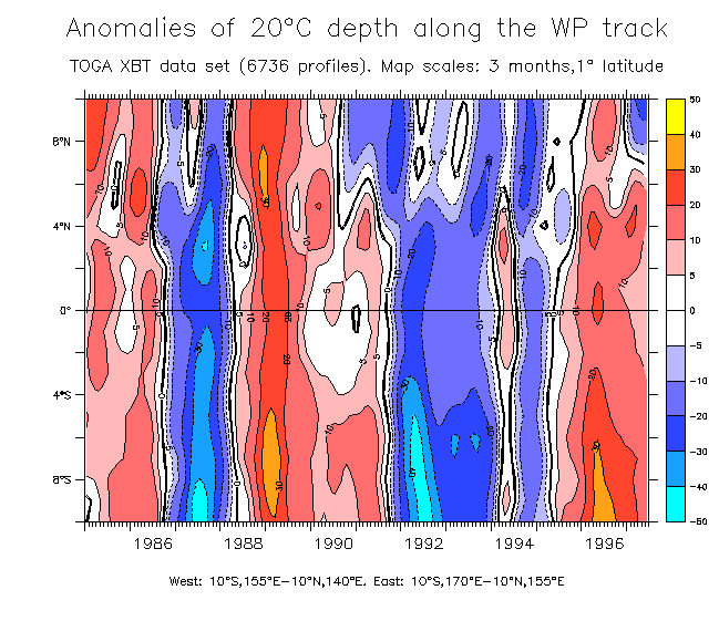
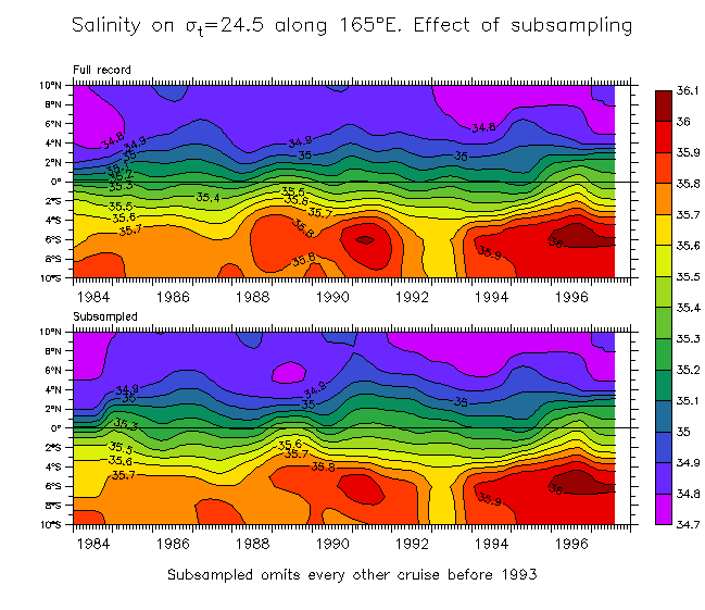
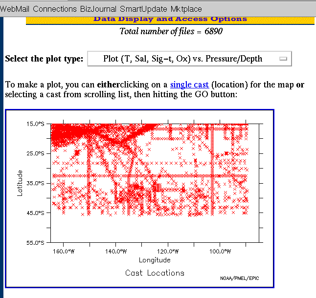
Even cruder than the above. Fewer profiles, and gridded by 5° longitude, with scales of 25° longitude and 6 months.