Methodology and InSAR Scenes
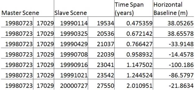
Thanks to the high density of wells and continuous drilling in the area any InSAR pair is sure to cover multiple active sites. As such we can pick scenes based solely on their quality. The ERS2 satellite has several dozen SAR scenes of the area from 1995-2001. We first calculate the perpendicular baseline for all pairs of SAR scenes and pick those pairs with a small (<60m) baseline. From these two dozen scenes we finally pick seven pairs sharing a common initial master scene (see Table 1) to serve as a time series. Each interferogram will then show the cumulative surface displacement since the initial scene (July 1998) and we will be able to track the change in the surface deformation with time.
Interferograms are created using the ROI_PAC software package.


