
Exposure dating project pages
| ESS 461 home |
| Information |
| Lecture notes |
| Labs |
| Research project |
| Term papers |
| Reading |
| Web resources |
| Footnotes |
| FAQ |
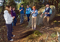
Fieldwork, Friday 11 April, 2 pm ...
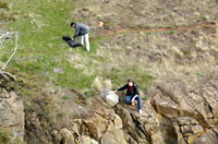
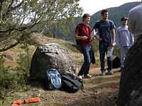
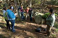
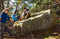
Our aim is to date boulders exposed by falling sea level and erosion of overlying till at the end of the last ice age. By taking samples at different elevations, we may also be able to measure the rate of relative sea level (RSL) change. In Puget Sound, RSL fell rapidly after the last glaciation, even though retreat of the ice sheets around the world was adding a huge volume of meltwater to the oceans. This is because the isostatic rise of the land, freed from the weight of the ice sheet, outpaced the eustatic rise of sea-level due to melting of the distant ice sheets. On two field trips, in 2008 and 2010, we found more than half a dozen boulders in various positions on the hillside. Not all of these are suitable for exposure dating.
 |
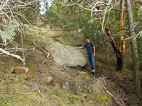 |
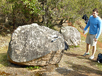
We judged five granite boulders likely to be suitable. The first two sit side by side on a bedrock shelf at an altitude of 59 meters. A third comes from farther north and lower on the hillside, at an elevation of 16 m. Two more, collected in 2010 come from further north along the bluffs, at about 45 and 60 meters. All of these are resting stably on flat bedrock shelves. They all have slightly roughened surfaces indicating a few centimeters of erosion. We also found a few unsuitable boulders, perched precariously or partly buried by soil washing down drainage gullies.
 |
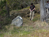
We used a laser rangefinder to measure sample elevations, by a sequence of triangulation measurements down to the beach. On both field trips we sampled right around low tide, so the elevations measured to water level are about 0.5 meters higher than heights above mean sea level.
 |
 |
 |
| Sample site 08-PUG-023-GPT | Sample site 08-PUG-024-GPT | Sample site 08-PUG-025-GPT |
 |
 |
 |
| Sample site 10-PUG-043-GPT | Sample site 10-PUG-044-GPT | ESS 461 (2010) Sampling 044-GPT |