Overview of GIS Analysis
Identify Parcels Within the Municipal Boundary
Export from MetroScan to ARC/INFO
Dissolve Adjacent Polygons with the Same PINs
Calculate (Fix) Original Parcel Areas, Counts of Housing Units,
and Building Square Footage
Define Sensitive Areas
Stream & Wetland Buffers, Steep Slopes
Set &/or Calculate Initial Baseline Data
Housing Units
Employees
Union Parcel Data with Current and Future Zoning Data
Union Parcel+Zoning with Urban Center Boundary
Union Parcel+Zoning+Urban Center with Airport Area
Removal of "Slivers"
Eliminate
if polygon size less than 300, and an area-to-lot square foot ratio less than or equal to 0.1
Cull Parcels Not in Analysis
Parcels Excluded from Analysis:
Airport
Schools
Fire Station
Utility-related parcels (e.g., water, electrical)
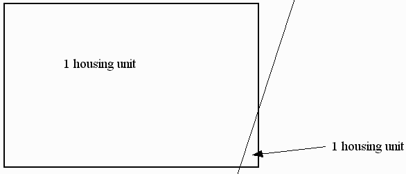
Specific residential units*.
*Apartment buildings straddling parcel boundaries
Export Data
Infodbase to get data into Access
Filters, Calculations, & Summaries
Within Access
Data Sources
Filters & Calculations