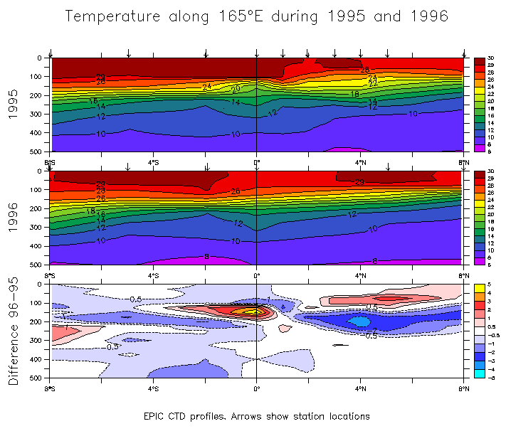
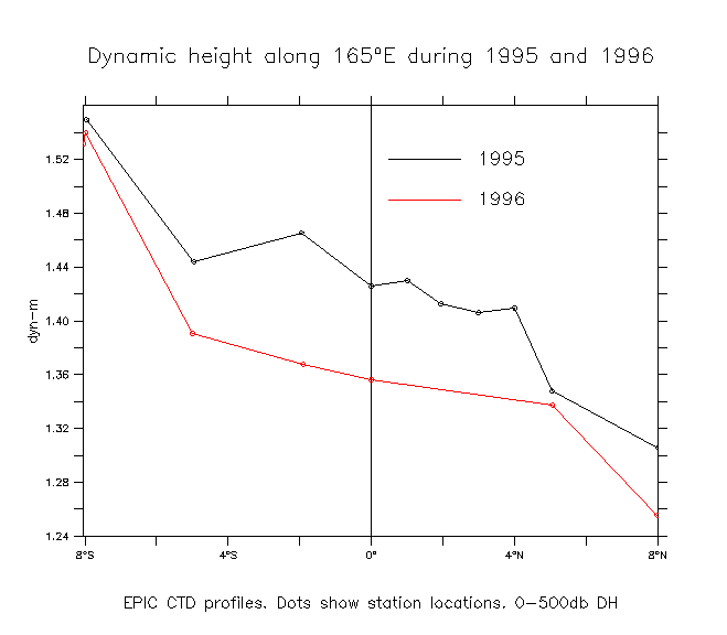
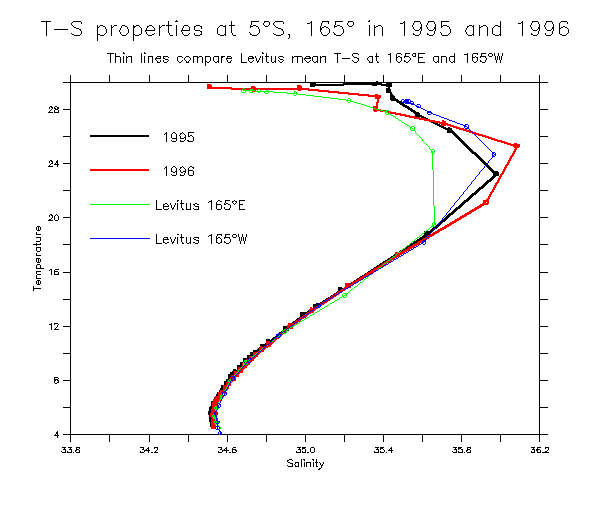
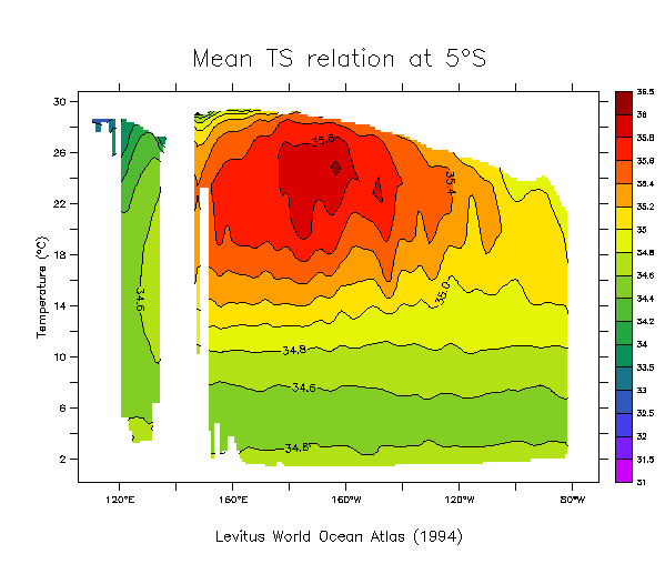
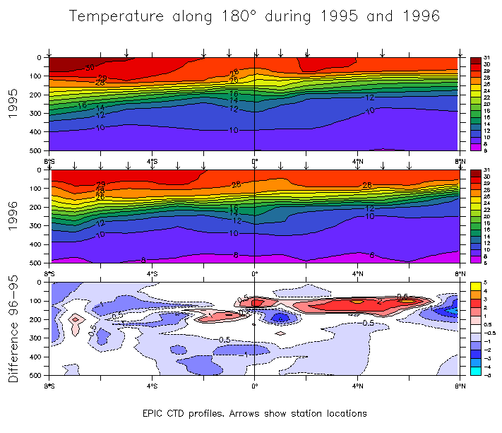
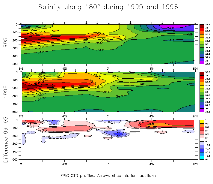
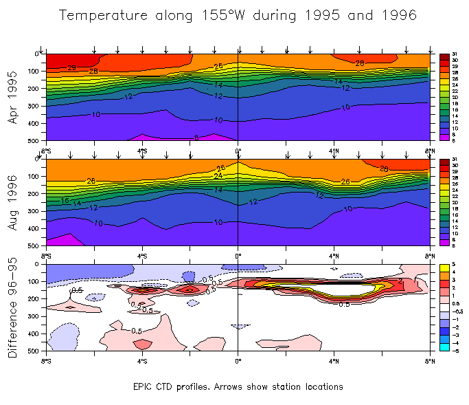
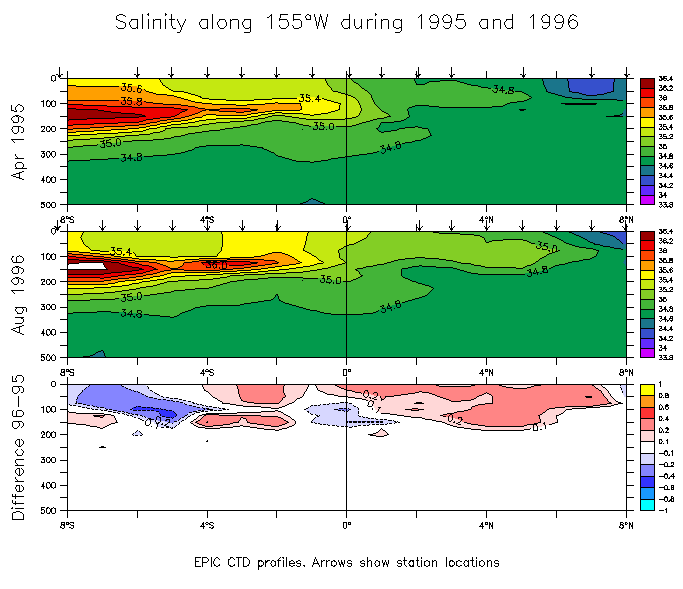
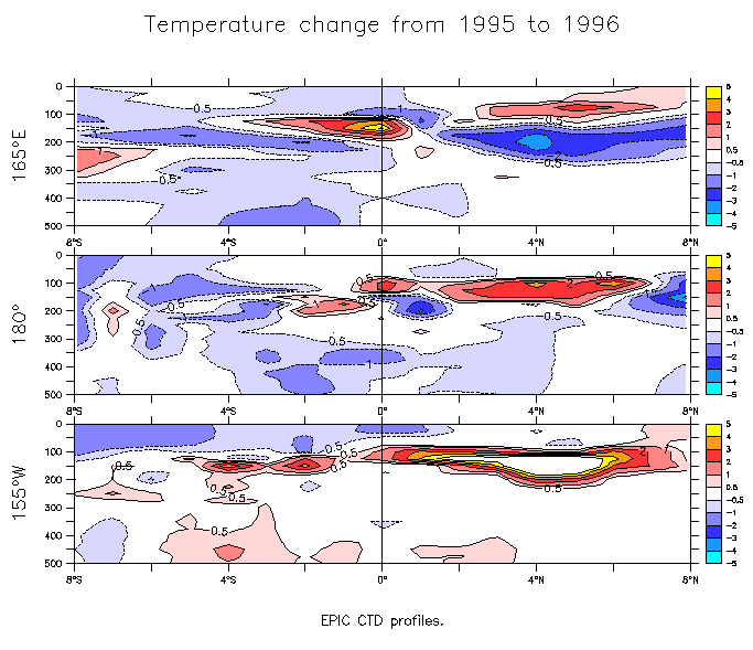
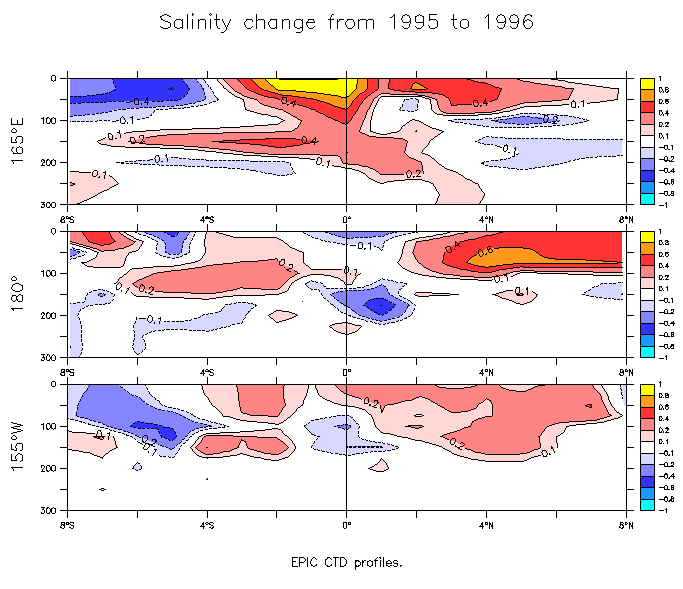
Temperature and salinity changes along 165°E, 180° and 155°W (1995 vs 1996)
Differences are found by comparing CTD profiles taken during TAO buoy deployment cruises roughly one year apart (in May 1995 and July 1996). The gridding is quick and dirty. Therefore these pictures are for your personal viewing enjoyment in the privacy of your own home. Please do not distribute these crude plots!!!