Destination of the NGCU
Work done during my poste rouge at LEGOS, April-July 2010
- Initial data exploration:
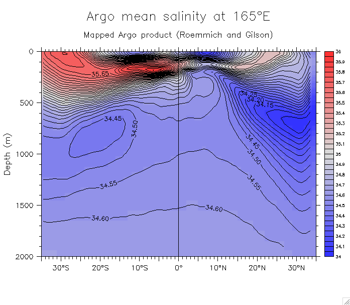
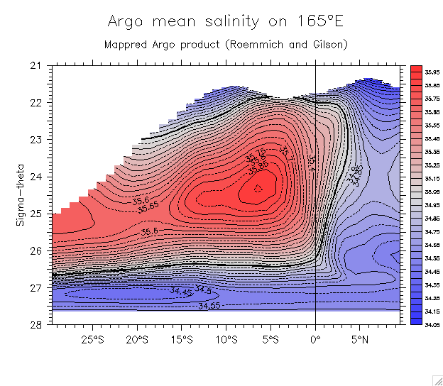
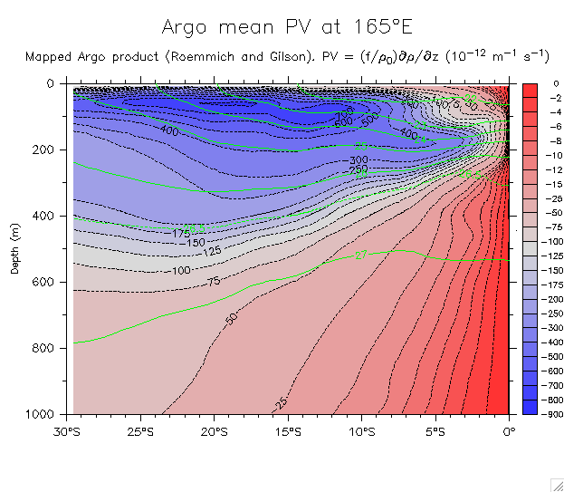
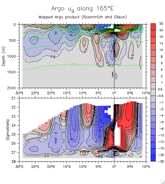
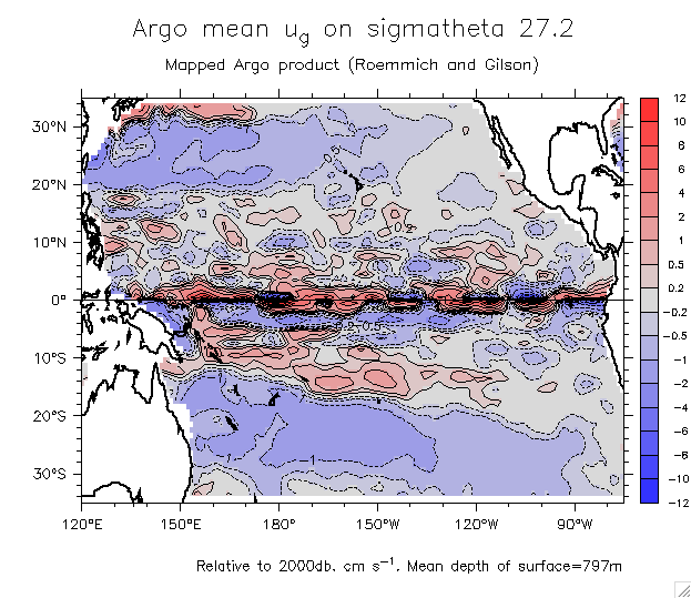
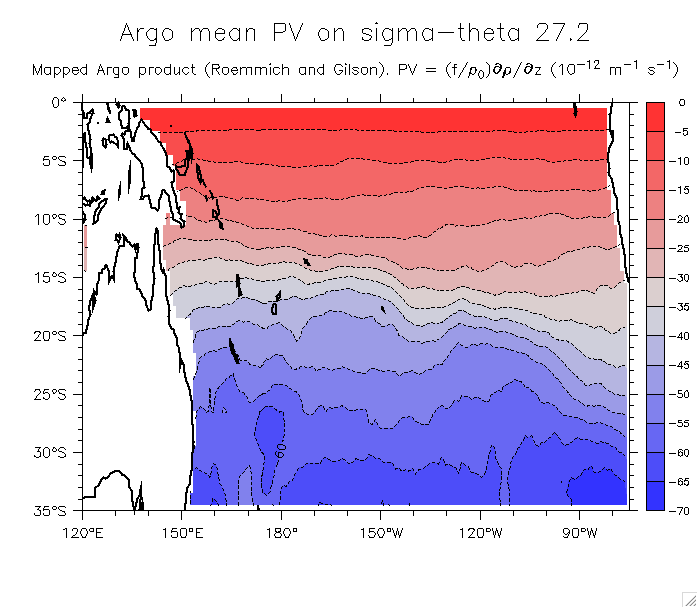
- Mapped Argo product (Roemmich and Gilson)
- Sections on 165°E:
- Salinity: Whole section Overlay sigma Detail 30°S-10°N, 0-1000m On sigma
- PV: Whole section Detail
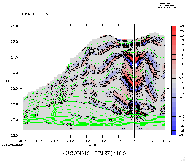
- u_g on density: Whole section
- Maps on isopycnals:
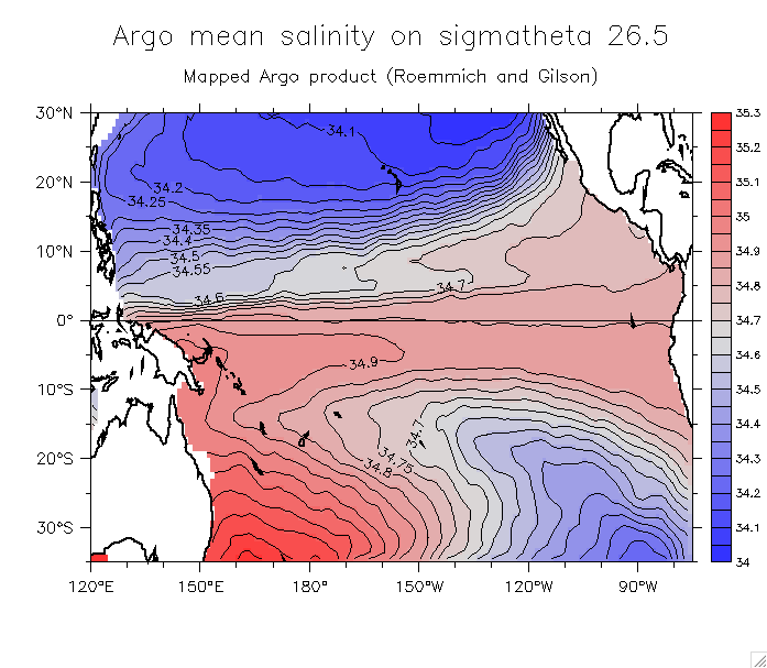
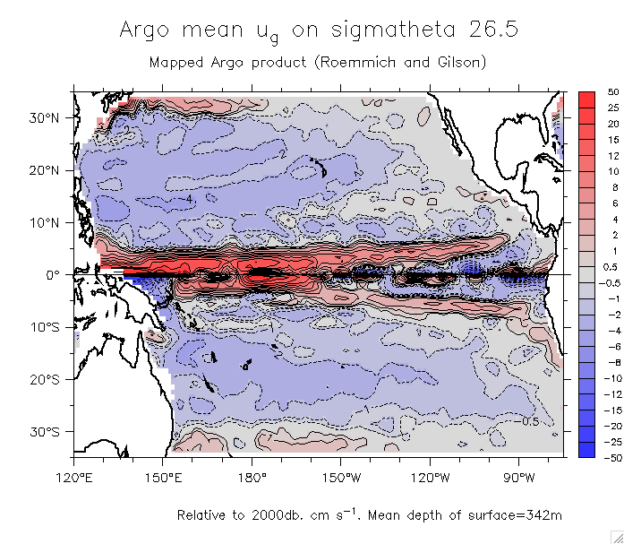
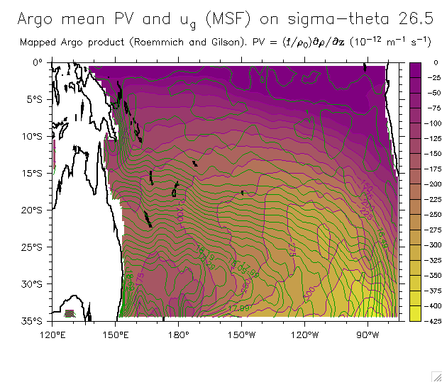
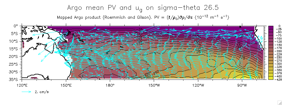
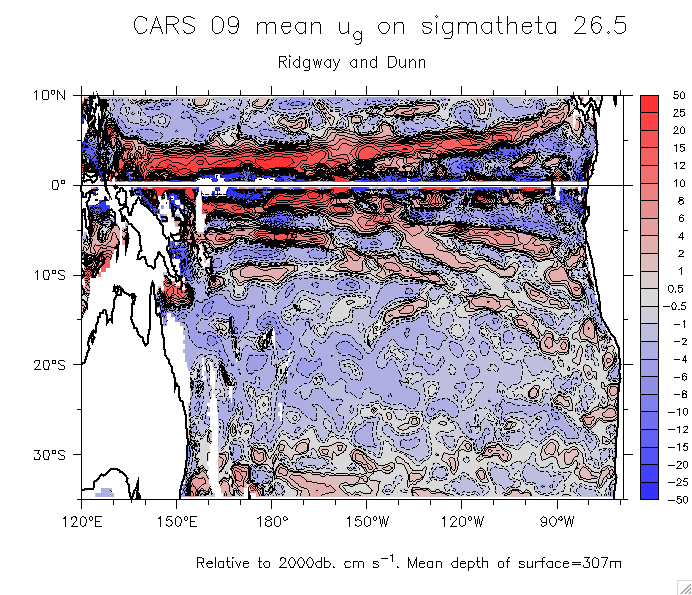
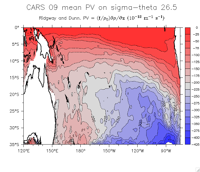
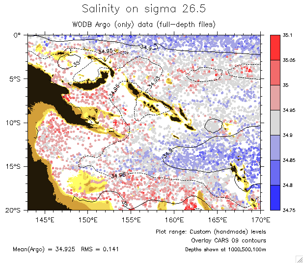
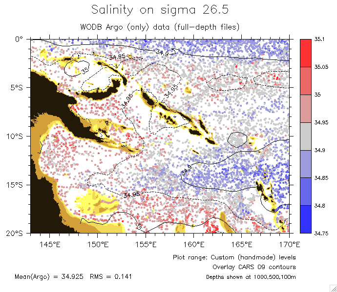
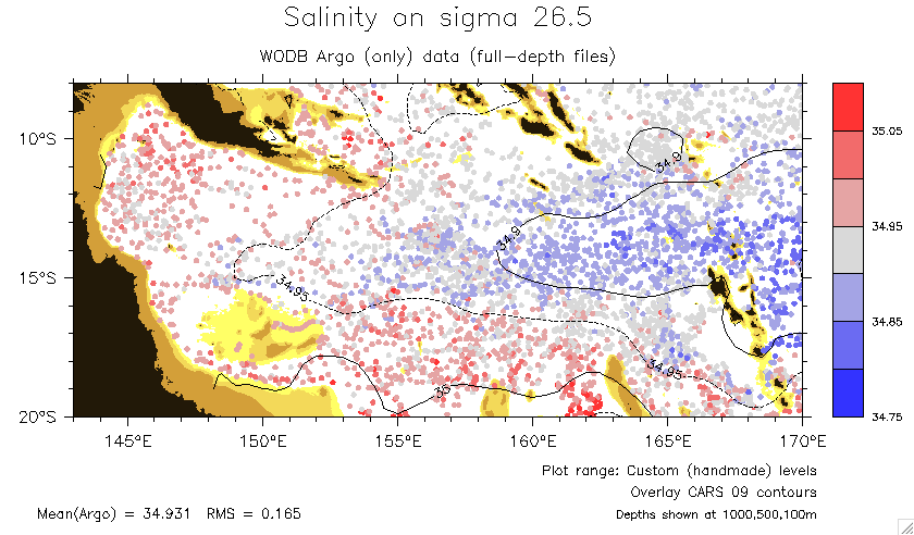
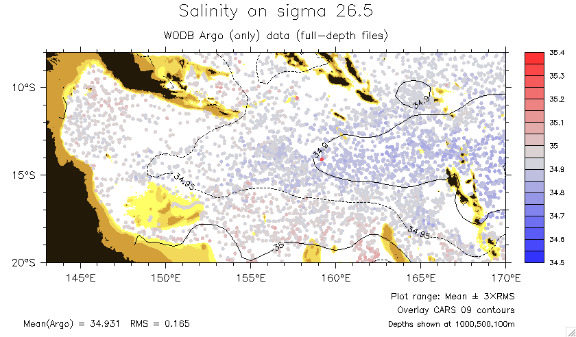
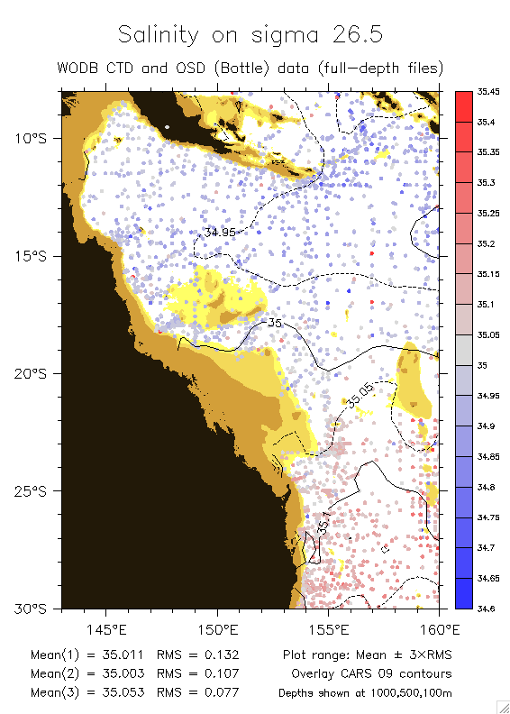
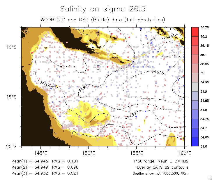
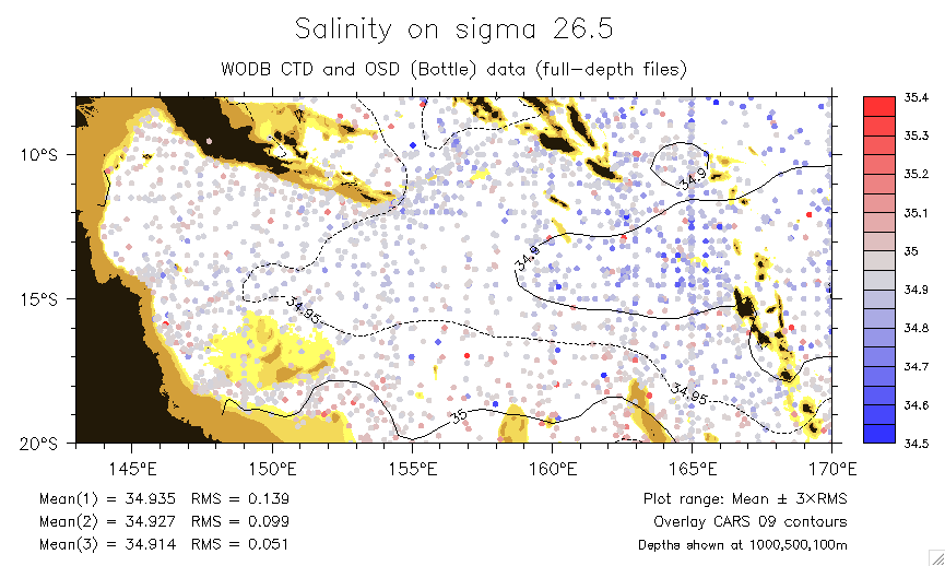
- Sigma 26.5: Salinity ug PV PV and overlaid MSF PV and overlaid ug vectors v2
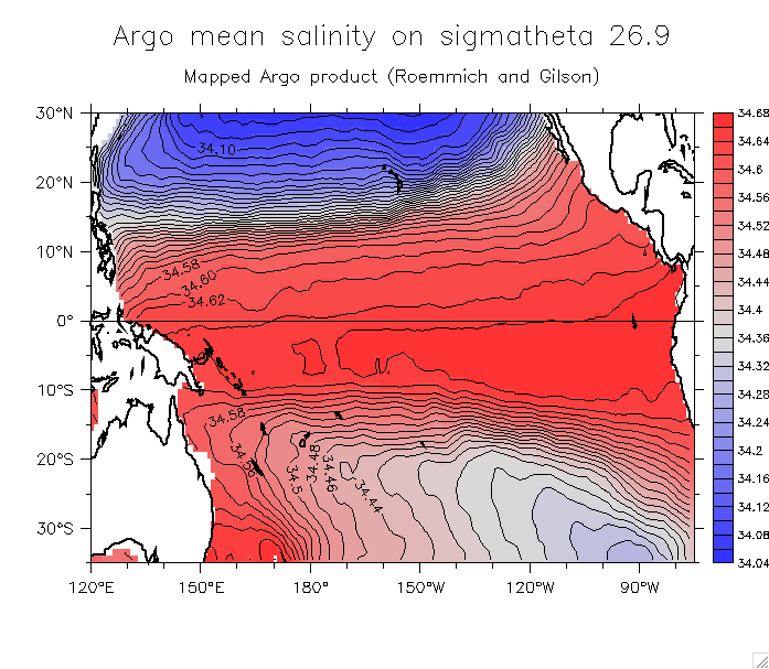
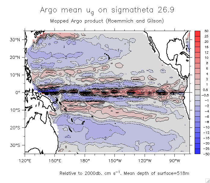
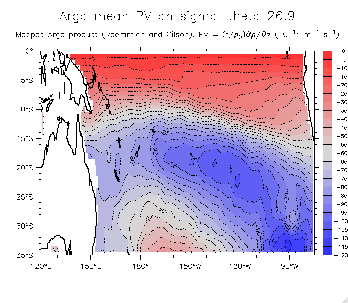
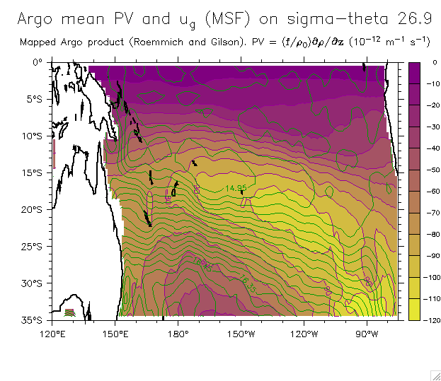
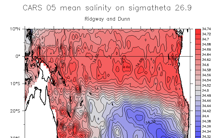
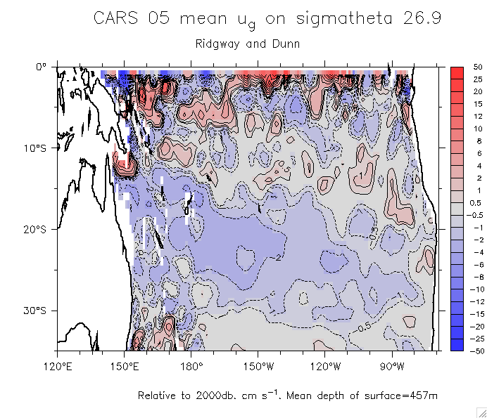
- Sigma 26.9: Salinity ug PV PV and overlaid MSF
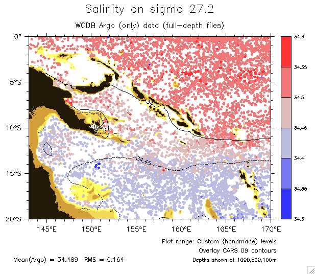
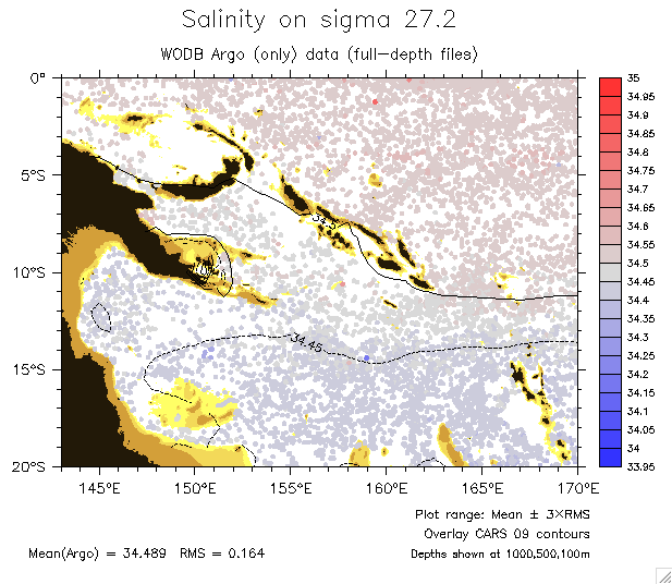
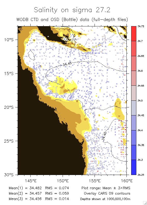
- Sigma 27.2: Salinity ug PV PV and overlaid MSF
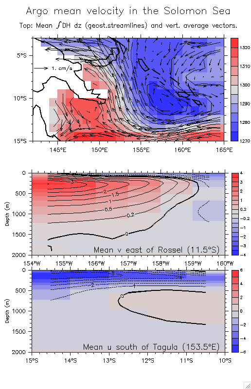
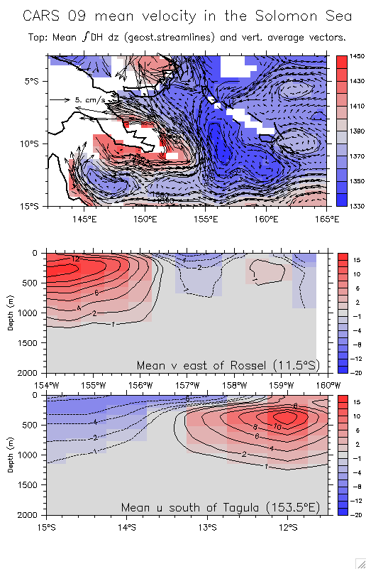
- Sections of the NGCU near Rossel Same from CARS 09
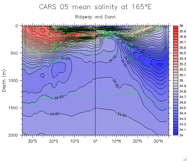
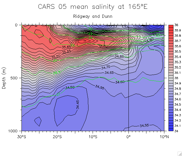
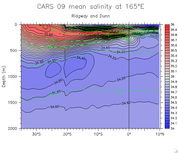
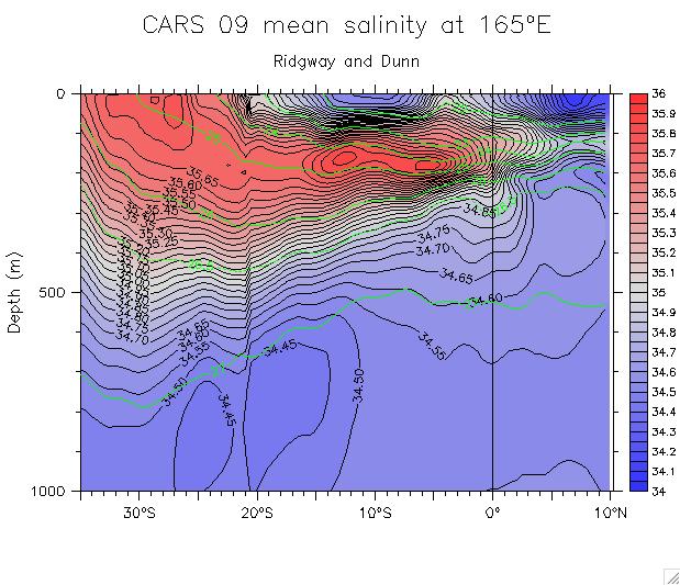
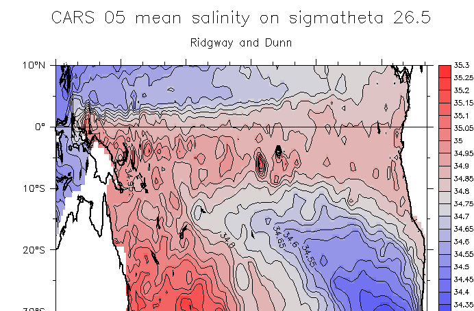
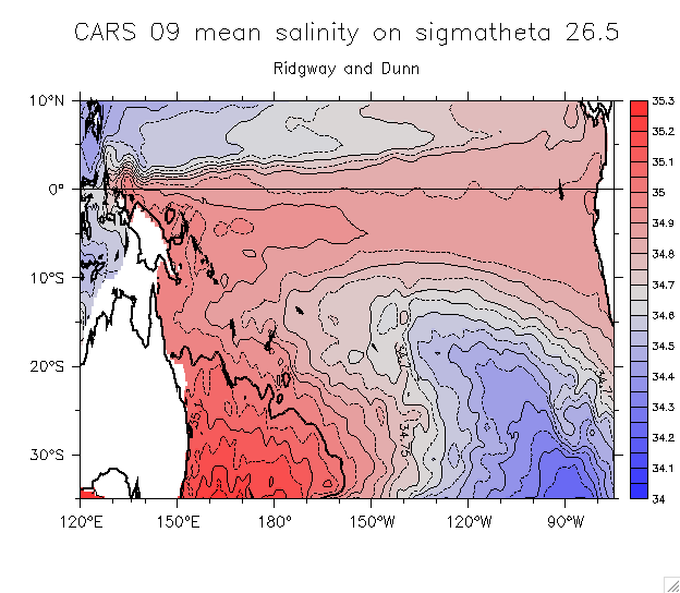
- CARS climatology (Ridgway and Dunn)
- Sections on 165°E:
- Salinity: (CARS 05) Whole section Overlay sigma Detail 30°S-10°N, 0-1000m
(CARS 09): Whole section Overlay sigma Detail 30°S-10°N, 0-1000m
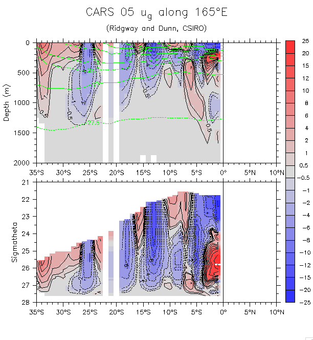
- u_g on density: (CARS 05) Whole section
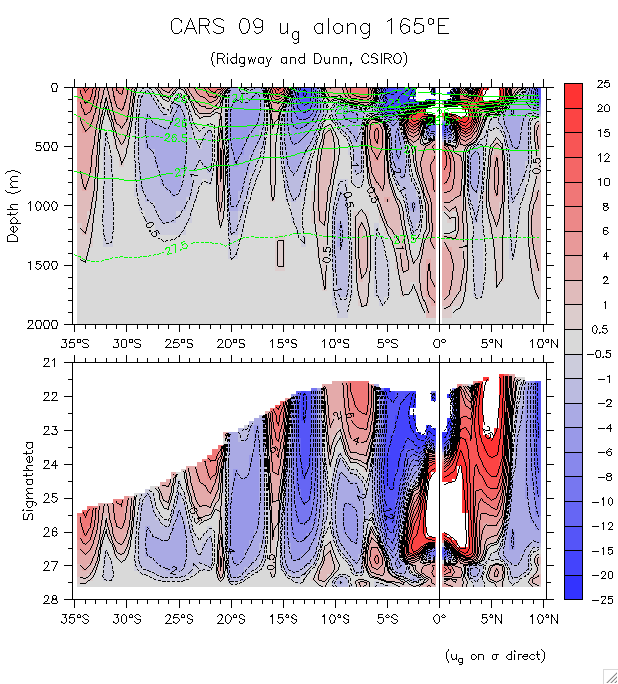
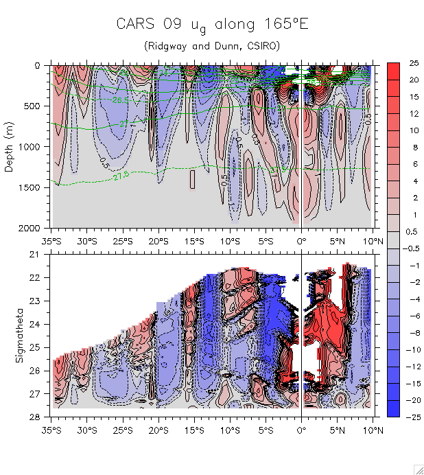
u_g on density: (CARS 09) Whole section (35°S-10°N)
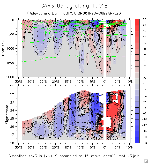
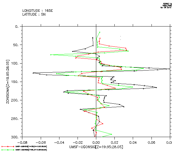
Recall Ferret struggling: problems (Try smoothing)
Difference Difference profiles
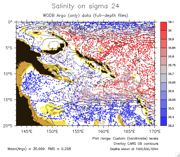
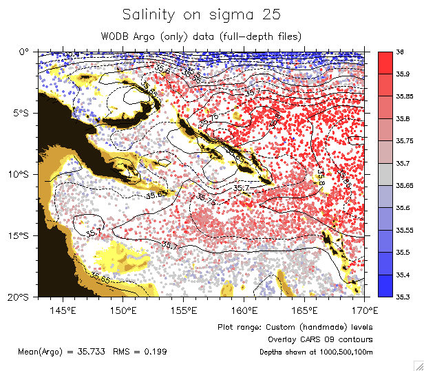
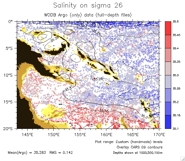
- Maps on isopycnals:
- Reference maps of salinity and oxygen at every 0.5th isopycnal from 23.5 to 27.5.
- And ... another version!!! Salinity Oxygen Salinity, overlay oxygen
(En fait, ces figures montrent des niveaux legerement differentes)
- Isopycnal depths
- Sigma 26.5:
CARS 05: Salinity ug
CARS 09: Salinity ug PV
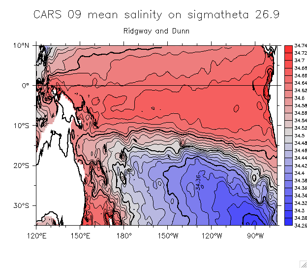
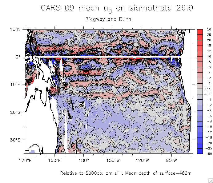
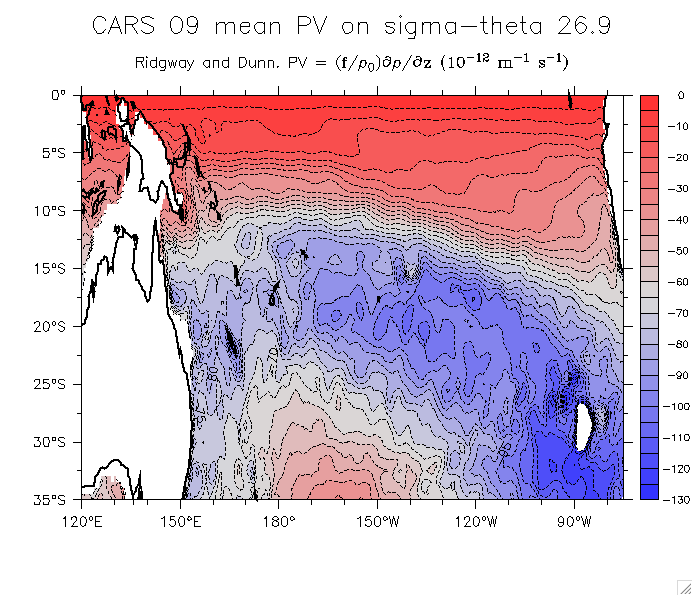
- Sigma 26.9:
CARS 05: Salinity ug
CARS 09: Salinity ug PV
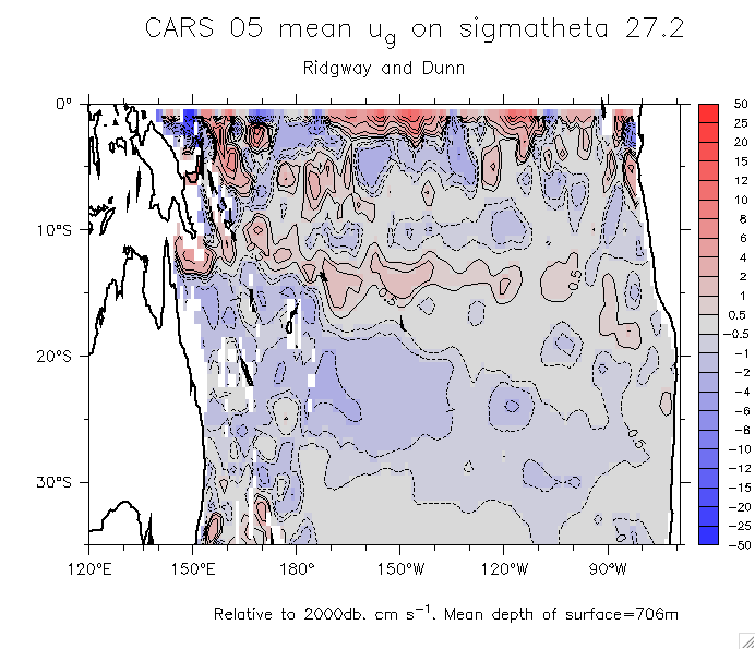
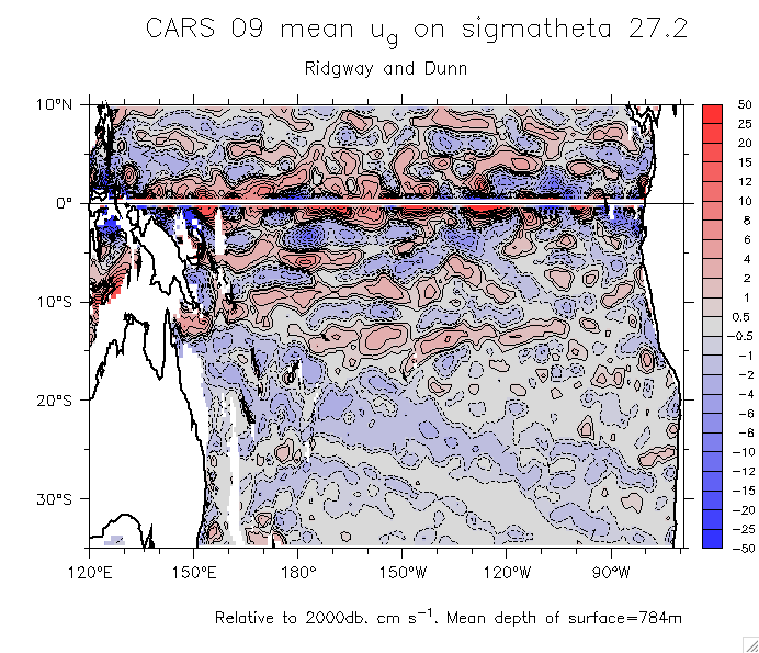
- Sigma 27.2:
CARS 05: Salinity ug
CARS 09: Salinity ug PV
- Sections of the NGCU near Rossel Same from Argo Atlas
- Zonal vertical sections:
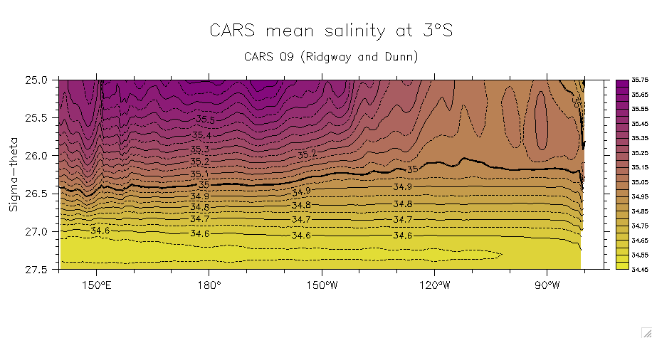
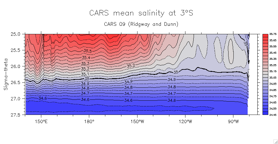
Salinity at 3°S: v1 v2
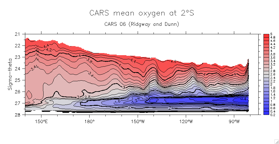
Oxygen: 3°S, 25-27.5 3°S, 21-28 2°S, 25-27.5
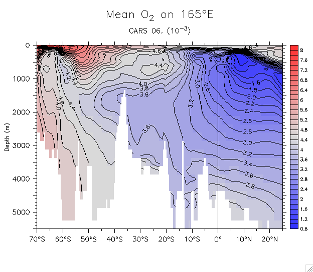
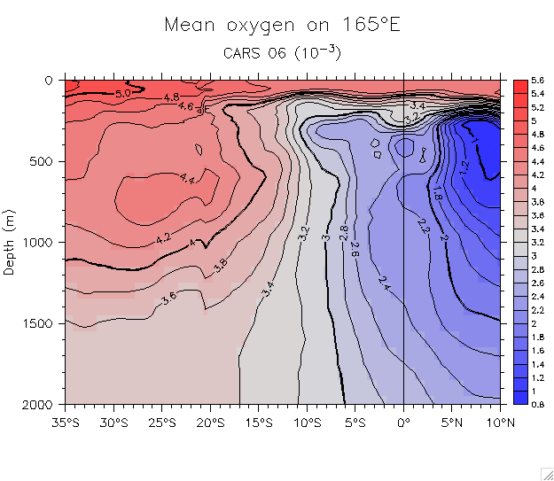
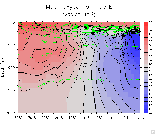
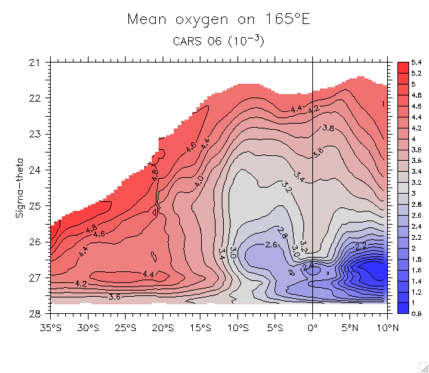
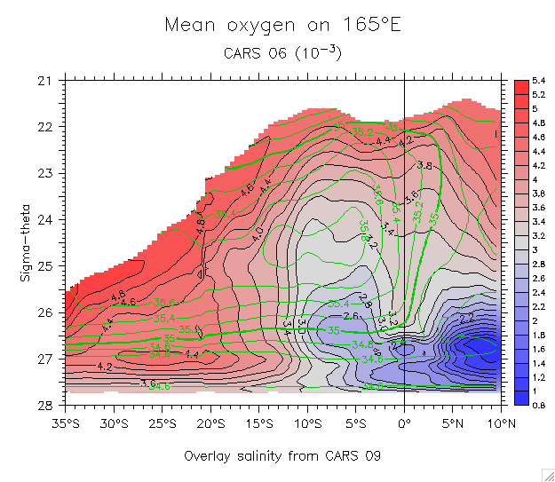
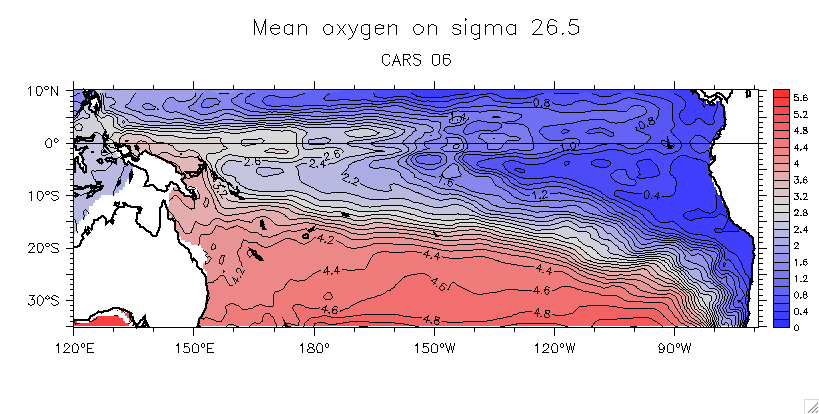
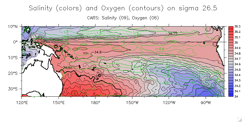
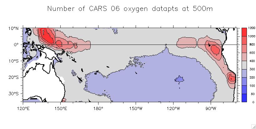
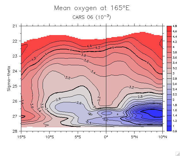
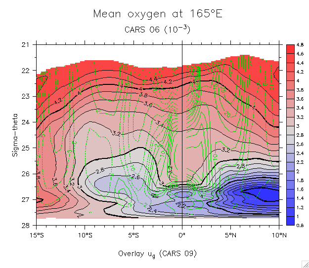
- Oxygen (CARS 06):
- Sections on 165°E:
On depth: Full section Detail Overlay sigma
On density Overlay salinity
- Maps: On sigma 26.5 Salinity and oxygen on 26.5
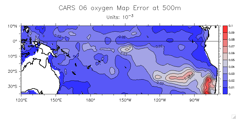
- Error stats: Number of data pts (profiles?) Estimated map error of mean
- 165°E sections on density (details): ug Oxygen Oxygen, overlay ug contours
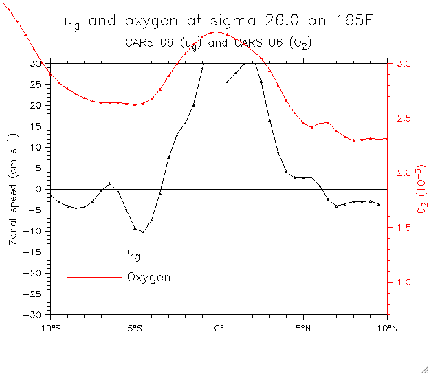
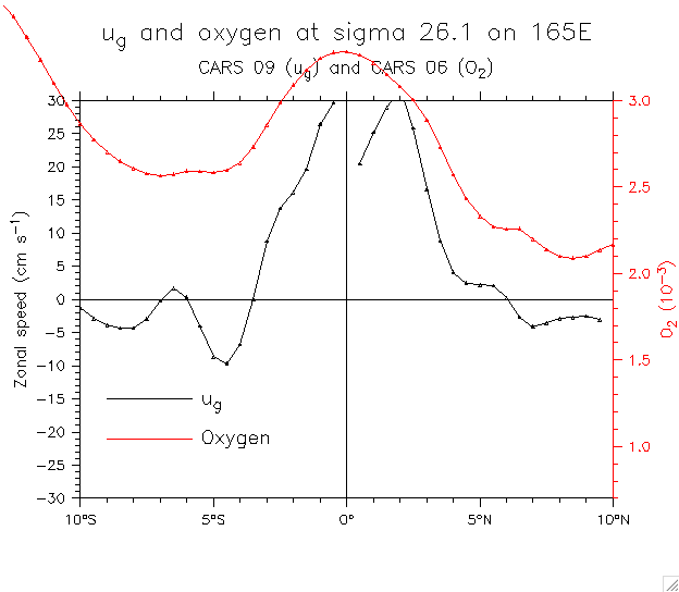
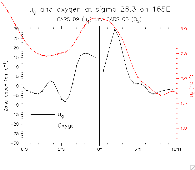
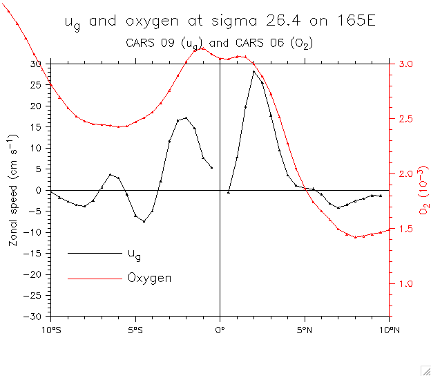
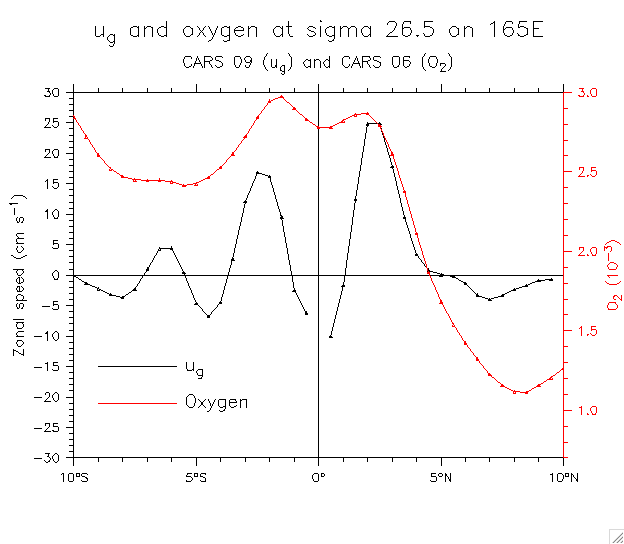
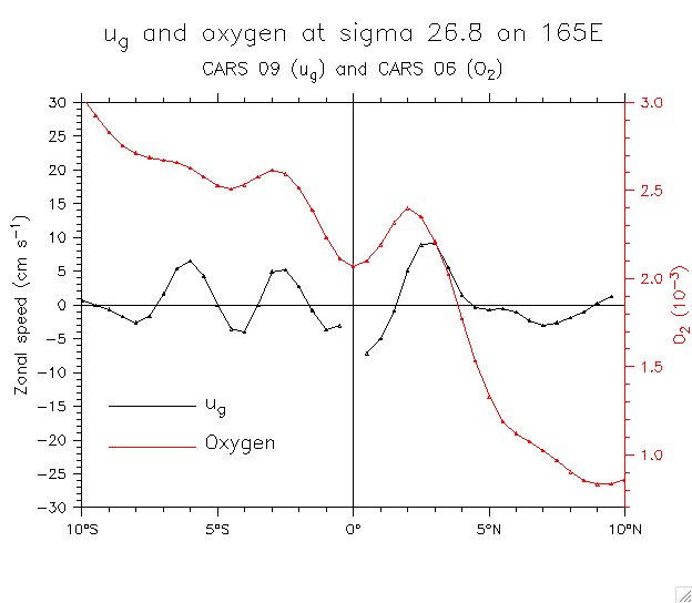
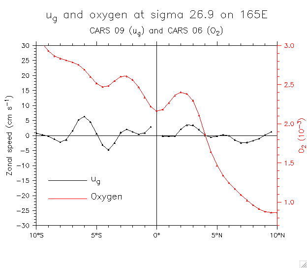
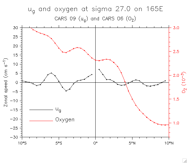
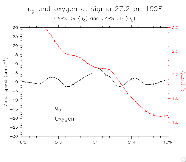
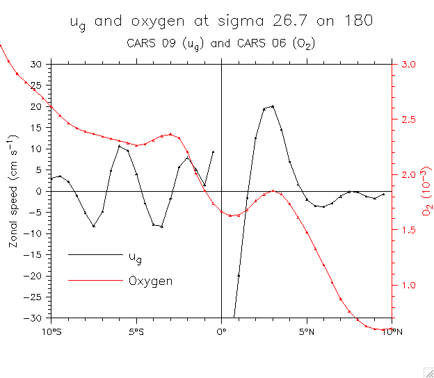
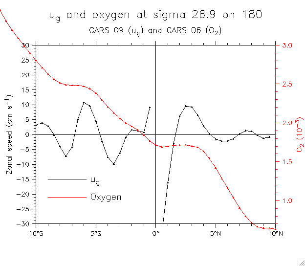
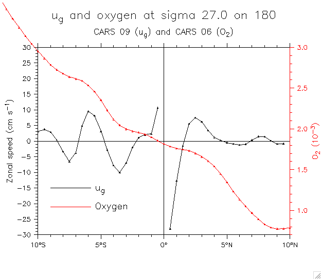
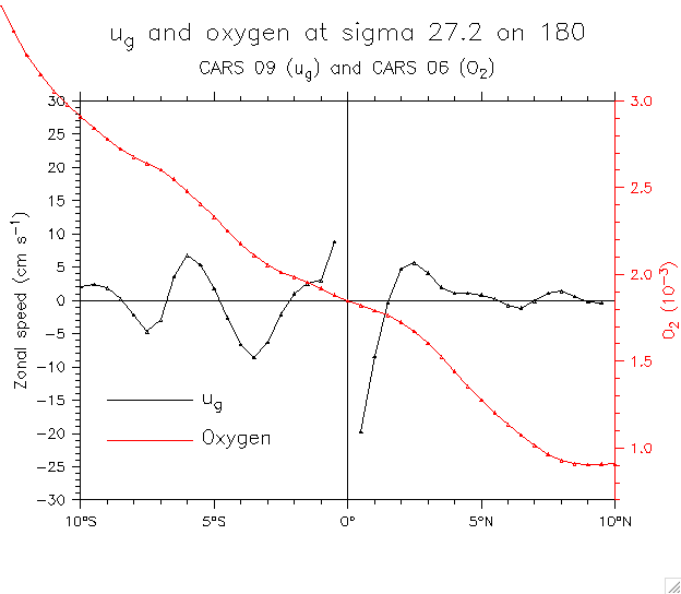
- Line plots of oxygen and ug by isopycnal and longitude:
- 165°E: 26.0 26.1 26.2 26.3 26.4 26.5 26.6 26.7 26.8 26.9 27.0 27.2
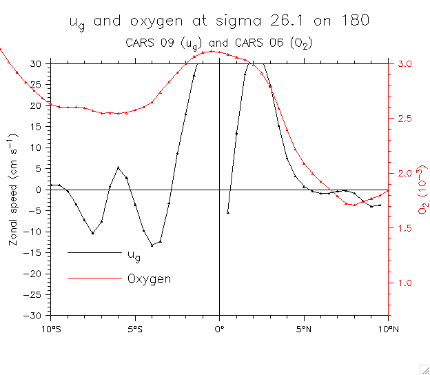
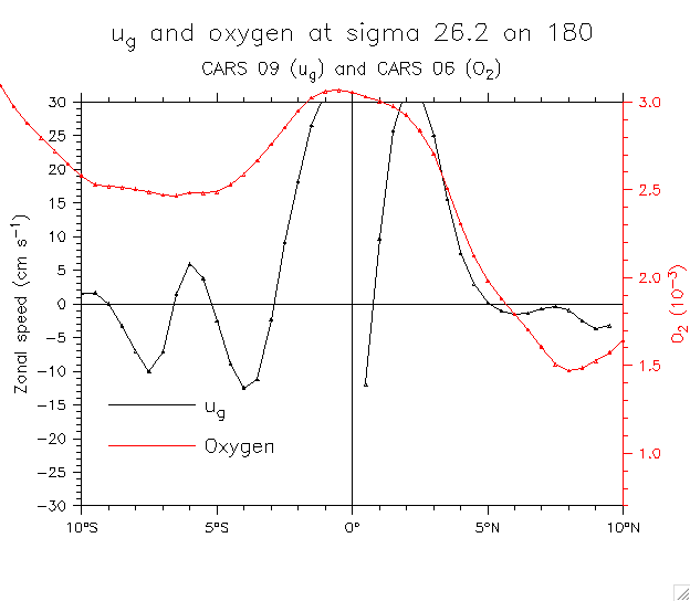
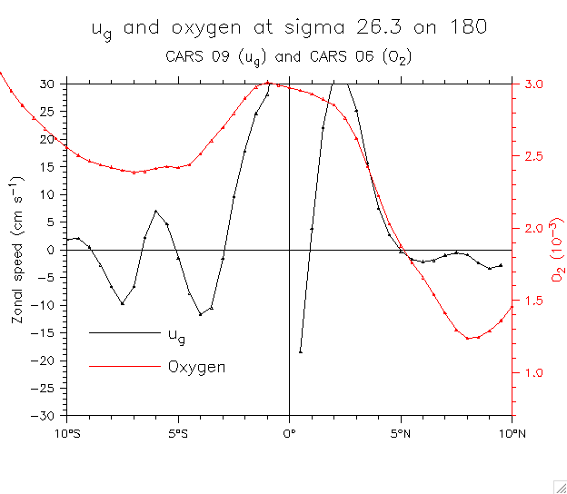
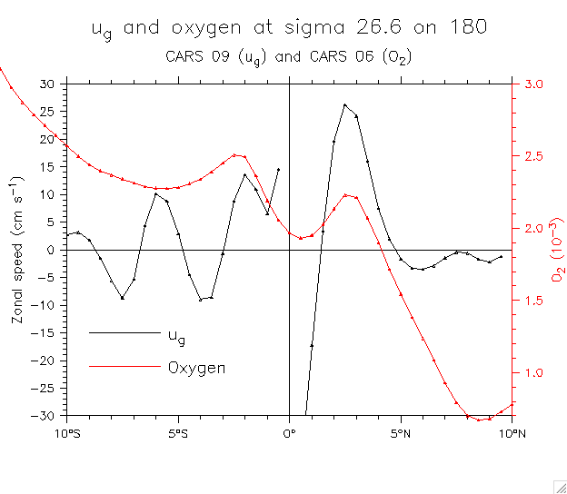
- 180°: 26.0 26.1 26.2 26.3 26.4 26.5 26.6 26.7 26.8 26.9 27.0 27.2
Extra: show salinity and oxygen together at 165°E, sigma 26.5
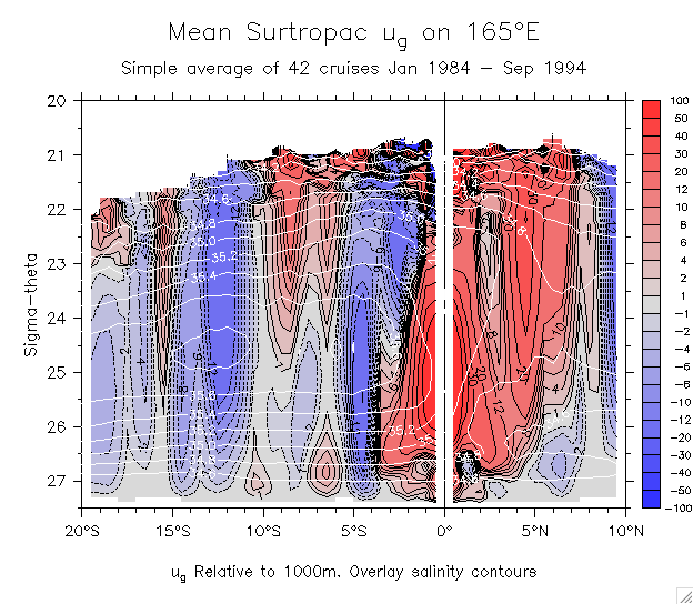
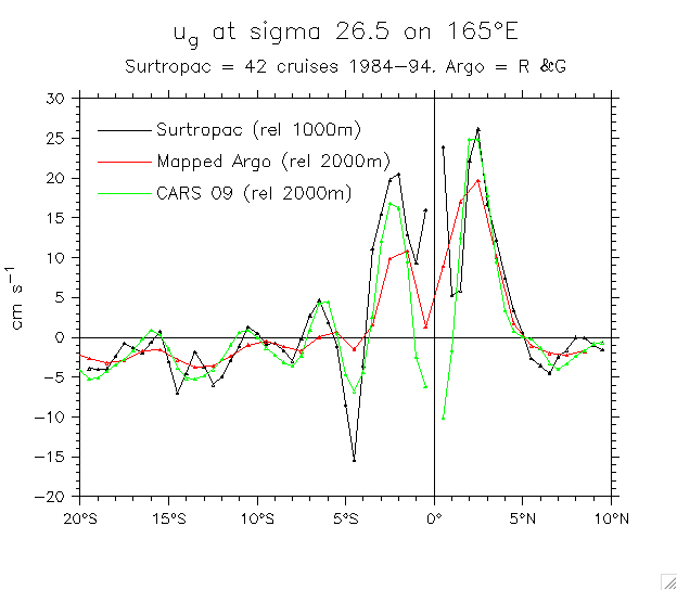
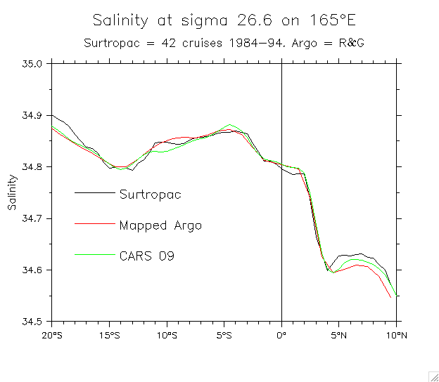
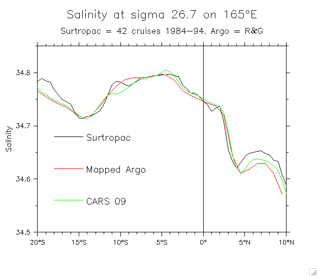
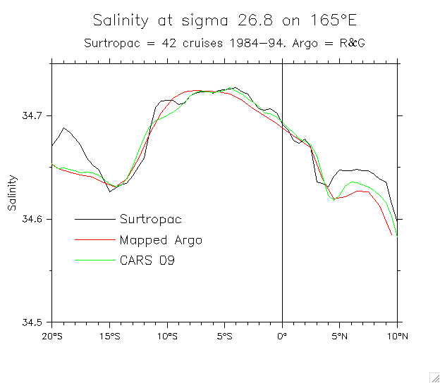
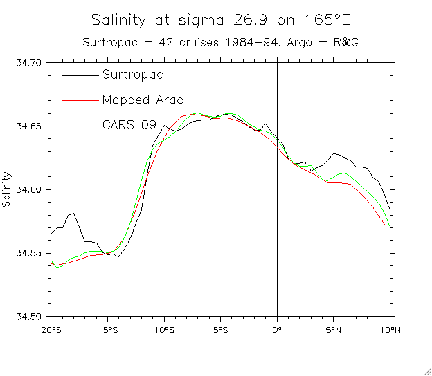
- Surtropac (42 cruises on 165°E, 1984-94):
- Mean ug sections: On (y,z) On sigma On sigma, overlay salinity
- ug on sigma 26.5: Surtropac, Argo, CARS
- Salt on isopycnals. Compare Surtropac, Argo, CARS: 26.5 26.6 26.7 26.8 26.9 27.0
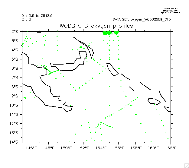
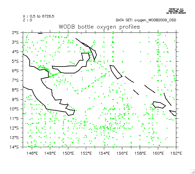
- WODB oxygen data:
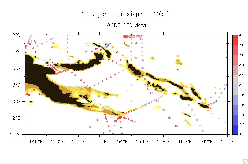
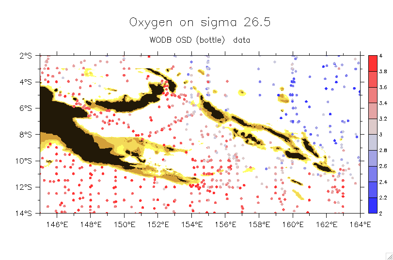
- Solomon Sea profile locations: CTD Bottle
- Solomon Sea oxygen at sigma 26.5: CTD Bottle
- Oxygen dot-maps on isopycnals for 145°E-172°E, 15°S-Equator:
- Version 1 (smaller region, specified levels): CTD and bottle data CTD data only Salinity
- Version 2 (larger region, 3RMS levels): CTD and bottle data salinity
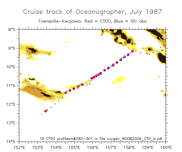
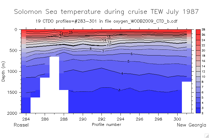
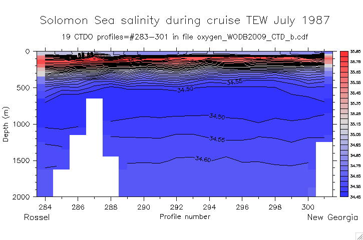
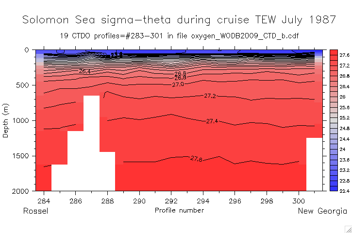
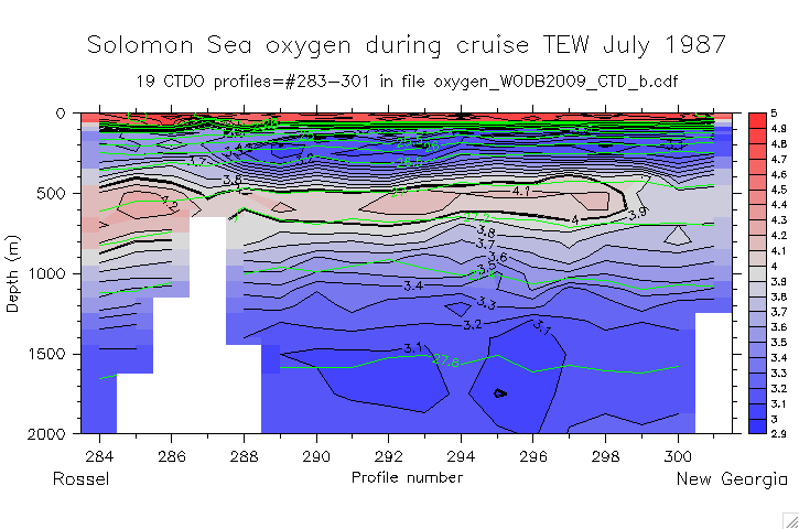
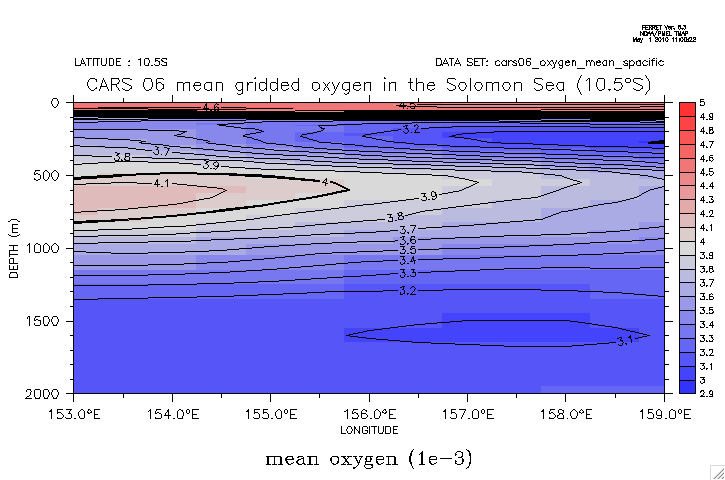
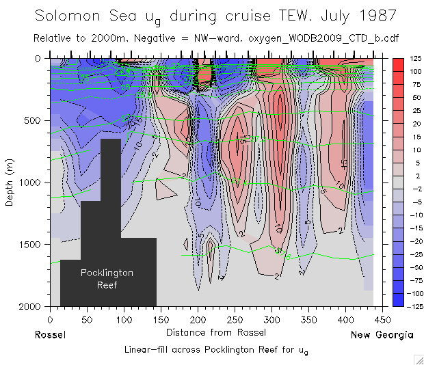
- Extract the cruise TEW (July 1987):
- Cruise track showing CTDO profile locations
- TEW sections Rossel-New Georgia:
T S Sigma Oxygen Oxygen, overlay sigma CARS 06 gridded oxygen ug
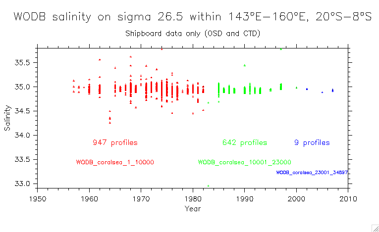
- WODB salinity data on isoycnals:
Note: must use actual depths! Standard depths are unrealistic!
- Argo salinity:
- Custom levels:
24.0
24.5
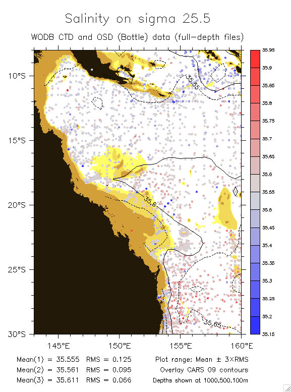
25.0
25.5
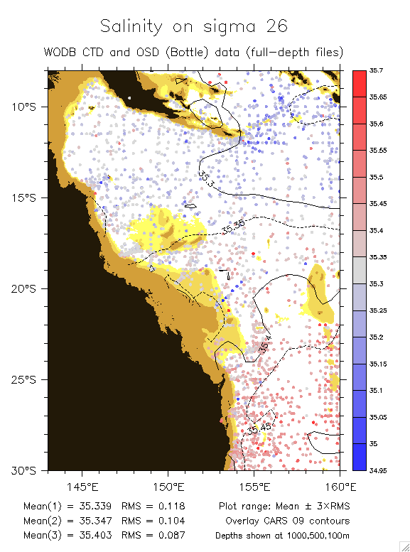
26.0
26.5
26.5 (b)
26.9
27.2
26.5 C.S. only
- Automatic levels: 26.0
26.5
26.9
27.2
26.5 C.S. only
- OSD and CTD salinity:
- Large area: 25.5
26.0
26.5
27.2
- Detail (26.5): v1
v2
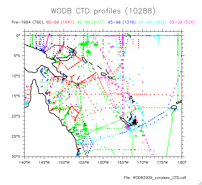
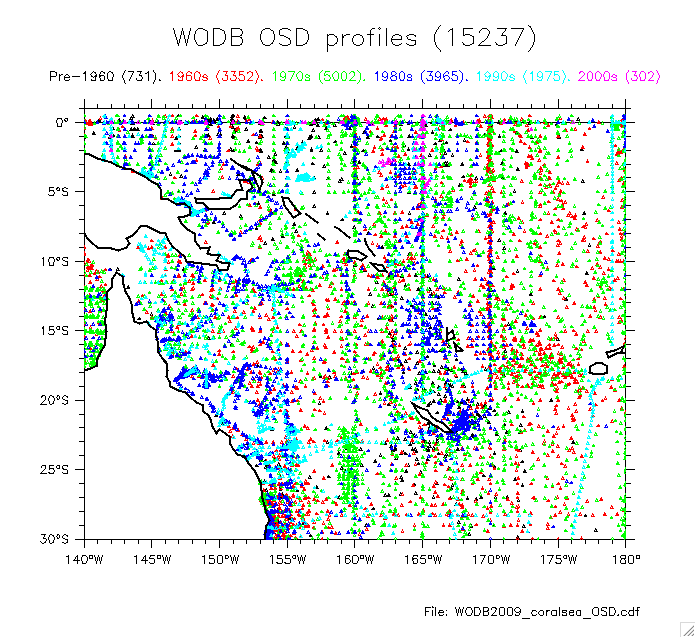
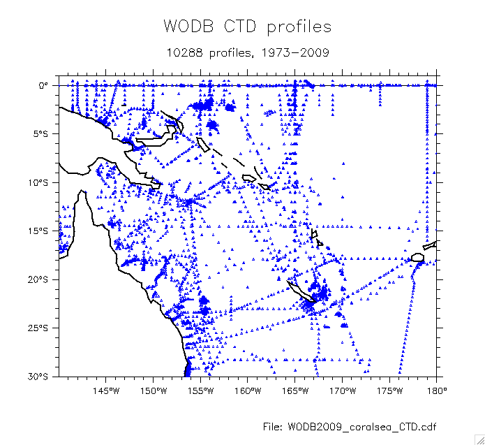
- WODB locations/dates:
By year: CTD
CTD detail
OSD
OSD detail
All: CTD
OSD profile dates (cumulative)
Shipboard data count by year (S on sigma 26.5)
(check ranges)
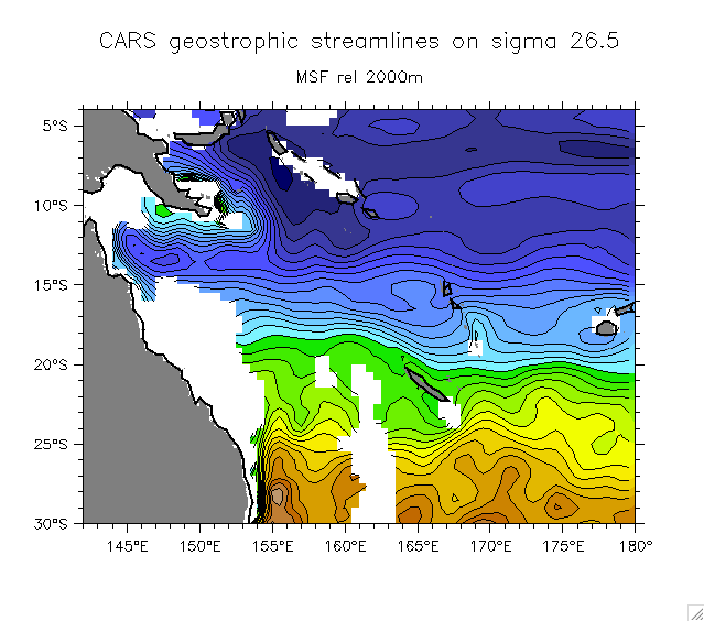
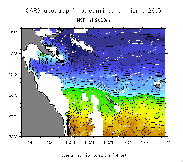
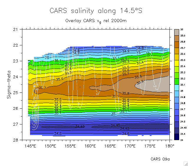
- CARS circulation:
- Streamlines on 26.5 Overlay salinity
- CARS salinity and vg on 14.5°S
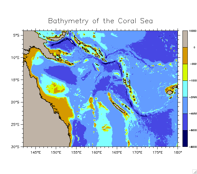
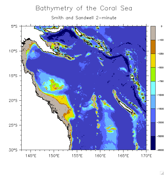
- Coral Sea bathymetry
- Old WODB plots using standard depths (unrealistic, ignore):
25.5
26.0
26.2
26.5
26.7
26.9
27.2
OSD only: 25.5
25.5 27.2 CTD only
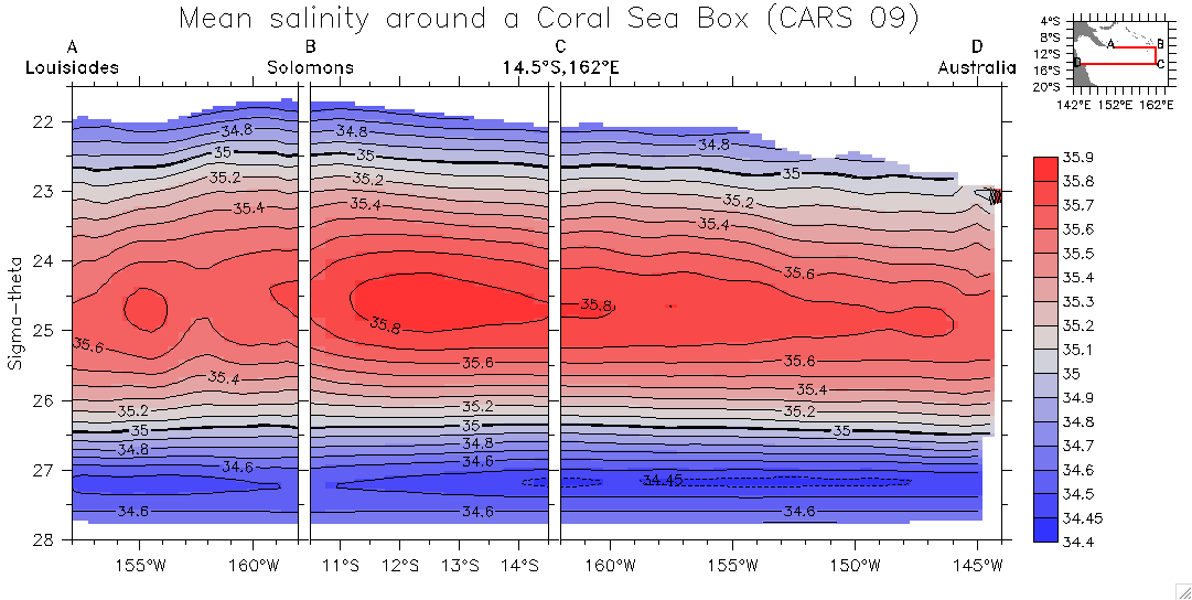
- Sections defining a box around the Coral Sea
- Early ones (test single sections): 162°E
10.5°S
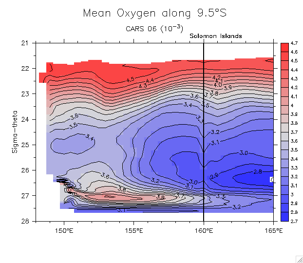
9.5°S
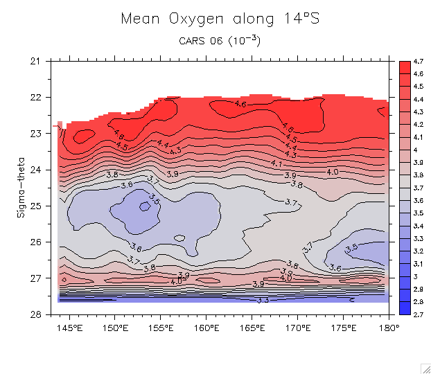
14°S
14°S (b)
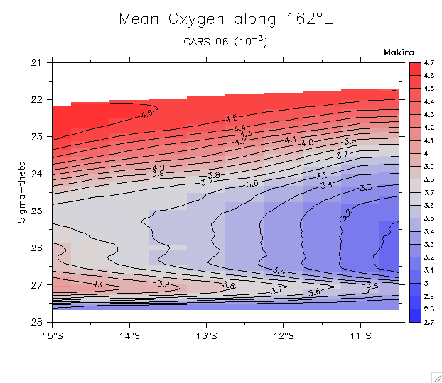
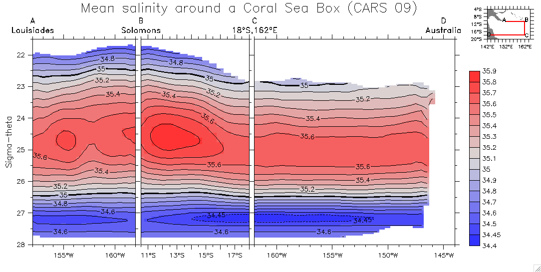
Boxes (all 10.5°S and 162°E. Different southern edges):
- Salinity:
14.5°S
16.5°S
18°S
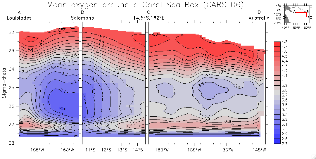
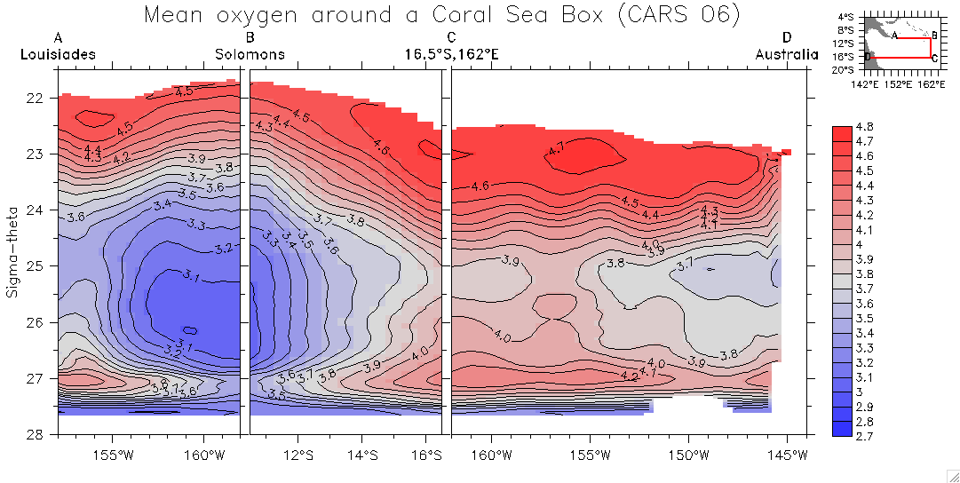
- Oxygen:
12.5°S
14.5°S
16.5°S
18°S
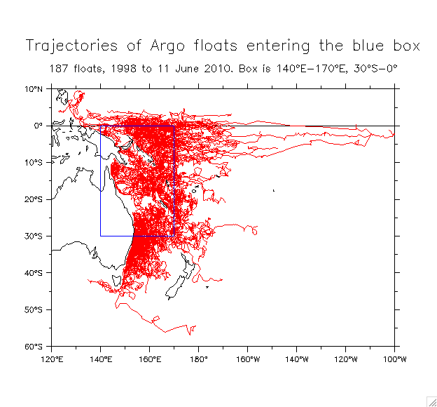
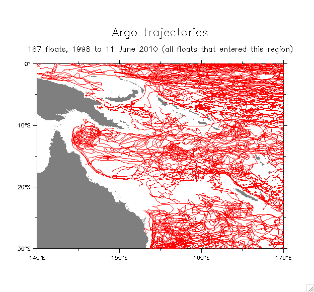
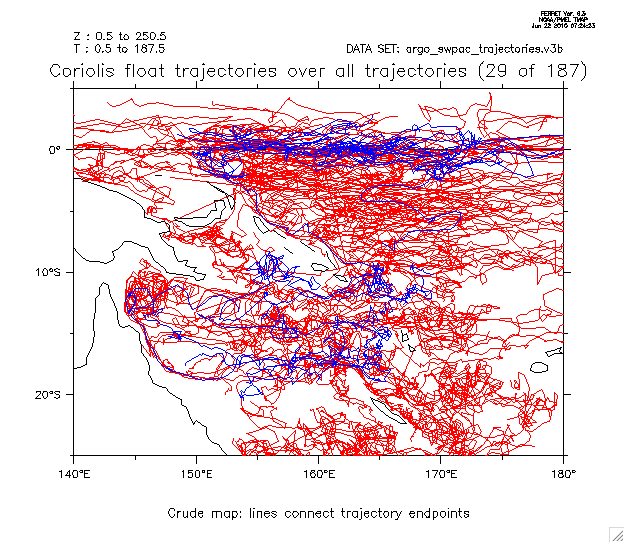
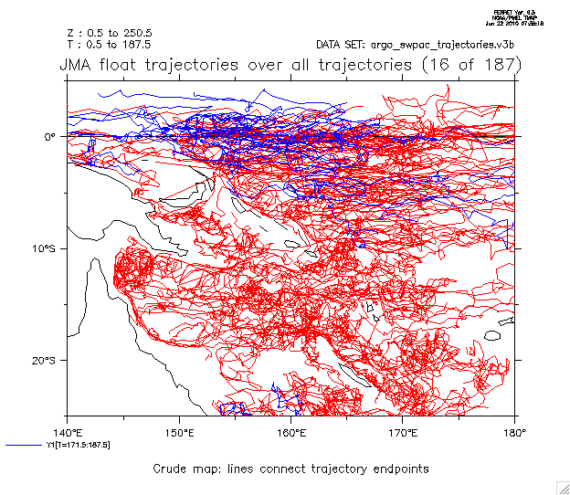
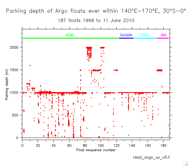
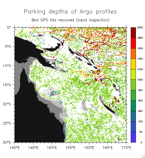
- Argo float trajectories in the Coral Sea
=> Find all floats that ever entered the region 140°E-170°E, 30°S-0°
- Bathymetry of the Coral Sea
- Overview of trajectories: All Regional detail
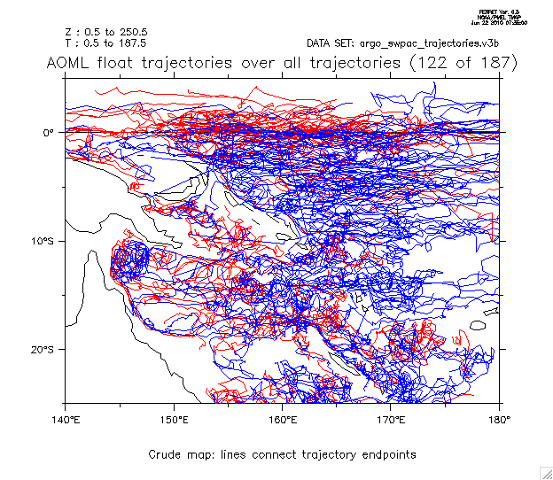
- Trajectories by source: AOML
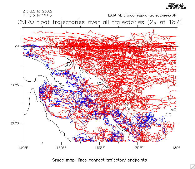
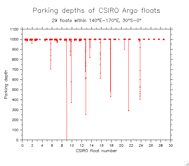
CSIRO
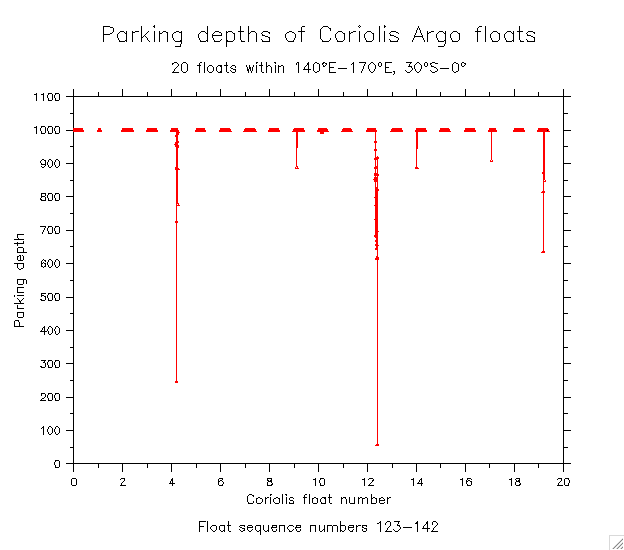
Coriolis
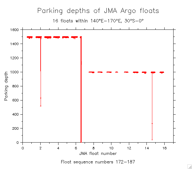
JMA
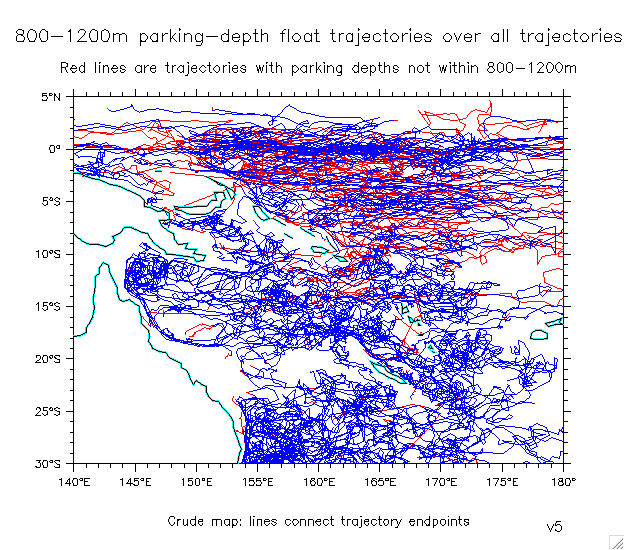
- Trajectories of parking depths within 800-1200m
- All parking depths: Shade Dots Dots on map (v6)
- Details within each group: Coriolis CSIRO JMA
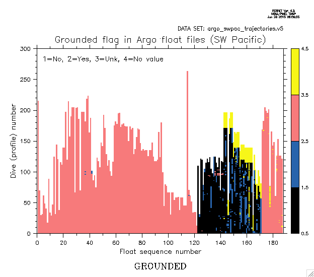
- Grounded flags
- Individual trajectories, sorted various ways (checking bad ones):
- All floats that ever entered 150°E-162.5°E, 11°S-5°S
(with details of some bad ones)
- Checking some high-speed trajectories (100 fastest speeds, sorted)
- Float vectors within the Solomon Sea (11)
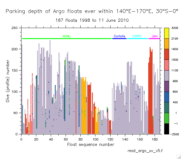
- Argo parking depths
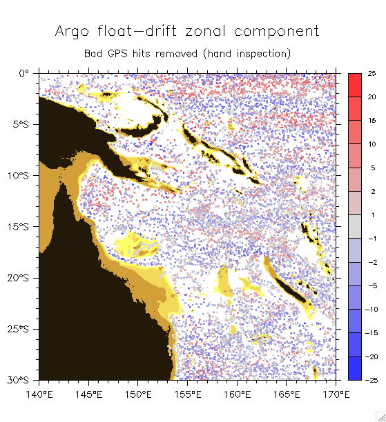
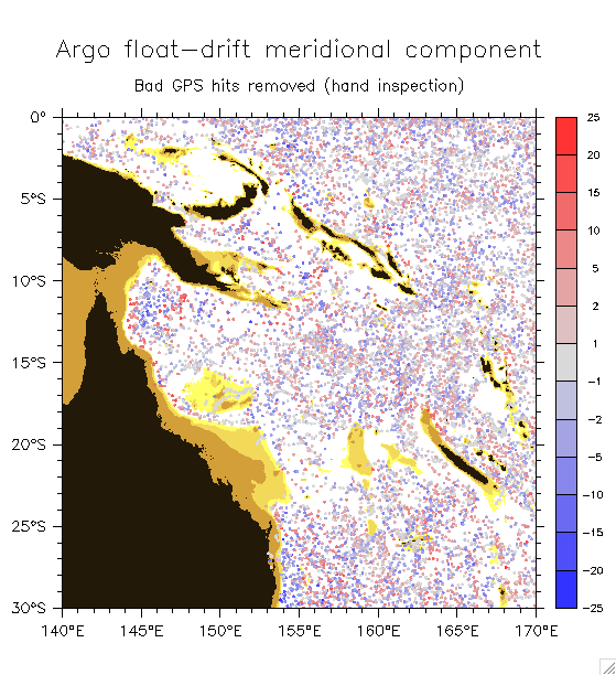
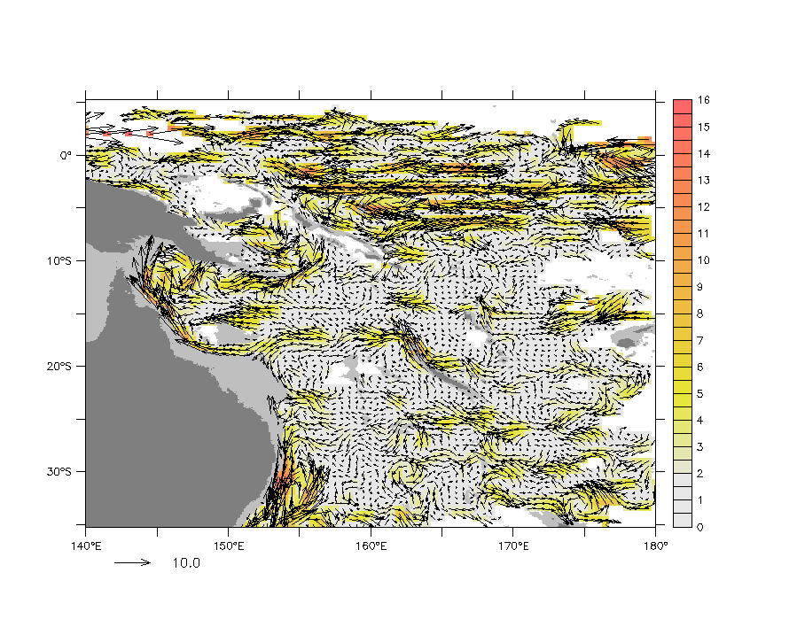
- Float-drift velocity components (raw): Zonal Meridional
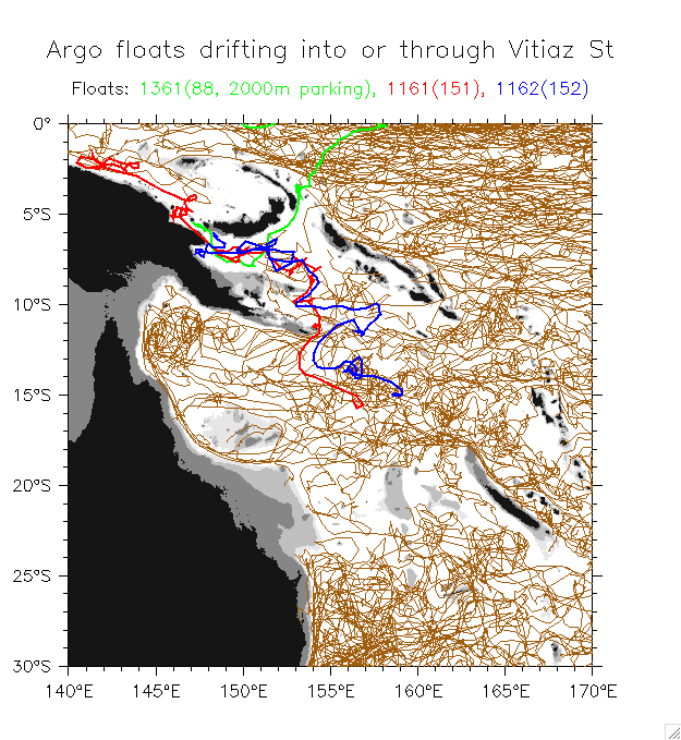
- Floats that drifted to (2) or through (1) Vitiaz St
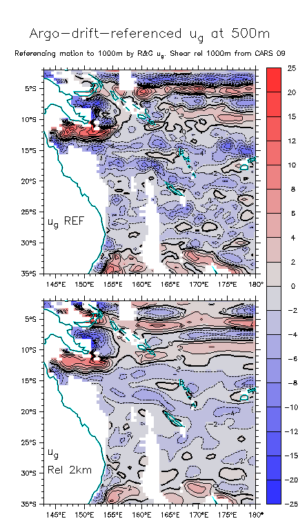
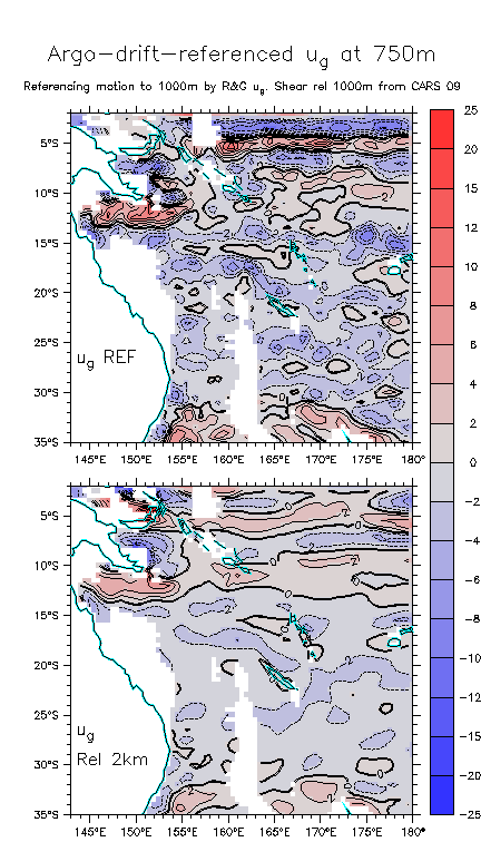
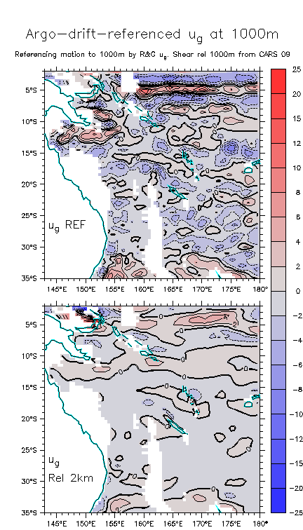
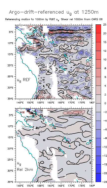
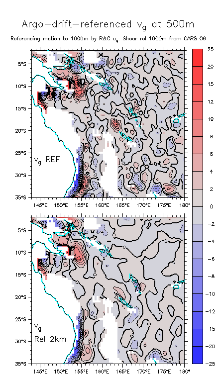
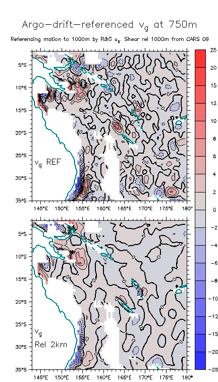
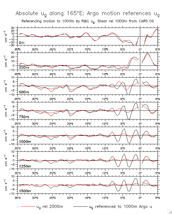
- Referencing the Argo float-drift velocities to 1000m:
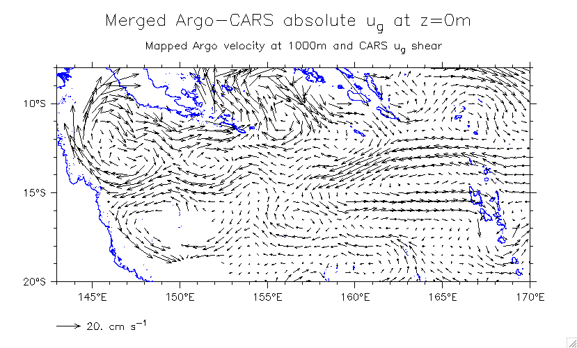
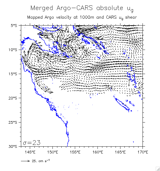
- Mapped velocities (SC)
- Compare drift-referenced vs pure ug:
ug: 500m 750m 1000m 1250m vg: 500m 750m
ug lineplots along 165°E
- CARS sfc ug rel 1000m
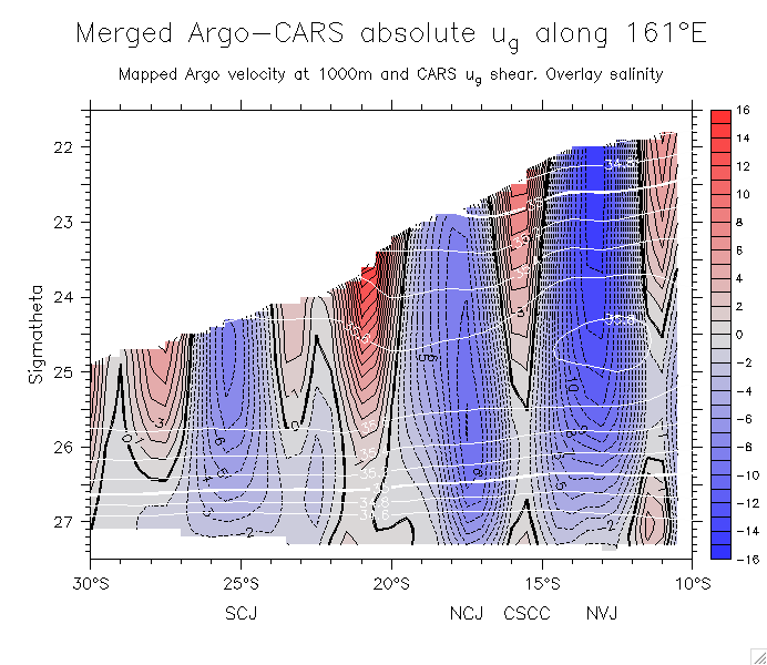
- Merged u along 161°E on density (overlay salinity)
- Queensland Passage transport
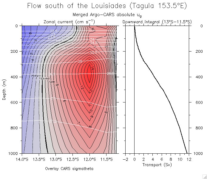
- Transport south of Tagula, Louisiades
- "Movies" (sequential maps of merged velocity in depth or density: save and flip through)
- Large region on z-levels
- Zoom on central Coral Sea
- On density
- Relevant glider figures:
- Back to main Solomon Sea glider page
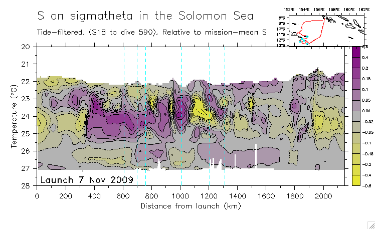
- Mission 10 salinity relative to mission-mean S on each isopycnal
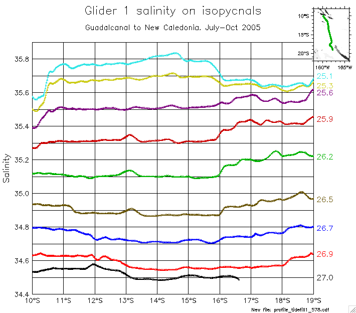
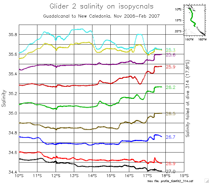
- Salinity between Guadalcanal and New Caledonia (2005 and 2007)
- Mission 1: Salinity on isopycnals
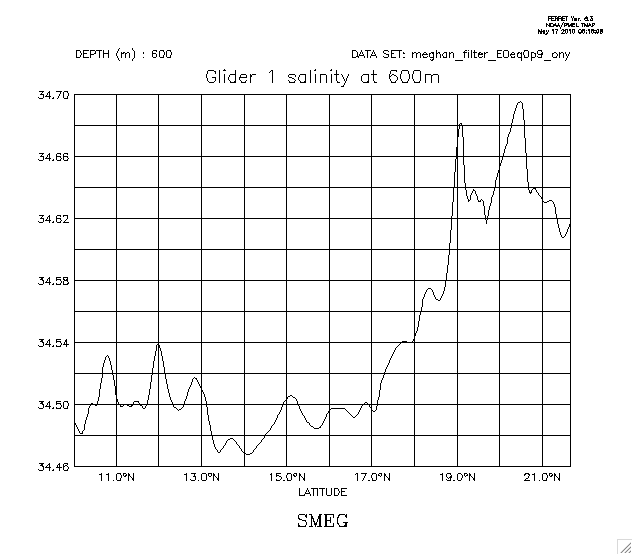
Salinity at 600m
Sigmatheta at 600m
- Mission 2: Salinity on isopycnals