Historical ADCP work in the Solomon Sea
Preparations:
Analyses of historical data in the region
For current glider information go to
the glider main page
. Especially see the link there to
the page for current (cross-Solomon Sea) glider missions
. This page is for prep work only.
Bathymetry maps and calculations
Bathymetry of the Solomon Sea
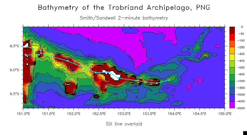
Detail of Trobriand-Woodlark ridge (showing sill section)
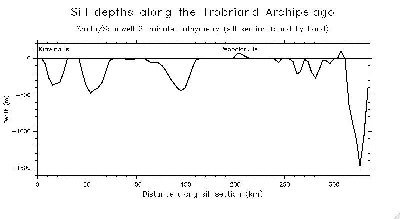
Sill depths along the ridge
Running area of the straits
Pre-existing ADCP sections (from the
Firing SADCP website
)
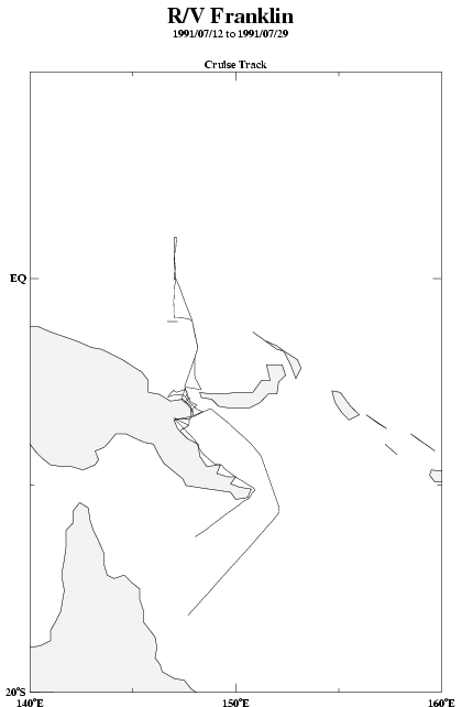
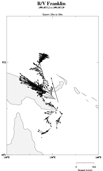
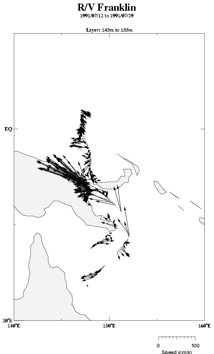
Franklin 1991:
Track
30m vectors
150m vectors
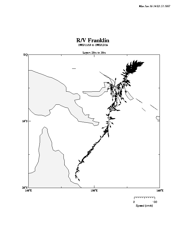
Franklin 1992:
Track
30m vectors
150m vectors
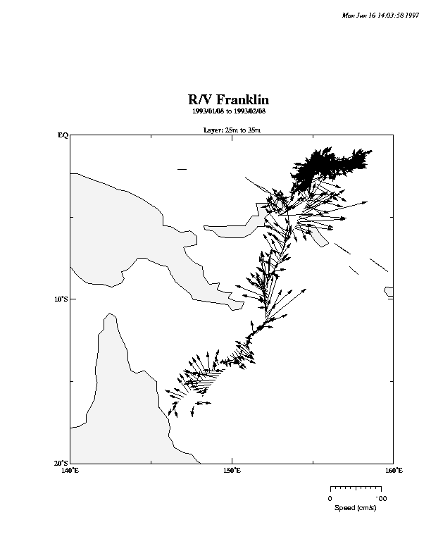
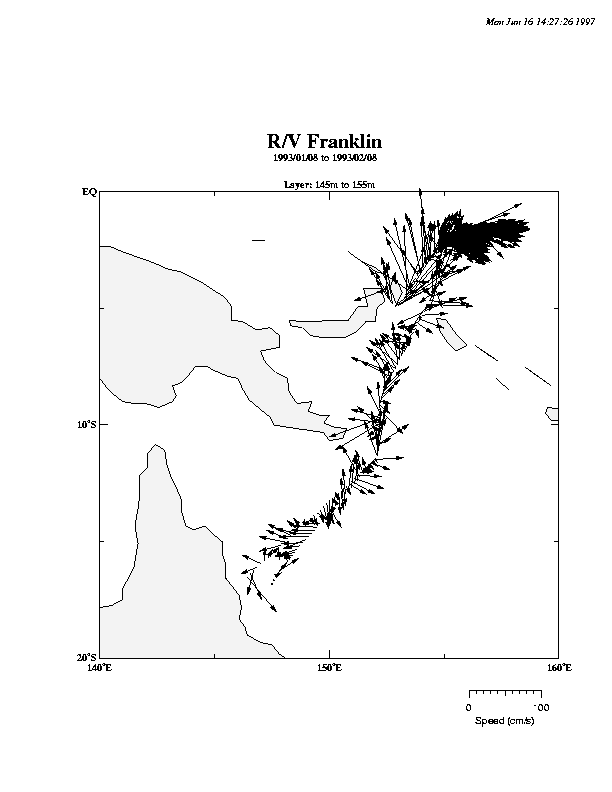
Franklin 1993:
30m vectors
150m vectors
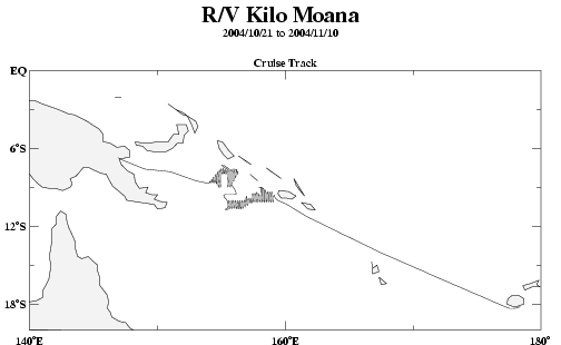
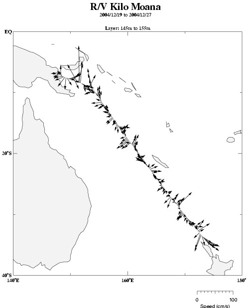
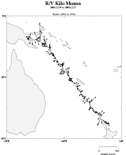
Kilo Moana:
2004a
2004b
2004c
2004d
WEPOCS:
T.G.Thompson 1985
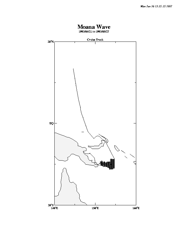
1986 Moana Wave (see below)
Moana Wave 1993:
Milne Bay, see below
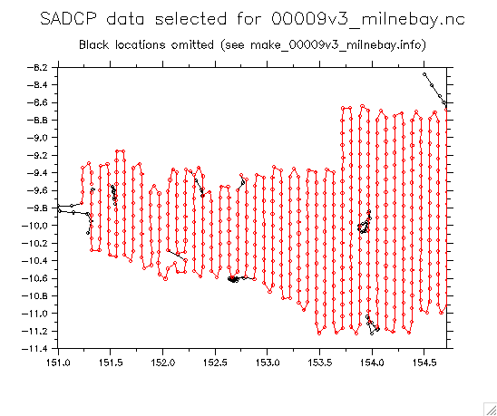
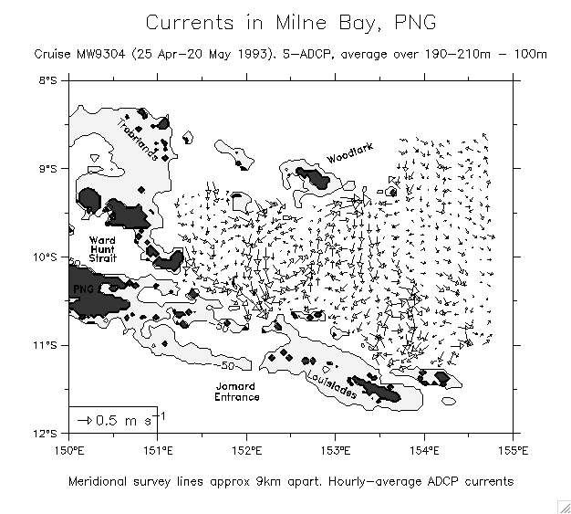
Cruise MW9304 (a dense set of Moana Wave sections in Milne Bay)
Cruisetrack (dots show 50s and 100s)
Extracting/constructing the Milne Bay region from the full cruise
Final region (dots show 50s and 100s)
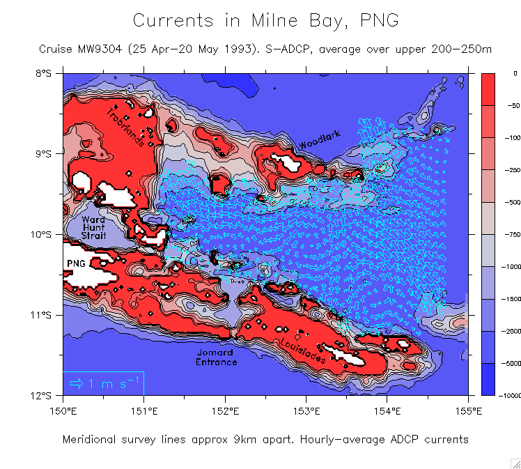
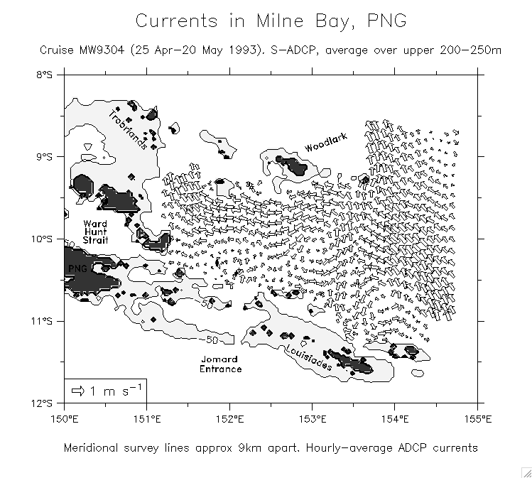
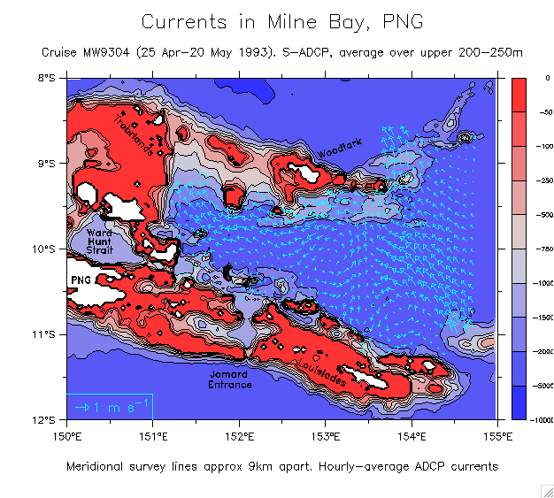
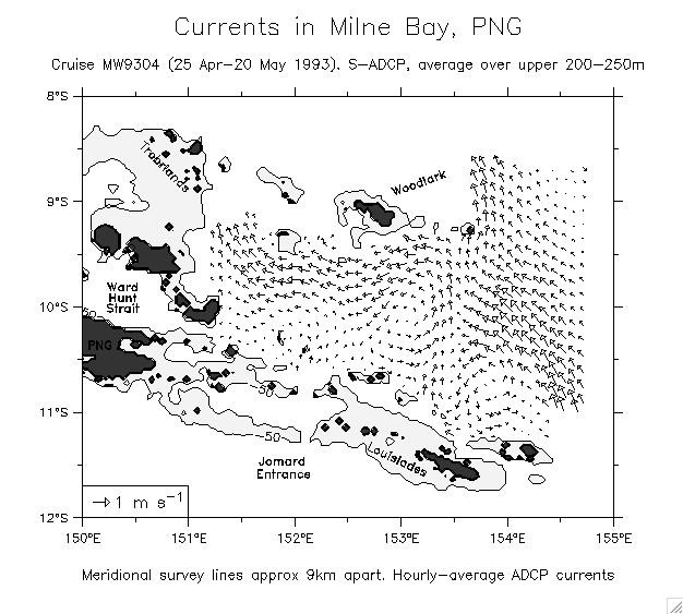
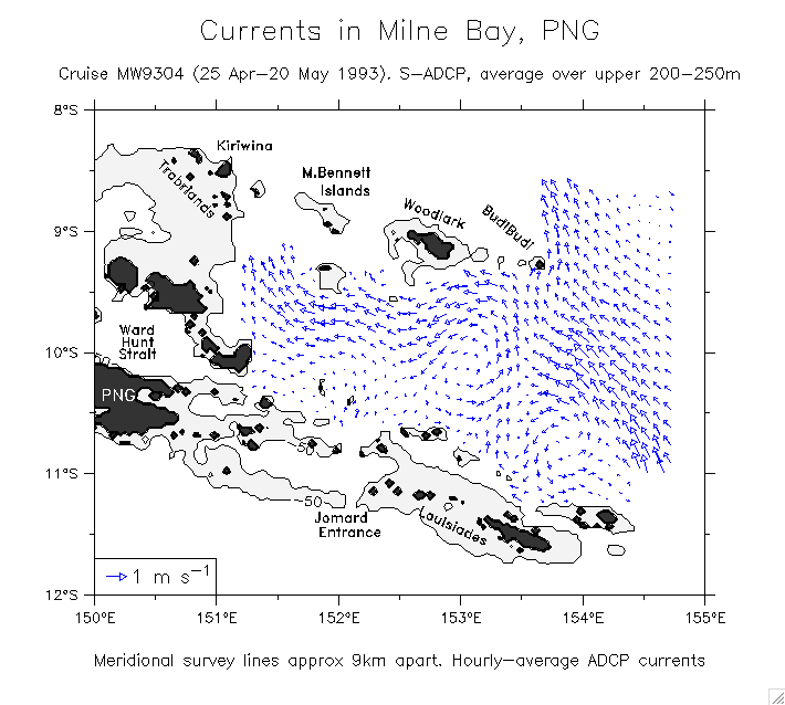
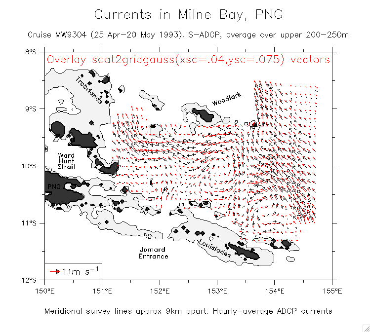
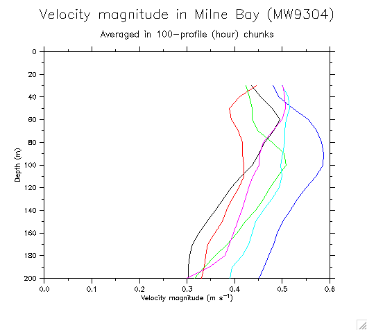
Milne Bay velocities:
Block vectors (scale by area)
B/W
Stick vectors (scale by length)
B/W
Blue
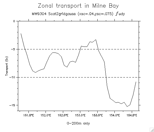
Gaussian grid
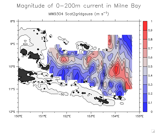
Velocity magnitude as a function of depth
Map of magnitude of 0-200m average current
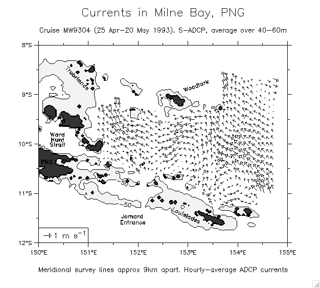
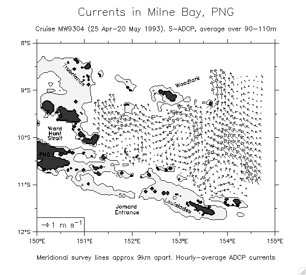
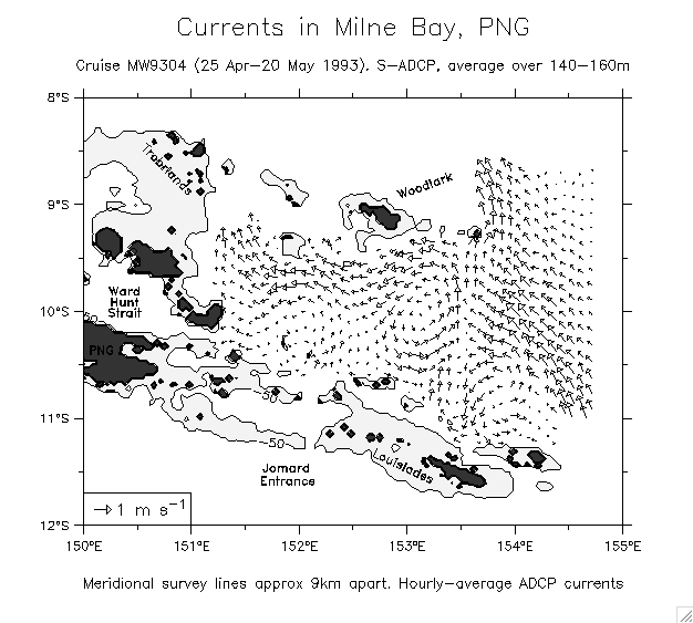
Velocity level by level:
40-60m
90-110m
140-160m
190-210m
190-210m minus 100m
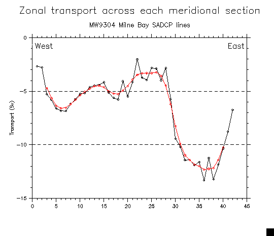
Zonal transport (int in y each line)
(From Gaussian gridding)
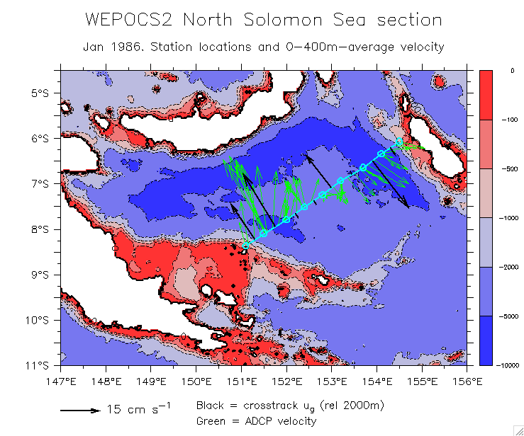
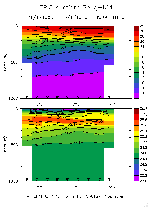
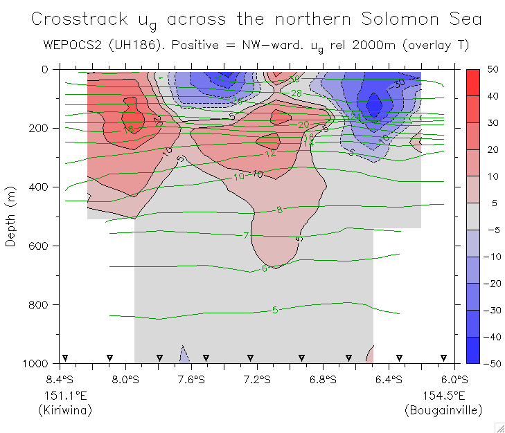
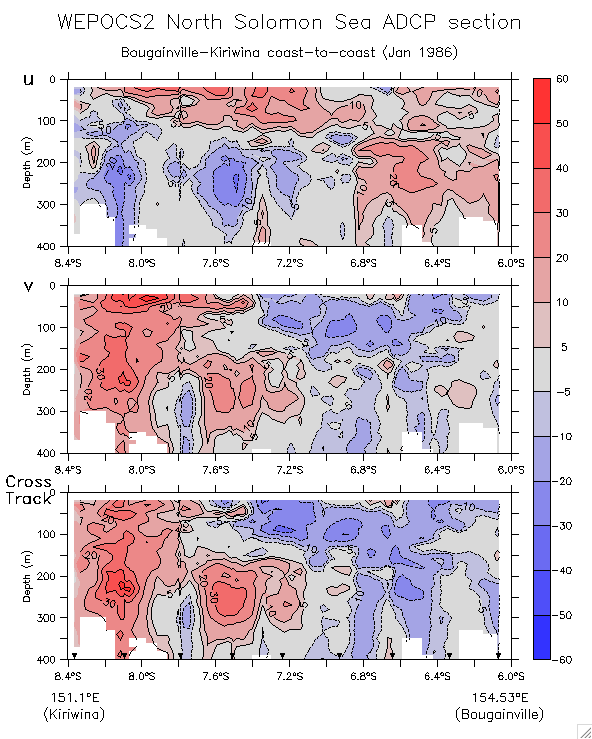
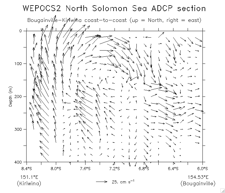
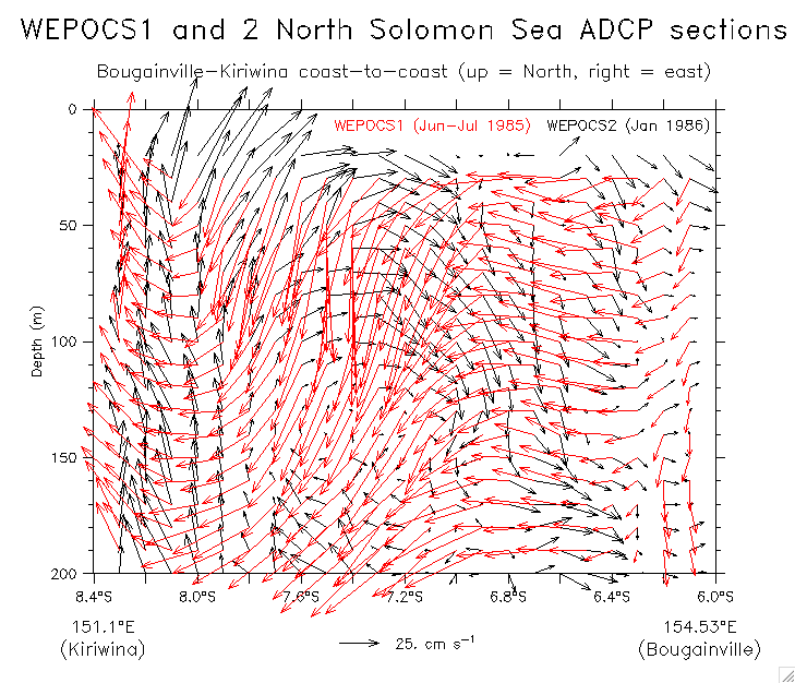
Cruise WEPOCS2 (UH186 section from Bougainville to Kiriwina, Jan 1986)
Note that this cruise had 3 duplicate stations, one shallow, one deep (to bottom). That makes a bad plot (T and S sections), but was removed from the u_g plot.
Section map on bathymetry with vertical-average ug and uADCP
T and S sections:
0-1000m
0-2500m
u_g section
ADCP:
Section of u,v,crosstrack
(Compare crosstrack to u_g)
Vector section (u,v(y,z))
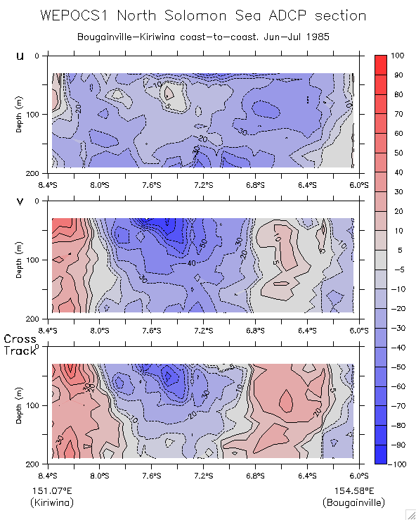
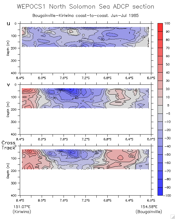
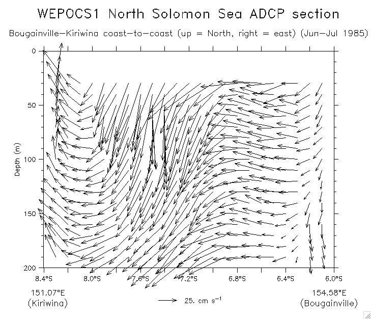
Cruise WEPOCS1 (same section, Jun-Jul 1985)
ADCP:
Section of u,v,crosstrack (200m)
400m to compare WEPOCS2
Vector section:
WEPOCS1
Overlay WEPOCS1 and 2
Glider main page
Dr. William S. Kessler
NOAA / PMEL / OCRD
7600 Sand Point Way NE
Seattle WA 98115 USA
Tel: 206-526-6221
Fax: 206-526-6744
E-mail:
william.s.kessler@noaa.gov
See also:
Kessler home page
Kessler publications
PMEL home page
