MJO rectification into the ENSO cycle
Figures from a talk on MJO rectification into the ENSO cycle
These are figures from work underway in collaboration with Richard Kleeman (BMRC, Melbourne). I showed various combinations of these figures during talks at the EuroCLIVAR Workshop on Time Scale Interactions (Paris, 14 Sep 98) at the Hayes Center Review (Seattle, 7 Oct 98), and at the CORC ENSO Workshop (La Jolla, 22 Oct 98).
Get the full text and figures from the paper submitted to J. Climate
- Introductory slide
- SOI and OLR intraseasonal variability
Since we've been able to observe intraseasonal variability (i.e. since we've had satellite OLR in 1979), the coincidence of enhanced intraseasonal amplitude with El Nino events has been clear. Here the time series of intraseasonal OLR was found by bandpassing pentad OLR to 25-120 day periods. The figure shows the RMS of bandpassed OLR in running 1-year bins. It shows that intraseasonal OLR RMS roughly doubled during each of the El Nino events since 1980. Note that the SOI is inverted so El Nino events are upward peaks in this figure.
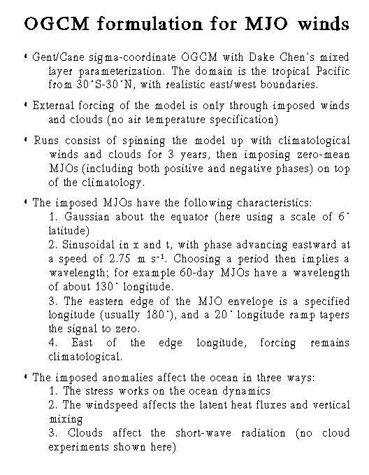
- The formulation of the Gent/Cane OGCM for studying idealized MJO winds
Briefly, the model was spun up with 3 years of climatological forcing. At the start of year 4, idealized MJO-like winds were imposed on top of the climatology (see next figure). Many of the next figures show the difference during year 4 (days 1080-1440) between a climatological run and the run with added idealized MJO zonal winds.
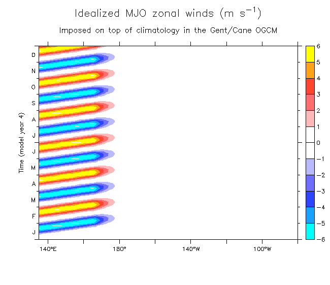
- Idealized MJO zonal winds on the equator
The idealized MJO winds imposed on the model have 60-day period, amplitude of 6 m/s, and propagate eastward at 2.75 m/s, similar to observed MJOs. They ramp down at the dateline; east of this the forcing remains climatological. The idealized MJOs have equal-amplitude easterly and westerly phases, so there is no low-frequency difference from the climatological winds. I emphasize that I am NOT suggesting that the real MJOs can be described as symmetric. The point here is to isolate the rectification without additional effects that could be due to stronger-than-normal westerlies.
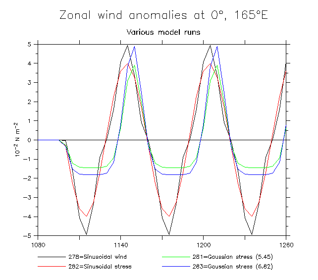
Compare forcing for various model runs: Zonal stress at 165°E Windspeed
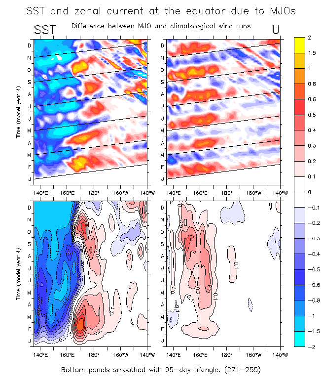
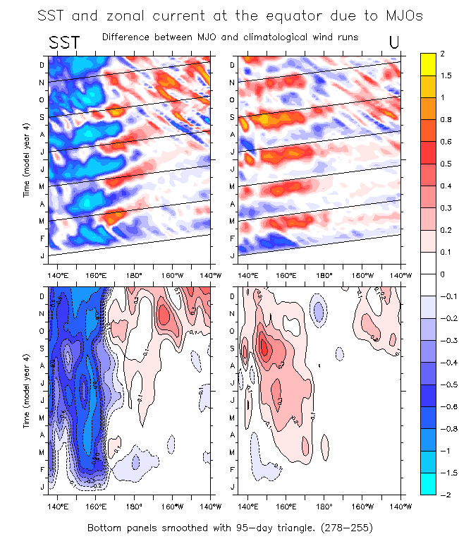
- SST and zonal current difference due to idealized MJO forcing
Despite the fact that the MJO run has low-frequency winds that are exactly the same as the climatological run, the solution fields of SST and zonal current are significantly different. SST (left panels) is seen cool rapidly in the west (by more than 1°C), and (more gradually) warmer to the east of the strong winds and later in the central Pacific. (After several cycles the out of phase relations in the tropical instability wave fields in the two runs produce high difference values in the central Pacific). In the first MJO cycle, zonal current (right panels) initially appears as a linear response (westward under the initial easterlies, then eastward under the subsequent westerlies). However, within one cycle the westward phase is almost gone, and the current is strongly net eastward.
The slant lines in this figure show the 1st baroclinic mode Kelvin wave speed (3 m/s) in this model. Note that the SST warming to the east of the strong wind region spread eastward at slower than the Kelvin wave speed. These signals will be seen to be due to advection.
The lower two panels show the same fields as in the upper panels, but smoothed with a 95-day triangle, so the individual events are no longer seen. The warming east of the strong wind region is somewhat delayed behind the cooling directly under the winds, and slowly spreads eastward. Similarly, the eastward current tendency also spreads eastward.
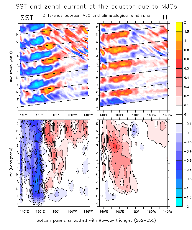
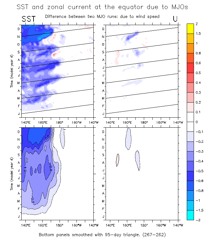
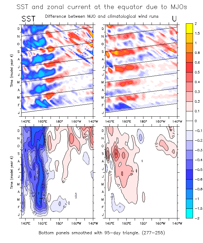
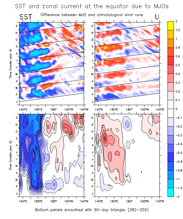
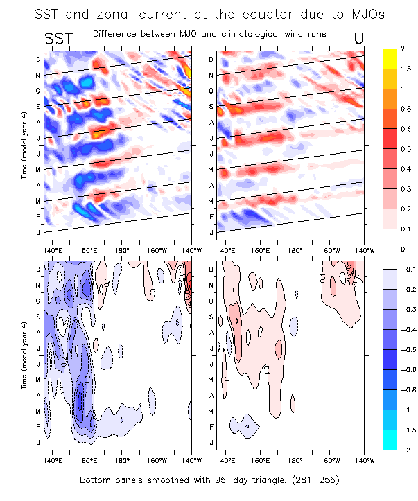
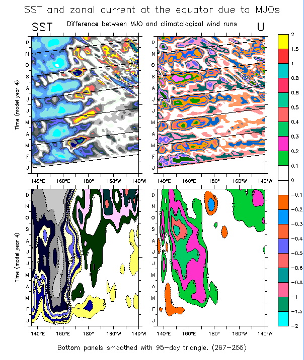
Same fields for various other test runs:
Reversed wind phases (271). Stress forcing only (262) Difference due to wind speed (267-262) 5 m/s winds (277-255) 5 N/m2 winds (278-255) Compare 6 N/m2 winds and 5 N/m2 winds (278-267) Sinusoidal stress (not wind) (282) Gaussian stress (.0545N/m2) (281) Gaussian stress (.0682N/m2) (283) Crazy (broken) color map!.
- Surface current difference due to MJOs (average over year 4)
The surface currents due to the MJOs form a pair of cyclonic gyres, with eastward currents along the equator and a westward return flow at about 2°-6° latitude (more strongly in the northern hemisphere). The strength of these currents is non-negligible (note the 10 cm/s scale arrow at bottom).
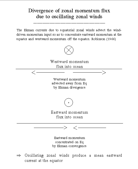
- The divergence of zonal momentum flux always is an eastward tendency for equatorial zonal wind forcing
Schematic diagram showing that meridional advection due to Ekman currents forced by equatorial zonal winds produce an eastward tendency on the equator, and a westward tendency off the equator, for either sign of the wind. This has been called the "first nonlinear correction for equatorial zonal winds" since it was explained by Robinson (1966).
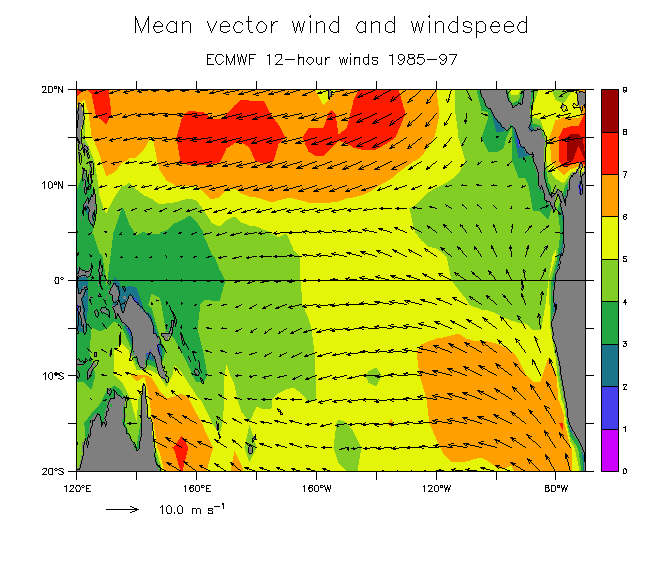
- Mean vector winds and windspeed from the ECMWF 12-hour winds during 1985-97
The mean windspeed over this region is weaker than anywhere else in the tropical Pacific, less than 4 m/s.
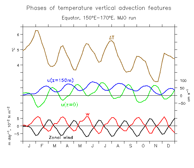
- Phase relation of vertical advection terms on the equator under the MJO winds
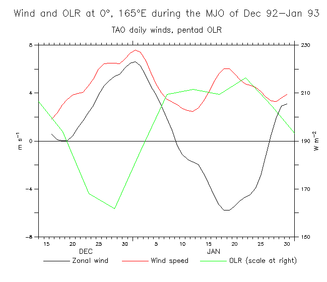
- Example of OLR, zonal wind and windspeed at the TAO mooring at 0°, 165°E during Dec 1992-Jan 1993
MJO events can produce strong winds of both signs, similar to the idealized OGCM forcing. In this example, a well-studied event during the COARE IOP, negative OLR anomalies (less than about 190W/m2) indicate deep convection during late December. The zonal winds were westerly at about 6m/s during this phase (note that all values shown are absolute, with no mean removed). During the suppressed-convection phase, equally strong easterly winds prevailed, with the result that the 60-day cycle of OLR and zonal winds produced a 30-day periodicity of windspeed, with mean positive values.
- OGCM d(SST)/dx on the equator: climatological forcing; MJO forcing; difference
The SST changes in the OGCM due to MJO winds are strong enough to reverse the model's zonal SST gradient at the east edge of the MJO region (roughly 160°E-180°). One might hypothesize that the reversed SST gradient would tend to produce additional westerlies (blowing from cool to warm SST) in a coupled system.
This idea was tested using Richard Kleeman's intermediate coupled model. The effects of the MJO-induced SST changes was compared to the "control forecast". This control was made by initializing the model to Dec 1996, then letting it run forward to forecast the 97-98 event (next figure). The effects of MJOs as seen in the OGCM were imposed into the coupled run as a heat flux with the same spatial pattern as the SST anomalies in the OGCM, and with magnitude so as to produce, in a 50m mixed layer over 90 days, the same SST signature as in the OGCM. Values of this heat flux were up to 26 W/m2.
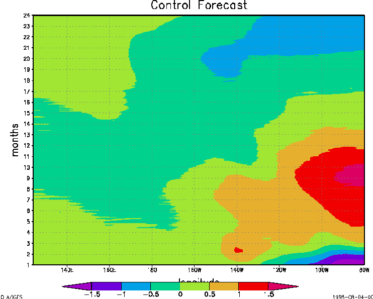
- Control forecast by Kleeman's model. Initialized to 31 Dec 1996.
Time in this figure is months beginning 1 Jan 1997 (immediately after the model began running in coupled mode). The model forecast a somewhat too-weak El Nino event (slightly more than 1.5°C anomalies), peaking in Sep 1997.
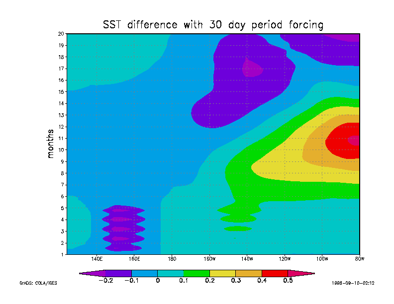
- SST difference in the Kleeman model due to MJO heat flux from the OGCM
The difference between the control forecast as the forecast with the MJO heat flux described above imposed as an oscillating pattern for 120 days (Jan-Apr 1997). The MJO anomalies are seen as the purple area in the west (SSTs cooler by about 0.2°C), with weaker warm anomalies near 140°W (green). This SST pattern leads to additional warming of about 0.5°C (roughly 30% larger than the control forecast) in the east, peaking in Oct-Nov 1997. The warming is due to the generation of westerlies blowing from the cool area in the west to the warm area in the central Pacific.
The results suggest that the heat flux effects of MJOs can contribute to the intensity of the event. One can speculate that once the El Nino is developing, then the early stages of warming are favorable for the
expansion of MJOs over the west Pacific. If those are vigorous
(something probably not predictable), then they can enhance the
event according to this mechanism. This is consistent with the onset of the 1997-98 El Nino, in which many models forecast a weak event when initialized with conditions of late 1996. Once the models took into account the strong MJO winds of early 1997, the predictions then jumped to show the very large event that actually occurred.
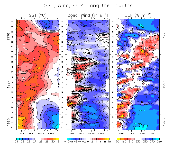
- Observed zonal wind, SST and OLR on the equator during Oct 1996-Jul 1998
(TAO mooring data; 5-day means)
Buoy observations show that the MJOs of early 1997 were associated with cooling under the strong winds (compare the left and right panels), and that the later MJOs and low-frequency westerly tendency occurred in the gradient region between cool and warm anomalies (160°E-180°).
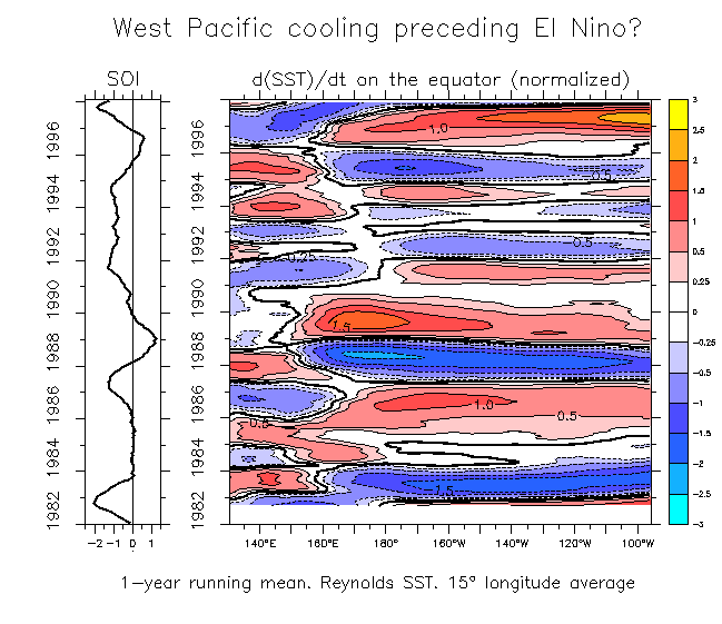
- Observed d(SST)/dt on the equator (1982-97)
A longer time series of d(SST)/dt from the Reynolds SST shows that cooling in the west Pacific preceded (by roughly 6 months) each of the El Nino events since 1982. (OK, the 1994-95 pre-cooling was weak, and cooling did occur at other times, too). "Normalized" here means that SST is divided by its standard deviation. The purpose of this is to equalize the magnitude of variability across the basin. Otherwise the signals in the west are very weak. Therefore the units of SST in the color panel are standard deviation.
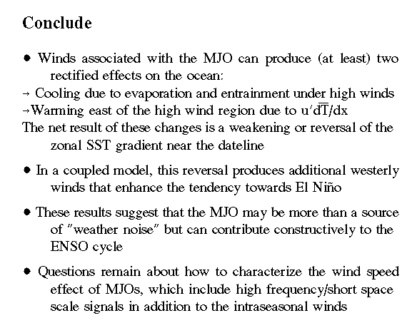
- Conclusion
Back to Kessler home page
Back to main Kessler figures page