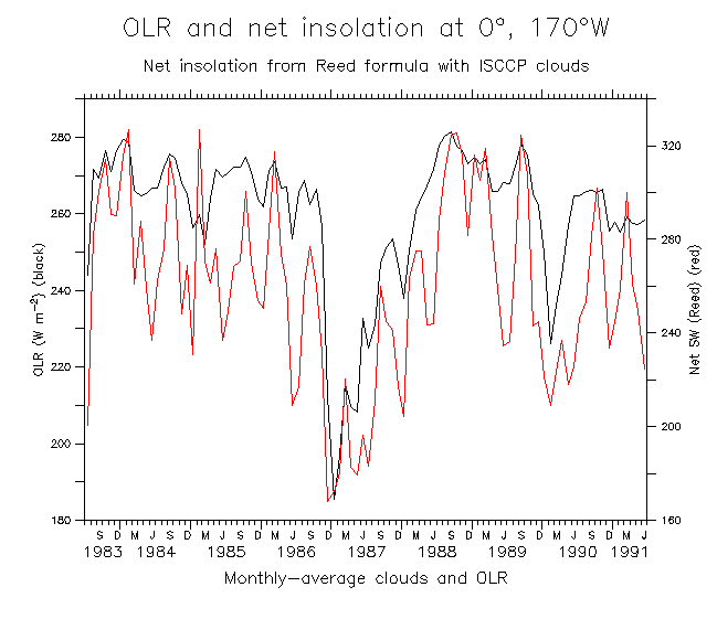
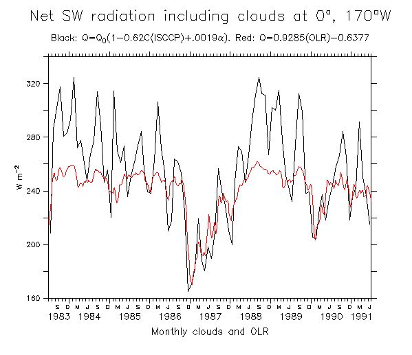
This set of figures compares two ways of estimating the net solar radiation at 0°, 170°W.
Direct comparisons between Reed formula and OLR regression, for
monthly clouds and OLR during 1983-91 when ISCCP clouds were available.
Overall, the agreement is good at the lower values (high cloudiness), but
the Reed formula suggests that at low cloudiness the insolation is much
greater than the OLR regression would indicate. The
Reed formula gives a range of SW values about twice as large as the OLR
regression.
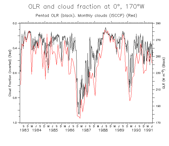
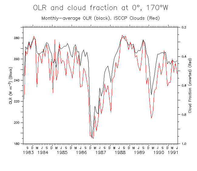
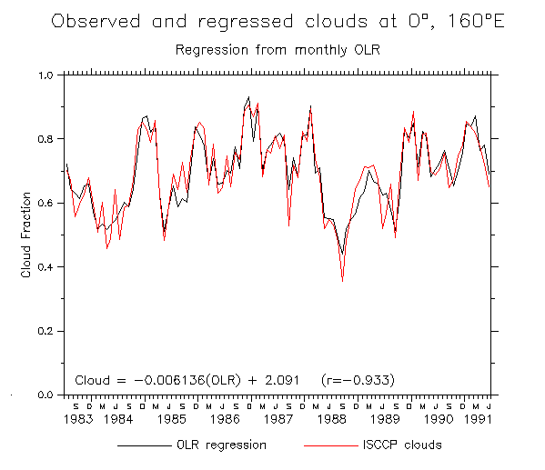
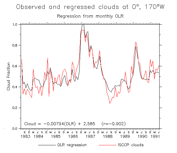
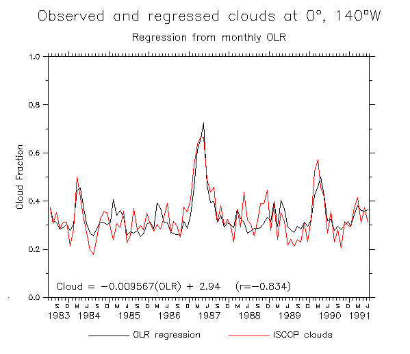
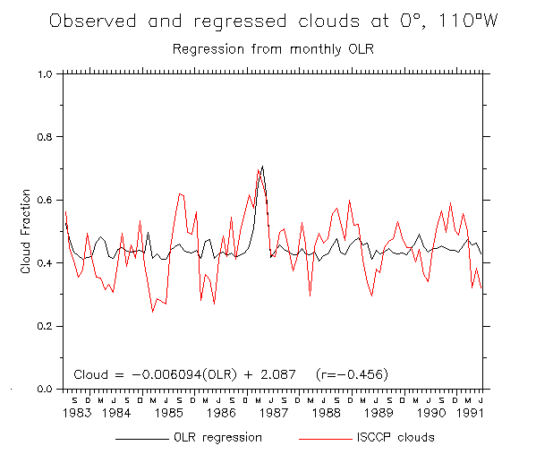
Clouds are available between July 1983 and June 1991. Use monthly-average OLR.
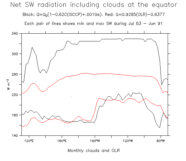
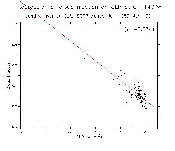
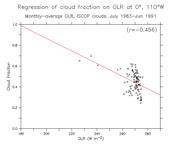
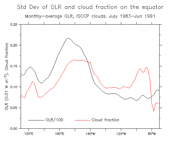
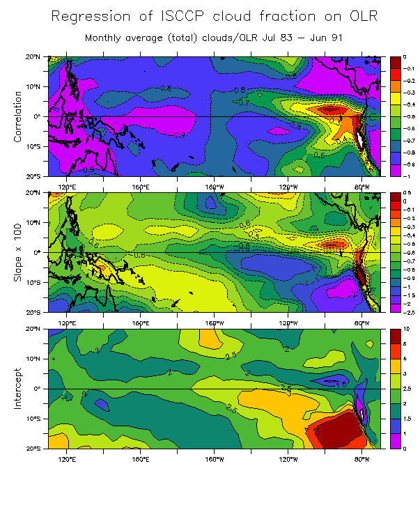
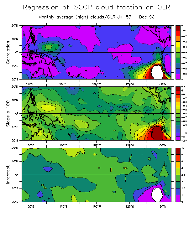
Some statistics. The correlation is good (>0.8) west of about 140°W, and excellent (>0.9) west of 170°W. East of 140°W the relation is unusable. In the east a lot of cloudiness is stratus, which does not produce an OLR signature. Note the increase in cloud variance, particularly east of 120°W, that is not seen in OLR.
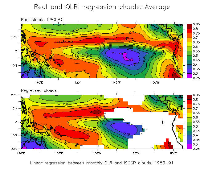
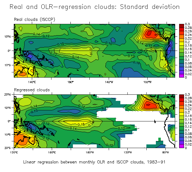
Cloud time series estimated by regression:
Regression over the entire tropical Pacific
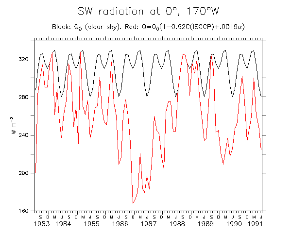
First, Reed (1977) found the empirical formula Q=Q0(1-0.62C+0.0019alpha), where
C is total cloud cover and alpha is noon solar angle. (For C less than 0.3,
Reed finds no reduction in insolation (Q = Q0)).
Second is a regression directly between OLR and SW: Q=0.9285(OLR)-0.6377. (This one was used in Fig 5 of the bottom set).
Some preliminaries:
See these results put to good use on the Idealized MJO page
You want monthly-average OLR? We got monthly-average OLR
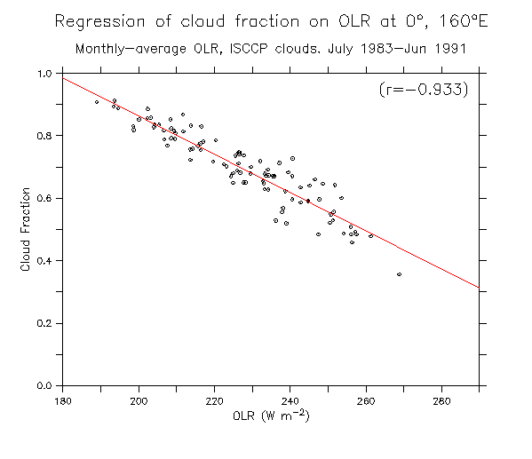
Try a regression between OLR and ISCCP clouds.
Figure 1 suggests that a regression could be found between OLR and cloud fraction that might improve the estimate of solar radiation. The regression from OLR to cloudiness could then be used in the Reed formula. This intuitively makes sense, since OLR is really closest to a measure of cloudiness (at least in the west where much of the cloud cover is associated with deep convection that is well-represented by OLR). Another advantage of this method (rather than regressing directly from OLR to radiation), is that Q0 in the Reed formula contains much of the annual cycle variability. Finally, variations of OLR above about 250 W/m2 or so are not meaningful in the context of radiation received at the sea surface. It would be desirable to be able to ignore those variations. Regressing directly OLR -> radiation means that these meaningless signals have as much significance as the low values. However, since the Reed formula ignores cloud variations below 0.3 sky cover, high values of OLR (that regress to low cloud cover values) are less of a factor.
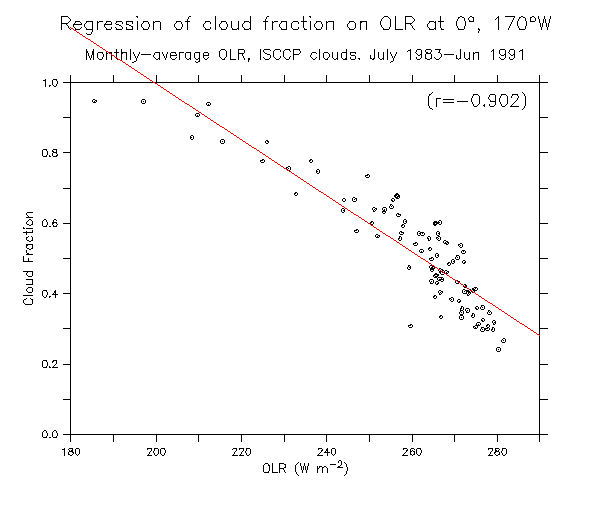
Examples at longitudes across the Pacific (scatter diagrams and regression lines):
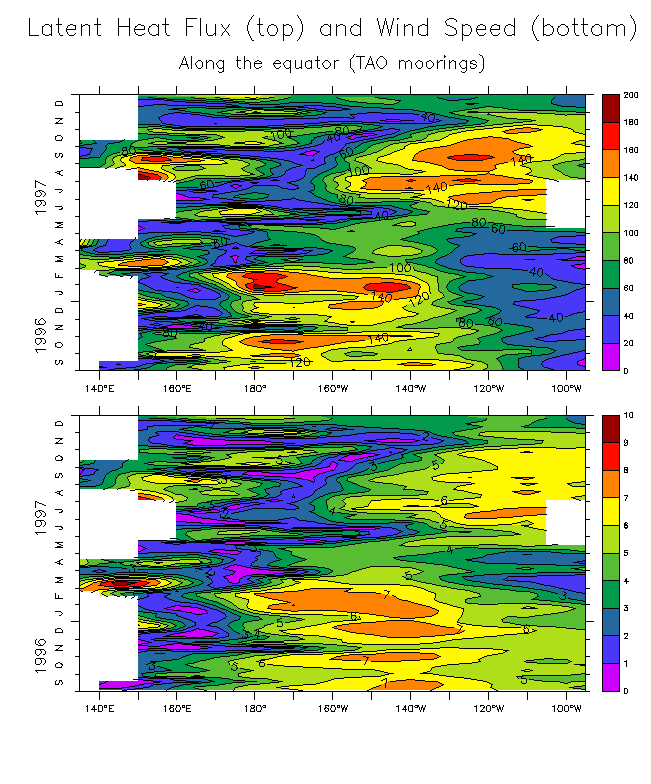
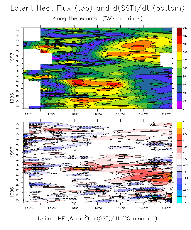
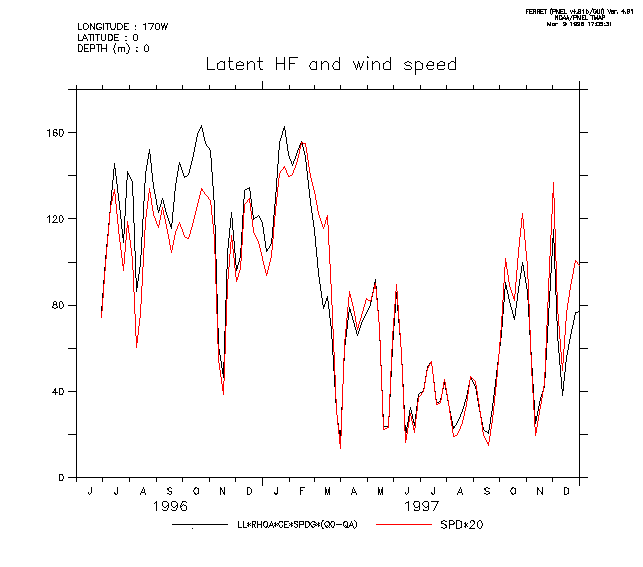
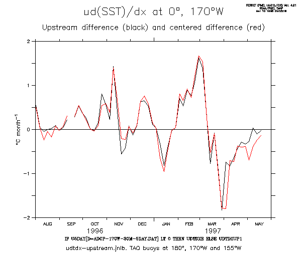
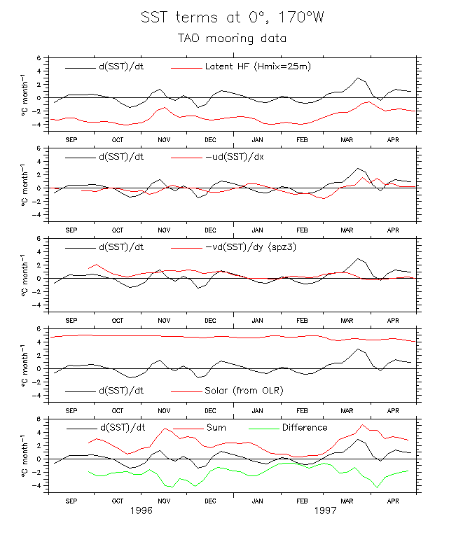
Some things related to the heat balance at 170°W
A few figures I saved while checking ways of doing the heat balance. Only figure 5 is probably of interest to anyone but me.
The radiation estimate is from OLR (see the third set of figures on this page), and is probably not right.