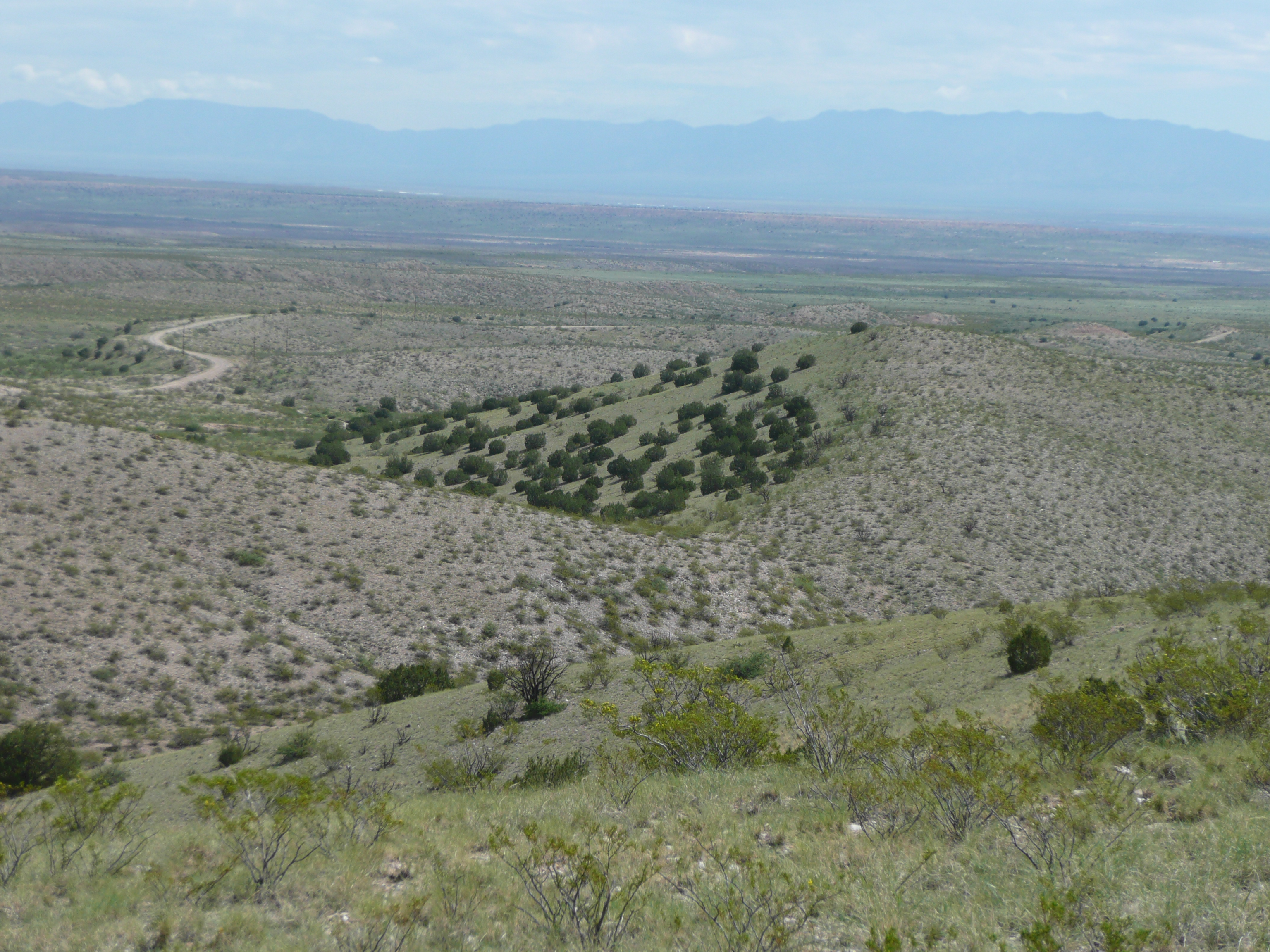
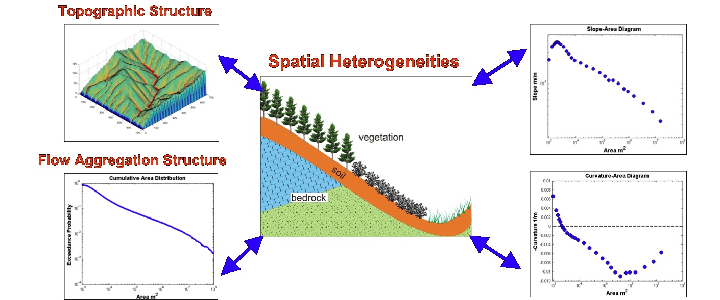
We investigate the controls of soils, rock type, and vegetation on the geomorphic
expressions of landscapes. This understanding is critical for developing models to
predict the climate change impacts and the rate of change in the landscape. Numerical
modeling, digital data sets, and remote sensing and field observations are jointly used
in this work.
Our research questions include:
1. What are the effects of spatial heterogeneities in lithology, soil type, and vegetation
on landscape evolution and resulting morphology?
2. Can we detect these on the mathematical properties of landscape organization?
3. Is there a characteristic time-scale within which different source of heterogeneity
impact geomorphic expression of catchments?
We use the CHILD landscape evolution model for hypothesis testing and examining
the impacts of certain physical processes on landscape response. In particular we
develop vegetation dynamics and hydrology components in CHILD.
Below are two CHILD model animations for basin development in a semi-arid climate
with a wet season typical to the monsoon of the Southwestern US. The first
simulations shows the elevation field as basin develops, and the second simulations
maps grass dynamics during the development of the same basin.
Note: You may need to set your browser to allow ActiveX scripts to view the animations.
Current Projects:
Predicting Climate Change Impacts on Shallow Landslide Risk at Regional Scales
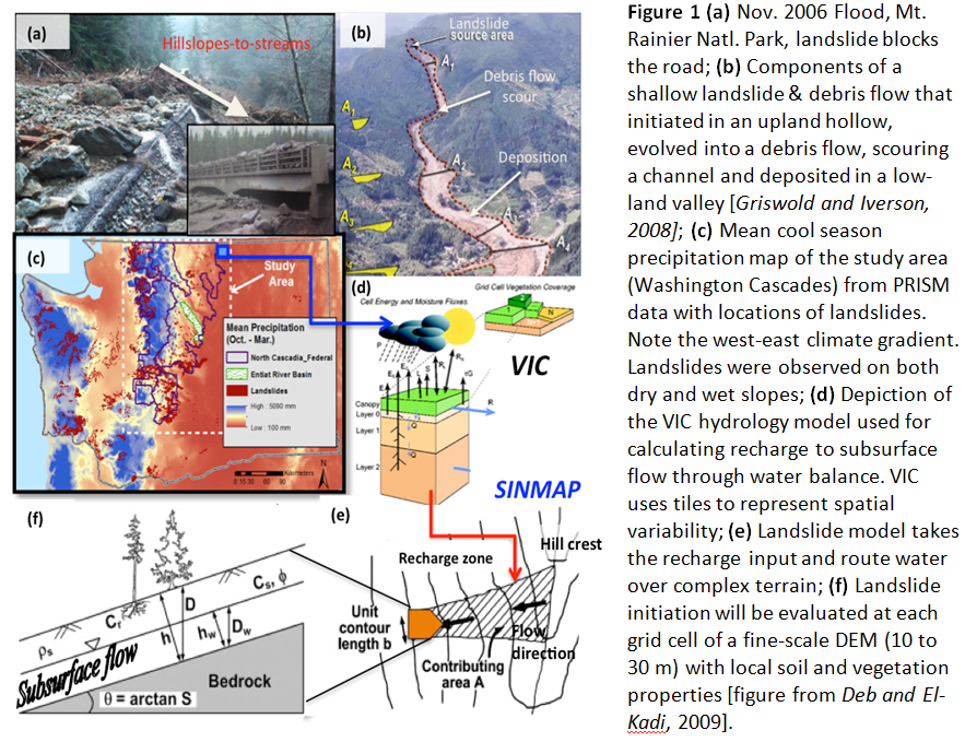
Landslides disrupt aquatic habitats and damage infrastructure (e.g., roads, utilities, dams). Landslide hazards in the west are expected to grow with climate change, but to date, geologic landslide research has been typically conducted independently from hydroclimate research. In our group we unify these two lines of research and pioneer an innovative numerical model design (Figure 1) for landslide risk assessment at regional scales. Figure 1 illustrates the model flow conceptually. Our objective is to capture and represent climate gradients in space and variability in time, and topographic details of the landscape by combining subsurface flow recharge and surface runoff from a 5,500-m resolution land surface model (VIC) with a slope stability model using 10-m resolution Digital Elevations Model. Our approach integrates regional scales of climate with shallow landslide processes (initiation, transport, deposition) resolved at fine topographic scales with an innovative numerical model design. Based on this framework, deterministic and probabilistic methods are being used to map landslide hazard in the past (for model validation) and into the future (for model application). Landslide observations are used to constrain and test models. Initial funds were obtained from the National Science Foundation (NSF).
Climate change effects on transportation in federal lands
Students: Ronda Strauch, Zhuoran Duan
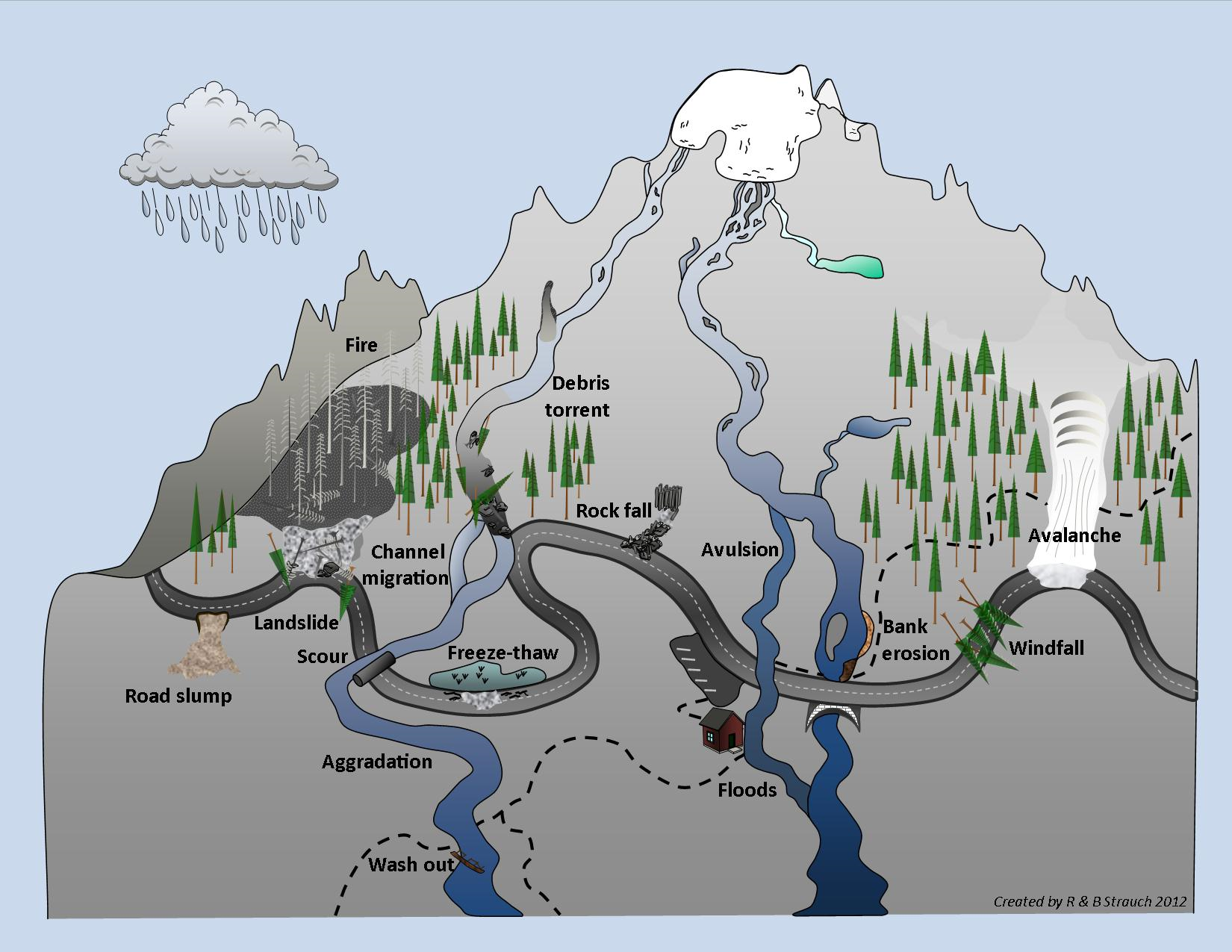
Climate change is already affecting access to public lands such as national parks and national forest from extreme events and models project continued or intensifying risks. These lands are often located in mountainous terrain where access is already challenged by steep topography, high elevation, and numerous streams and rivers (Fig. 1). Impaired access to public lands reduces the ability of land managers to preserve, protect, and restore resources and to provide for public use of resources. In this project funded by the National Park Service we develop methods to estimate streamflow extremes for past and future conditions in ungauged headwater catchments using hydrologic model data and local measurement. Our objective is to develop a technique for a "hydrologic downscaling" from outputs of a macro-scale model to low-order catchment scales for regional applications in mountain ranges. This approach will be useful for land managers to evaluate risks of flooding and sediment transport in headwater catchments (Fig 2)
Figure 1 - Climate-related exposures to access in the Cascades Mountains. In this mountainous region, there are many threats to travel, including migrating rivers, bank erosion, scour under and around culverts and bridges, debris flows below glaciers, landslides (especially after fires), road slumping, freeze-thaw cycles, avalanches, and even windfall. These exposures can affect both the operation and integrity of the transportation system over short or long time periods.
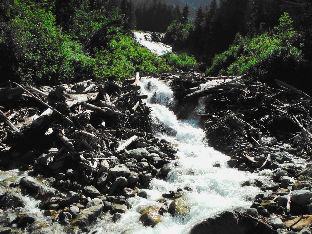
Sediment and debris transported by high flows in Boston Creek contributing to blocking a culvert and forcing the stream to cut through Cascade River Road in North Cascades National Park, stranding 72 hikers over night.
CHILD-Solar Radiation Examples
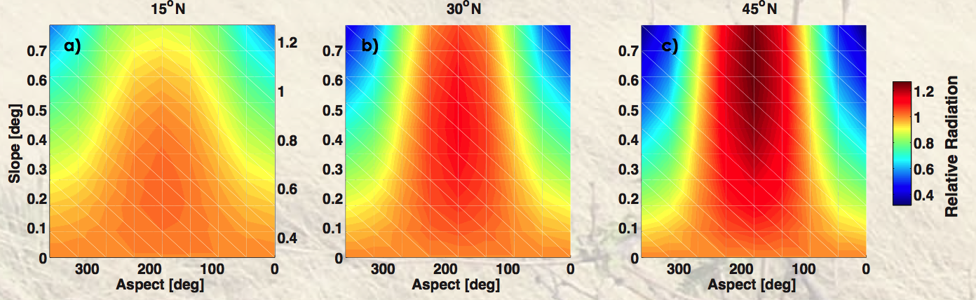
Our landscape evolution modeling research currently focuses on introducing the role of solar radiation to ecohydrology and geomorphology over evolving landforms. Below examples are provided that illustrate the role of solar radiation on the development of landscapes with north and south-facing hillslopes.
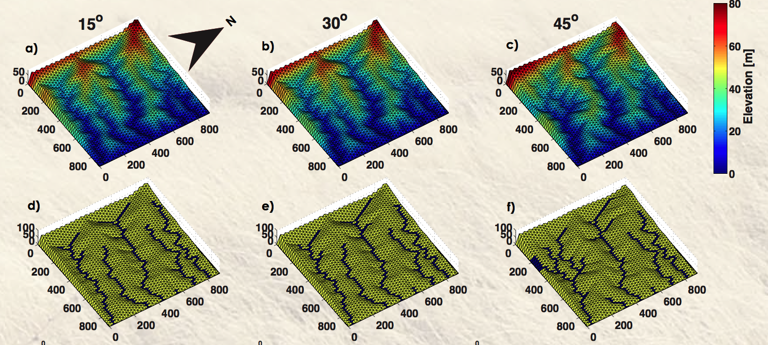
Topographies and their channel networks, after 500,000 years of CHILD simulation forced by a semiarid climate (storm inter-storm statistics from central US, P=400 mm/a). The drainage network extends towards the south facing hillslopes, leading to the network asymmetry as degree-latitude gets higher.
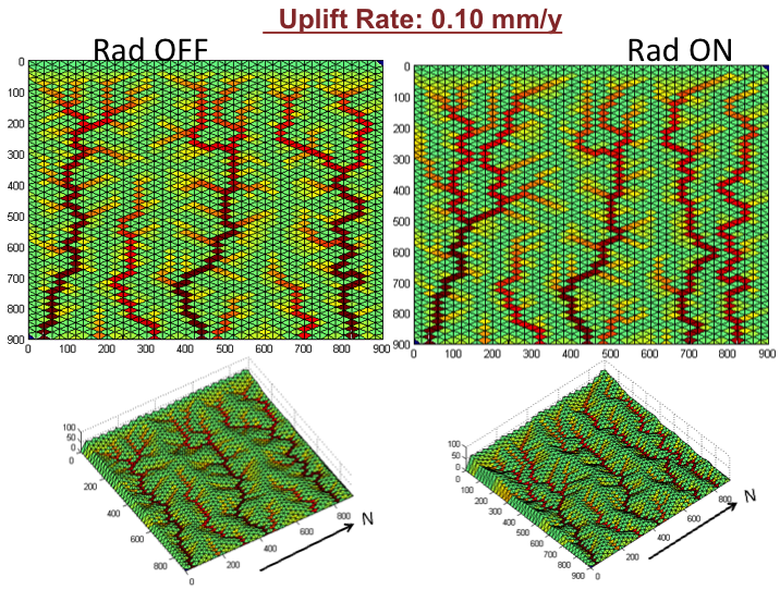
When the radiation module turned on a more pronounced south-facing network expansion is observed in central New Mexico climate (by Omer Yetemen).
Ā
Ā
Ā
Department of Civil and Environmental Engineering
University of Washington
164 Wilcox Hall, Box 352700
University of Washington
Seattle, WAĀ 98195