|
|||||
Ecohydrology
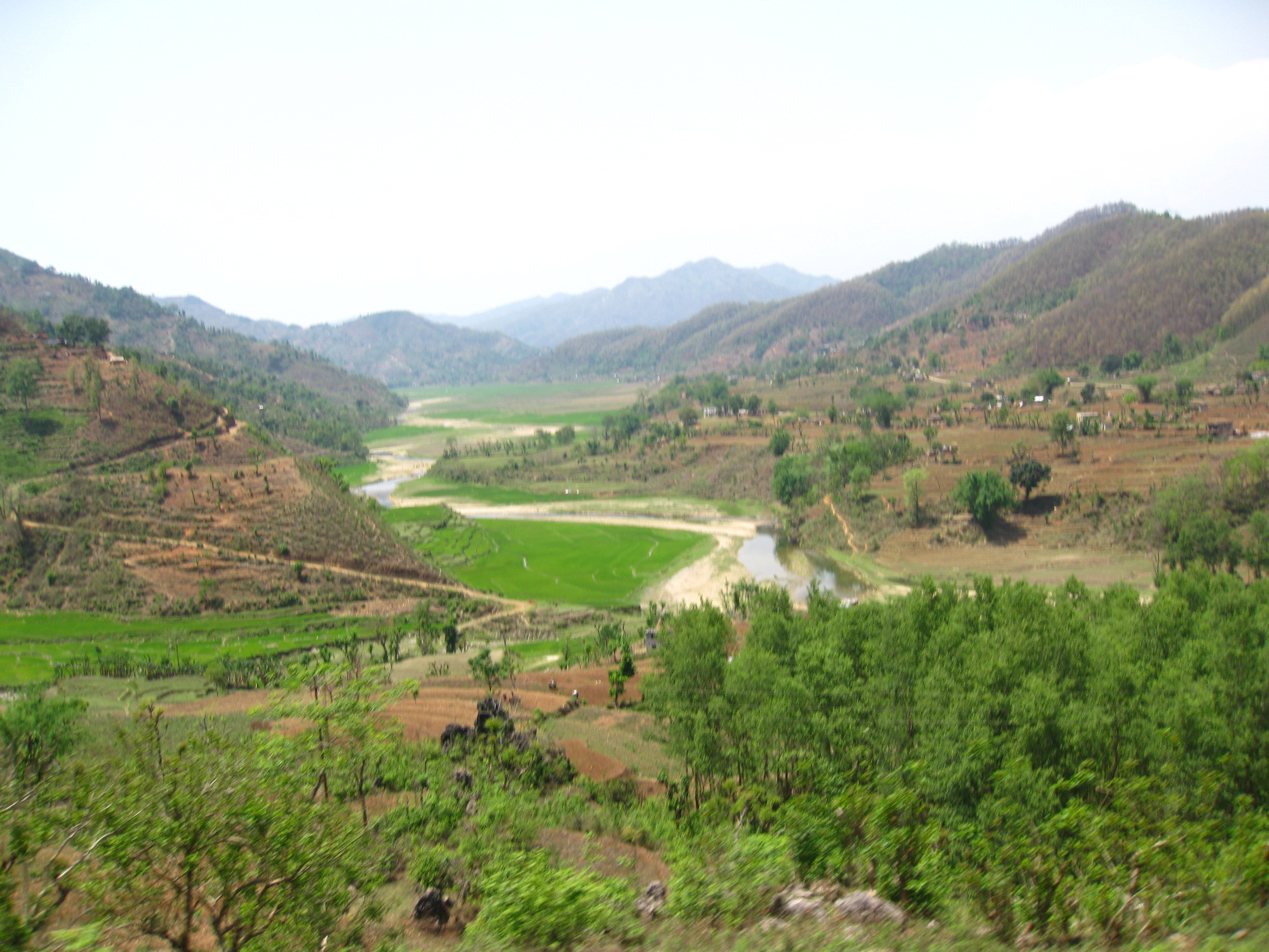
Our current ecohydrology research concentrates semi-arid ecosystems in Nebraska, Central New Mexico, and Arizona. We seek to understand and model vegetation response to climate, the role topography on the establishment of plants and their productivity and the role of vegetation in predicting regional water balance. Below sample results from recent research are provided.
Models:
We develop parsimonious numerical models of vegetation dynamics. We start with relatively complex models and break them input simpler models and test their performance.
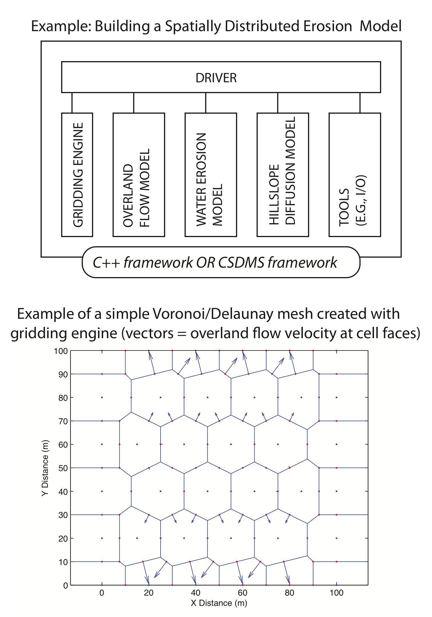
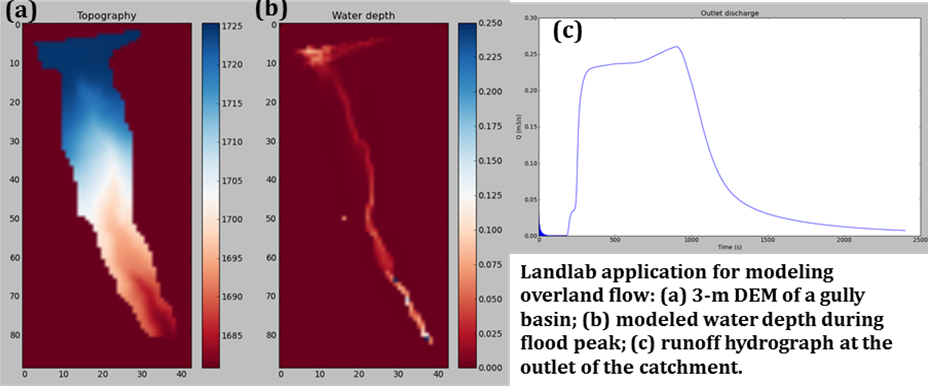
Landlab: Component-Based Software Architecture for Computational Landscape Modeling [Funding: NSF, G. Tucker (UC, Boulder), N. Gasparini (U Tulane), E. Istanbulluoglu (UW)]
Landscape models compute flows of mass, such as water, sediment, glacial ice, volcanic material, or landslide debris, across a gridded terrain surface. Science and engineering applications of these models range from short-term flood forecasting to long-term landform evolution. At present, software development behind these models is highly compartmentalized and idiosyncratic, despite the strong similarity in core algorithms and data structures between otherwise diverse models. We introduce a component-based approach to software development for landscape models that will provide the platform to integrate range of earth science and engineering fields. We call this new modeling framework “Landlab”.
BGM (Bucket Grassland Model)
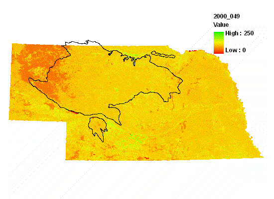
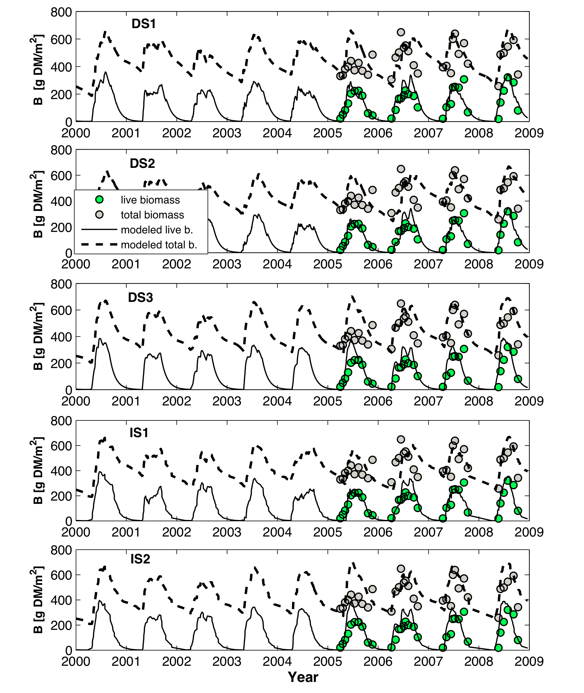
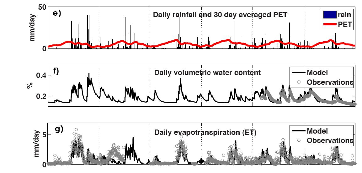
BGM is a zero-dimensional ecohydrology model based on a vertically averaged representation of soil moisture in the root-zone, coupled with grass dynamics represented by live and dead above and below ground biomass pools. Five variants of the model, combined the different time steps (daily vs interstorm), representations of potential evapotranspiration (PET), and constant versus variable water use efficiency (WUE) were developed and tested across the Nebraska Sand Hills (NSH) (Istanbulluoglu et al., 2011). Water table is also added in the model as a lower boundary condition (Soylu et al., 2011).
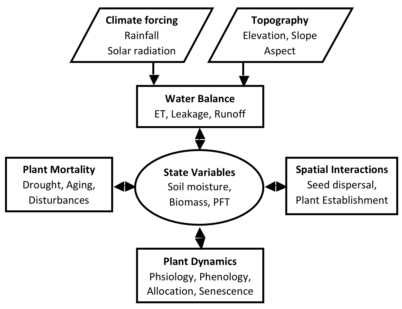
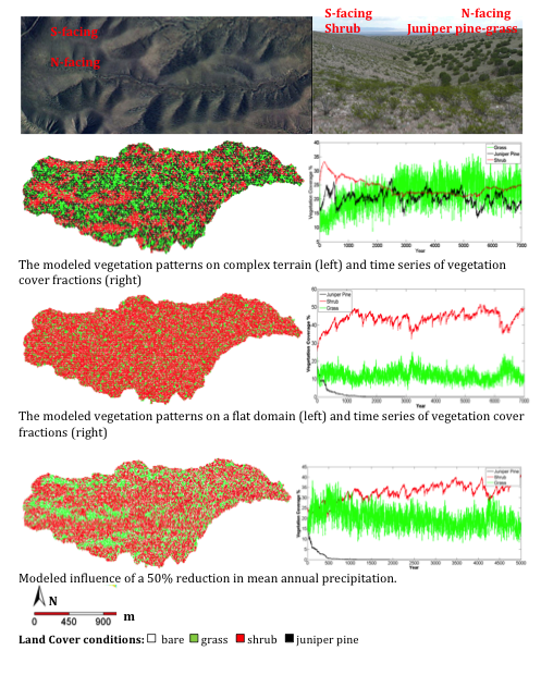
CATGraSS (Cellular Automata Tree-Grass-Shrub Simulator)
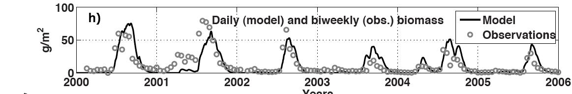
CATGraSS is developed to simulate tree-grass-shrub coexistence and their dynamics on the complex terrain. The salient aspect of this model is the explicit treatment of topography on the distribution of solar radiation, leading to spatial variations in evapoatranspiration, soil moisture, and plant water stress on the landscape. Plant establishment and mortality are driven by water stress and competition for space. Developed by: Xiaochi Zhou and Erkan Istanbulluoglu.
Modeling of vegetation dynamics in a semiarid site (Walnut Gulch, southeastern Arizona)
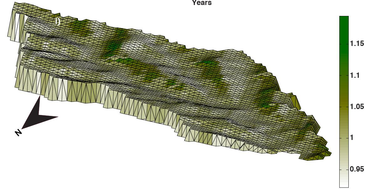
We integrate ecohydrology models with the Channel and Hillslope Integrated Landscape Development (CHILD) model. Below are examples from the validation of ecohydrology model implemented in two study sites, Walnut Gulch basin Arizona (by Homero Flores), and the Sevilleta National Wildlife Refuge, New Mexico (by Omer Yetemen).
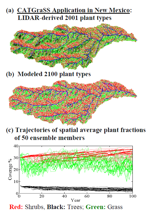
Sevilleta National Wildlife Refuge, New Mexico (Collaborator Enrique Vivoni, ASU):
|
|||||
|
|||||
|
|