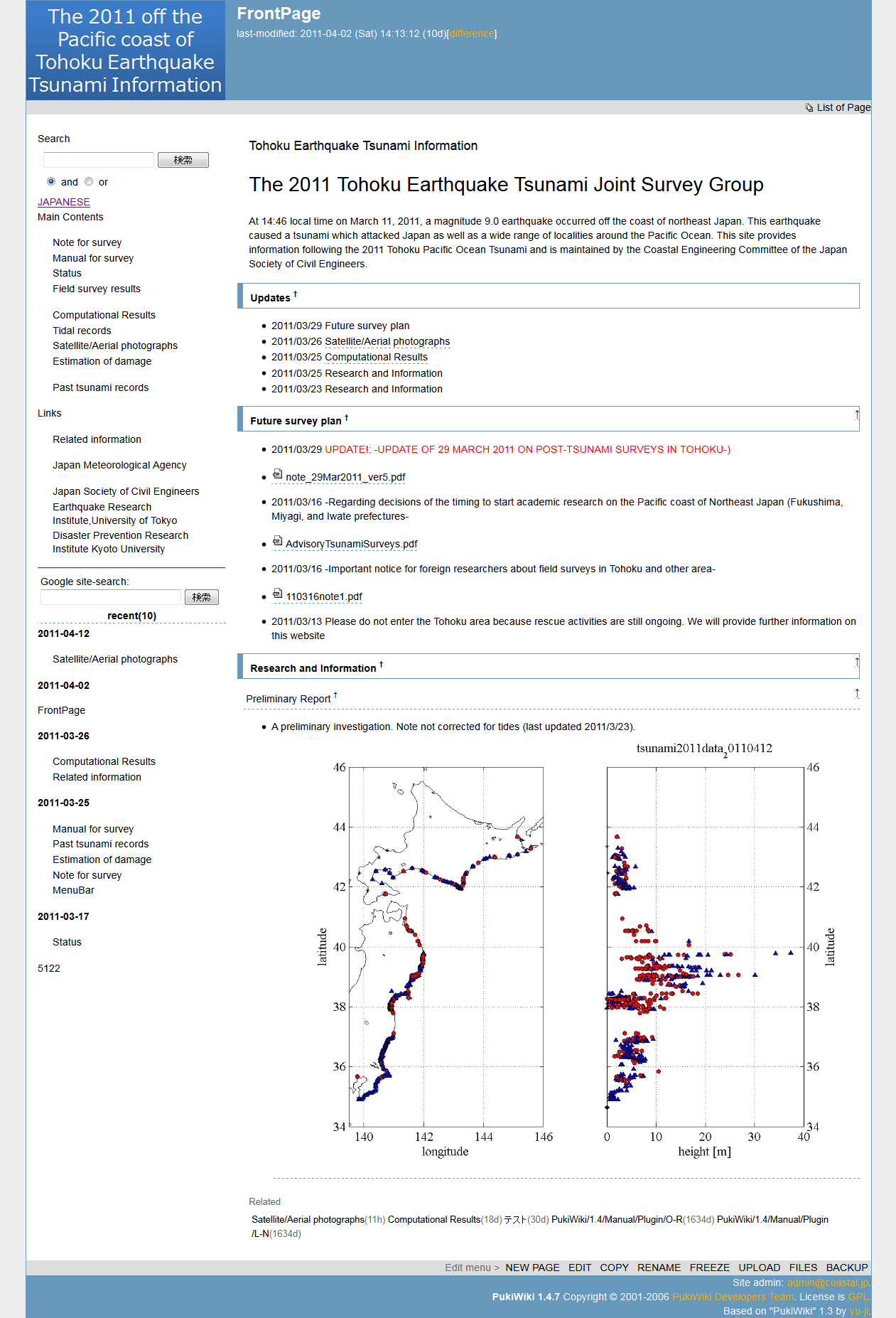
 At 14:46 local time on March 11, 2011, a magnitude 9.0 earthquake occurred off the coast of northeast Japan. This earthquake caused a tsunami which attacked Japan as well as a wide range of localities around the Pacific Ocean.
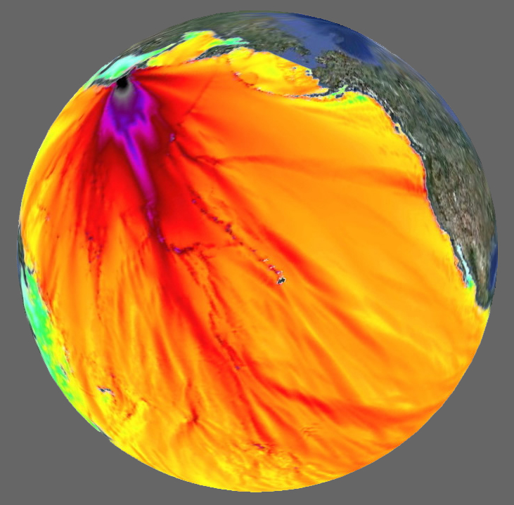
This graphic rendered on Google Earth shows the propagation of waves from the Tohoku tsunami event around the globe. The model amplitudes were calculated with the MOST forecast model. Filled colors show the maximum computed tsunami amplitude during 24 hours of wave propagation.
Image courtesy of NOAA PMEL Tsunami Research Center
Selected Event Summaries:
From Japan –
 Japanese Meteorological Agency Page: The 2011 off the Pacific coast of Tohoku Earthquake -Portal: Earthquake and tsunami data, advisories, warnings and forecasts. (in English, for Japanese see http://www.jma.go.jp/jma/index.html )
 Japan Society of Civil Engineers Page: This site provides information on the 2011 off-the-Pacific-coast-of-Tohoku earthquake tsunami, operated by the Coastal Engineering Committee of the Japan Society of Civil Engineers. Surveys, computational results, tidal records, and satellite/aerial photographs. (in English, for Japanese see http://www.coastal.jp/ttjt/index.php )
US and International –
 NOAA-PMEL Center for Tsunami Research – March 11, 2011 Honshu (northeastern Taiheiyou) Main Event Page: This page has modeling results for amplitude and global propagation of the Tohoku tsunami, comparisons to DART® (Deep-ocean Assessment and Reporting of Tsunamis) buoy and tide gauge data as well as a weblink compilation. The Center for Tsunami Research is part of the National Oceanographic and Atmospheric Adminstration (NOAA) Pacific Marine Environmental Laboratory (PMEL).
 International Tsunami Information Center Page: The event webpage of the ITIC, established by the Intergovernmental Oceanographic Commission (IOC) of the United Nations Educational, Scientific and Cultural Organization (UNESCO), has links to alert information, sea level and seismic data, models simulations and data as well as media reports, video and photographs.
 United States Geological Survey Magnitude 9.0 – Near the East Coast of Honshu, Japan Event Page: Earthquake summary and details, maps, scientific and technical information, tsunami information and additional weblinks. This page is hosted by the Earthquake Hazards Program of the United States Geological Survey (USGS). For USGS news on tsunami observations and modeling results from the Pacific Coastal & Marine Science Center see the related page: http://walrus.wr.usgs.gov/news/field.html.
Photos –
 Australian Broadcasting Company Before and After Photos: Satellite/aerial imagery with pre-event and post-event scrolling overlay at Japanese coastal locations.
Selected Videos –
 Japan Tsunami: Compiled Footage: Video footage shot in various locations around north-east Japan shows raging tsunami waves rushing over embankments and flowing into cities and towns carrying vehicles, ships and houses inland. Posted to YouTube. (5:39 mins.)
 Tsunami at the city of Kesennuma, Miyagi Prefecture in the northeastern part of the Japan. Kesennuma, located 300 miles northeast of Tokyo, was near the epicenter of the March 11 earthquake. For a related story about Kesennuma City Crisis Management Department’s Twitter feed during the disaster see http://www.slate.com/id/2288248/.
 Natorigawa River TSUNAMI Earthquake in Japan: Live NHK News feed during tsunami (in Japanese) shows views of the tsunami from helicopter and commentary. Posted to YouTube. (15:13 mins.)
Crisis Response –
 Google Japan Quake Crisis Response Page: Provides information about the Tohoku earthquake/tsunami/nuclear crisis, resources for those affected, and ways to contribute to relief efforts in Japan. Includes Person Finder, message boards and alert and transit information.
 Direct Link to Japanese Red Cross: (in English, for Japanese see http://www.jrc.or.jp/index.html)


 Jody Bourgeois—Paleotsunami Travels
 Hig (Bretwood Higman) blogs about Alaska resources and other topics
 Tsunami Project
 Paleoseismicity
 AGU Blogosphere