Plots for HAI1107_Hon_Harbor
Gauge locations
Station data ...
raw data files
Speed at different depths:
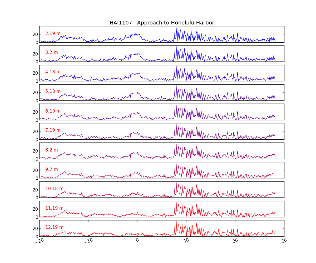
Speed at different depths:
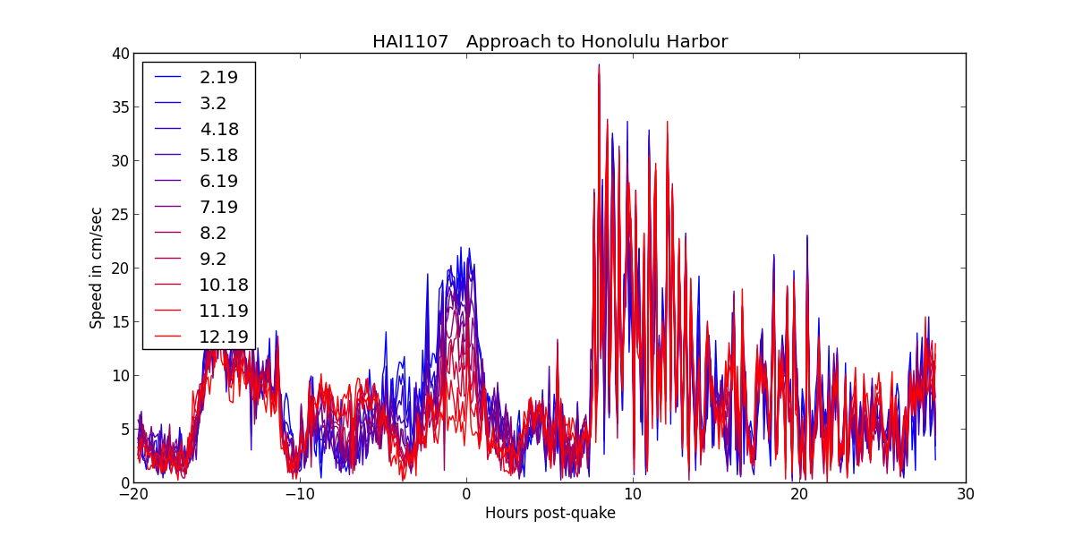
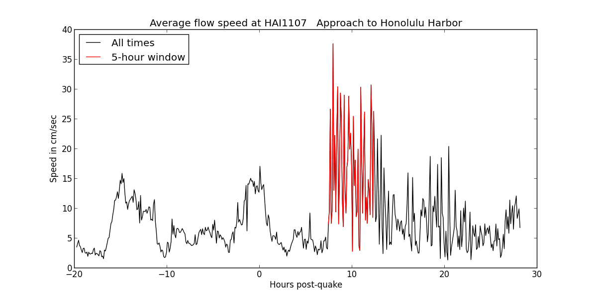
Average speed at all depths:
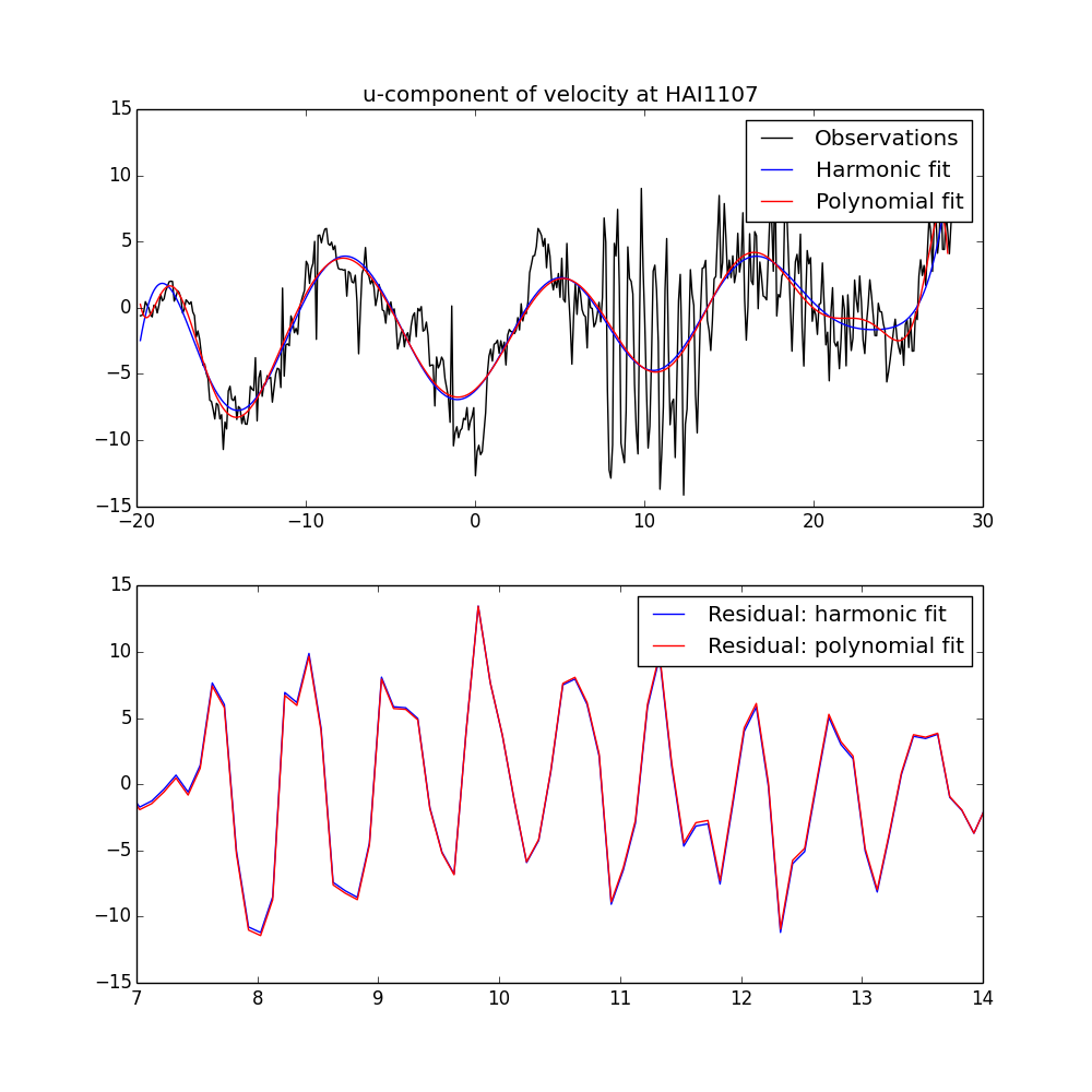
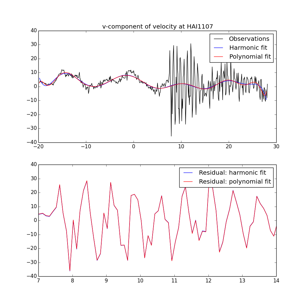
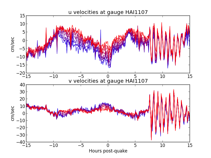
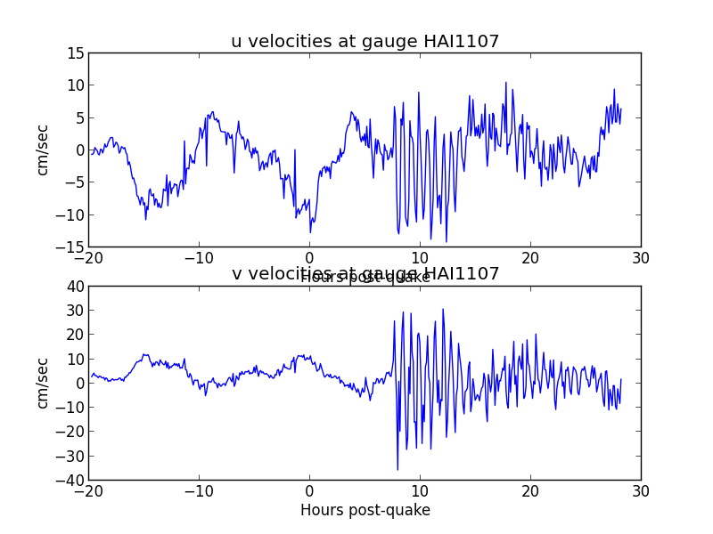
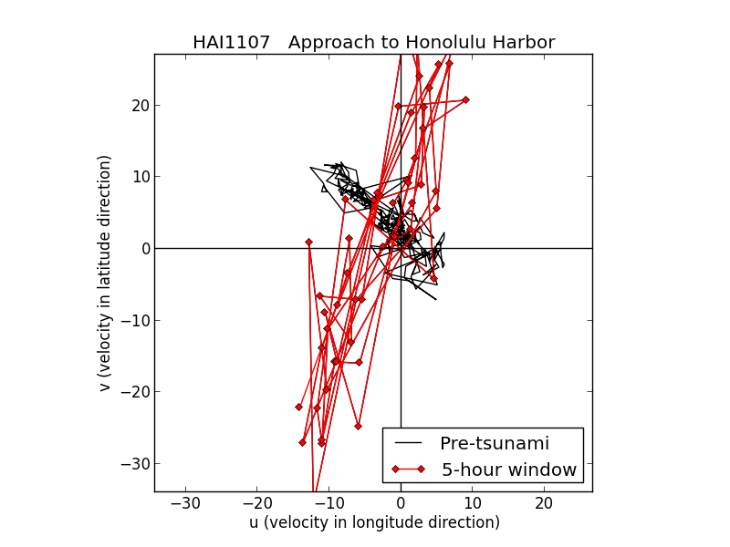
u, v at all depths:
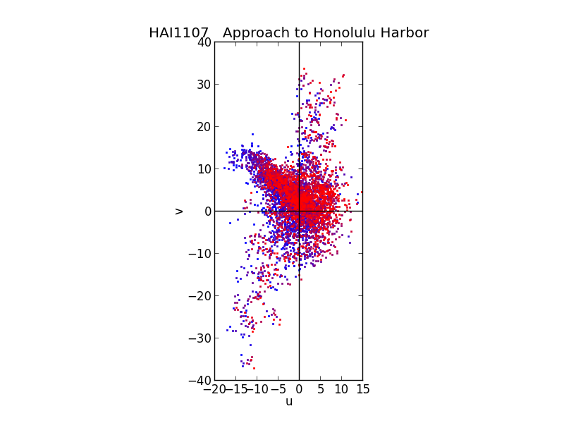
u, v at all depths and average:
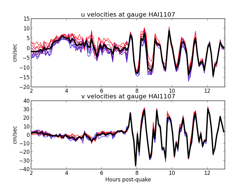
Average u, v at all depths:
Result of de-tiding: