Results with McCreary's beams model (grunter)
Results with McCreary's beams model (grunter)
There are a variety of topics represented here, based on various uses I've made of grunter over the years.
Scroll down and rummage. At this point I can't remember what all of this meant, but it was very important at the time, believe me ...
Also see some work specifically related to the Costa Rica Dome on another page.
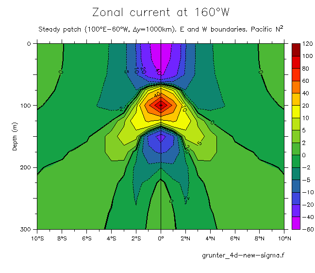
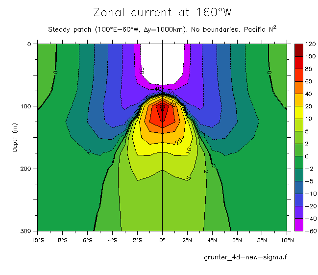
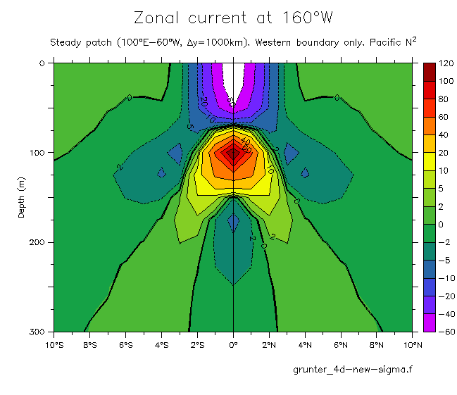
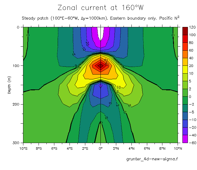
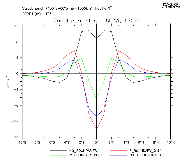
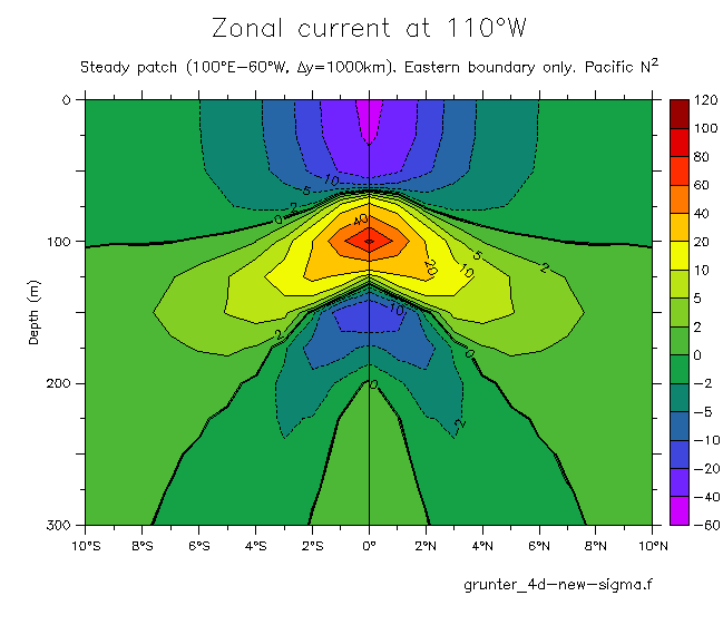
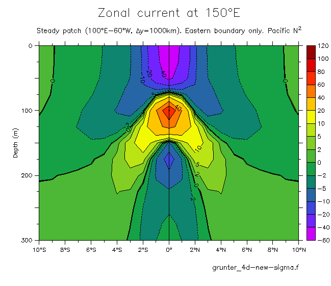
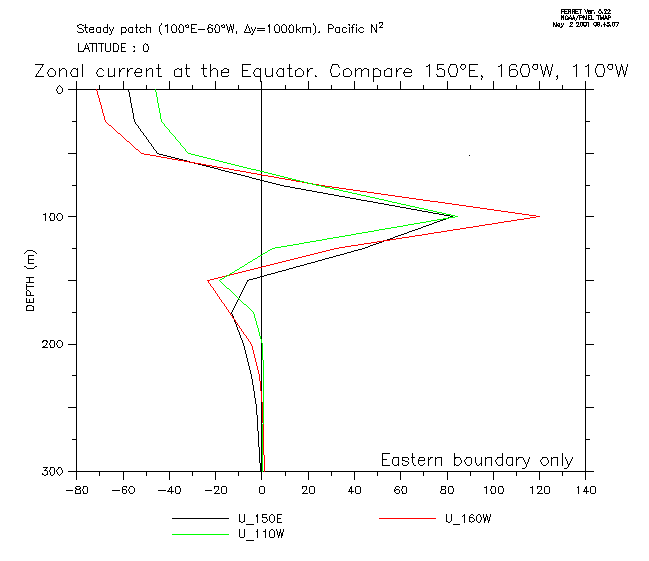
Runs to explore the forcing of the Tsuchiya Jets. Does the existence of these jets depend on the model boundaries?
The model was forced with a steady patch:
X(x)=sin(pi*x/delx), delx=100° longitude, centered at 160°W.
Y(y)=exp(-(y/dely)**2/2), dely=1000km.
Taux=-0.1 dynosaurs.
100 year damping time.
100 vertical, 101 meridional modes.
Pacific N**2
- Meridional sections of U at 160°W: E+W boundaries No boundaries Western boundary only Eastern boundary only
- Line plots of U at 160°W, 175m (compare EIC and TJs for all of the above)
- Eastern and western meridional sections (E boundary only): 110°W 150°E
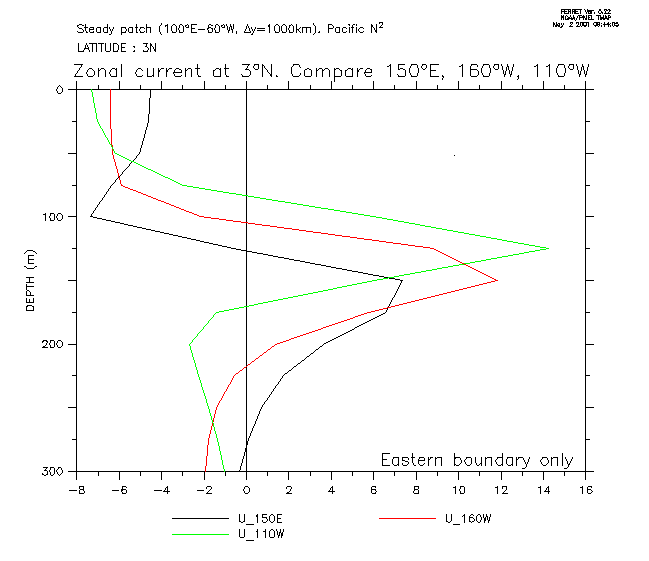
- Vertical profiles of U at 150°E, 160°W, 110°W (E boundary only): Equator 3°N
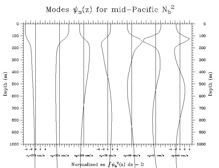
Vertical modes in the equatorial Pacific (FGGE Shuttle average profile)(upper 1000m)
The normalization here is as in Cane (1984, JPO p1864).
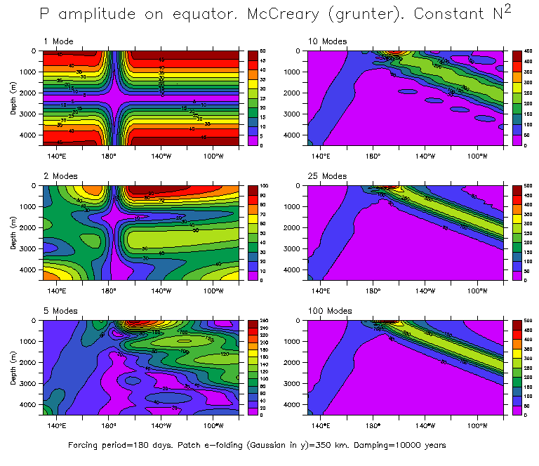
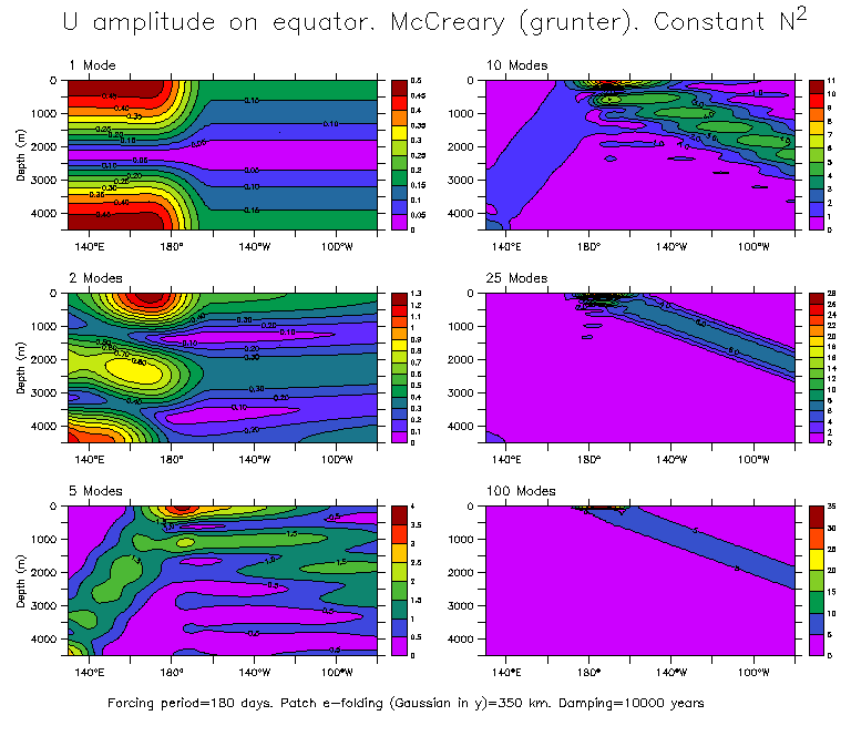
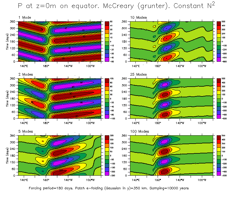
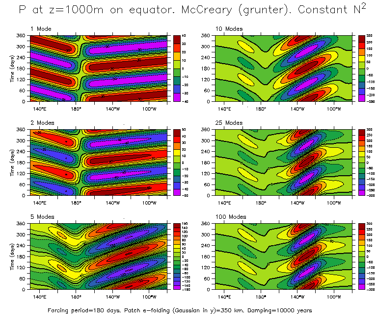
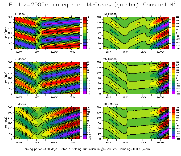
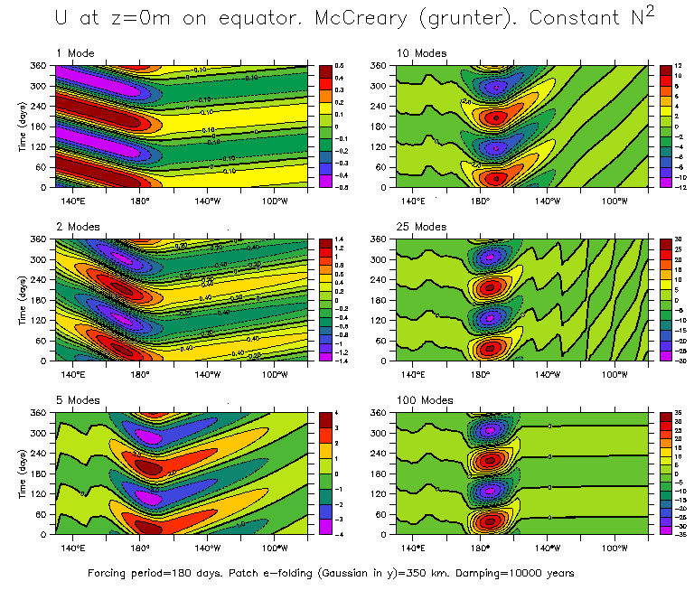
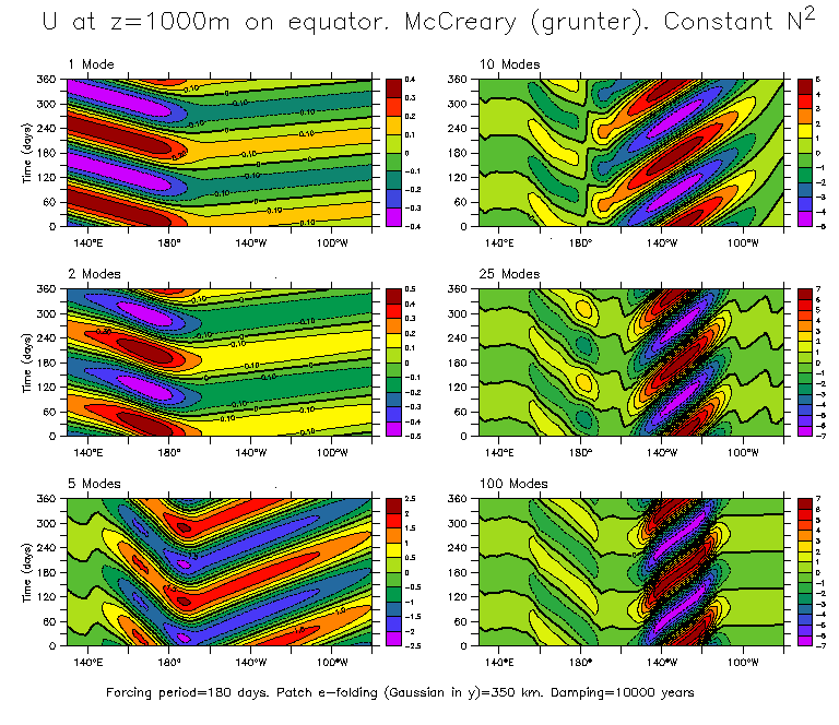
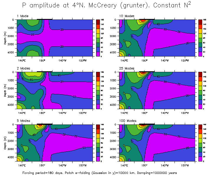
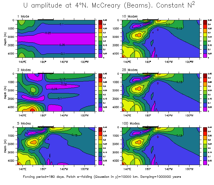
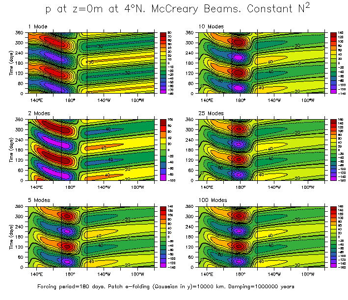
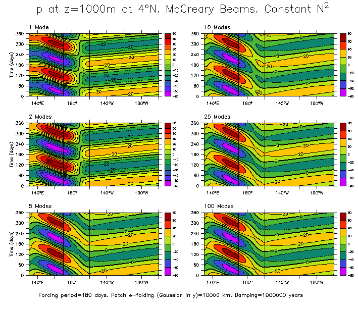
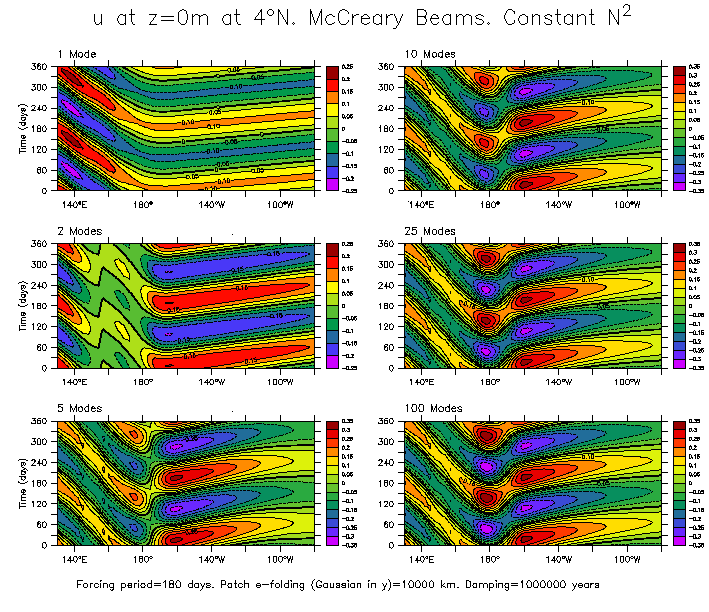
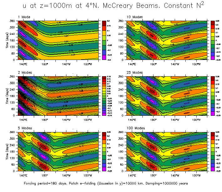
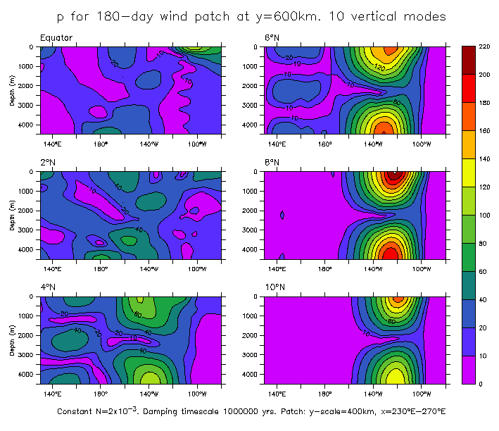
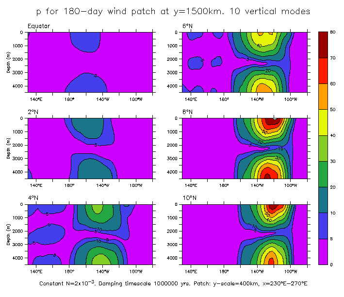
Model forced with an oscillating wind patch between 170°E and 160°W,
with frequency 180 days. The ocean stratification is linear, with N=2x10**-3 (c1=2.9m/s, similar to Pacific). Note that the contour interval is different in each panel of the plots.
Sections along the equator. The wind is gaussian in y with an e-folding distance of 350km.
- Amplitude of pressure
- Amplitude of zonal current
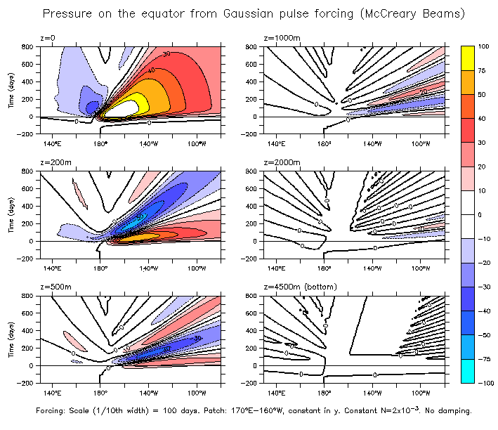
- Time series of pressure at z=0m
- Time series of pressure at z=1000m
- Time series of pressure at z=2000m
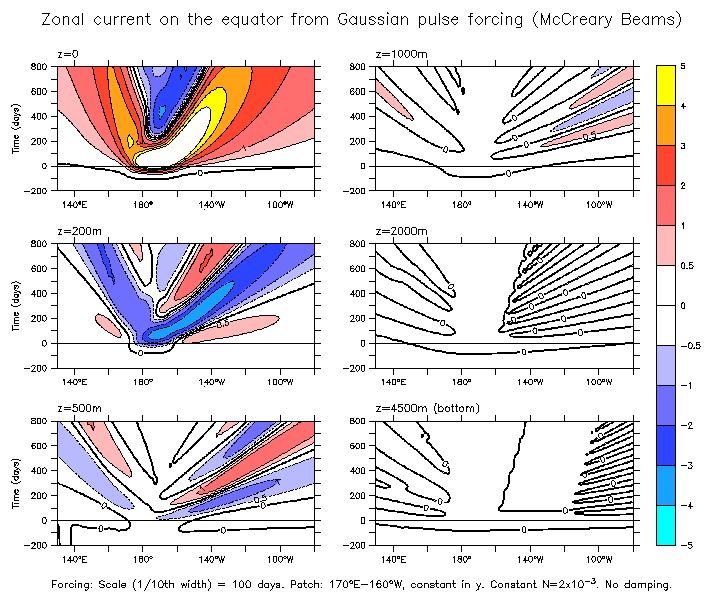
- Time series of zonal current at z=0m
- Time series of zonal current at z=1000m
Sections along 4°N. The wind is uniform in y.
- Amplitude of pressure
- Amplitude of zonal current
- Time series of pressure at z=0m
- Time series of pressure at z=1000m
- Time series of zonal current at z=0m
- Time series of zonal current at z=1000m
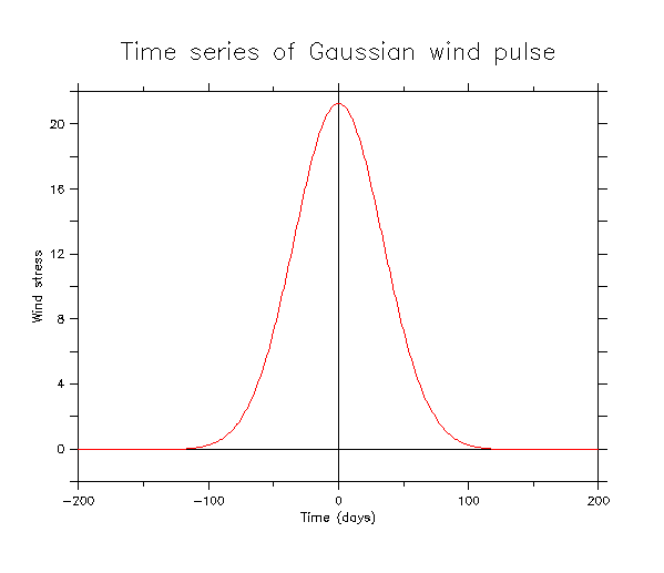
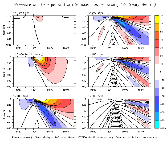
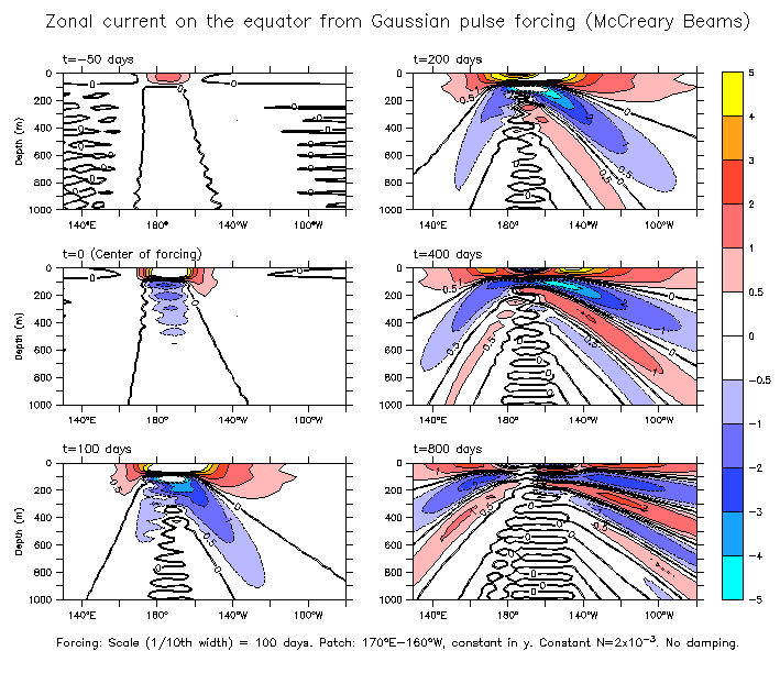
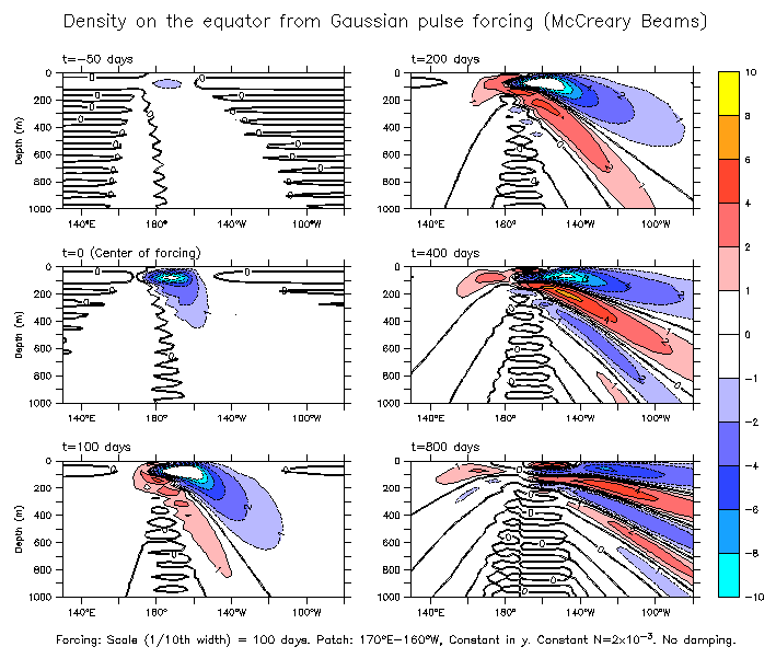
Some figures from the model forced with a summation of many wind frequencies. The frequencies sum to form a westerly Gaussian pulse, centered at t=0, and scaled so that the amplitude is 1/10th of the maximum at a period of 100 days. The pulse itself has amplitude half the maximum at t=±40 days, and 1/10th the maximum at t=±72 days (Fig 1 below). Periods from 100 years to 50 days were used, in 731 even frequency increments. The result of the summation is a series of Gaussian pulses 100 years apart, so each appears effectively as an isolated event. (Between the pulses the wind is weakly easterly with an amplitude roughly 1/400th of the peak value).
All frequencies have the same spatial structure. The patch is between 170°E and 160°W, and is (almost) constant in y. 100 vertical and 101 meridional modes are summed. The model ocean has constant N=2x10**-3, which gives low vertical mode speeds similar to the real Pacific (c1=2.9 m/s, c2=1.4 m/s, c3=0.95 m/s).
Slices from the output show x-t, x-z, and z-t sections.
- time series of Gaussian wind pulse
X-T slices:
- Pressure
- Zonal current
X-Z slices:
- Pressure
- Zonal current
- Density
Z-T slices:
- Pressure
Patches centered off the equator. The interesting (what I don't know is always interesting) thing here is that there are maximum periods for Rossby waves (minimum frequency = Beta*c/2f), and so off-equatorial forcing may not produce beams. Since c decreases for higher vertical modes, eventually a mode will be reached for which no Rossby wave is possible. Going poleward, only lower and lower-mode Rossby waves exist, and the sum of modes necessary to produce a beam will be truncated. Even for tropical latitudes, this can happen fairly quickly:
		 Maximum RW latitude (degrees)
  Mode  c (cm/s)     Annual   Semi-annual
    1    272.62        61.6	 31.8
    2    173.84        39.3	 19.7
    3    106.33        24.0	 11.9
    4     76.06        17.2	  8.5
    5     59.02        13.3	  6.6
    6     51.21        11.6	  5.7
    7     43.59         9.8	  4.8
    8     37.00         8.4	  4.1
    9     33.16         7.5	  3.7
   10     29.57         6.7	  3.3
The values above are for the equatorial Pacific (FGGE Shuttle) modal decomposition. The examples here are for a constant-N ocean, but the speeds c are similar, and so the modal Rossby latitude limits are also similar.
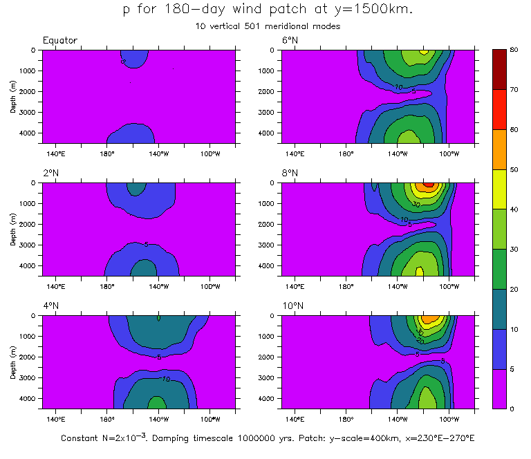
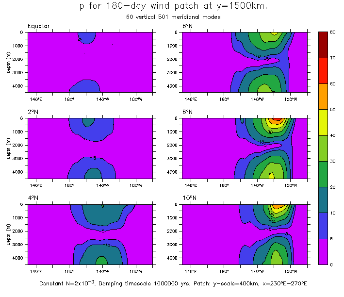
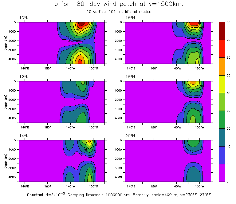
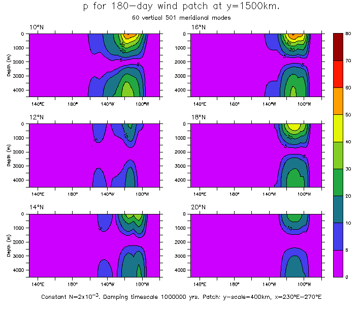
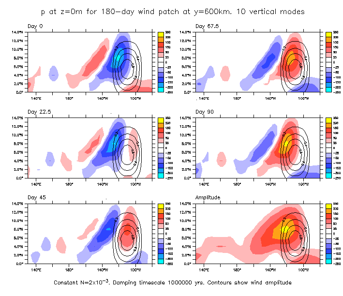
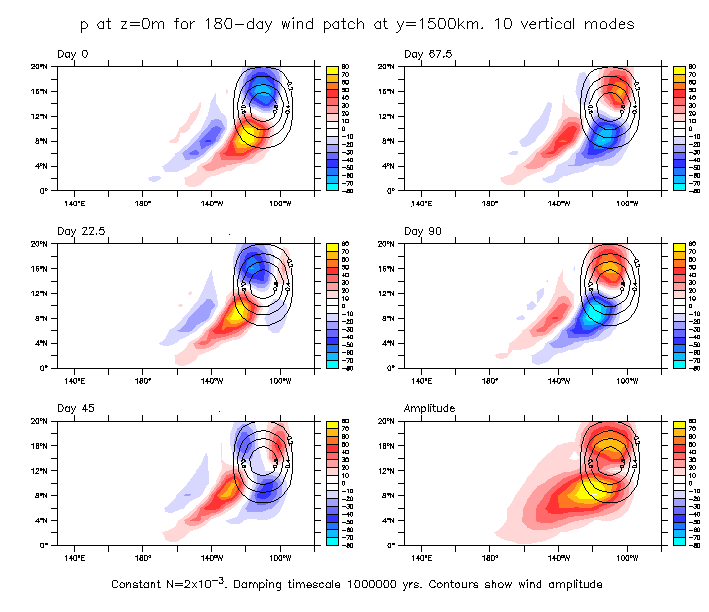
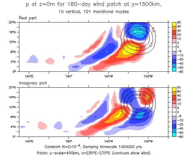
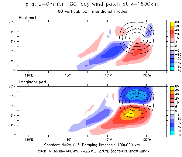
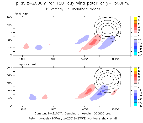
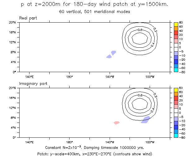
The examples here show beams forced with patches at 6°N and 14°N, with a period of 180 days. The patches are the usual half-sine, centered in x between 130°W and 90°W, and with a Gaussian form in y, with e-folding scale of 400km (Figs 3 and 4 contour the wind amplitude). The above table shows that the 14°N patch generates mostly vertical modes 1-3, and therefore does not produce a beam.
These figures are all of the pressure field.
Amplitude as a function of (x,z) at latitudes 0° to 10°N. The 6°N patch extends to the equator (see fig 4), so at very low latitudes all modes are forced, but moving to higher latitudes only the low modes exist. The 14°N patch has amplitude only down to about 8-9°N, so only 3 modes are forced, and the wave does not propagate vertically.
Sections from the equator to 10°N:
- Patch centered at 6°N (10 vert, 101 merid modes)
- Patch centered at 14°N (10 vert, 101 merid modes)
- Patch centered at 14°N (10 vert, 501 merid modes)
- Patch centered at 14°N (60 vert, 501 merid modes)
Sections from 10°N to 20°N:
- Patch centered at 14°N (10 vert, 101 merid modes)
- Patch centered at 14°N (10 vert, 501 merid modes)
- Patch centered at 14°N (60 vert, 501 merid modes)
Time series at the surface for the same two patches. Note that the 14°N forcing produces an ocean response through the curl (relative minimum of pressure amplitude in the center of the forcing region, with opposite-sign maxima north and south (Fig 4)).
- Patch centered at 6°N (10 vert, 101 merid modes)
- Patch centered at 14°N (10 vert, 101 merid modes)
Real and imaginary parts of solution for 14°N, 180-day-period patch:
- P at z=0. 10 vert, 101 merid modes
- P at z=0. 10 vert, 501 merid modes
- P at z=0. 60 vert, 501 merid modes
- P at z=2000m. 10 vert, 101 merid modes
- P at z=2000m. 60 vert, 501 merid modes
Return to Kessler home page
Return to Kessler shareable figures page