 |
 |
 |
 |
 |
 |
The main purpose of this page is to provide a lot of photographs of Mustagh Ata and some of its surrounding region. Several of these photos have been reproduced on various web sites, often without attribution, and in some cases in rather poor copies. I decided it was high time to post the originals. A few details pertinent to climbing and hiking have been included, but additional descriptive material will have to wait for a second edition. All of the photos are thumbnailed--click to bring up the enlargements.
Note that during July 2000 a strong team of Dan Mazur, Walter Keller and Jon Otto made the first ascent of the SE (E) ridge of the mountain from the Koksay Glacier and then traversed to descend via the normal route. The snow conditions were not ideal; the climb turned out to be very demanding. From their descriptions, it sounds like an elegant route and a real challenge. To read about their climb and see the pictures, visit Mountainzone.com and use search word "mustaghata." There are countless pages and photos, not very well organized, with many dealing with the preliminaries (the group climbed with others the standard route first). The East Ridge climb is reported in the postings from about July 5 to about July 24. It is worth noting too that after showing dangerous symptoms of cerebral edema just below the summit on M.A., Mazur later recovered and summited on Cho Oyu in early October, a climb also reported on Mountainzone.
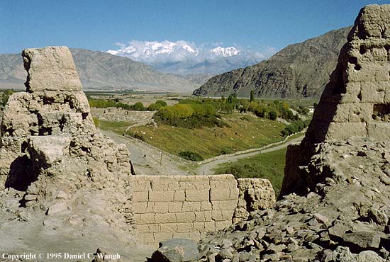
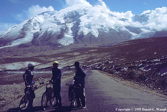
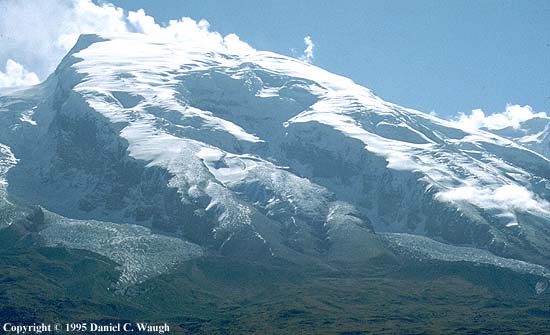
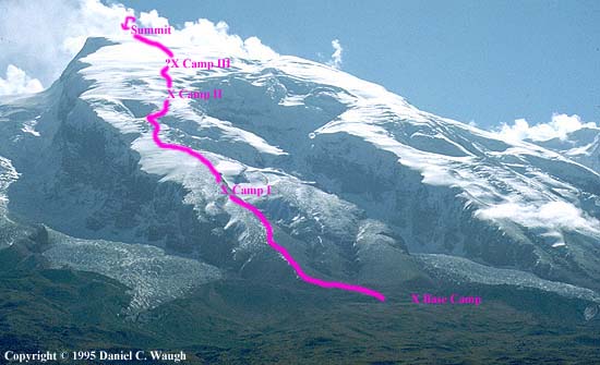
Approaching Mustagh Ata from the Southwest on the Karakorum Highway: 1. the view from the Tashkurghan fort; 2. peaks just south of Mustagh Ata (on the other side would be the peaks just south of the Koksay Glacier cirque); 3. the view from just the other side of the pass over the W shoulder of the mountain; 4. a detail of the same with the approximate indication of the normal (northwest ridge) climbing route; 5. the northwest side of the mountain; 6. a detail of the same with the normal climbing route (note: since slope near top eases off, last part of route and actual summit not visible).
|
|
|
|
|
|
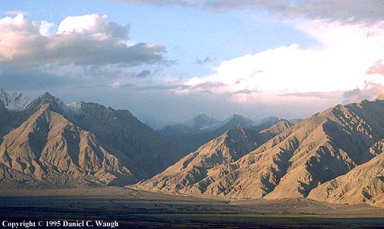
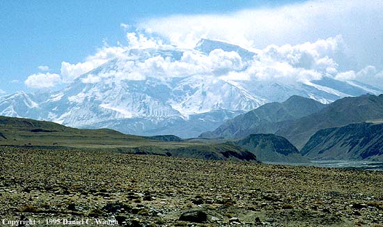
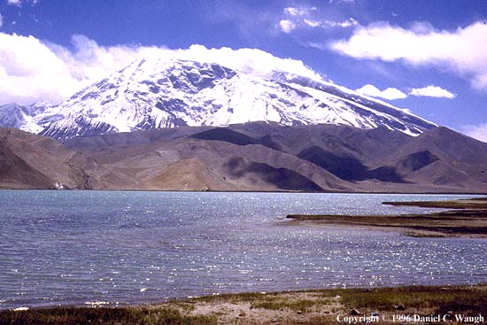
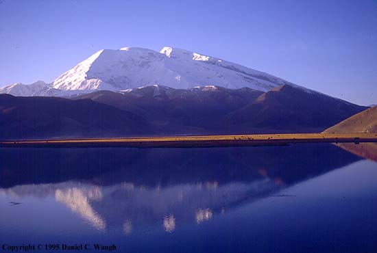
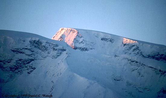
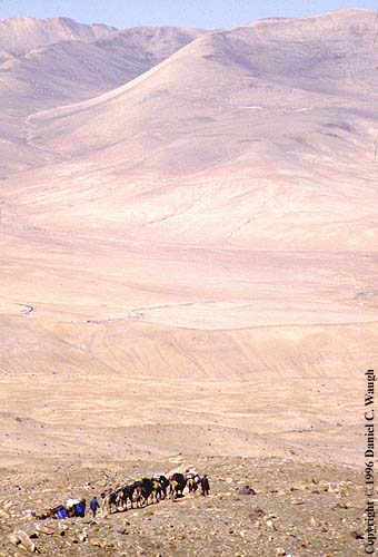
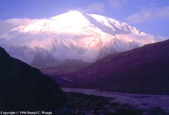
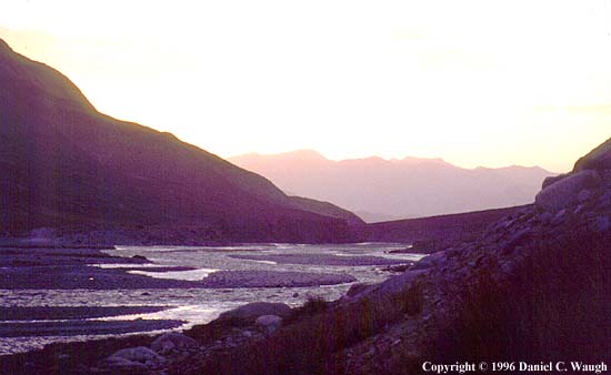
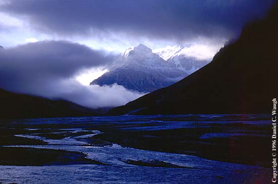
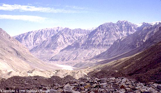
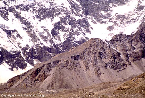
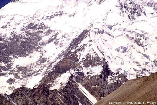
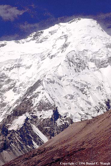
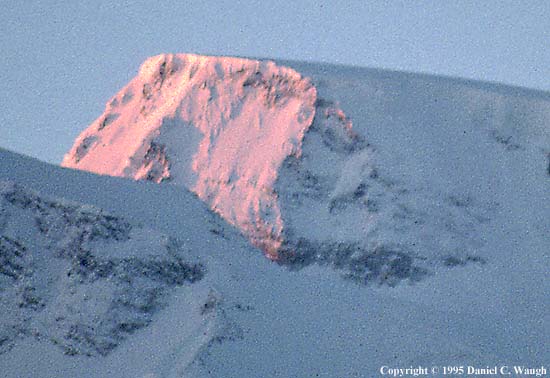
Approaching the mountain from the other direction; views from L. Karakul: 1. first view after leaving the Gez R. gorge (note beginning of normal afternoon cloud buildup); 2. from L. Karakul--on an otherwise fine day, already a cloud blowing across the summit; 3. first light (the normal climbing route approximately follows the right skyline); 4. detail of summit at dawn; 5. beginning the hike from upper Subax to base camp; 6. camel caravan heading back down from base camp.
 |
 |
 |
 |
 |
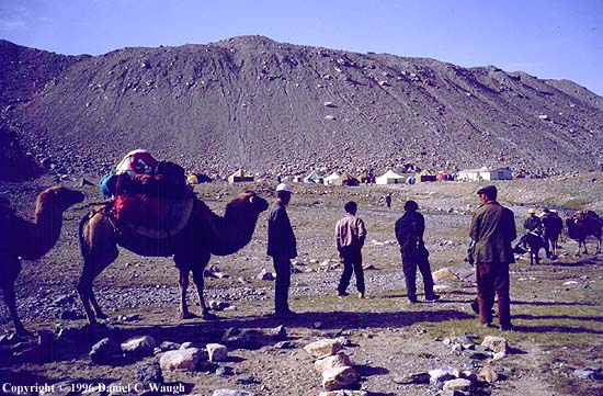
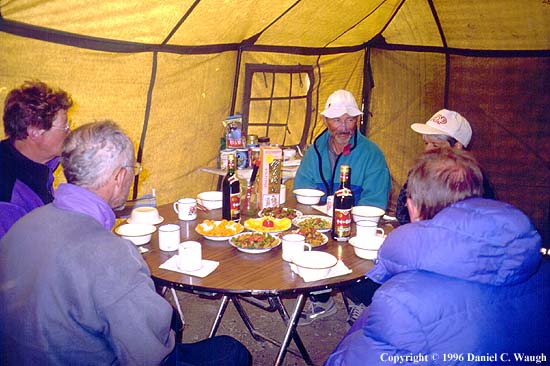
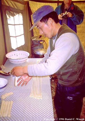
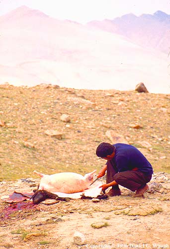
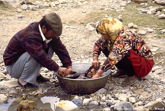
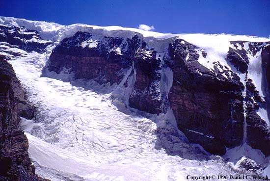
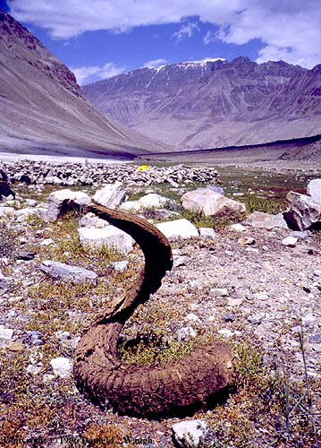
Life at base camp: 1. a very crowded place in the summer--for those who pay, a cook shack and mess tents; 2. inside a mess tent; 3. a Chinese cook at work--the Uighur cooks say they prepare better food, and vice versa; this fellow disappeared somewhat abruptly, supposedly because he was embezzling goodies, a story one is pressed to believe; 4. fresh meat being butchered; 5. choice cuts (the sheep heads) being washed--apparently they were for the staff (it's a local delicacy); 6. for acclimatization, can hike directly above base camp to views of the cliffs carved by the Kalaxing Glacier.
 |
 |
 |
 |
 |
 |
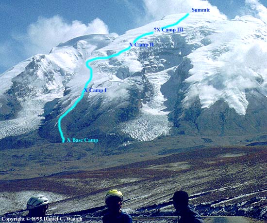
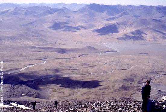
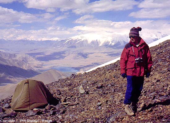
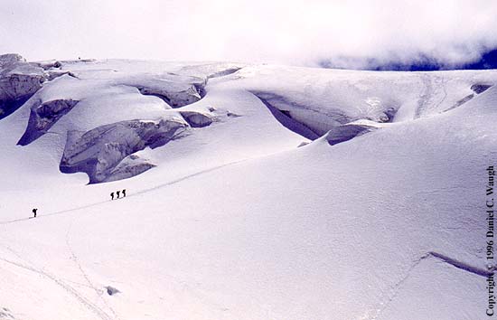
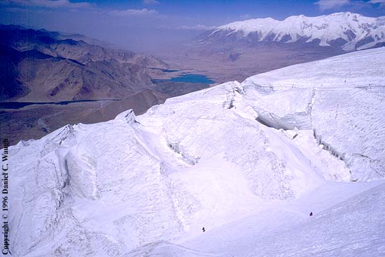
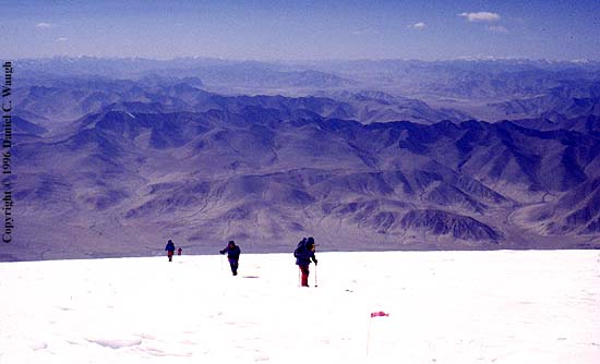
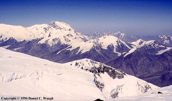
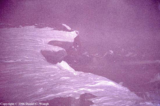
The climb: 1. View back down over base camp from approach to camp I on northwest ridge; 2. view from camp I across Karakul L. in direction of Gez R. gorge (end of Kongur ridge on right); 3. The one area on the route with seracs, between camps I and II; 4. looking back down on same (the climbers are about where ones in previous picture were); 5. about half an hour from the summit; 6. view from summit toward Kongur; 7. vastly underexposed picture of summit showing drop off into Koksay Glacier cirque on S. side of mountain (the batteries in the little point-and-shoots get cold fast; Kongur photo taken with different camera).
 |
 |
 |
 |
 |
 |
 |
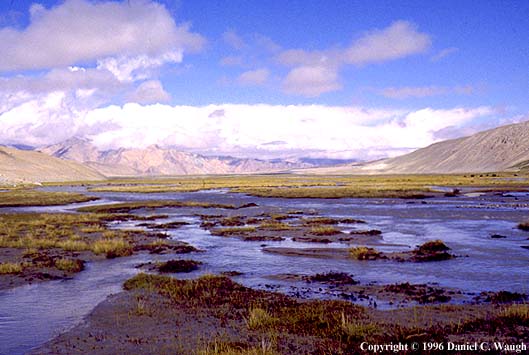
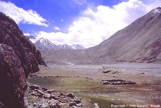
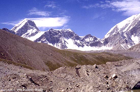
Around to the other side: 1. view of north peak at dawn from campsite below the Olimde Glacier; 2. the Kengxuwar River, looking north; 3. view across the Kengxuwar toward Kongur; 4. detail of same--summit pyramid of Kongur just visible below patch of blue sky; 5. view back down the Kengxuwar at sunset; 6. view upstream in clearing after storm; 7. the peak at the intersection of the Kengxuwar and the Ygebali (coming in on left), which one ascends if wishing to cross Karatash (Kalatax) pass to Chat (Qat).
 |
 |
 |
 |
 |
 |
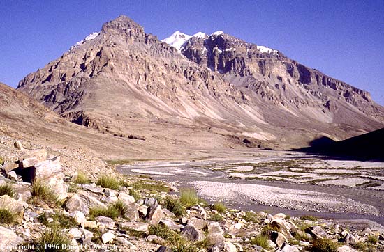 |
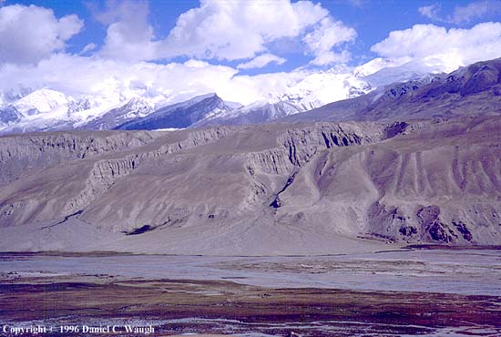
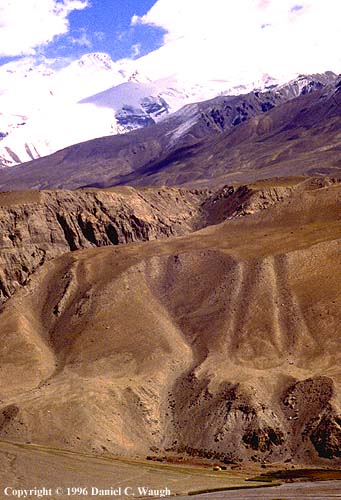
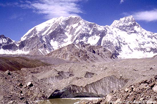
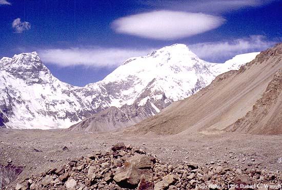
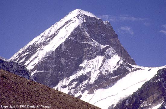
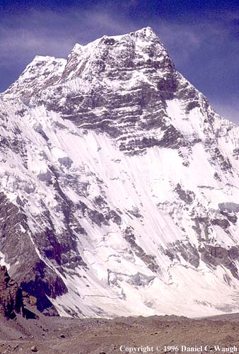
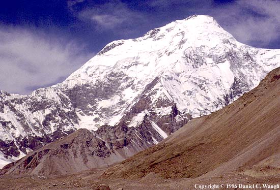
The Koksay Glacier cirque and the southeast ridge of Mustagh Ata: 1. a perfect campsite, just below the snout of the Koksay Glacier (the Torbulung R. with a spectacular waterfall comes in out of sight on left); 2. this is a hunters' camp; at one time there were sizeable Marco Polo sheep; 3. view back down the Kengxuwar R. from up on the glacier; 4-6. panorama of the cirque starting in SW and moving around to main peak of Mustagh Ata; 7-13. details of same, left to right, with closeups of the SE ridge of Mustagh Ata; the final picture is a detail of area just below summit (telephoto taken from Karakul L.), the profile presumably being the slope just to the right of the logical direct finish of the route on the ridge.
 |
 |
 |
 |
 |
 |
 |
 |
 |
 |
 |
 |
 |
Copyright © 2000 Daniel C. Waugh
Updated October 10, 2000.