 |
 |
 |
 |
 |
 |
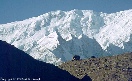
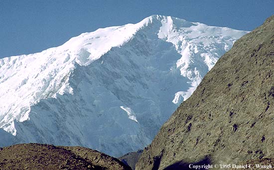
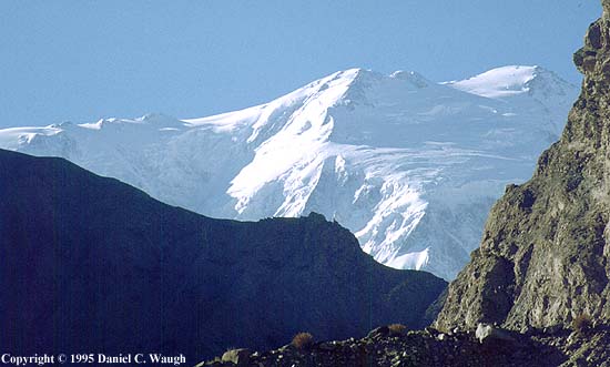
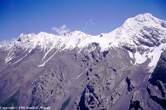
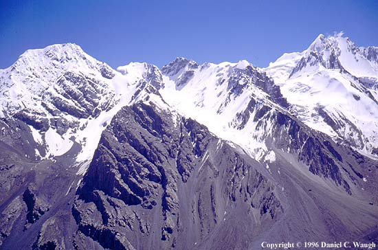
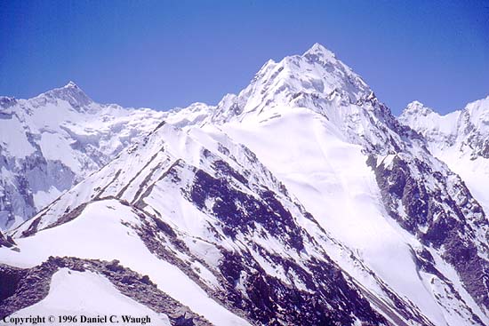
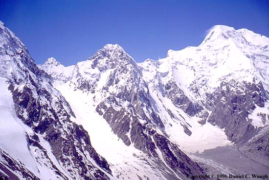
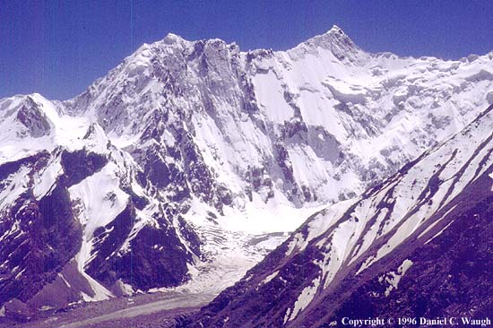
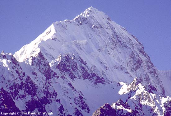
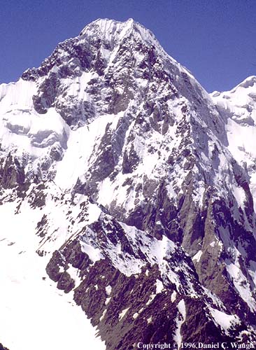
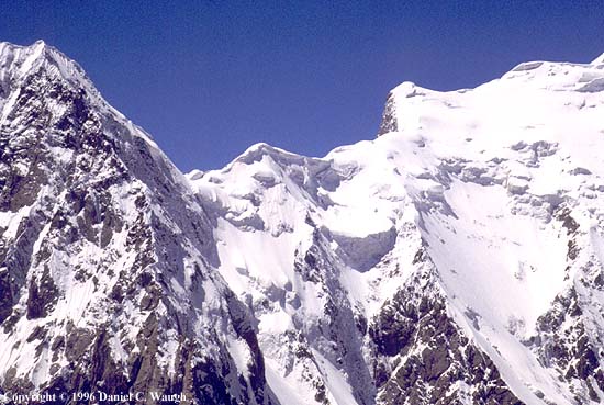
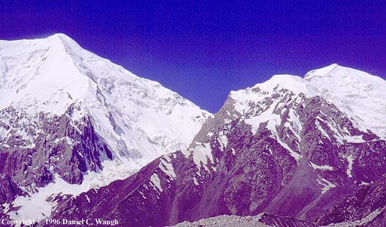
The walls of the Gez River gorge largely block views of Kongur from the Karakoram Highway on the north, except at a couple of gaps not long after departing from the Gez checkpoint on the way to Lake Karakul. The views here in photos kg14-kg19 are of two different segments of the Kongur massif; in neither case does one see the main summit area. Presumably the ferocious-looking ridge in the first set has not been climbed. The first set was taken closer to Gez than the second. Possibly the peak with the dramatic ridge is Kongur Tiube.
|
|
|
|
|
|
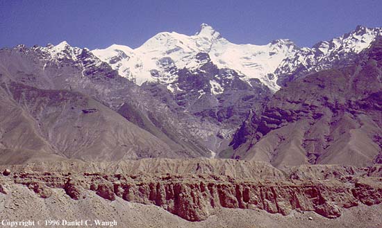
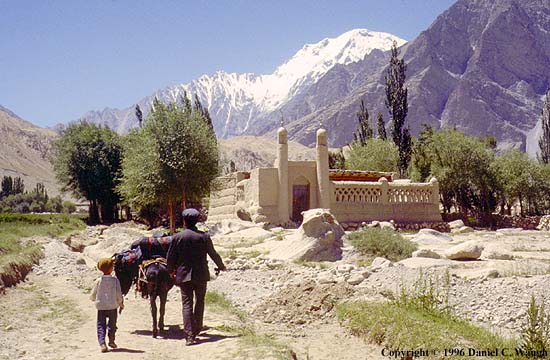
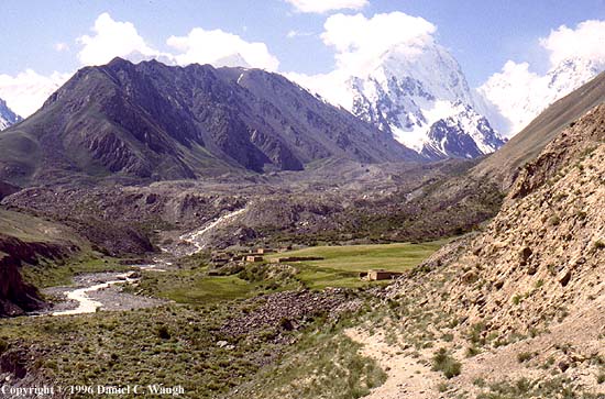
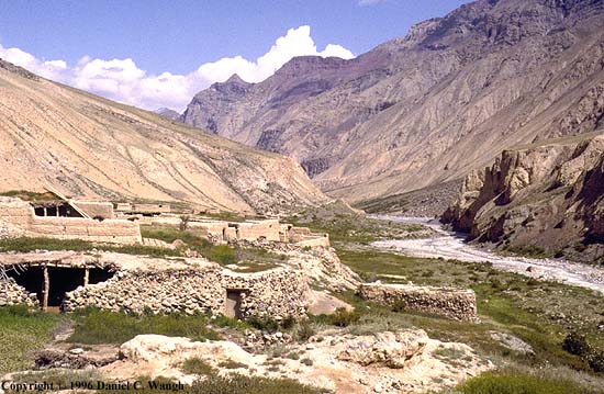
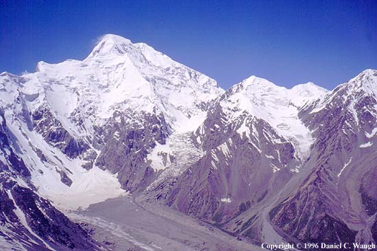
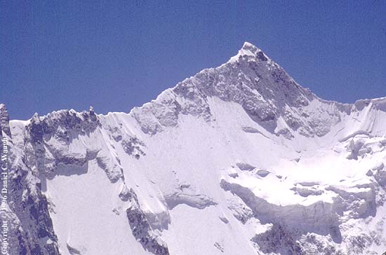
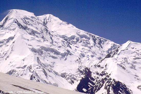
The Gez checkpoint (photo kg21), which marks the entrance into the restricted "border zone" as one heads toward Pakistan, is in one of the starkest locations imaginable, relieved only by views of the Gez "Matterhorn," an approx. 15,000-ft. snowcapped spire (photo kg22). Gez village is out of sight above the road--here one sees the "main street" and mosque (photo kg23). One walks through the village in the other direction to enter the Kurghan Jilgha, which leads to the NE side of Kongur and the Shiwakte Range (photo kg28,taken from the Arakler Ridge looking down toward the highway; photo kg24, looking at the Shiwakte peaks; photo kg26, the Arakler Ridge). A summer herders' settlement (Serai) (photo kg27) has several mud-brick houses and a large wheat field. Further up the valley next to the glacial moraine are other herder huts.
 |
 |
 |
 |
 |
 |
 |
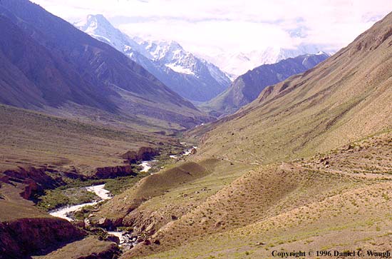
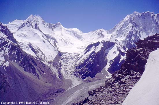
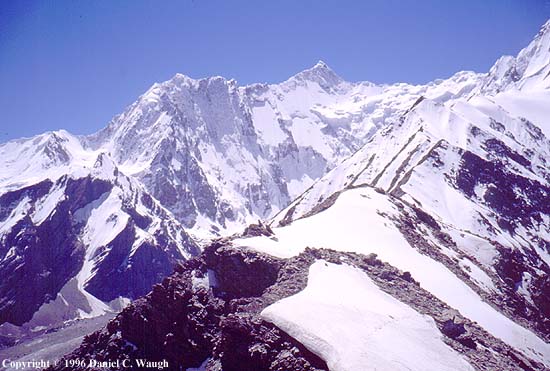
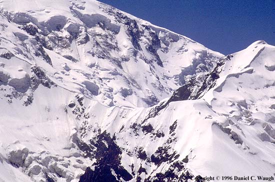
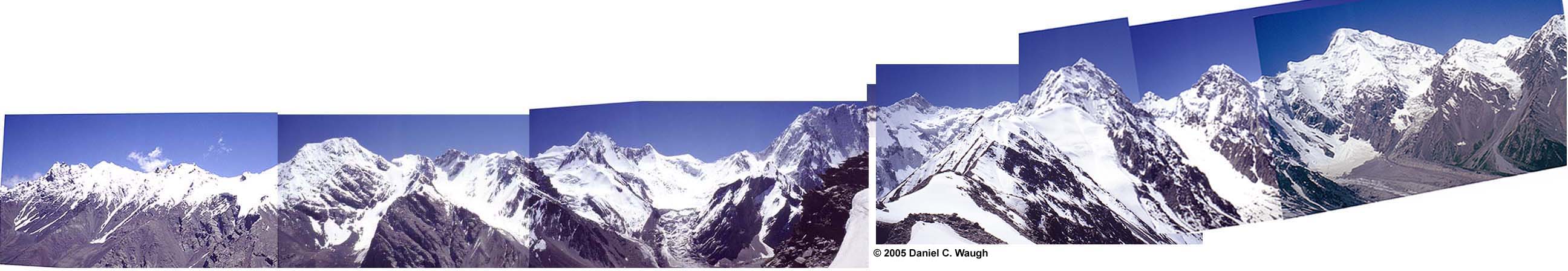
Photos kg29-kg36 are a panorama starting with the Shiwakte peaks to the east of the valley, sweeping around to the south and then along the east ridge of Kongur to the east shoulder of its main peak (the summit is well hidden behind the shoulder). The vantage point is from the Arakler Ridge (about 14,250 ft.--the triangulation survey marker on the ridge is at 4344 m.), although not all photos were taken from exactly the same spot.
 |
 |
 |
 |
 |
 |
 |
 |
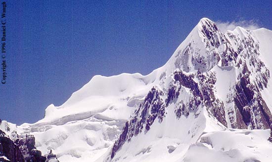
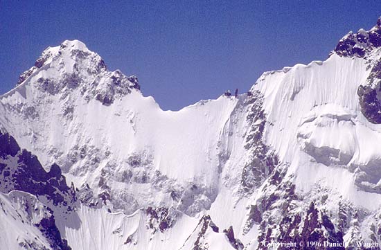
Photos kg37-kg48 are closeups of portions of the same panorama, starting with photo kg36, "Shiwakte I" (5601 m.), in the designation of C. P. Skrine. The main peak is behind the rocky spire. The adjoining image is a comparison of Skrine's 1924 photo of the peak taken from the NE and a detail of my 1996 photo taken from the NW. Photo kg40 is a closeup of Skrine's Shiwakte III (5981 m.). Most were taken from various places on the Arakler Ridge. A possible ascent route of Kongur from the NE might be to climb the subsidiary peak just to its right and then drop down to what looks like a ridge traversing in front of the dramatic wall of the north ridge (the right skyline--see esp. photo kg47). In 2004 an Italian team of the Club Alpino Accademicao Italia put up a new route on this face, starting in the center, angling up the glacier to the right, and then angling left up along the obvious ridge going to the subsidiary east summit. They ran out of time and good weather and did not summit, but had completed all the difficult part of the climbing. I include here an image of their postcard on which the planned route is overlaid on my photo.
 |
 |
 |
 |
 |
 |
 |
 |
 |
 |
 |
 |
 |
 |
I have spliced together the complete panorama of the Kurghan Jilgha, starting from the point of looking NNE and moving around to NW. Since some of the pictures were taken from slightly different positions, there is a small and obvious disconnect in the middle of the sequence, but the ridge line is complete. This at least gives a sense of the surroundings if one stands on the Arakler ridge in clear weather and pans the horizon. The image below is a thumbnail. Click to enlarge. Given my poorly developed skills in the photoshopping needed to produce the panorama, it is somewhat crude and not very sharp (the individual original pictures are in fact much better, for the most part). For a much more elegant treatment of the panorama, divided into three segments, see the web page created by Andrei Lebedev to accompany the Russian translation of C. P. Skrine's article on the "Qungur Alps." Lebedev and his colleagues have developed a very extensive set of web materials for the mountains of the Kongur/Mustagh Ata region, which they have been exploring in the last several years following new routes. The material is on the website of Turklub MAI
Copyright © Daniel C. Waugh
Revised March 5, 2005