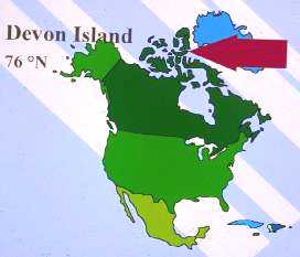
DEVON ISLAND
NORTHWEST TERRITORIES, CANADA
| Devon Island is located in the Canadian arctic archipelago,
within the zone classified as the High Arctic.
|
|
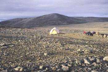
| The landscape of Devon Island is dominated by polar deserts, a barren ecosystem with sparse cover of vascular plants (generally <3%). Limited areas of greater ecosystem development, with vascular plant cover of 10-15% are associated with cryptobiotic surfaces. These sites are infrequent and often occur where moisture is available throughout the summer (e.g., "snowflush" sites downhill of persistent snowbanks) |
|
| The
research site I use is located on a plateau (330 m above sea level) above
the northeast coast of Devon Island (75°39'N, 84°24'W).
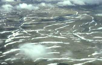
The landscape of this site is dominated by networks of sorted stone
nets and stripes which have formed on a dolomitic substrate.
These patterns result from cryogenic processes which segregate
finer grained (silt) particles of dolomite from the coarser fraction. Such
cryogenic features are common in high-latitude polar deserts. The soils
are classified as Pergelic Cryochrepts by the U.S.D.A. soil taxonomy
system and lack any significant horizon development.
The soils have almost no organic matter, low levels of
macronutrients, and are mildly to moderately alkaline (pH from 7.4 to
8.6). |
|
| This lowland, which is a mosaic of graminoid meadows and raised gravely beach ridges, has been the focus of considerable intensive research by Larry Bliss and colleagues for more than 25 years. |
Continue to learn more about the
Polar Desert Ecosystem Development Research Project