Results from the enhanced TAO mooring at 0°, 110°W
Results from an enhanced TAO mooring at 0°, 110°W
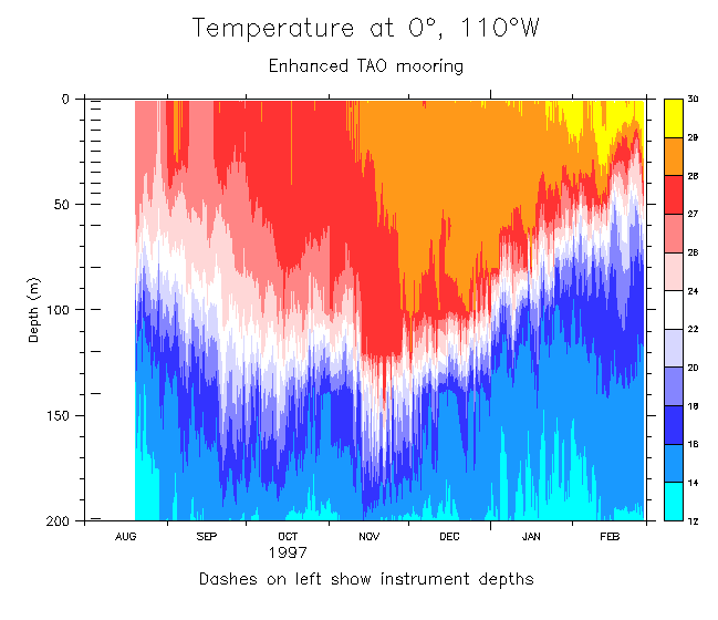
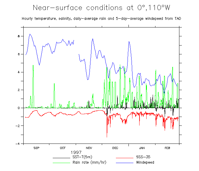
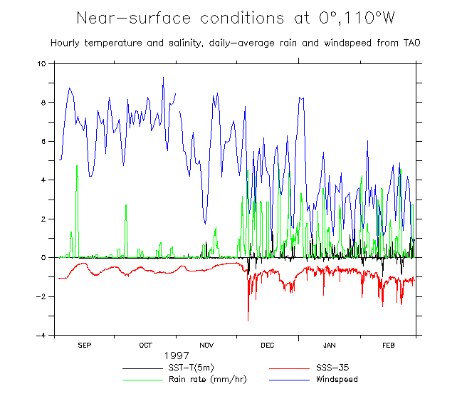
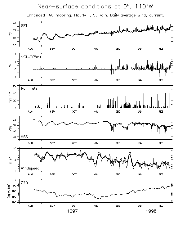
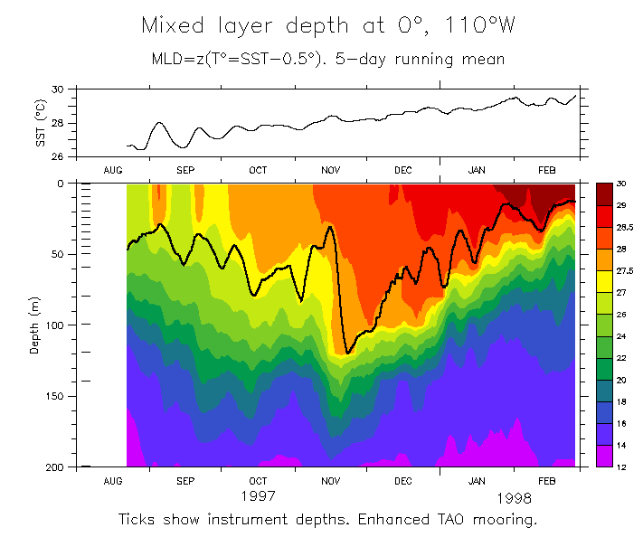
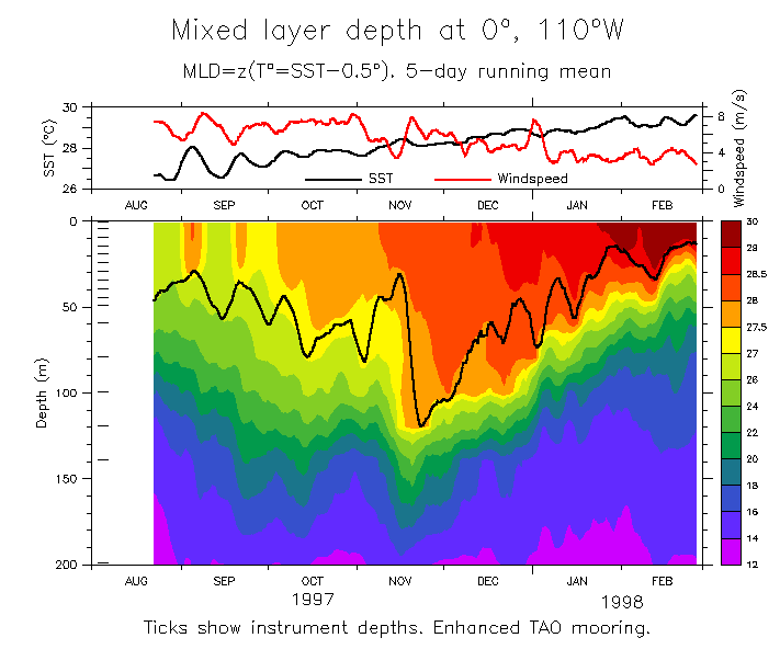
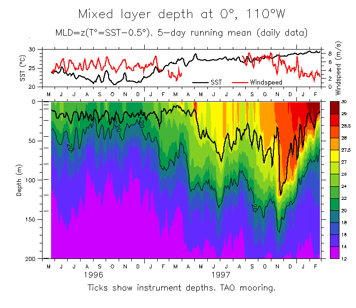
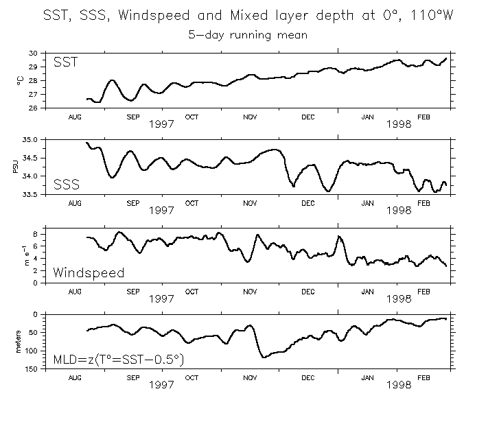
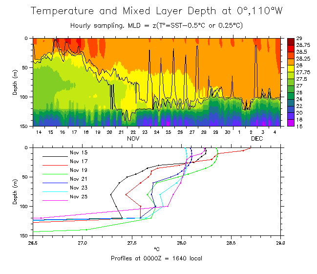
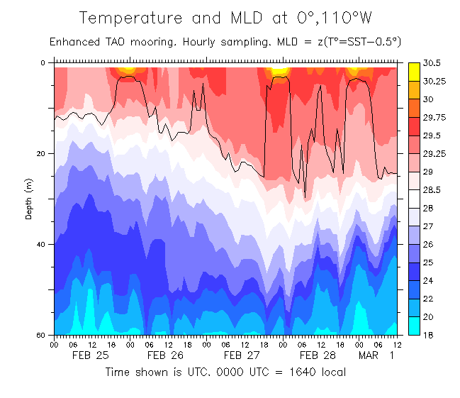
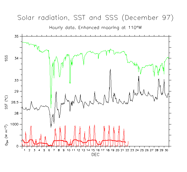
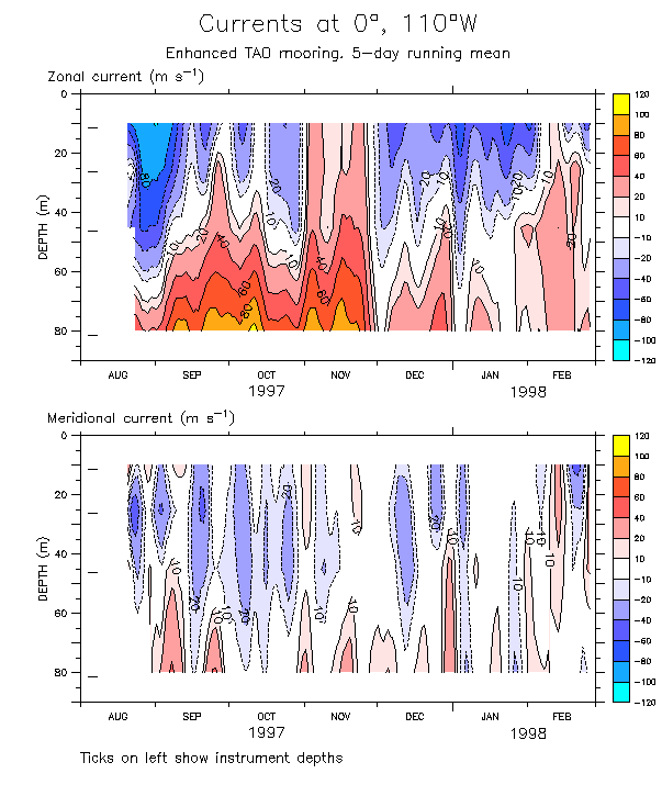
The TAO mooring at 0°, 110°W was enhanced during Aug 97 through Feb 98 by adding miniature temperature recorders (MTRs) to resolve the near-surface profile with a vertical resolution of 5m (Fig 1). The instruments recorded values every 7.5 minutes. This was a pilot study to observe the details of mixed layer depth changes, thought to be a significant influence on the heat balance in this region. The plots show surface temperature and salinity, windspeed, rain rates, near-surface temperature difference (SST-T(5m)) and (satellite) OLR. As it turned out, the deployment occurred during the eastward advance of the 1997-98 El Niño into the east Pacific, which had a major impact on the surface ocean.
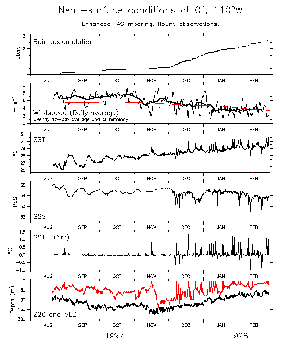
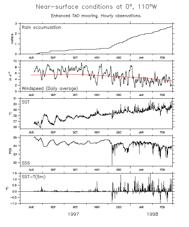
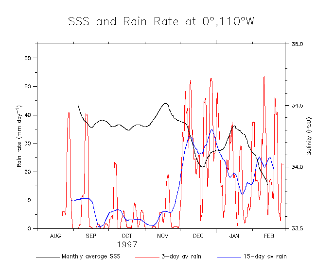
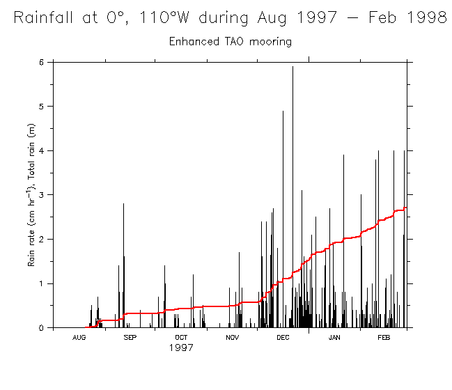
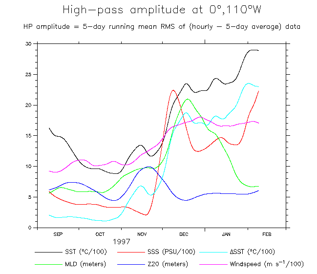
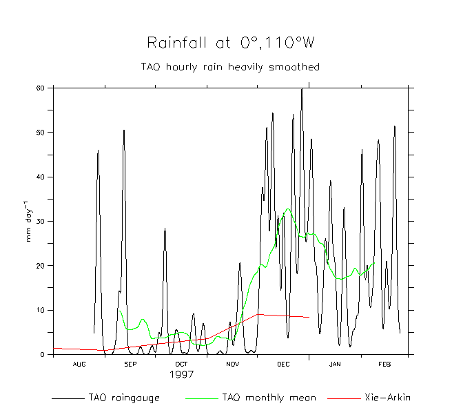
These figures show some preliminary results from these sensors. A major change in the surface conditions occurred at the beginning of December 1997 as the westerly wind anomalies reached this area and SST continued to warm (Fig 1). In general (Fig 2) the windspeed dropped by roughly a factor of two, while OLR fell from pre-event values of about 255 W/m2 to below 240 W/m2, a signature of the extensive convective cloudiness that covered this area. More than 2 meters of rain fell on the mooring during December-February.
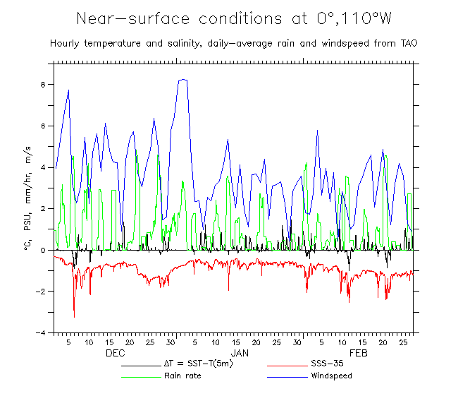
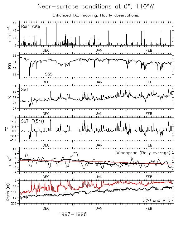
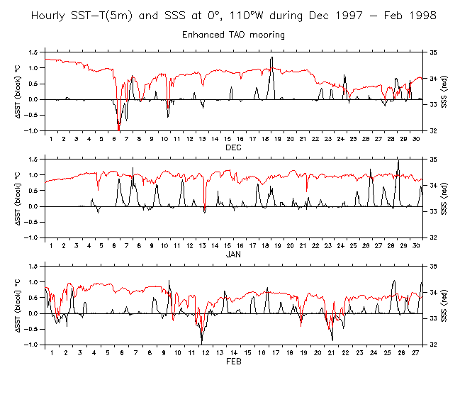
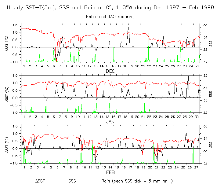
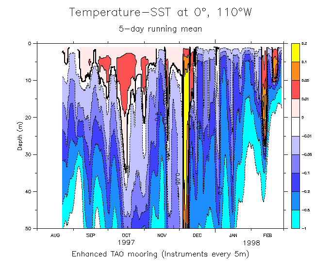
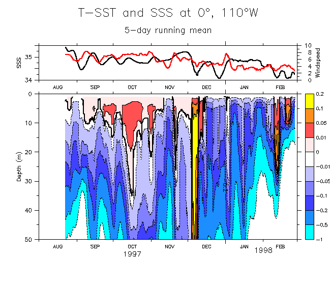
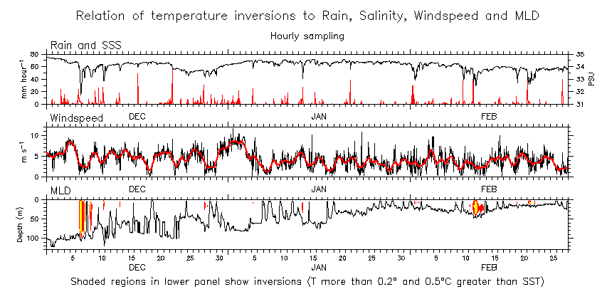
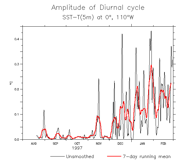
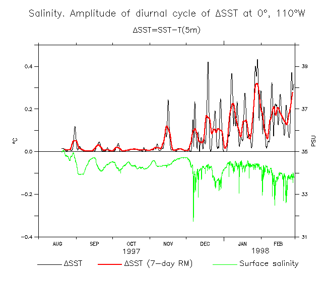
In December 1997, the frequency content of surface salinity and near-surface temperature difference changed from relatively low variability at timescales less than a few weeks to a strong diurnal cycle (Fig 4 or 7). The negative near-surface vertical temperature gradients seen during episodes of low surface salinity (Fig 11) indicates the presence of shallow fresh pools and vertical salinity stratification.
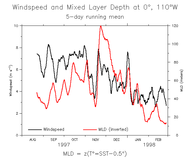
Note the high visual correlation (numbers along shortly) between high wind speed and low near-surface T gradient (Fig 2 or 3 to compare pre- and post-event variability and Fig 6 for detail of westerly wind/heavy rain period). Note the strong diurnal cycle of near-surface T gradient (Fig 8). All these aspects are reminiscent of conditions in the west Pacific warm pool, with one exception: at the time when the surface ocean was warmest, the thermocline shoaled to only 20m depth (Fig 1), far shallower than in the west. (It is worth noting that this timing and relation between SST and thermocline depth is similar to what happened in 1992 (Kessler and McPhaden, Fig 7)).
New main page
Primary paper figures
Secondary paper figures
Checking inversions page
Figure for MLD/Qsw/Z20/Windspeed comparison
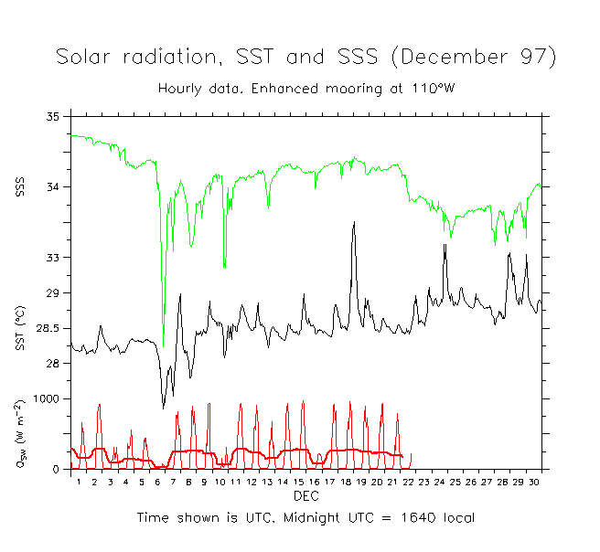
The times shown here are UTC, 7.33 hours ahead of local time at 110°W (midnight UTC = 1640 local).
- Hourly vertical temperature time series Full enhanced temperature data (z,t)
Figures 2-7 show very similar information, differently packaged. These are the various near-surface measured quantities (SST, SST, Rain, Windspeed, Surface currents). Can't make up my mind!
- Near-surface influences during Sep 97-Feb 98 (5-day-average wind)
- Near-surface influences during Sep 97-Feb 98 (as above with just rain, no OLR)
- Near-surface influences during Sep 97-Feb 98 (as above with daily-average wind)
- Near-surface influences during Sep 97-Feb 98 (as above with daily-average sfc current)
- Near-surface influences during the Dec 97-Feb 98 (as above: detail of heavy rain period)
- Near-surface influences during the Aug 97-Feb 98 (6 separate panels)
- Near-surface influences during the Aug 97-Feb 98 (6 separate panels)(incl Z20)
- Near-surface influences during the Aug 97-Feb 98 (6 separate panels)(incl Z20+MLD) (detail Dec 97-Feb 98)
- Near-surface influences during the Aug 97-Feb 98 (5 separate panels)
Here are some more plots showing various details and comparisons of the near-surface terms.
- Hourly SST - T(5m) during Dec 97-Feb 98
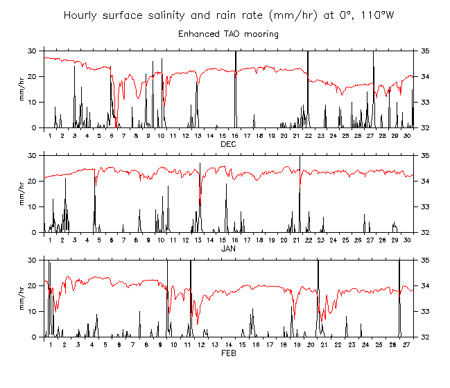
- Hourly SSS and rain during Dec 97-Feb 98
- 3-day average rain and monthly-average SSS
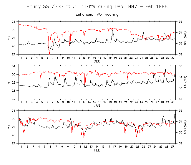
- Hourly SST and SSS during Dec 97-Feb 98
- Hourly SST-T(5m) and SSS during Dec 97-Feb 98
- Hourly SST-T(5m), SSS and rain during Dec 97-Feb 98
- Rain rate and total accumulation during Dec 97-Feb 98
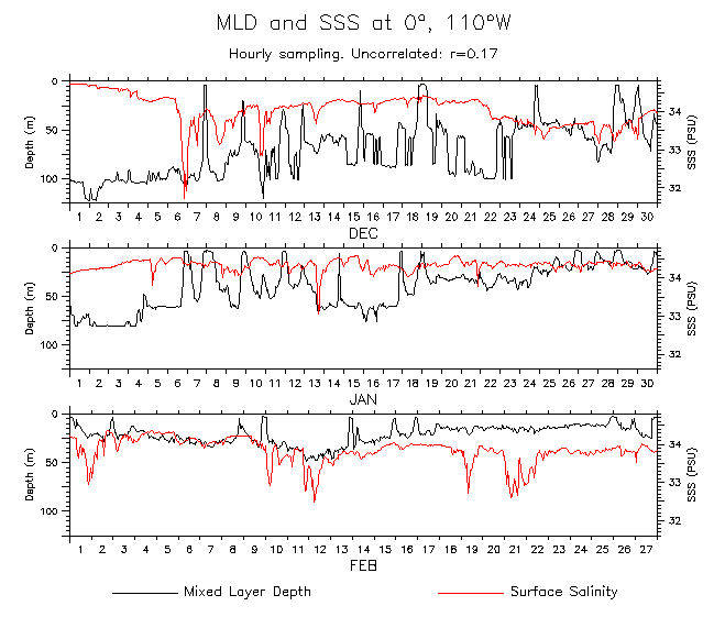
- SSS and MLD during Dec 97-Feb 98 Top 75m only
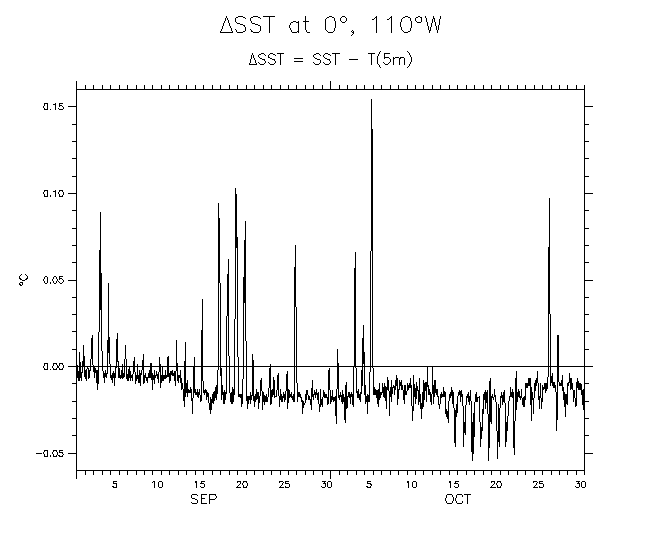
- Delta-SST during Sep-Oct 97
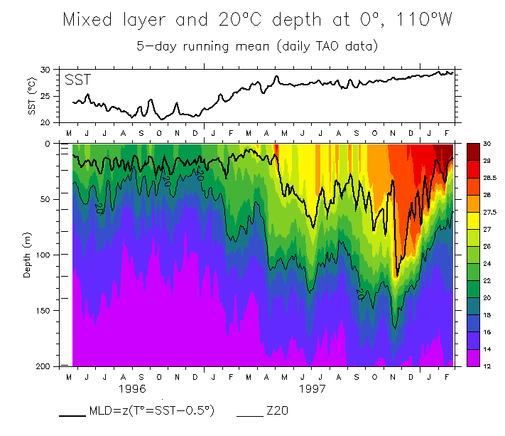
- SST, Temperature and Mixed Layer Depth (5-day RM)
- Temperature minus SST (5-day RM)
- Temperature minus SST (detail of upper 50m) (5-day RM). Temperature minus SST (with SSS)
- Inversion at 110°W? (Detail of hourly time series). (Detail for a few days in October)
- Temperature, SSS and MLD (5-day RM)
- Temperature, Windspeed and MLD (5-day RM) Extended period from daily data
- Temperature, SSS, Windspeed and MLD (5-day RM)
- SST, SSS, Windspeed and MLD (5-day RM)
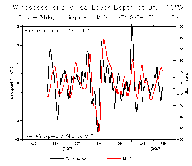
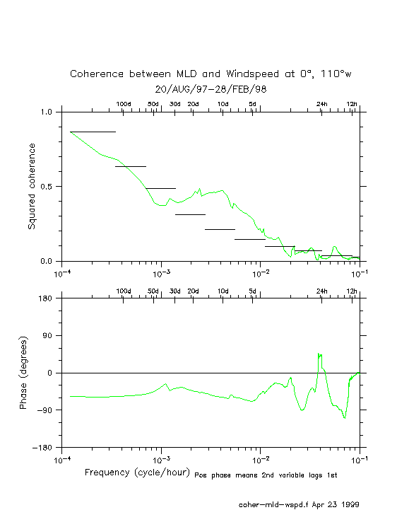
- Windspeed and MLD (5-day RM) Windspeed and MLD (5-31 BP) Coherence
Combined low and bandpass
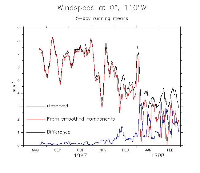
- Windspeed comparison: what is due to 5DRM smoothed winds?
- Distribution of hourly windspeed
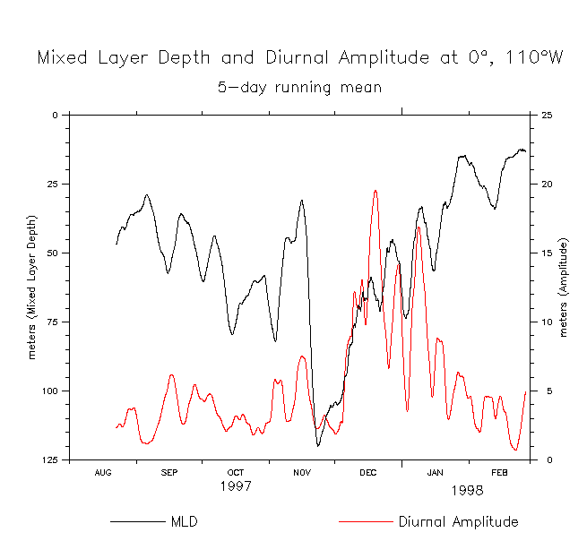
- Hourly and daily MLD
- Diurnal cycles of MLD in monthly bins
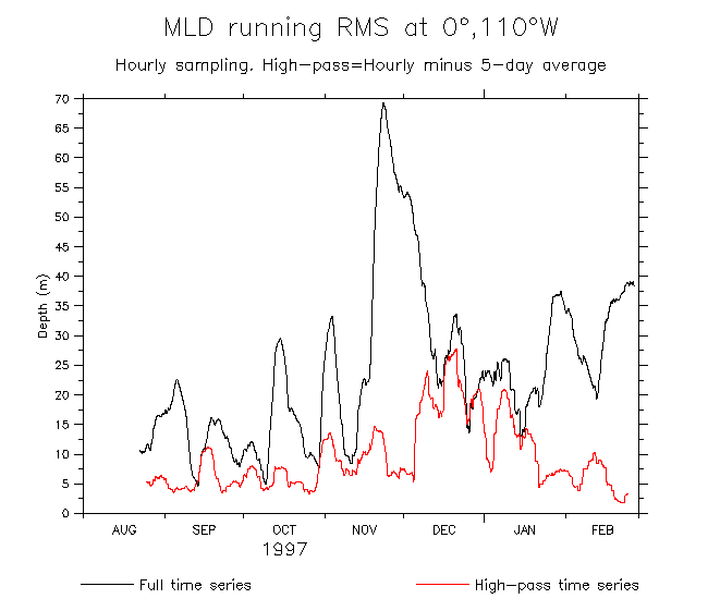
- Running RMS of MLD (full and high-pass)
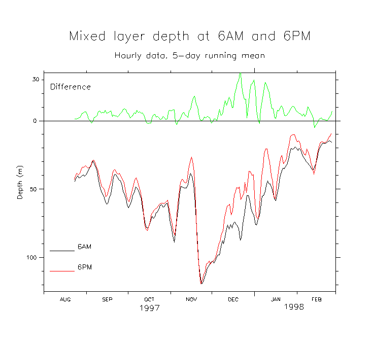
- MLD at 6Am and 6PM
- High-pass amplitude of SST, DelSST, SSS, MLD, Z20, Windspeed Same thing in 6 panels
- MLD deepening in November (detail)
- Winds and MLD during the big shoaling-deepening events of mid-Nov
- Amplitude of diurnal cycle of MLD by cdmod
- T(z) and MLD (Dec-Feb) Detail last few days of Feb (compare CTD)
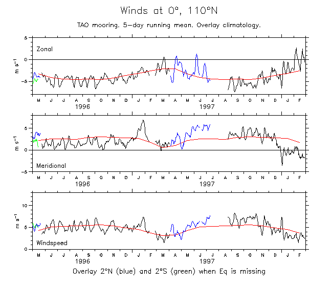
- Wind (zonal, meridional,speed) at 110°W. Overlay climatology Show filling with 2°N and 2°S
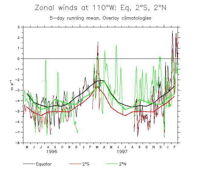
- Winds at Eq, 2°N and 2°S, with climatologies: Zonal Meridional Windspeed
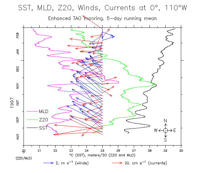
- SST, Z20, MLD, winds and currents, 5-day running mean
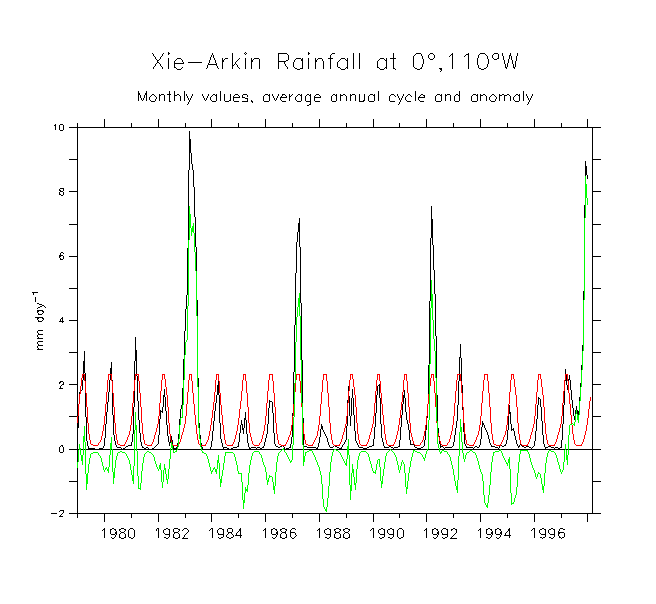
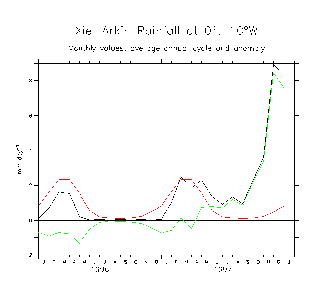
- Xie-Arkin rainfall 1979-98 1996-97 Aug 97-Feb 98 (with TAO)
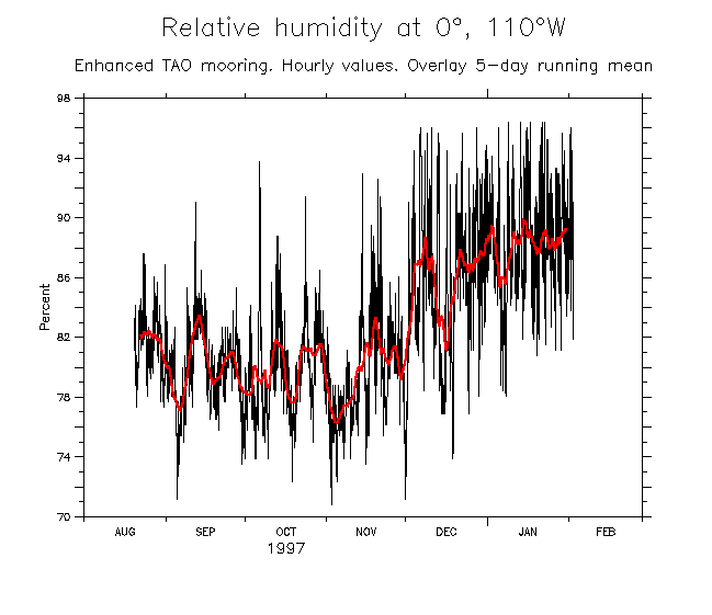
- Humidity
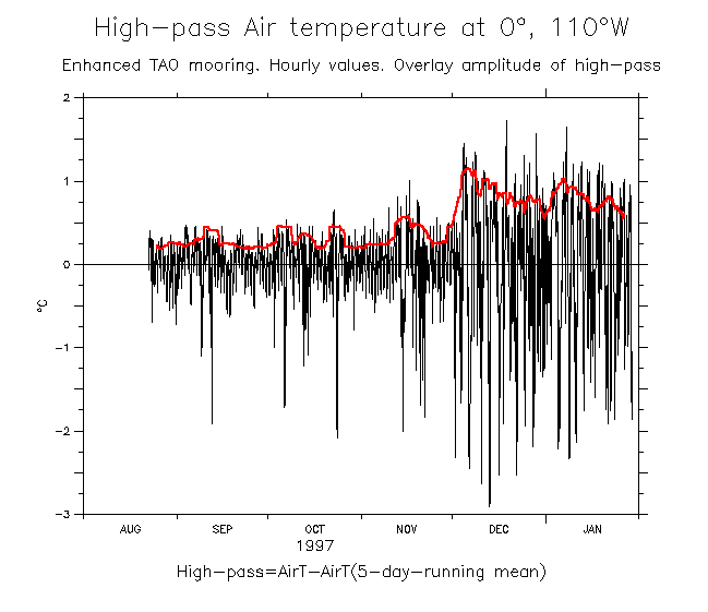
- Compare air-T and SST Air-T minus SST High-pass Air-T amplitude
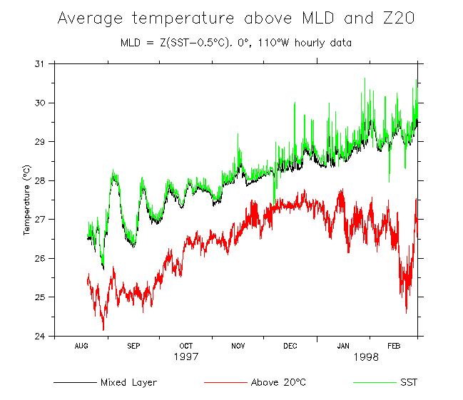
- Compare avT in ML vs above Z20: Time series Difference from SST
Some SSS plots and salinity-related things:
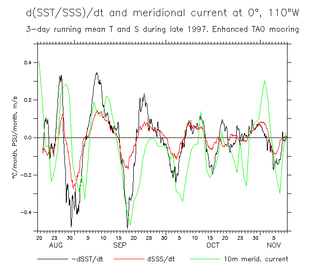
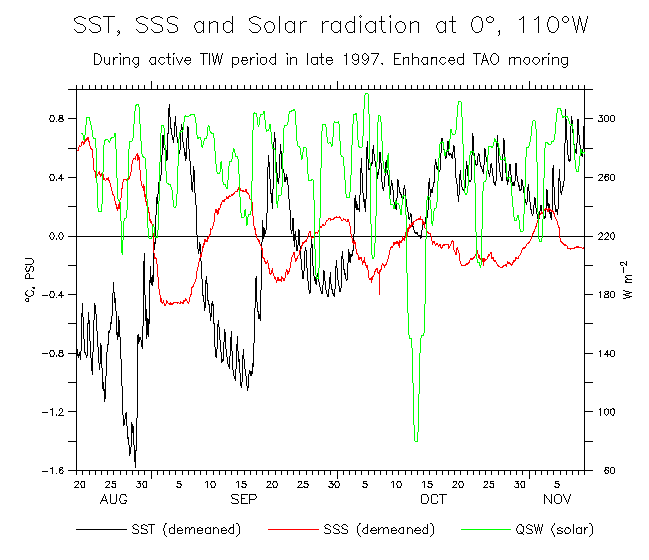
- Variations during the active TIW period (Aug-Nov 1997): d(SST)/dt, d(SSS)/dt, V, SST, SSS, QSW
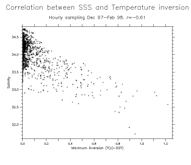
- Correlation of SSS and T inversions
- QSW-SST-SSS Dec 97 Better label
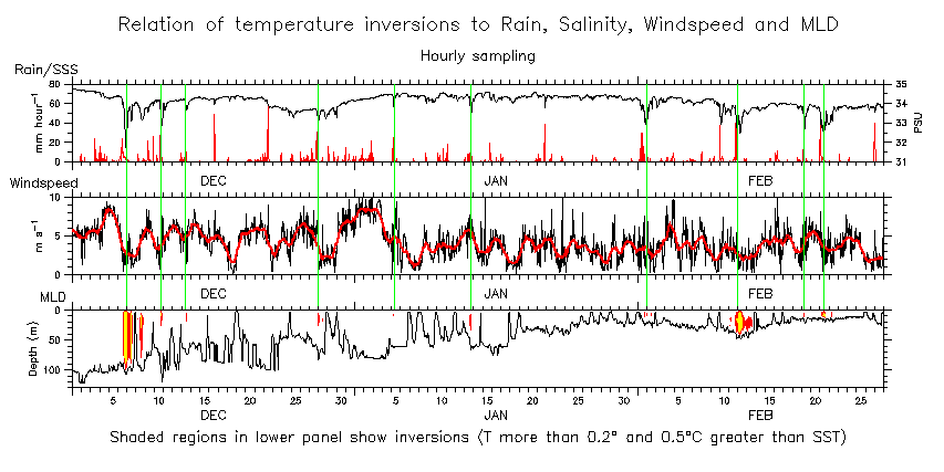
- SSS, rain, windspeed, MLD, inversions (3 wide panels) Verticals show inversion dates
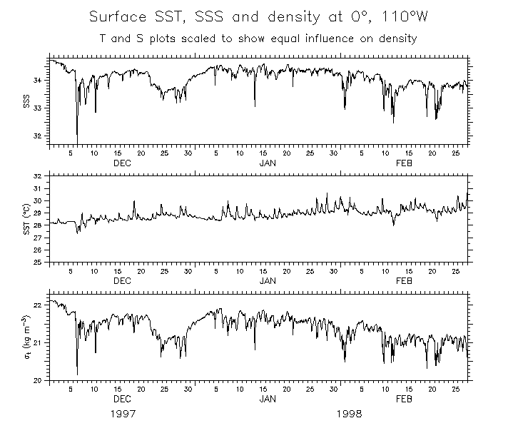
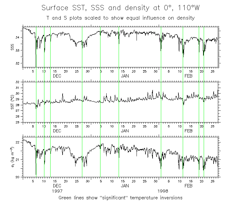
- Surface SST, SSS, Sigma-t (scaled for equal effect) (Dec 97-Feb 98) Verticals show inversion dates
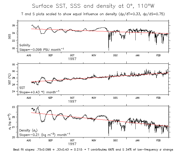
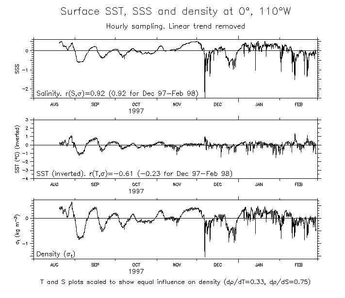
- Surface SST, SSS, Sigma-t (scaled for equal effect) (Aug 97-Feb 98) Linear trend removed
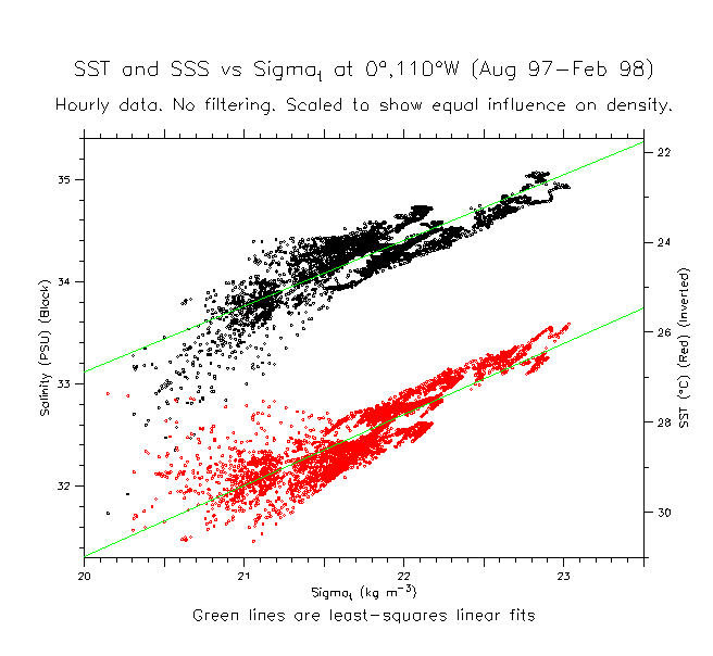
- Scatter diagram of surface SST, SSS, Sigma-t (scaled for equal effect) (Aug 97-Feb 98) Linear trend removed
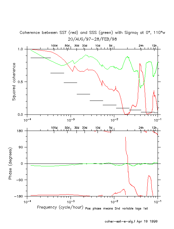
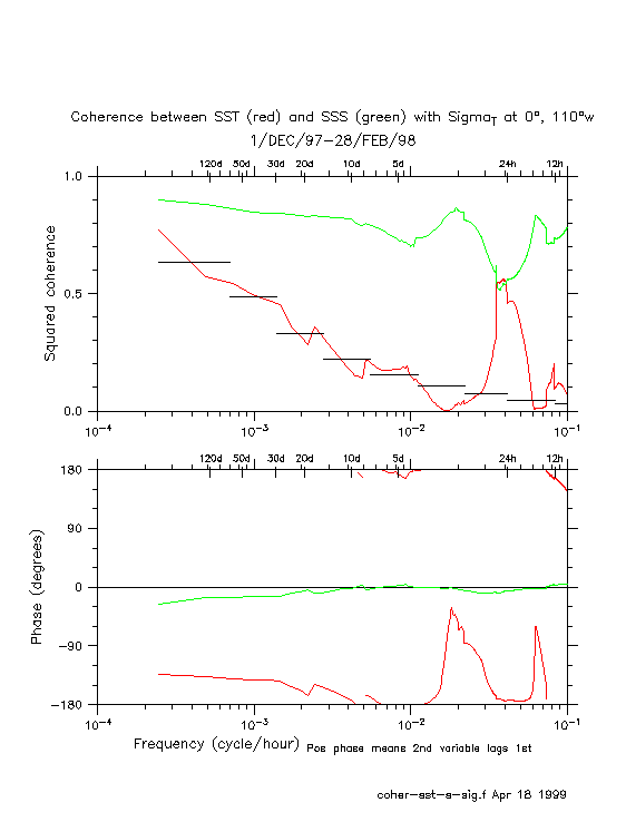
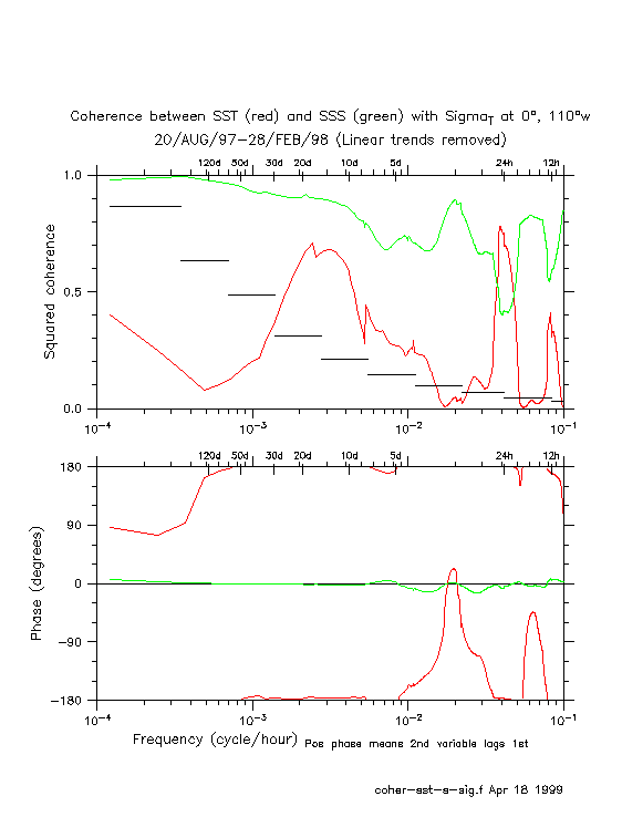
- Coherence of SST and SSS with Sigma-T (Aug 97-Feb 98) Dec 97-Feb 98 Linear trend removed
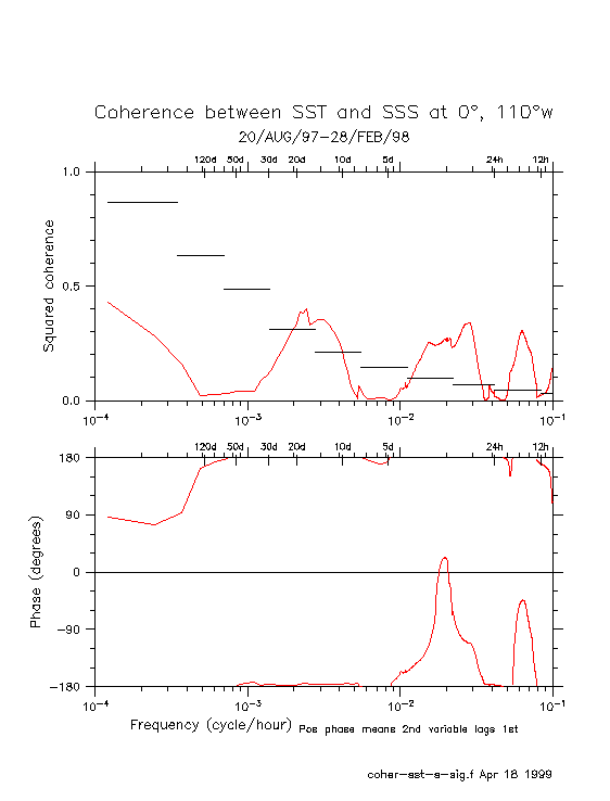
- Coherence of SST vs SSS (Aug 97-Feb 98)
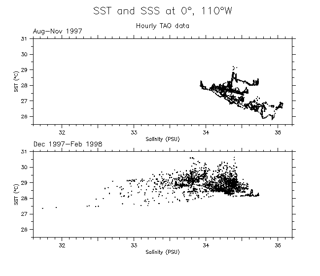
- Surface T/S
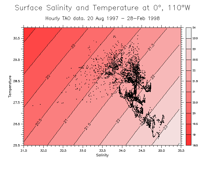
- Surface T/S over sigma-t
- Surface Delta-T vs S
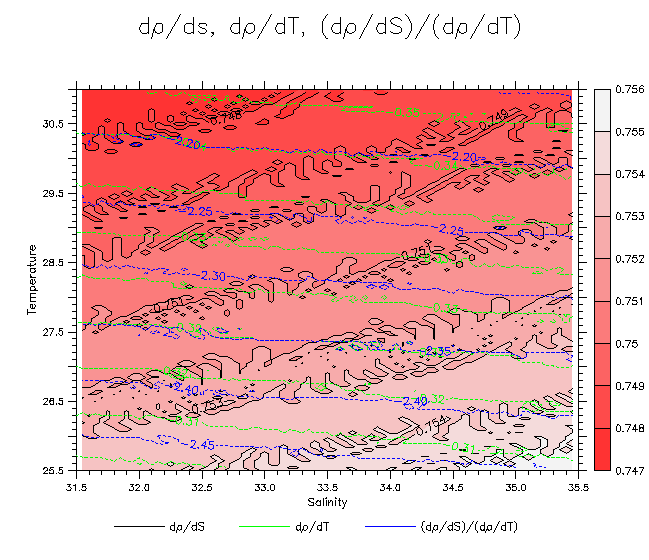
- d(sigma)/dS, d(sigma)/dT
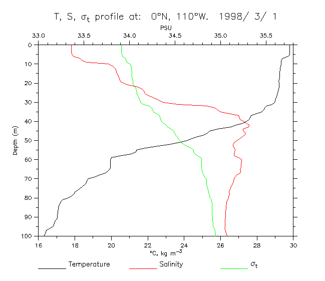
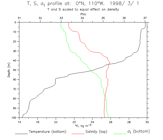
- Profile at 0°, 110°W on 1 Mar 1998 Scaled to equalize effect of T and S
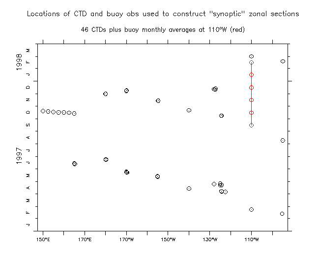
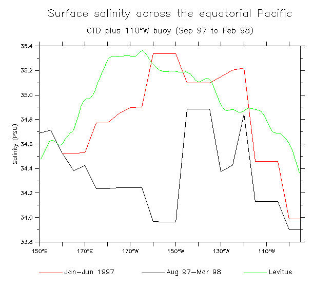
- A few plots using CTDs to make zonal quasi-synoptic sections: The data used to make the two sections SST SSS
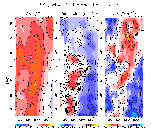
- SST, zonal wind and OLR along the equator. Anomalies
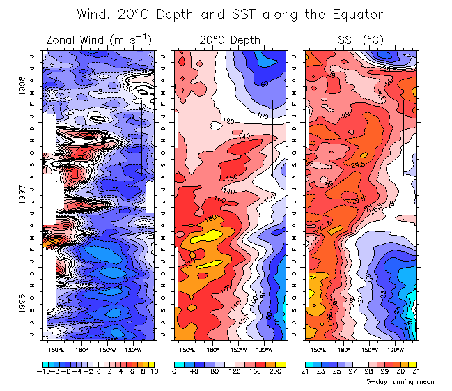
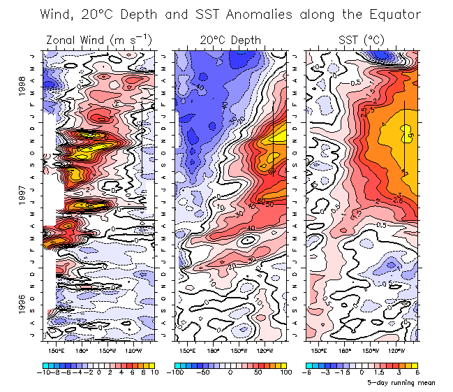
- Zonal wind, Z20 and SST along the equator (96-98). Anomalies
Plots showing an extended period (May 1996-Feb 1997)
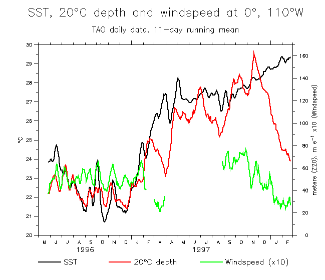
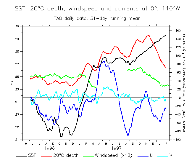
- SST, Z20 and Windspeed Throw the currents in too, why dontcha?
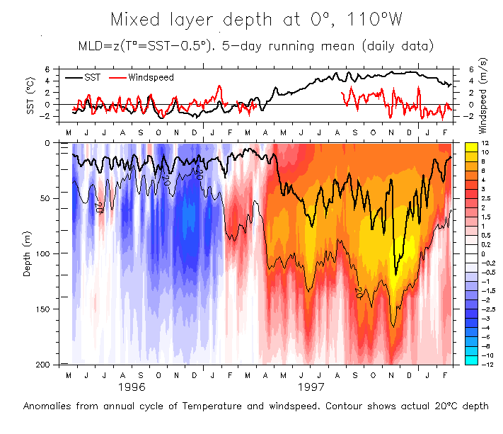
- T(z) with MLD, SST and windspeed
Anomalies from annual cycle
Another version (better labels).
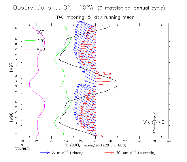
Include climatologies
- T and u,v 31-day running mean (May 96-Feb 98) Anomalies from climatology
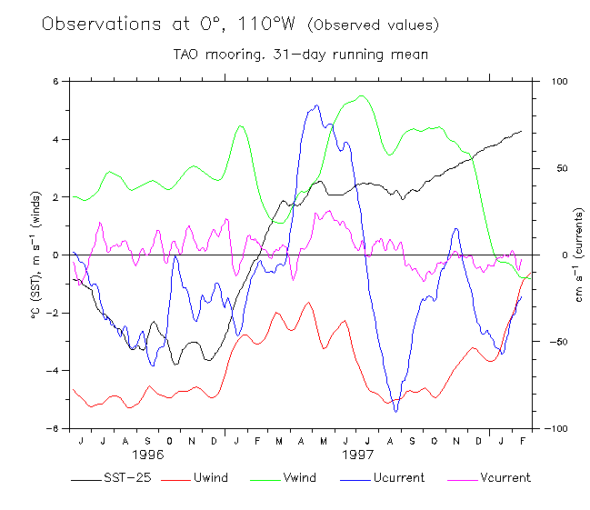
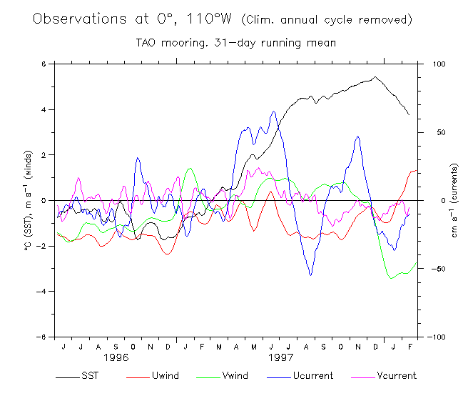
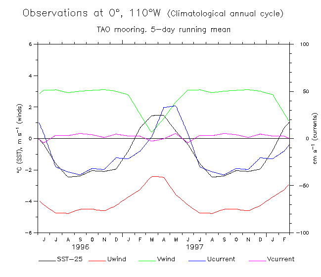
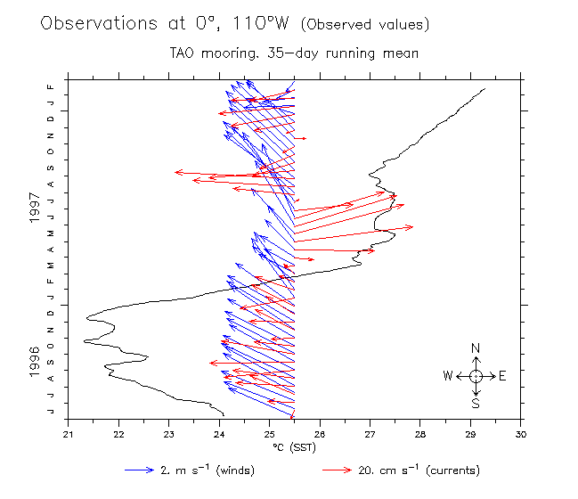
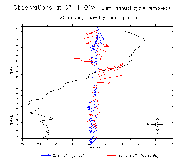
- SST, surface u,v, winds during May 96-Feb 98 Climatological annual cycle removed Just the climatological annual cycle
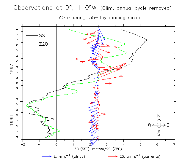
- Just like above but winds and currents shown as vectors: Obs De-clim Clim
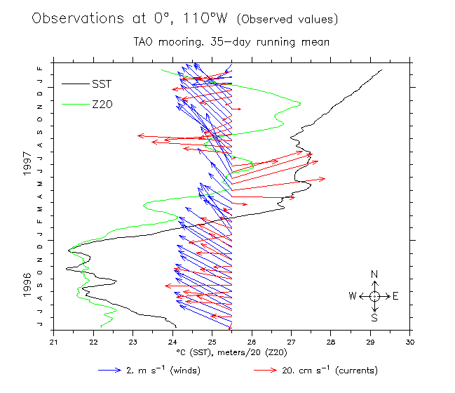
- Just like above but 20°C depth overlaid!: Obs De-clim Clim
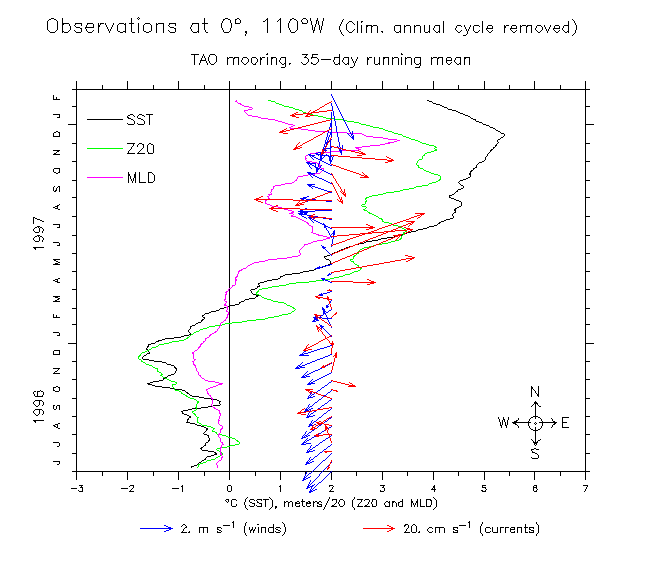
- Just like above but mixed layer depth overlaid too!: Obs De-clim Clim
- SST, Z20, MLD and windspeed line plot
- Zonal wind, Z20 and SST along the equator (96-98). Anomalies
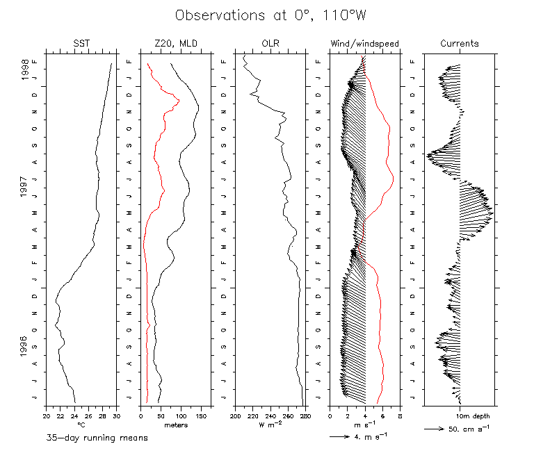
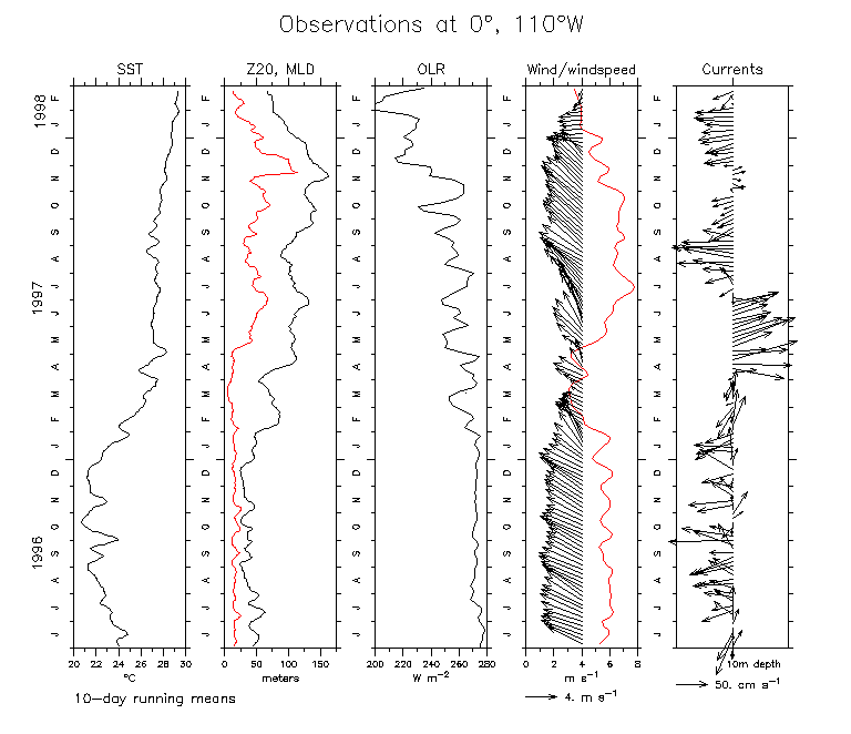
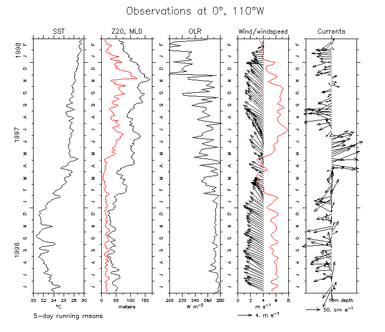
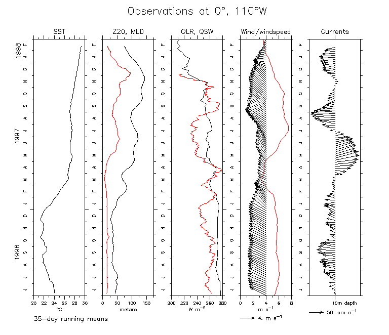
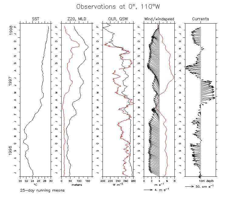
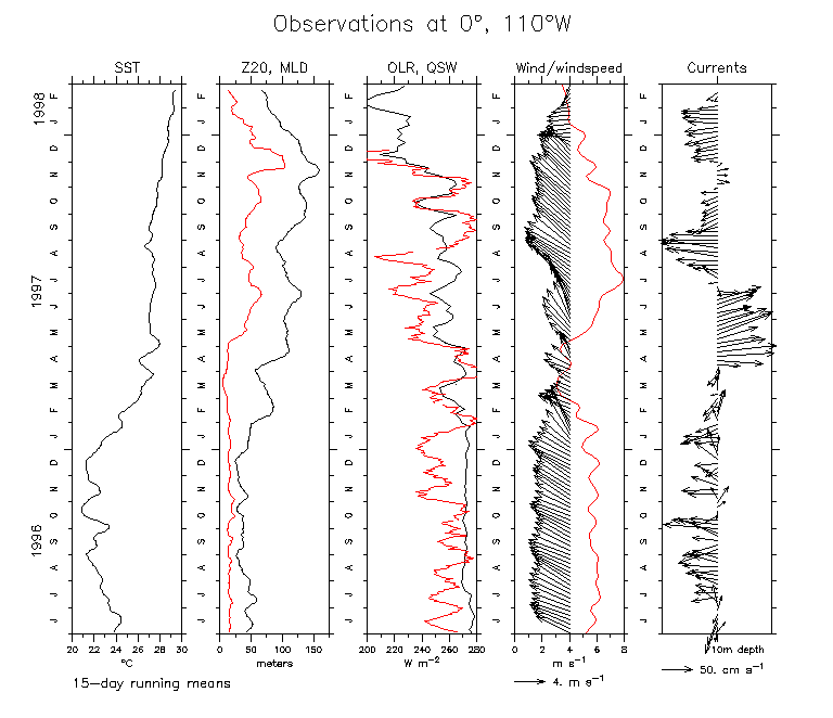
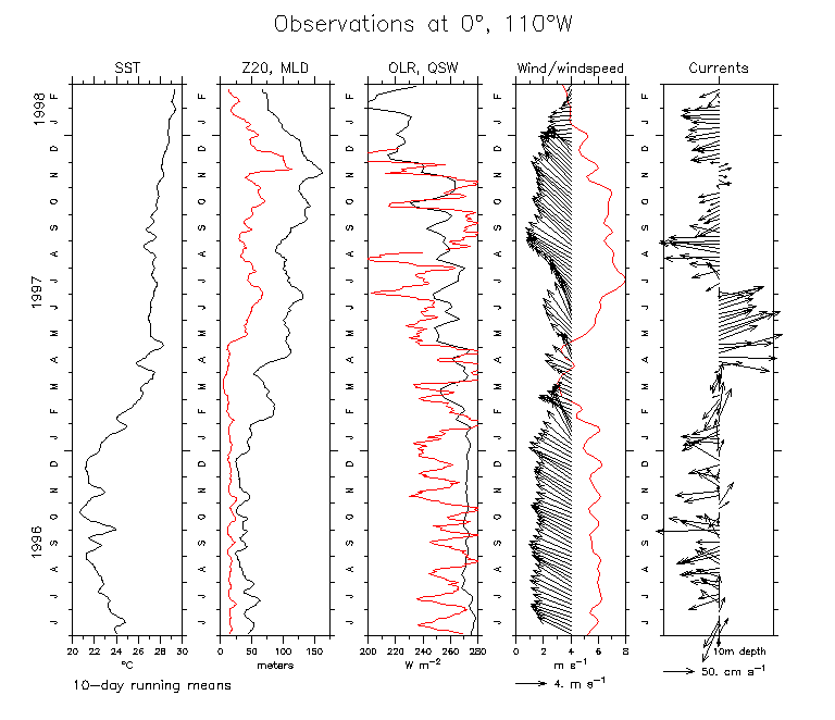
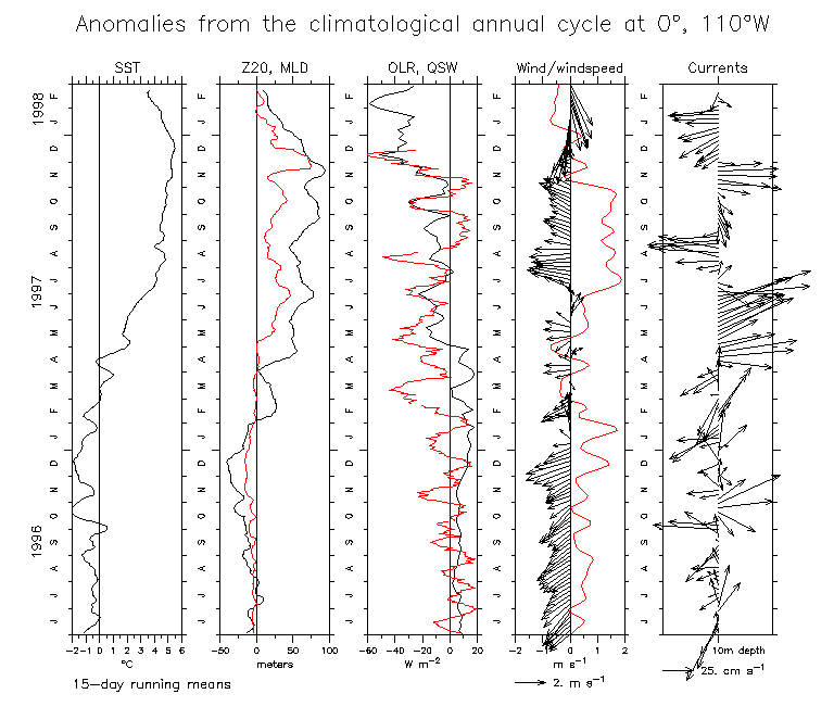
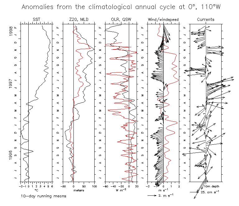
- Observations of SST, Z20, MLD, OLR, Winds and windspeed, Currents at 0°,110°W
35 day running mean 25 day 15 day 10 day 5 day (Add QSW: 35 day 25 day 15 day 10 day)
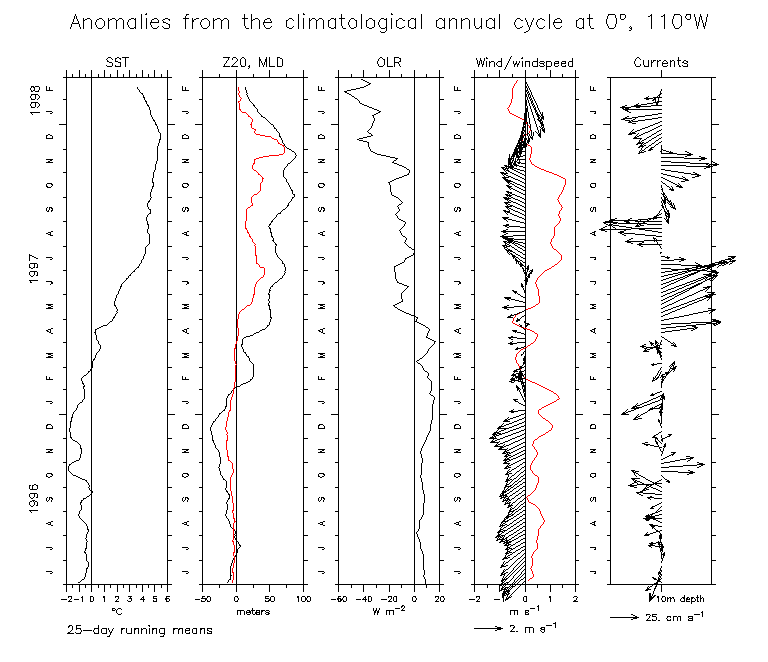
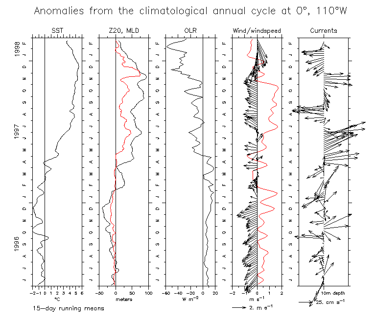
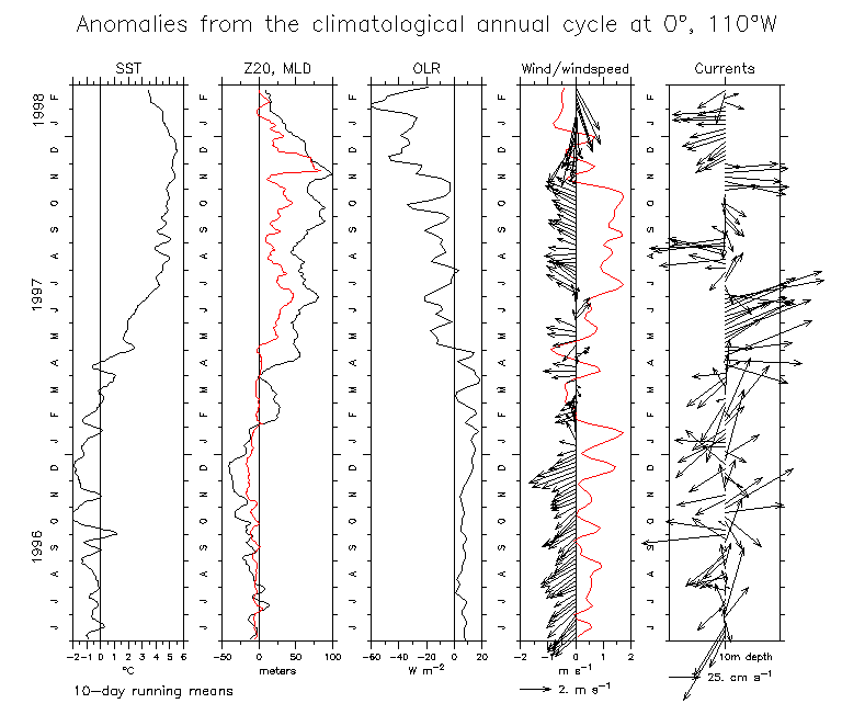
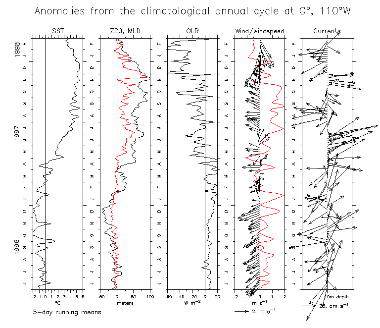
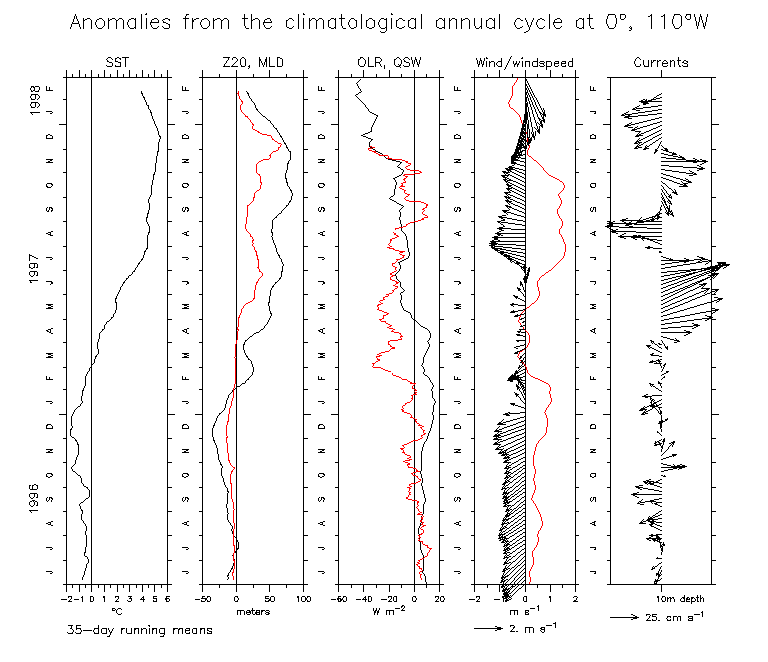
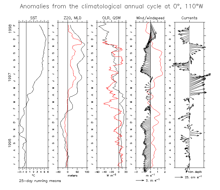
- Anomalies from the annual cycle of SST, Z20, MLD, OLR, Winds and windspeed, Currents at 0°,110°W
35 day running mean 25 day 15 day 10 day 5 day (Add QSW: 35 day 25 day 15 day 10 day)
Figures showing results from complex demodulation
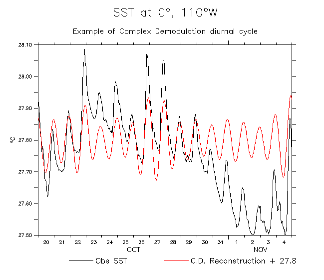
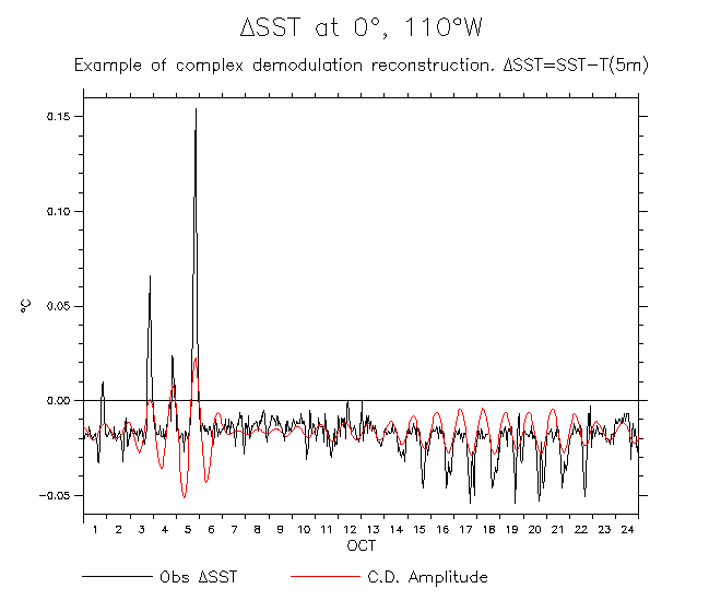
- Example showing reconstruction of SST from C.D. diurnal cycle
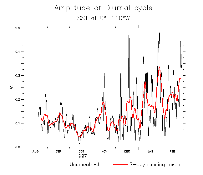
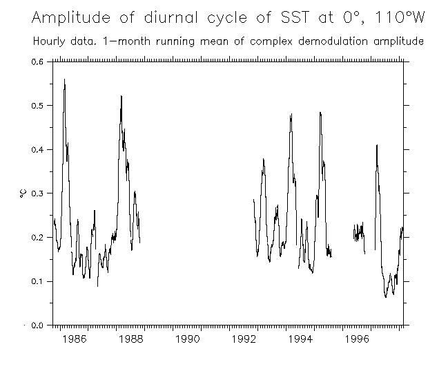
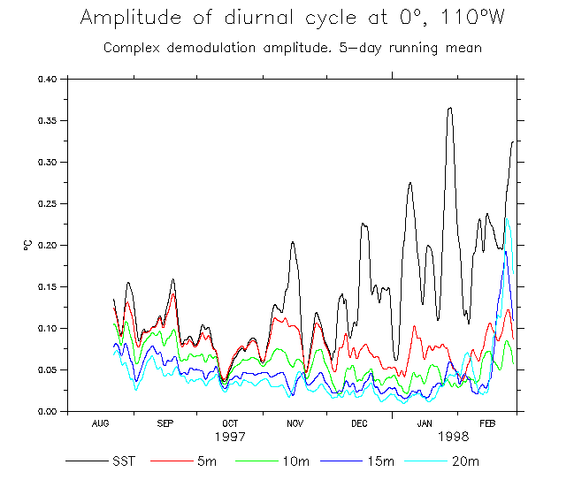
- Amplitude of SST diurnal cycle
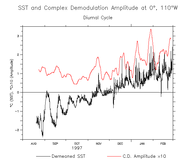
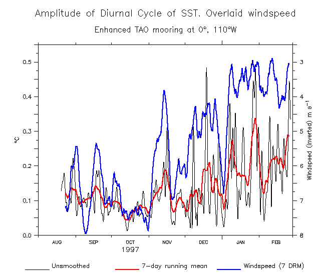
- Amplitude of SST diurnal cycle (overlaid SST) (Overlaid windspeed)
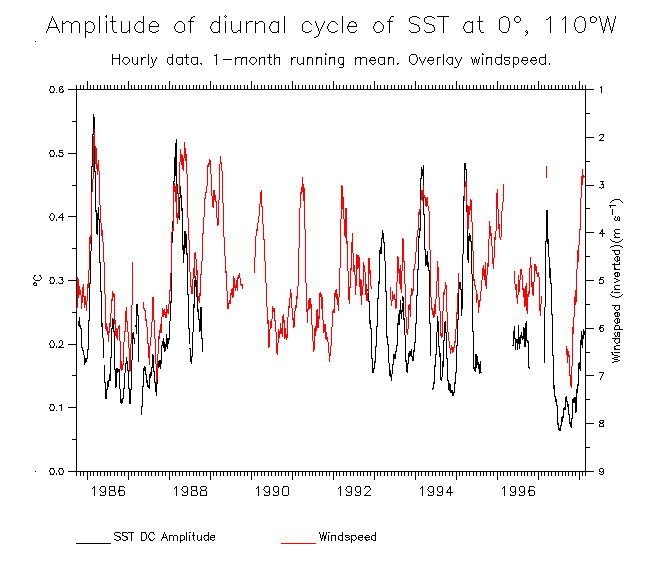
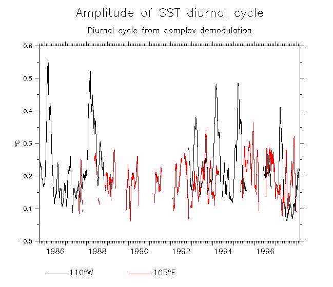
- Amplitude of SST diurnal cycle during 1986-98 Overlay windspeed
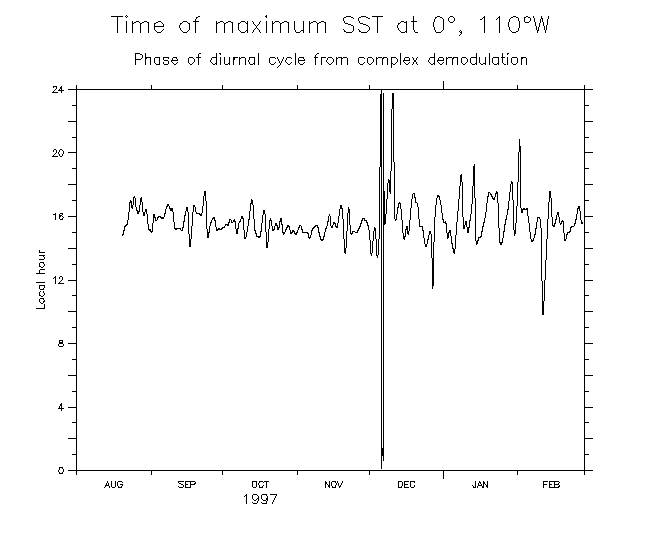
- Phase of SST diurnal cycle
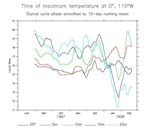
- Diurnal cycle as a function of depth (SST to 20m): Phase Amplitude Actual time series in Jan 98
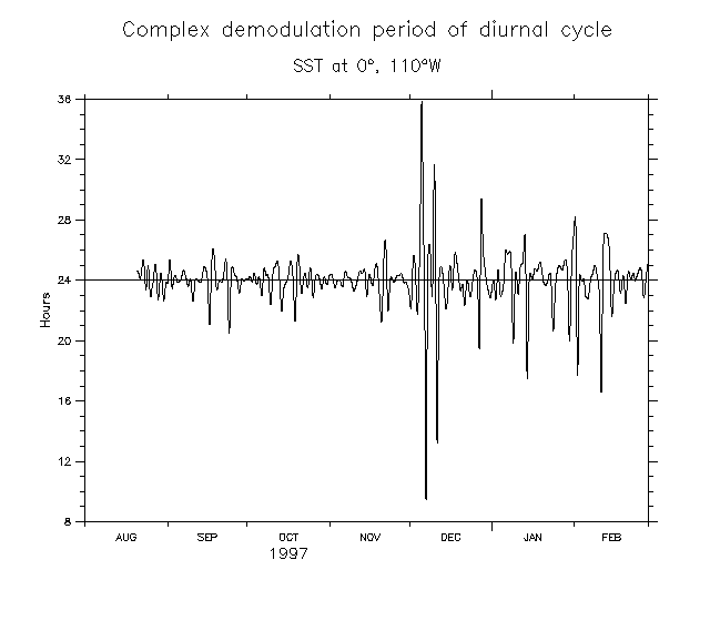
- Period of SST diurnal cycle
- Example showing reconstruction of Del-SST from C.D. diurnal cycle (small amplitude)
- Another example (larger amplitude)
- Amplitude of Del-SST diurnal cycle
- Amplitude of Del-SST diurnal cycle with overlaid surface salinity
(overlaid Del-SST) (overlaid windspeed)
- Phase of Del-SST diurnal cycle
- Windspeed and Del-SST HP AMPLITUDE Coherence of windspeed with Del-SST HP AMPLITUDE
- Rain rate and amplitude of SSS diurnal cycle
- Use long-term hourly records at 110°W and 165°E:
Phase Amplitude
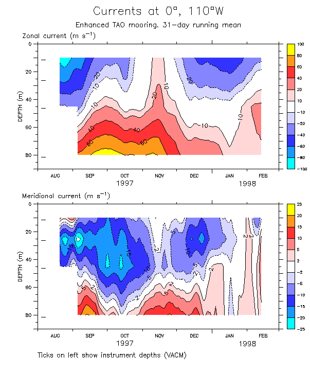
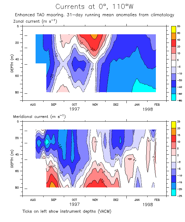
Figures showing currents at 0°, 110°W
Currents are daily averages from VACMs. The "surface" currents are at 10m depth.
- 1980-97 annual cycle climatology of u and v
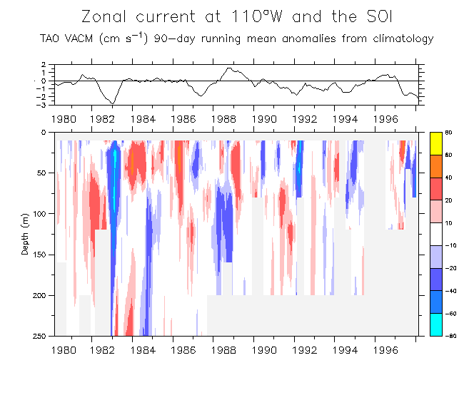
- SOI and u 90-day running mean anomalies (1980-98)
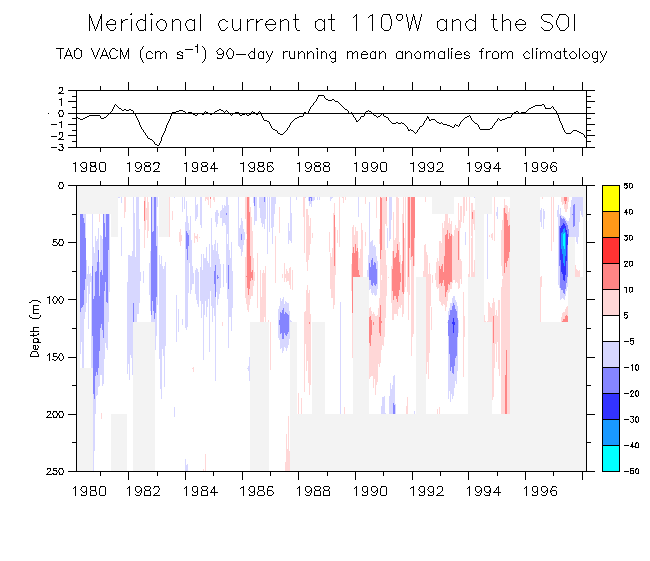
- SOI and v 90-day running mean anomalies (1980-98)
- u and v 5-day running mean (Aug 97-Feb 98)
- u and v 31-day running mean (Aug 97-Feb 98)
- u and v 31-day running mean (anomalies from climatology) (Aug 97-Feb 98)
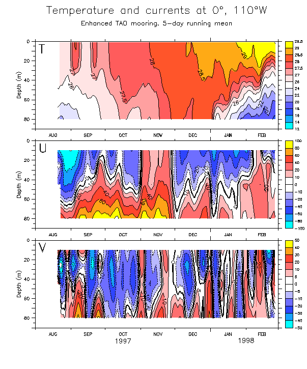
- 5-day running mean T and U during 97-Feb 98
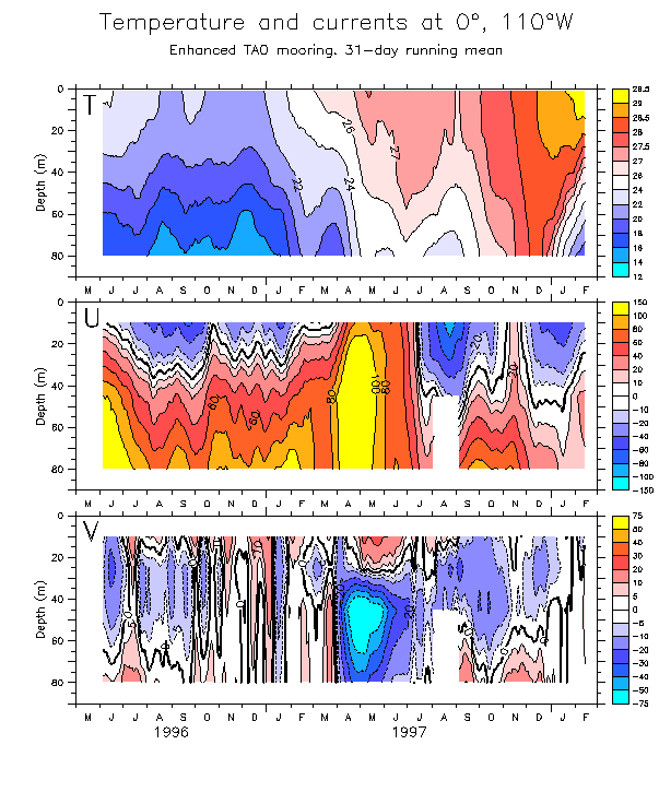
- T and u,v 5-day running mean (Aug 97-Feb 98)
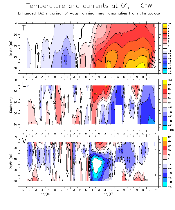
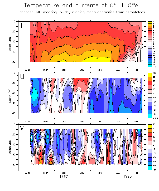
- T and u,v 5-day running mean (anomalies from climatology) (Aug 97-Feb 98)
- Like above plots but 31-day running mean over May 96-Feb 98 Anomalies from climatology
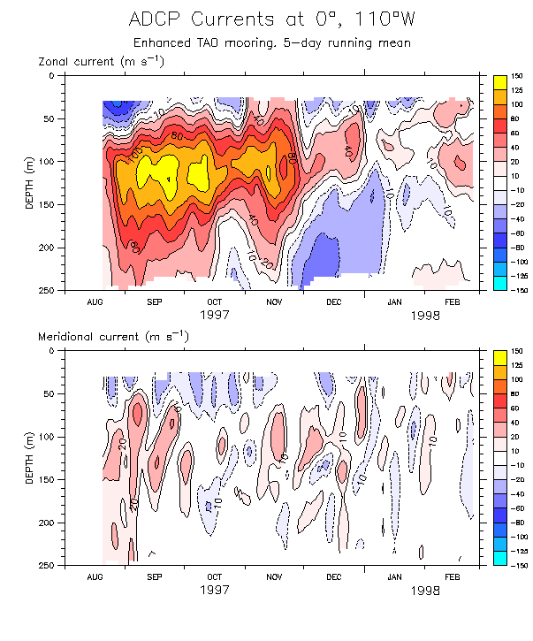
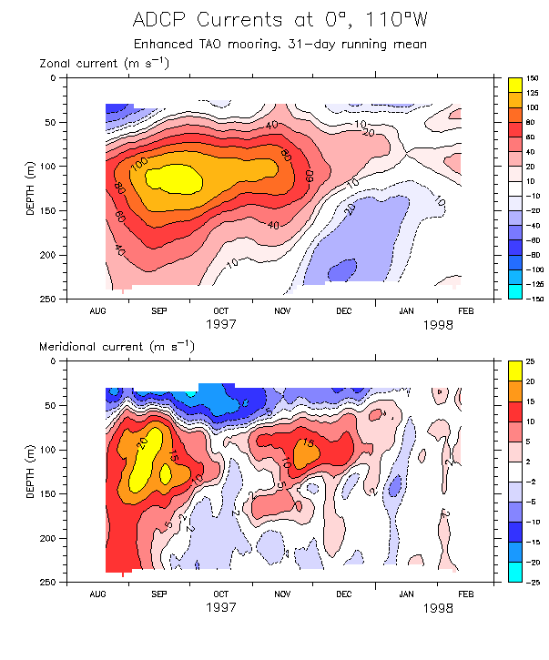
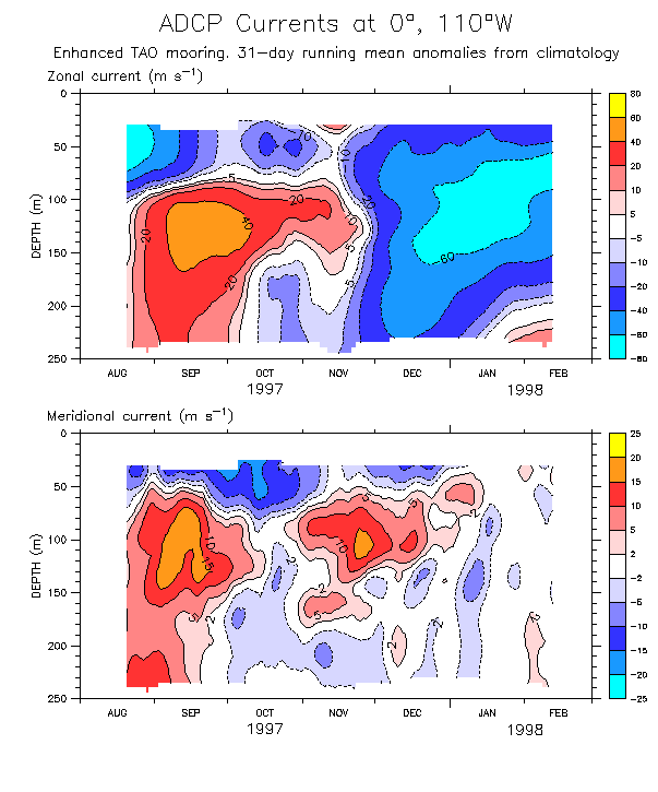
Currents from ADCP. Include deeper than 80m.
- u and v 5-day running mean (Aug 97-Feb 98)
- u and v 31-day running mean (Aug 97-Feb 98)
- u and v 31-day running mean anomalies from (ADCP) climatology(Aug 97-Feb 98)
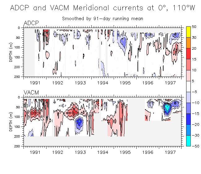
Compare ADCP and VACM current during the overlap period (1991-97).
- Zonal Meridional
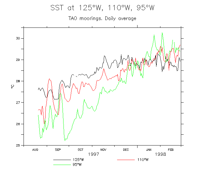
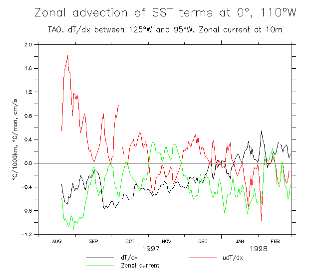
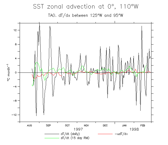
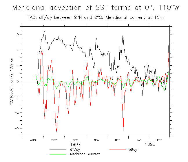
Stuff related to zonal/meridional advection during Aug 97 - Feb 98
- SST at 125°W, 110°W, 95°W
- Zonal advection terms at 110°W
- Zonal advection comparison at 110°W
- SST at 110°W, 2°N, 0°, 2°S
-
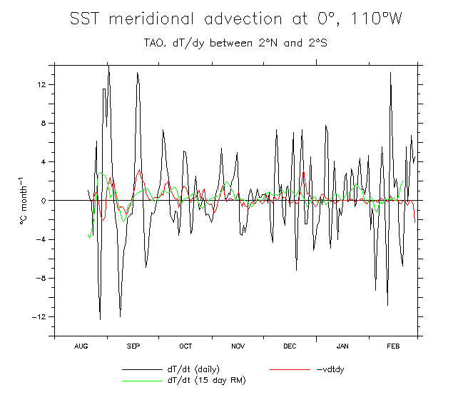
Meridional advection terms at 0°, 110°W
- Meridional advection comparison at 0°, 110°W (centered 2°N-2°S derivative)
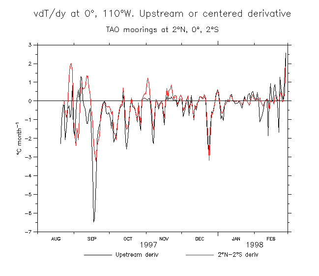
- Compare vdT/dy using upstream or centered differencing
- Meridional advection comparison at 0°, 110°W (upstream differencing)
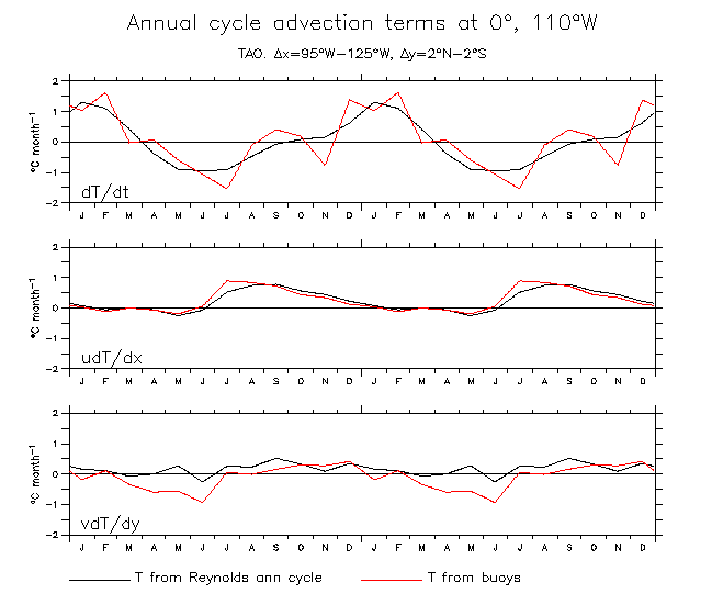
- Annual cycle advection terms at 0°, 110°W
- Advection terms at 0°, 110°W (31-day RM, Full and de-clim) Extend plot back to Nov 96
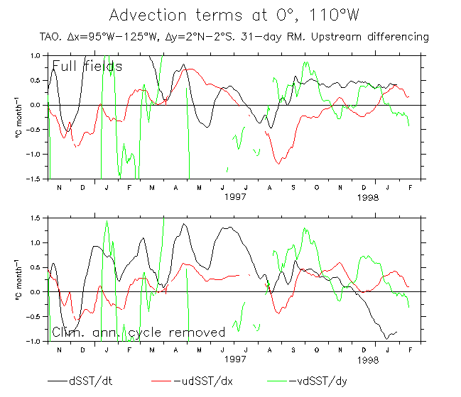
- Advection terms at 0°, 110°W (5-day RM)
Some checks on the hourly data.
Note that time in these plots is UTC (midnight UTC = 1640 local).
According to our expert in these things (Paul Freitag) the differences are probably due to the different SST sensors and their sampling rate. SST1 is a spot sample every 10 minutes, with the time stamp at the end of the hour, e.g., the value marked, say, 1500, is the mean of those at
1410, 1420, 1430, 1440, 1450 and 1500. SST2 is a spot sample
every 7.5 min, with the time stamp at the beginning of the
hour, e.g., the value marked 1500 is the mean of those at
1500, 1507, 1515,...1552.
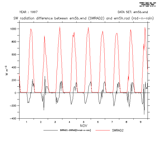
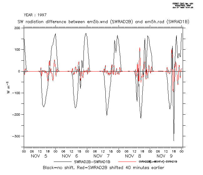
The SWR diurnal difference is due to timing. The two
time series are from the same sensor. In the em5b.wnd file, the
sample marked 1500 is from measurments at 1417-1423, 1437-1443, and
1457-1503. In em5h.rad, 1500 is from 1457-1503, 1517-1523, and
1537-1543.
- Difference between SST from em5b.wnd and em5h.001
- Difference between SW radiation from em5b.wnd and em5h.rad
- Difference between SW radiation from em5b.wnd and em5h.rad with 40-minute timeshift
More to follow ...