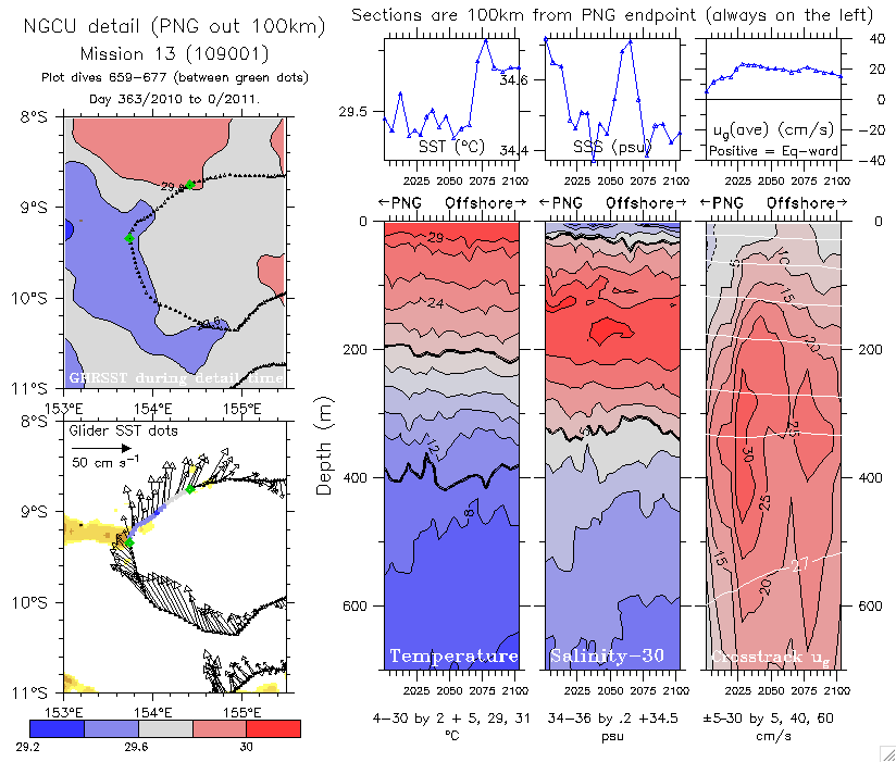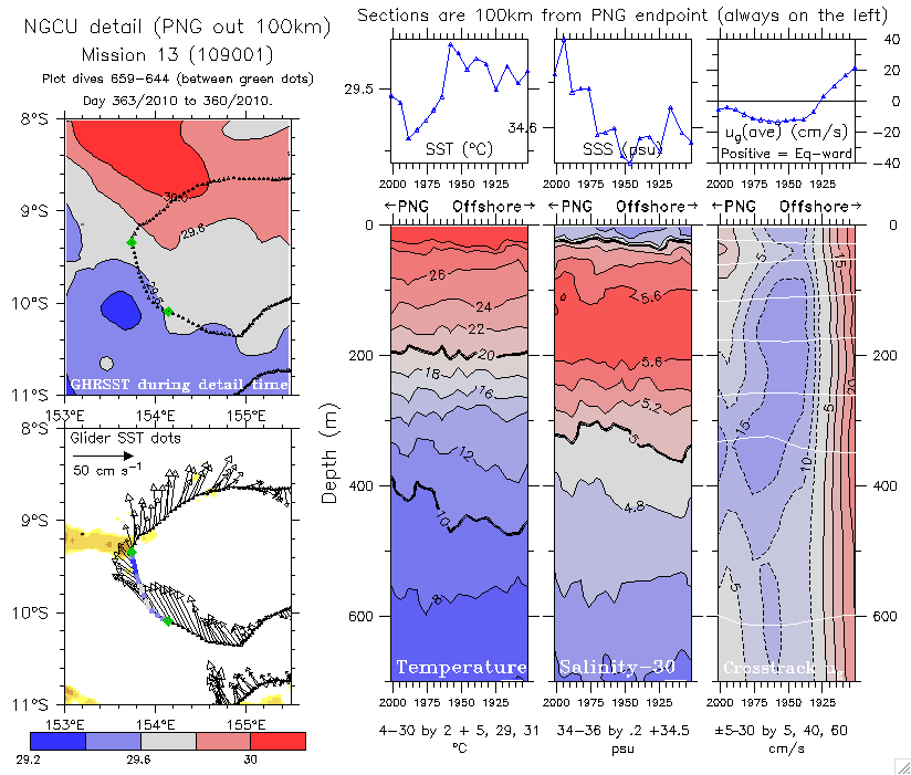
All sections are from the PNG coast (BudiBudi Island) out 100km.
In all plots the coast is on the left, and positive values of u are equatorward. T and S are unfiltered.
Left-side panels show the GHRSST (satellite) during the period of the 100km section (3-7 days) and the vector-average current and SST from the glider.

