The far eastern Pacific

The far eastern Pacific


  1. AMIP monthly maps:
    1. Clouds:   Whole atmos     PBL     High     Low     Middle     Convective
    2. Latent heat flux
    3. PBL height
    4. Sfc pressure
    5. Vector winds:  Winds     Anomalies

  2. CMIP monthly maps:
    1. Clouds:   Whole atmos     PBL     Low    
    2. Latent heat flux
    3. PBL height
    4. Sfc pressure
    5. Vector winds:  Winds
    6. Compare AMIP and CMIP vector 10m winds
    7. Sfc pressure gradient

  3. OMIP monthly maps:
    1. Ocean currents:  5m  15m  25m  35m  45m  55m  65m  75m  85m  95m  105m

  4. Monthly maps of SST: AMIP (Reynolds forcing)     OMIP     CMIP

  5. Compare CMIP annual cycle with AMIP/OMIP 2001 solutions at 88°-83°W:
    1. AMIP-CMIP:  Tauy     10m v-wind
    2. OMIP-CMIP:  SST     d(SST)/dy
    3. OMIP-CMIP:  5m v-current

  6. Compare component and coupled models with observations.
    ("Observations" means the forcing of the other component model)
    1. (y,t) plots: (88°-83°W, 5°S-5°N):
      1. SST (OMIP and CMIP Ocean):  SST     d(SST)/dy
      2. AMIP and CMIP Atmosphere:  Tau-y
      3. ISCCP, AMIP and CMIP:  Low clouds
    2. Time series of Obs, forced and coupled models at 1.5°S-1.5°N, 88°-83°W:   SST     Low cloud     Tauy
    3. Clouds:
      1. Compare each height of clouds among realizations:  Low    Middle    High
      2. Compare different height clouds within each realization:  ISCCP    AMIP    CMIP

  7. What is the relation between winds and SST gradient? Preliminary work:
    1. Checking the annual harmonic of Quikscat winds for 2001 only vs 1999-2009)
      1. 1 cpy harmonic:
        u:   Amp and phase     Vector harmonics (overlay)
        v:   Amp and phase     Vector harmonics (overlay)     Difference
      2. 2 cpy harmonic:
        u:   Amp and phase     Vector harmonics (overlay)
        v:   Amp and phase     Vector harmonics (overlay)
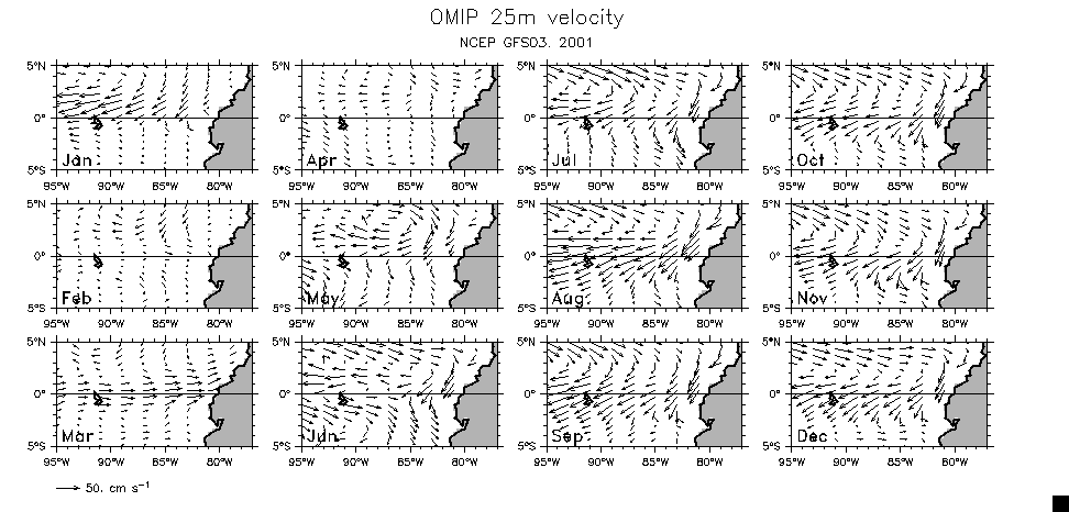
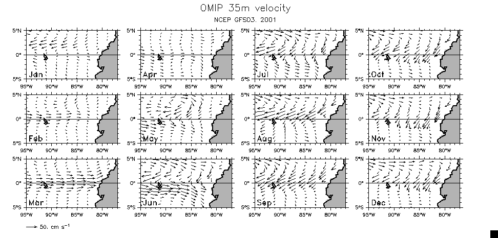
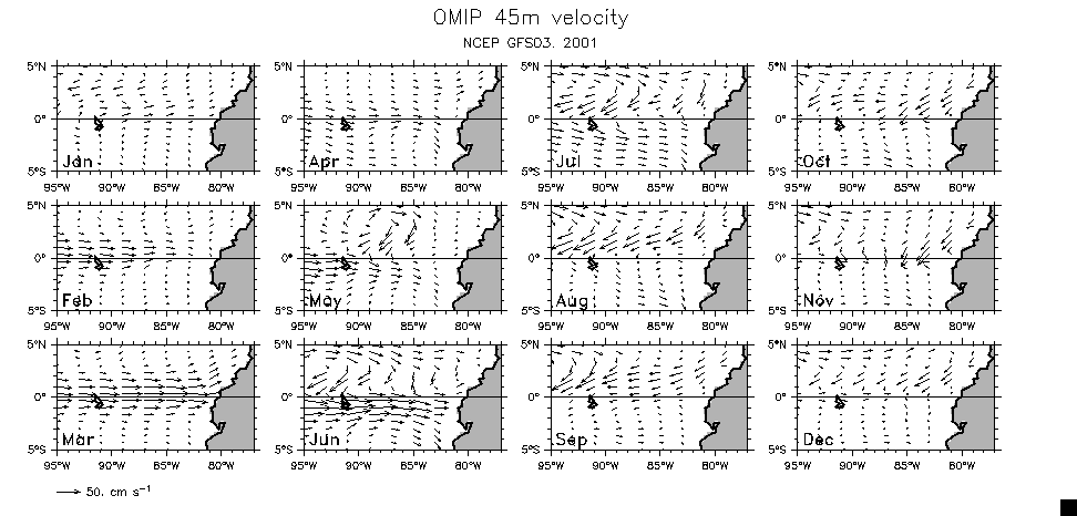
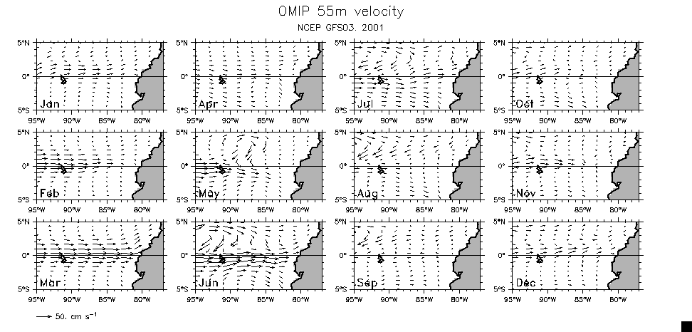
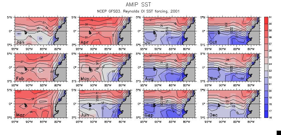
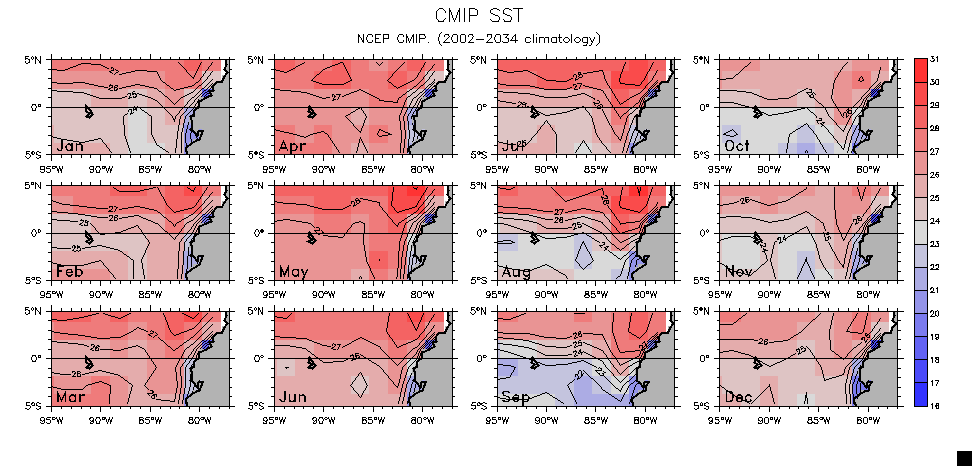
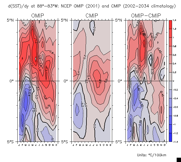
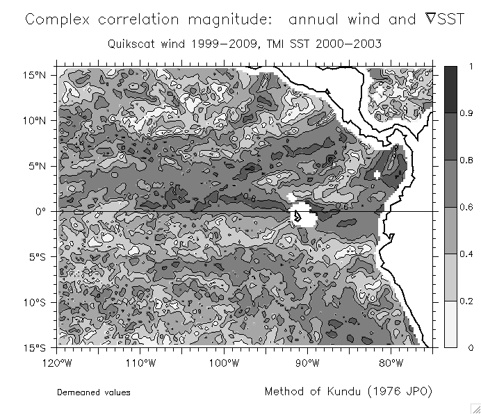
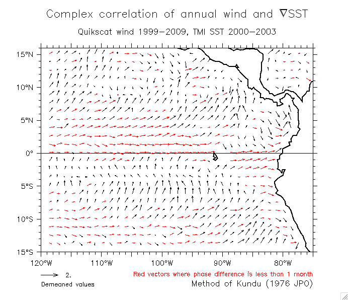
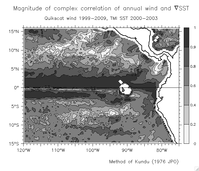
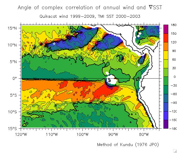
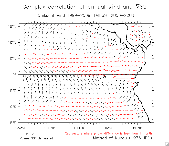
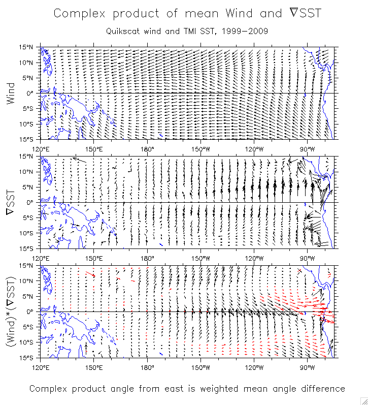
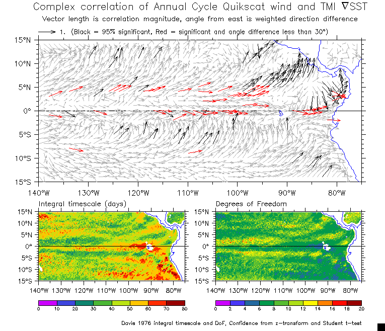
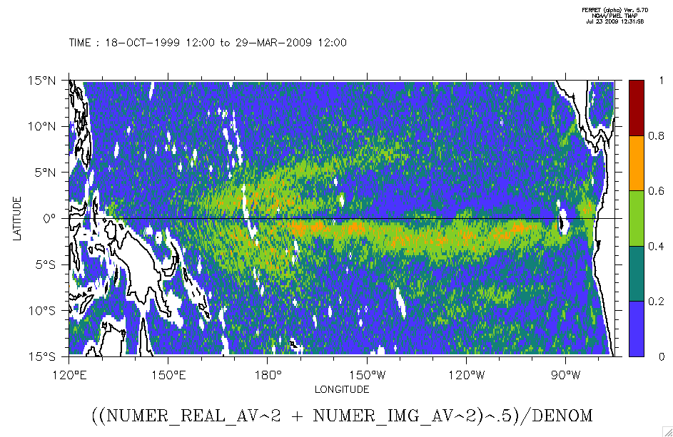
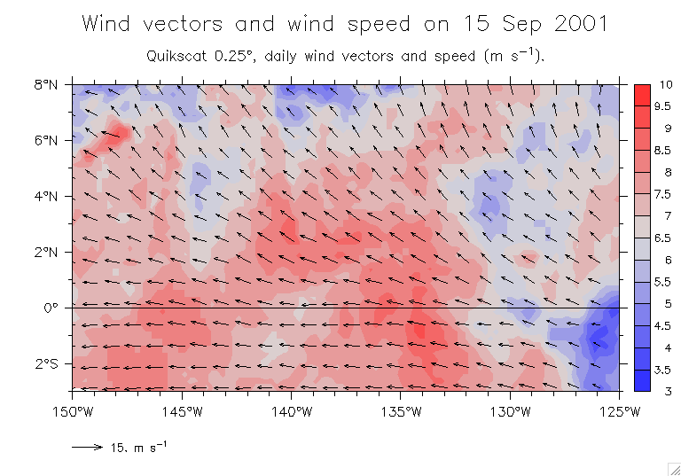
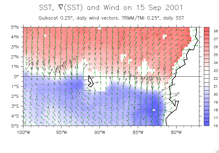
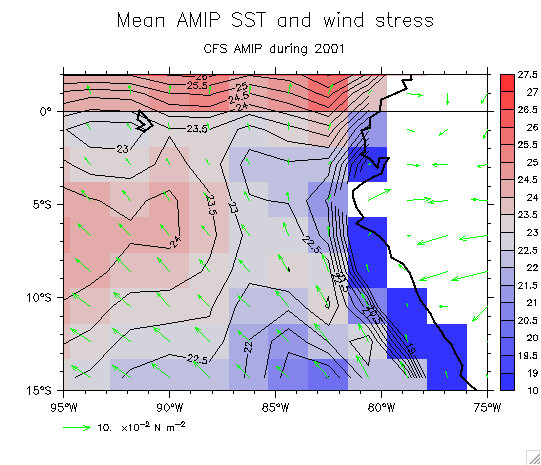
    2. Kundu correlation of annual cycle wind and SST:
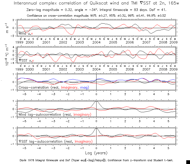
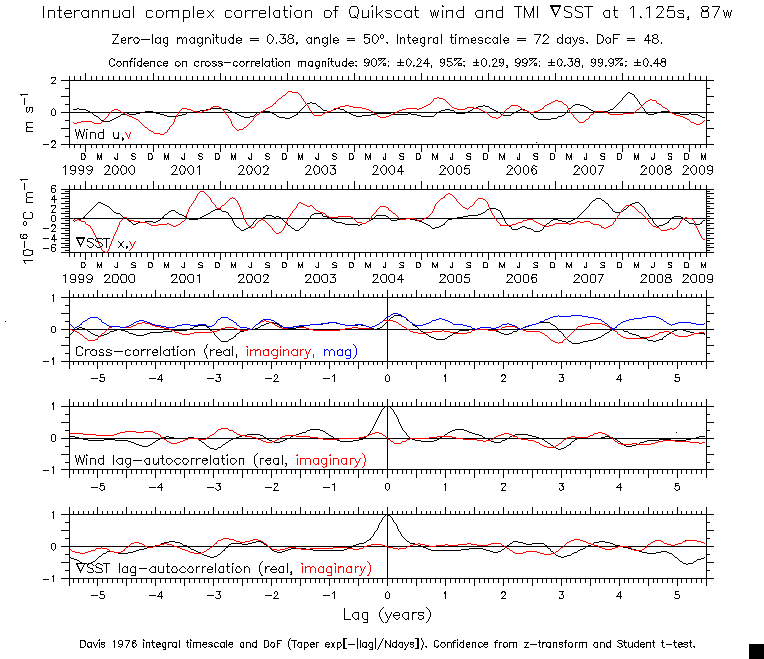
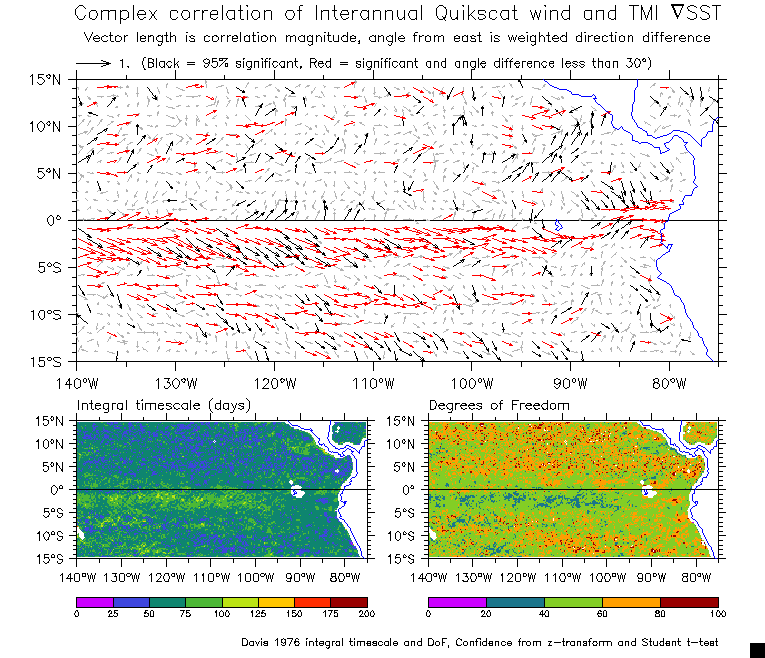
      For the choice made in kundu code (variable 1 is wind, variable 2 is grad(SST)), the angle of the correlation vector is:
      Grad(SST) clockwise from Wind => NEGATIVE angle (r-vector south of east)
      Grad(SST) counterclockwise from Wind => POSITIVE angle (r-vector north of east)
      ==> That is, the angle of the vector is the mean direction of Grad(SST) relative to wind.
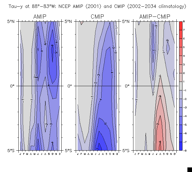
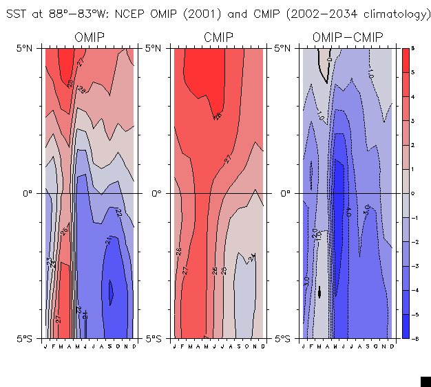
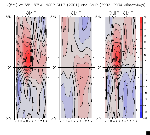
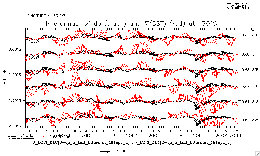
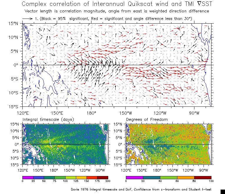
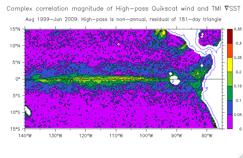
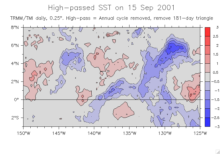
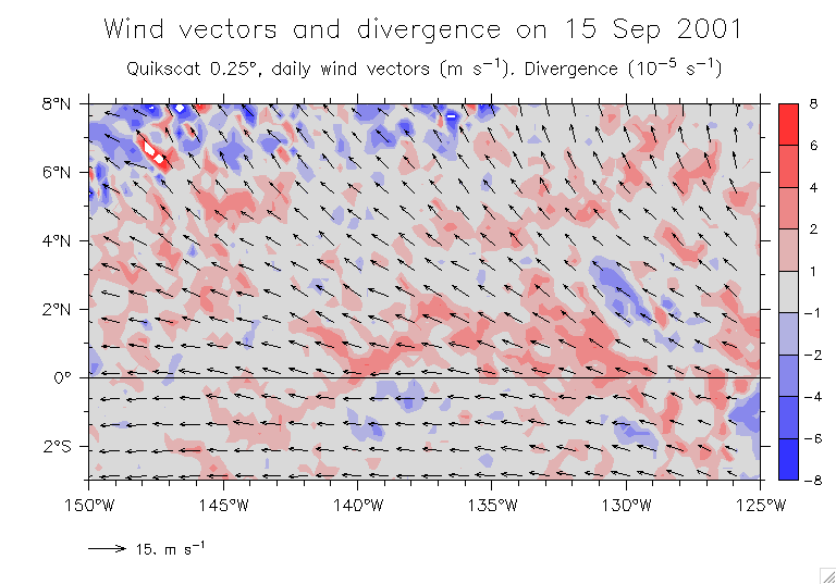
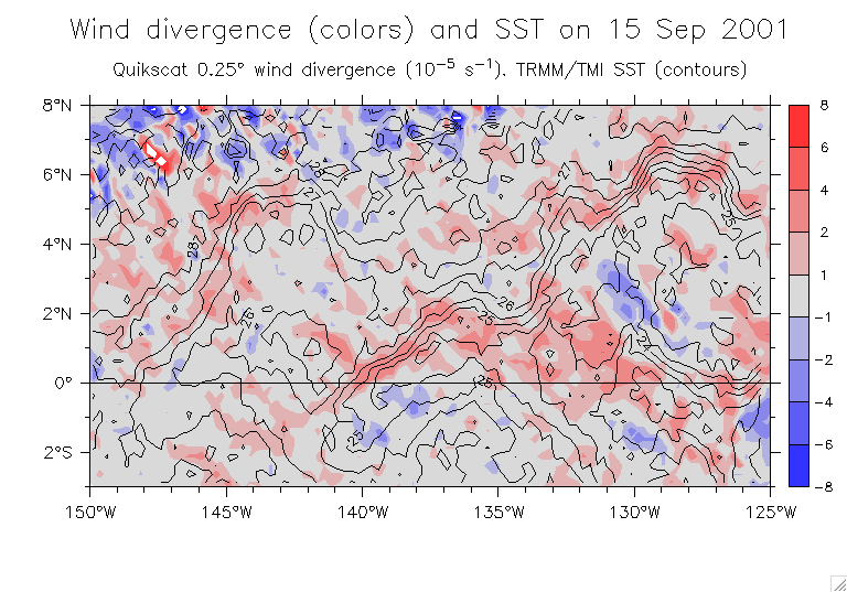
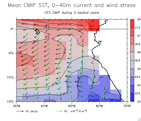
      1. First, the data:   Not demeaned     Demeaned
      2. Demeaned:   Magnitude     Angle (E means same direction)     Vectors (red means angle difference is less than ±30°; label is wrong)
      3. Not demeaned:   Magnitude     Angle (E means same direction)     Vectors (red means angle difference is less than ±30°; label is wrong)
      4. Some cooked examples for testing the Kundu correlation

  8. More serious work: complex correlation of wind and Grad(SST)
    1. Mean velocity and Grad(SST)
    2. Examples of complex correlations:  140°W,8.125°S    160°E,11°N    165°W,1.125°S    165°W,2°N    165°W,1.125°S    87°W,1.125°S
      More examples (interannual timeseries at a few latitudes just S of the equator):   105°W     170°W
    3. Correlation vectors, timescale and DoF:  
      1. Internannual:  Basinwide     Eastern detail
        Thus, the equatorward-pointing interannual vectors near the dateline imply:
              Grad(SST) clockwise from Wind north of the equator, counterclockwise from Wind south of the equator.
        Interpret: warmest SST (anomalies) on the equator, wind anomalies are eastward,
              and this wind is NOT driven by the local equatorward SST gradient.
      2. Annual cycle:  Basinwide     Eastern detail
      3. Highpass:  Basinwide     Eastern detail     Equator detail
    4. Interannual:  Correlation magnitude     Angle
    5. High-pass:  Correlation magnitude     95pc significance level

  9. Some examples of the relation between winds and SST
    1. The central Pacific cold tongue on 15 Sep 2001: (All these plots on one page)
      1. SST     High-passed SST anomalies     Del-squared SST
      2. Wind vectors and windspeed     Wind vectors and divergence
      3. Wind divergence and SST contours     (with colored SST contours)
      4. Wind and Grad(SST) vectors over SST
    2. Far eastern region on 15 Sep 2001: (All these plots on one page)
      1. SST     High-passed SST anomalies     Del-squared SST
      2. Wind vectors and windspeed     Wind vectors and divergence
      3. Wind divergence and SST contours
      4. Wind and Grad(SST) vectors over SST

horizontal black line
NOAA logo Dr. William S. Kessler
NOAA / PMEL / OCRD
7600 Sand Point Way NE
Seattle WA 98115 USA
Tel:   206-526-6221
Fax:  206-526-6744
E-mail:  william.s.kessler@noaa.gov
See also:    Kessler home page        Kessler publications         PMEL home page         Privacy notice