 |
 |
 |
 |
A Trek in the Pamir-Alai (Turkestan Range) in Kyrgyzstan
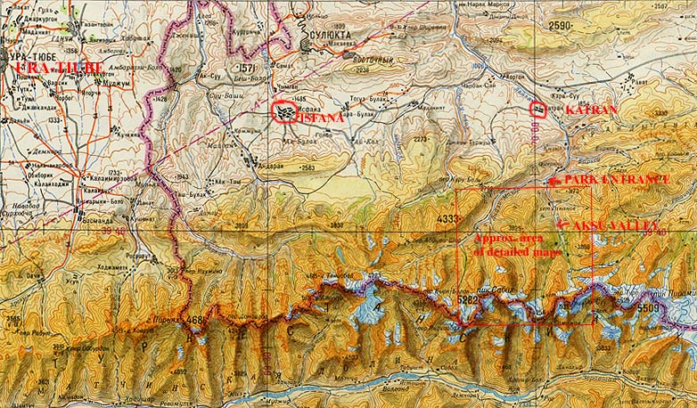
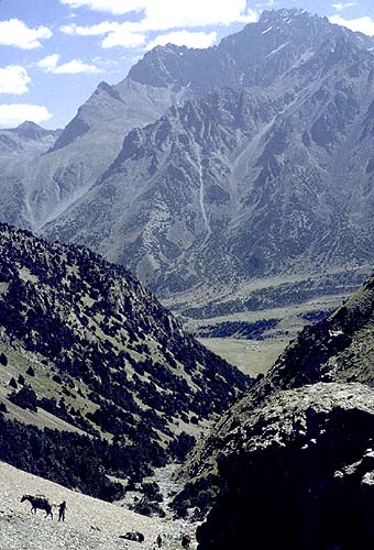
These pages will provide some visual impressions of one of the very appealing and moderately strenuous treks in the Pamir-Alai mountains of Kyrgyzstan--the region of the country that projects to the west just south of the Ferghana Valley (most of which is part of Uzbekistan). The route--in the Aksu, Uryam, Ashat and Lyailyak valleys--is moderately strenuous and is frequently done by organized parties. Verbal description here has deliberately been minimized; additional information can be found in Frith Maier, Trekking in Russia & Central Asia: A Traveler's Guide (Seattle: The Mountaineers, 1994; rev. ed. 1997), pp. 176-179, which describes a variant of the route involving crossing of a second pass. A good overview of the region, and some description and photos of the serious rock climbing on the major peaks at the upper end of the Aksu Valley, can be found in Unknown Grandeur of Russian Mountains. Distances and altitudes below are based on readings made by GPS in 1995, but note the distances are straight-line measurements.
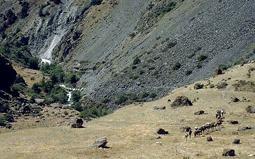
I make no effort here to propose specific ways to get to the start of the trek, since outfitters are many and local conditions may vary. For years, the normal pattern was to drive pretty directly from Tashkent through the lower tip of the Ferghana Valley to the park entrance. However, because of problems at border crossings (the route goes through a small portion of Tajikistan), in 1999 alternative routes via Kokand, up in the heart of Ferghana, were used, following often rather rough back roads. In late summer 1999, there was a hostage taking incident close to that route. Apparently an armed group crossed over the mountains from Tajikistan and seized a group of foreign geologists and their guides. The matter was finally resolved with no one harmed. The situation escalated in 2000, with some American climbers taken hostage in one of the neighboring valleys (it seems they were lucky to escape unharmed) and serious fighting occurring between the infiltrators and various countries' troops that had been sent in to restore security. Until further notice, unfortunately, these valleys and the adjoining region should be considered unsafe for trekking and climbing. I am leaving this page up because of the beauty and cultural interest of the region, not as a recommendation that anyone attempt to trek there until the region is certified as safe.
For those who would undertake the trek, a few general words of caution are in order. Summer conditions on the approaches to the park are likely to be very hot (temperatures in the 90s [F] or well above are common). The lower parts of the trek also may be quite hot. However, one should go prepared as one would for any mountain hike with a range of clothing layers, since there is substantial altitude gain during the trek and some of the camps are at relatively high altitudes. Even though summer conditions are generally dry, the mountains do produce their own weather. Rain or even snow might be encountered at the higher altitudes. Those who would hike with the support of a camp crew and pack animals should be sure to carry in their day packs appropriate layers, in order to stay warm and dry. The maximum altitude on this trip is reached in crossing the pass between the Aksu and Uryam valleys (12,300 ft./3749 m.; note Maier's book gives an erroneous, higher reading); one may approach that altitude in optional day hikes in the upper ends of the valleys. The highest of the normal campsites is a little under 10,000 ft. (3040 m.) in the Uryam. Generally trekkers feel the altitude on the first few days of the trek, but it seems to be relatively rare that they are unable to cross the one high pass.
[For the maps and pictures below, click on each thumbnail to bring up an enlargement.]
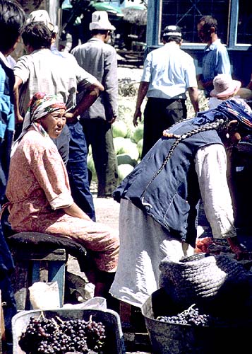
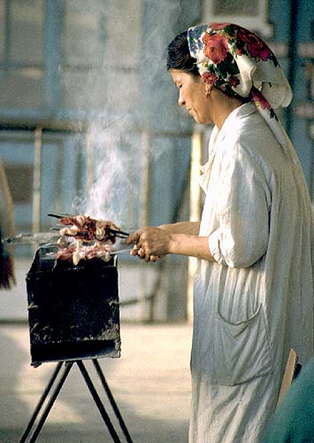
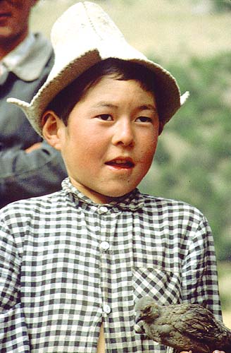
The approach (see map) goes through the town of Isfana (located at 39 deg. 49' 50"" N/69 deg. 32' 32" E.; 2250 ft./686 m.), where, in the shadow of an image of the Kyrgyz epic hero, Manas, is a typical Central Asian market.
|
|
|
|
After passing through the gate at the entrance to the park (4500 ft./1372 m.) (map),
the rough dirt road continues to a point where washouts prevent further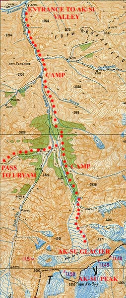 vehicular traffic. In the past this
has been above but not far from the intersection of the Aksu and Lyailyak valleys, where
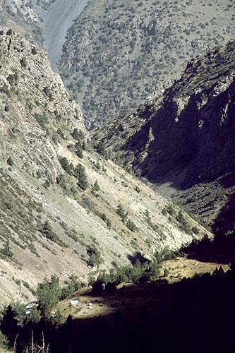
most groups establish a first camp at 4980 ft. (1518 m.) in a small pasture area.
vehicular traffic. In the past this
has been above but not far from the intersection of the Aksu and Lyailyak valleys, where
most groups establish a first camp at 4980 ft. (1518 m.) in a small pasture area.
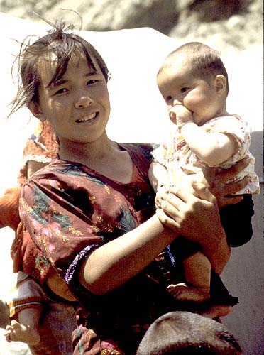
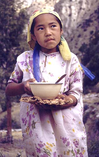
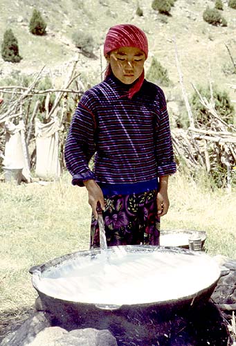
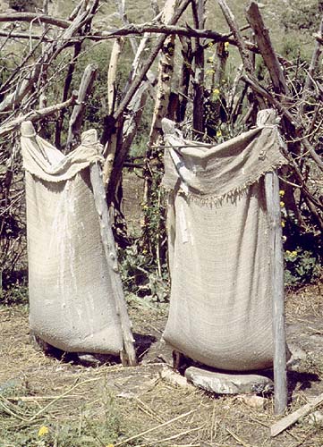
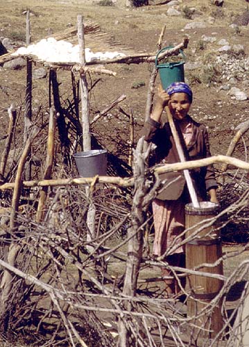
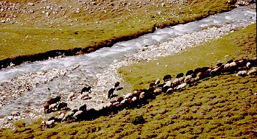
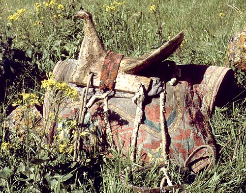
The first day of hiking (some 6.2 mi./10.1 km. with 4050 ft./1234 m. elevation gain) is along the road, where one soon passes a Kyrgyz summer camp. There one can see traditional techniques of processing milk products and enjoy the traditional offering of hospitality--nan (flat bread) and ayran (yoghurt).
 |
 |
 |
 |
 |
 |
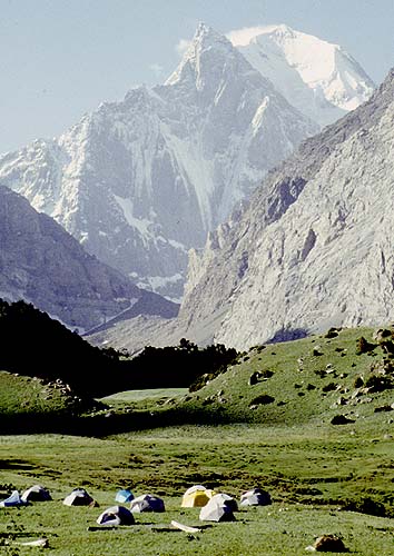
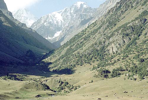
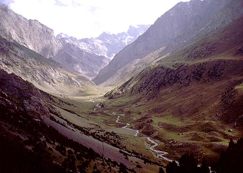
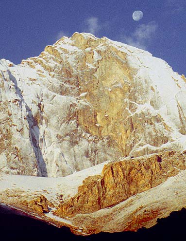
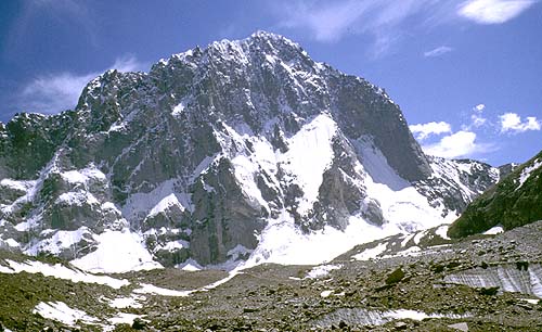
The site of camp 2 (9030 ft./2752 m.) is a meadow near the Aksu, from which on a clear day spires of Aksu Peak (17,568 ft.) can be seen at the upper end of the valley.
 |
 |
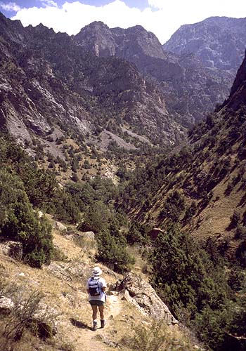
It is normal to spend two nights at camp 2, allowing for some acclimatization before crossing the pass. The intervening day can be spent hiking to the head of the valley, past herder camps and up the glacial moraine to the edge of the cirque formed by some of the spectacular granite walls that attract rock climbers to this area.
 |
 |
 |
 |
 |
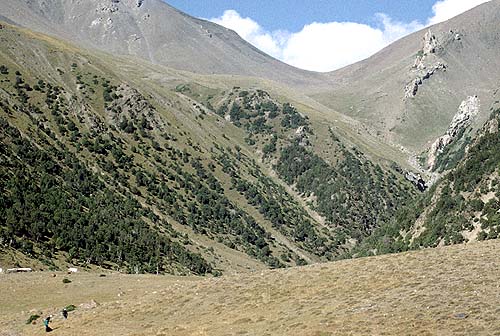
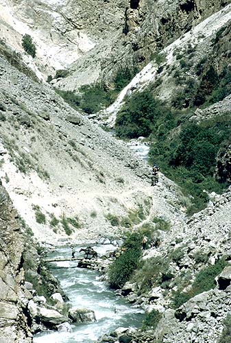
The route over the pass to the Uryam begins by crossing the Aksu on a bridge, then gradually ascending (a view of the Karasu valley is off to the left) past another herder camp to an obvious gulley. Here the way gets substantially steeper, some of the trail trodden across scree slopes. In the upper reaches, views back across the Aksu are spectacular.
 |
 |
 |
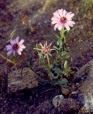
The pass is reached at 3.1 mi./5.0 km. from camp 2, after an elevation gain of 3250 ft./997 m. For the remainder of the trek from the pass, see the map. The descent is an easy one, through a sharply-defined valley and then emerging past wild flowers on wooded slopes that command a dramatic view up the Uryam and straight down to a campsite on the valley floor. The last stretch of the trail involves some switchbacks down a steep slope.
 |
 |
 |
 |
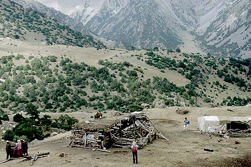
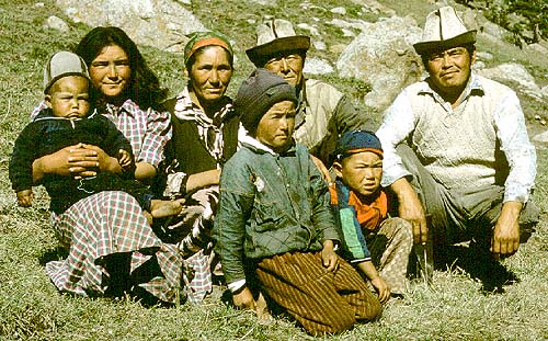
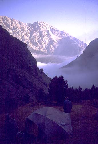
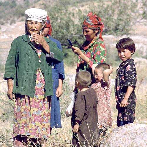
Camp in the Uryam (1.4 mi./2.3 km. as the crow flies from the pass) is on the east side of the stream, across from a stone herder hut, at 9990 ft./3045 m. whose extended family is shown in the photos. One can wake up in the morning to a fresh dusting of snow framing the impressive rock faces above the valley.
 |
 |
 |
 |
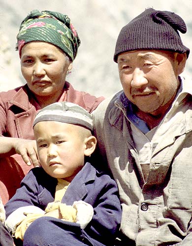
Day hiking up the Uryam to the glacier at its head is worthwhile; here in the photo is
one of the local guides, the late and much respected Satybay, who was an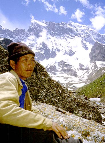 experienced mountain man and hunter in the
winter season. Other hikes are possible up side slopes of the valley. It is possible to
cross from the head of the Uryam to the head of the Ashat rather than go downstream and
back up again, but such a crossing presumably requires some roped glacier travel, which is
not in most hikers' plans. There also is a pass which allows crossing from the Uryam to
the Ashat (see Frith Maier's book).
experienced mountain man and hunter in the
winter season. Other hikes are possible up side slopes of the valley. It is possible to
cross from the head of the Uryam to the head of the Ashat rather than go downstream and
back up again, but such a crossing presumably requires some roped glacier travel, which is
not in most hikers' plans. There also is a pass which allows crossing from the Uryam to
the Ashat (see Frith Maier's book).
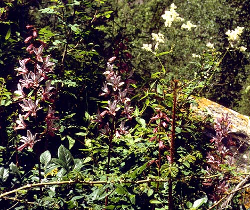
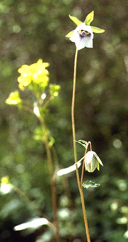
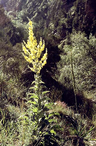
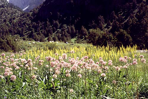
From the camp in the Uryam to the next logical campsite at its intersection with the Lyailyak is a downhill 5.0 mi. (8 km.) (elevation loss of 3790 ft./1155 m.; the next camp is at 6200 ft./1890 m.). Especially in early season, the wildflowers in this area are quite varied. One moves from the relatively open upper valley into an increasingly narrow gorge, where in on or two places the trail crosses fairly fairly exposed scree slopes that could be somewhat uncomfortable for individuals made nervous by heights.
 |
 |
 |
 |
 |
 |
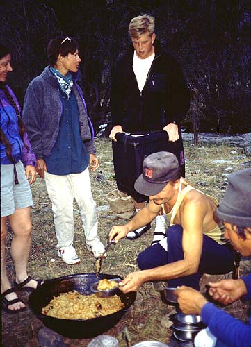
The camp at the confluence of of the two streams is a pleasant place to take a sponge bath and watch the crew prepare a delicious meal of the tradition dish of plov (pilaf).
 |
 |
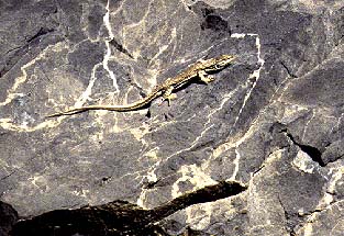
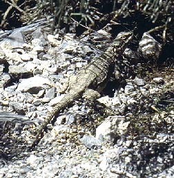
To proceed on the trek, you descend along the Lyailyak a short distance to a bridge, cross, and then turn left and go ascend gradually (upstream) on the other side. Along the way there are local wildlife (lizards come in small and in larger varieties), more wild flowers, and a lovely waterfall, best visible after you cross above it if you hike out toward the gorge away from the trail.
 |
 |
 |
 |
 |
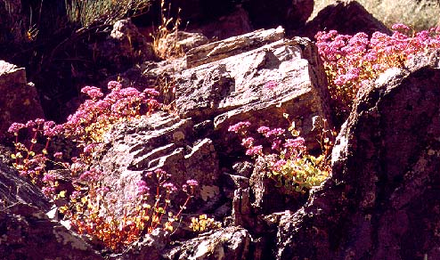
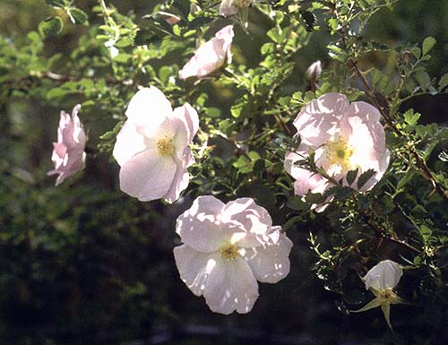
The trail traverses a wide meadow and then enters again a narrower part of the gorge, before crossing the stream on a bridge near which are some of the lovely, ubiquitous wild roses.
 |
 |
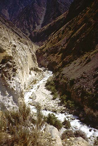
A short distance brings you to the Ashat, which enters on the left. Just above the intersection is a bridge over the Ashat which you do not cross (the path on the other side of it continues up the Lyailyak). Instead you stay on the left side of the Ashat and ascend the largely open slopes. The gorge with its waterfall and rapids below is quite spectacular, although there really is no vantage point enabling one to see all of the falls.
 |
 |
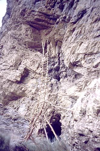
The normal camp in the Ashat is in a meadow beyond some lovely wild flowers (8300 ft./2530 m.). From there one can look down over the morning mist to the Lyailyak or up to the cliffs where a rickety ladder leads to a cave where locals collect mumiyo, a sticky black substance that is probably rodent droppings and, after boiling, is packaged and sold in the markets as a cure-all (among other things, it seems, a kind of traditional version of Viagra).
 |
 |
 |
Hiking beyond the camp quickly leads to a short, somewhat steep ascent through woods to a lovely vantage point looking back down on the camp and then across a short stretch of a rather loose scree slope (more intimidating than dangerous) to the solid trail on the other side that ultimately brings you to the lovely upper valley.
 |
 |
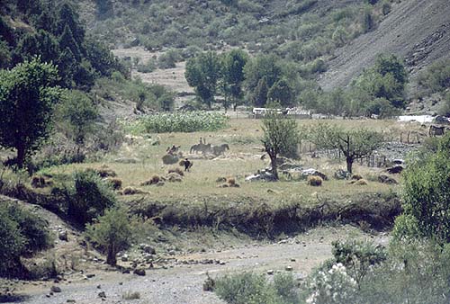
At the upper end of that valley is a striking granite pinnacle (Parus), and the imposing face of Peak Sabakh (15,498 ft.). There is some wonderful pasturage here for horses.
 |
 |
 |
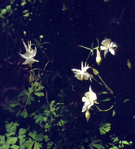
The way back retraces your steps down the Ashat and Lyailyak all the way to the Uryam, where, instead of crossing back over the bridge, you keep going straight down the Lyailyak. There are a couple of bridge crossings along the way; eventually the valley begins to widen. Near a lovely, clear intersecting stream is a good lunch spot, where you can share the welcome shade with a display of columbine. There are ruins of a former settlement and a Muslim tomb. From this point, the trek is largely on a dirt road.
 |
 |
 |
 |
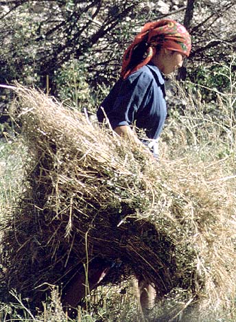
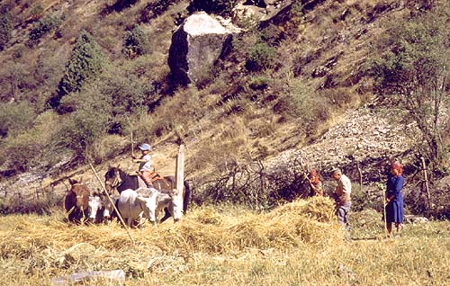
At a sizeable herder settlement, you may see threshing going on in late season; with a last glimpse back on that, you head down through the groves of pecans and apricot trees. Most groups camp in an apricot orchard (4900 ft./1494 m.) not far from the completion of the hike at the road which led from the park entrance up into the Aksu. The final full day of hiking between the Ashat and this camp is fairly long (7.4 mi./11.9 km, straight line distance) and increasingly hot as the day progresses, but with the exception of a few minor ups and downs, it is generally downhill or flat.
 |
 |
 |
 |
Please note that these pages and all photographs are copyrighted 1999 © by Daniel C. Waugh. You may use them for non-commercial purposes, but please ask permission and give appropriate credit. Thank you.
Revised September 27, 2000.