Locking on the Cascadia Subduction Zone
Project Collaborators: David Schmidt, Ray Weldon (UO), Reed Burgette (UO)
Evidence suggests that the Pacific Northwest has repeatedly experienced magnitude 9 earthquakes approximately every 500 years. These mega-thrust earthquakes represent the sudden release of crustal strain related to the subduction of the Juan de Fuca oceanic plate beneath the North American plate (more info). The strain accumulates because these two plates are locked and they can only slide pass each other during large earthquakes. During the time between these large failure events, the North American margin uplifts and shifts eastward. These displacements, which are on the order of centimeters, can be measured with modern geodetic techniques and used to constrain the size of the locked patch that will fail in future earthquakes.
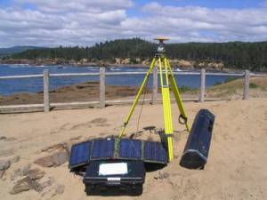
 We use a variety of observational techniques to measure the surface displacements in Oregon, Washington, and Northern California. Displacement rates are inferred by repeatedly surveying the exact 3-dimensional position of surface benchmarks, and mapping changes in position through time. GPS is used to constrain the horizontal displacements and spirit leveling is used to constrain the vertical displacements. Additionally, tide gauge records provide precise measures of how the land surface uplifts relative to mean sea level. By combining these datasets, we resolve coastal uplift and eastward drift of the continental margin on the order of mm/yr.
The modeling of the data reveal that the locked zone is primarily offshore and that the degree of locking varies along the subduction margin. This information helps to define the proximity of major cities to the source zone of the next megathrust earthquake, which constrains the amount of strong ground shaking that might be expected. We continue to refine our locking model by incorporating new data sets, and by exploring new modeling techniques.
Additional details are provided in Burgette et al. (2009).
This work has been funded by the USGS National Earthquake Hazards Reduction Program (Grants G09AP00007 and 05HQGR0053).
