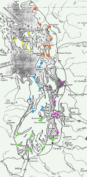
 Orange spots = Sept.
11
Orange spots = Sept.
11
MAP OF COLLECTION LOCATIONS FOR FIRST
PUGET SOUND EXPEDITION, SEPTEMBER 8-14, 1998
(including a few sites not sampled for lack of time)
Orange spots = Sept.
11
Blaine
near Cherry Point
Bellingham
Samish Bay
Padilla Bay
Anacortes
Cornet Bay, Whidbey Island
La Conner
Yellow spots = Sept. 12-13
Friday Harbor, San Juan
Island
Westcott Bay, San Juan Island
Eastsound, Orcas Island
Fisherman Bay, Lopez Island
Mackaye Harbor, Lopez Island
Blue spots = Sept 10
Brownsville
Seabeck, Hood Canal
Quilcene, Hood Canal
Port Ludlow
Port Hadlock
Port Townsend
Penn Cove, Whidbey Island
Oak Harbor, Whidbey Island
Magenta spots = Sept. 8
Everett
Edmonds
Elliott Bay Marina
Fisherman's Terminal
Harbor Island, Duwamish River
Des Moines
Green spots = Sept. 9
Tacoma
Steilacoom
Olympia - Boston Harbor
Shelton
Grapeview
Union, Hood Canal
Bremerton/Port Orchard
Base map from "The Natural History of Puget Sound Country" by A. R. Kruckeberg
Return to the Puget Sound Expeditions Homepage